Marvell is a city in Phillips County, Arkansas, United States. As of the 2010 census, the city population was 1,186.
| Name: | Marvell city |
|---|---|
| LSAD Code: | 25 |
| LSAD Description: | city (suffix) |
| State: | Arkansas |
| County: | Phillips County |
| Elevation: | 210 ft (60 m) |
| Total Area: | 1.44 sq mi (3.72 km²) |
| Land Area: | 1.44 sq mi (3.72 km²) |
| Water Area: | 0.00 sq mi (0.00 km²) |
| Total Population: | 855 |
| Population Density: | 595.40/sq mi (229.83/km²) |
| ZIP code: | 72366 |
| Area code: | 870 |
| FIPS code: | 0544420 |
| GNISfeature ID: | 0051716 |
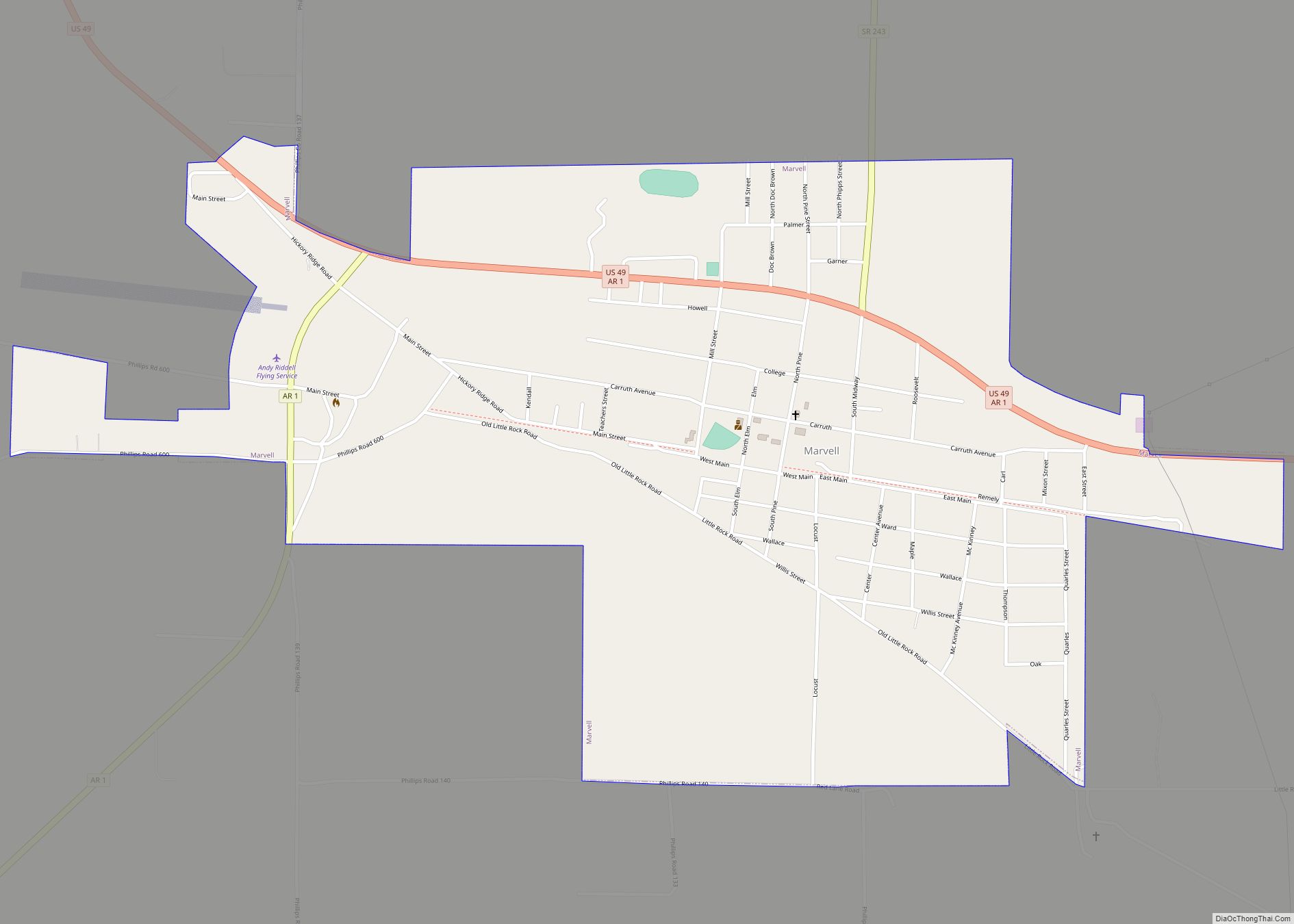
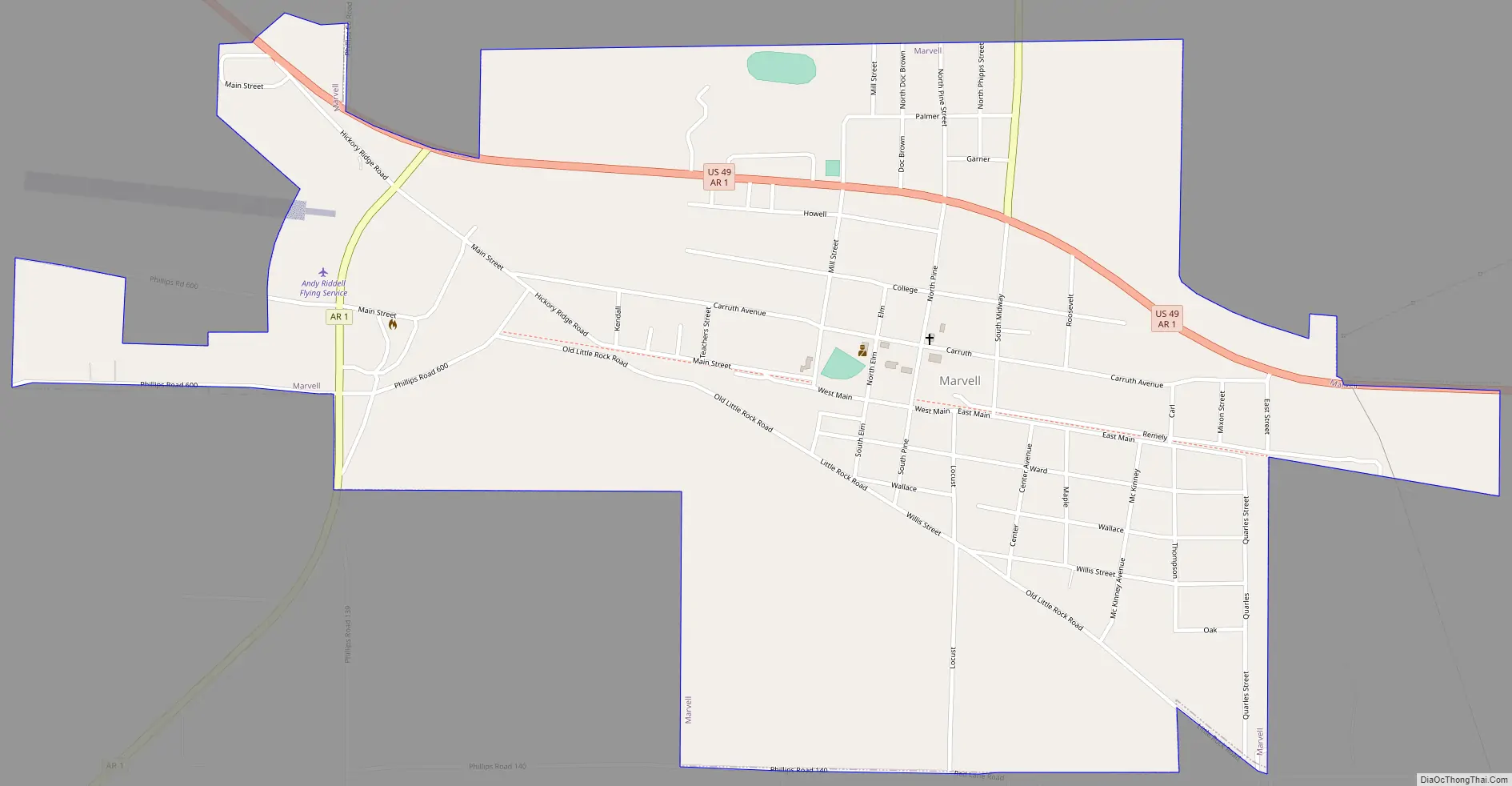
Online Interactive Map
Click on ![]() to view map in "full screen" mode.
to view map in "full screen" mode.
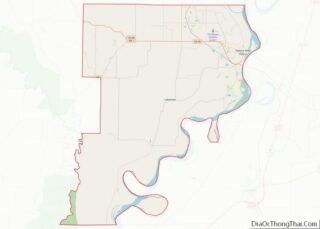
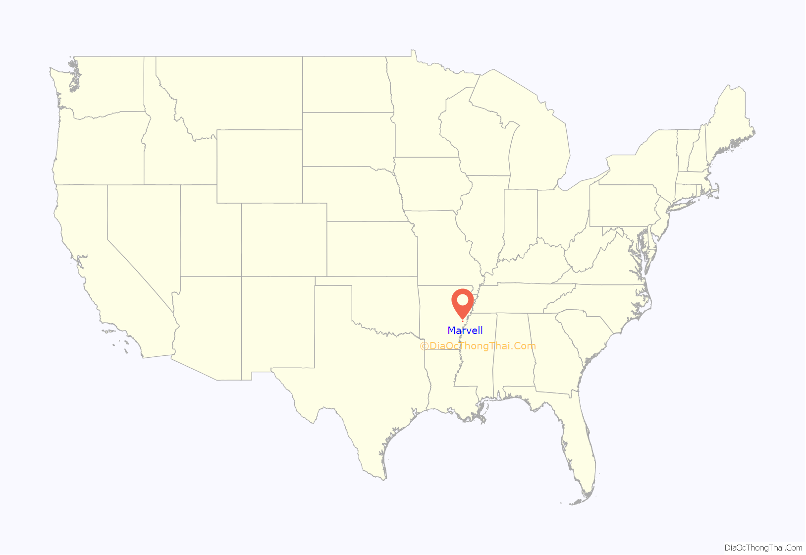
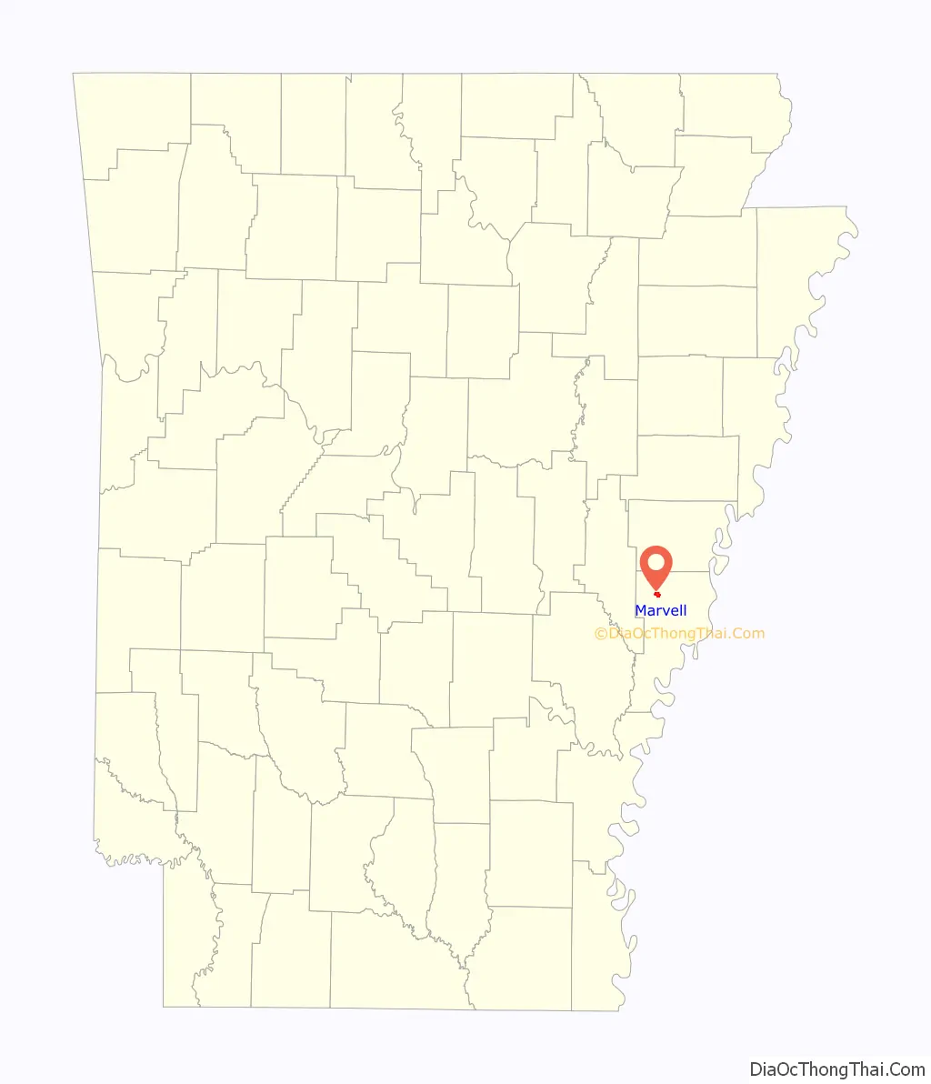
Marvell location map. Where is Marvell city?
History
Marvell was founded when Marvell M. Carruth and his wife, Rachel, sold 50 lots of land given to him by his father, Ladson Carruth, to the Arkansas Central Railroad. A train depot was soon established. Marvell became an un-incorporated town on May 28, 1873, with R.M. Jackson as its first mayor. Three years later, on October 3, 1876, Marvell became an incorporated town.
In 1877, the Union Trust foreclosed on the Arkansas Central Railroad and sold all of its assets at public auction. On December 6, 1877, the Arkansas Midland Railway Company was formed. Under new ownership, the railroad became profitable, not only as a freight line, but also by providing daily passenger service from Clarendon to Brinkley and on to Helena, making stops in Marvell along the way. This service ran until 1952. The tracks which ran from Marvell to Holly Grove were abandoned in 1977.
In the early 1900s there were 15 different merchants in the city of Marvell. One of the stores that stayed in business the longest was A. Hirsch & Co., which did an immense mercantile business and owned valuable land in the area. The Garner Stave Company sold miscellaneous items, such as farming and manufacturing goods.
The Marvell Public Library was established in 1922 by Mrs. Dave McDonald, who remained active until her death. In 1925, the Marvell Bottling plant was built by James Williford, only to close shortly afterward due to the high cost and shortage of sugar. At the beginning of the Great Depression all banks in Phillips County closed, with the exception of the Bank of Marvell. County Judge E.P. Molitor, a Marvell native, began construction on a road connecting Helena to Clarendon in 1930. J. L. Turner was mayor during the thirties. In 1939 the Marvell School burned. M.M. Tate School burned at a later date.
During the 1940s the population of Marvell was approximately 1,000.
In the 1980s, under the leadership of Mayor Alma Norton, the Marvell City Park and bike trail were built on the old railroad. The Davidson Park was also built and given to the city by the Abe Davidson family.
In the 1990s, the population of Marvell was approximately 1545. In 1997 cooperation with UAMS east and grant from federal government the city under mayor Clark Hall, the Marvell Medical Clinic was built with citizen donations. The clinic expanded in only one year to include dental services and interactive two-way compressed video use for medical consultations and health education.
Marvell was featured on ABC News’s World News With Charles Gibson October 6, 2009 telecast as a center of infestation by newer pesticide-resistant strains of pigweed, threatening the region and raising the possibility of hand harvesting crops. Marvell is located in the Arkansas Delta.
Marvell Road Map
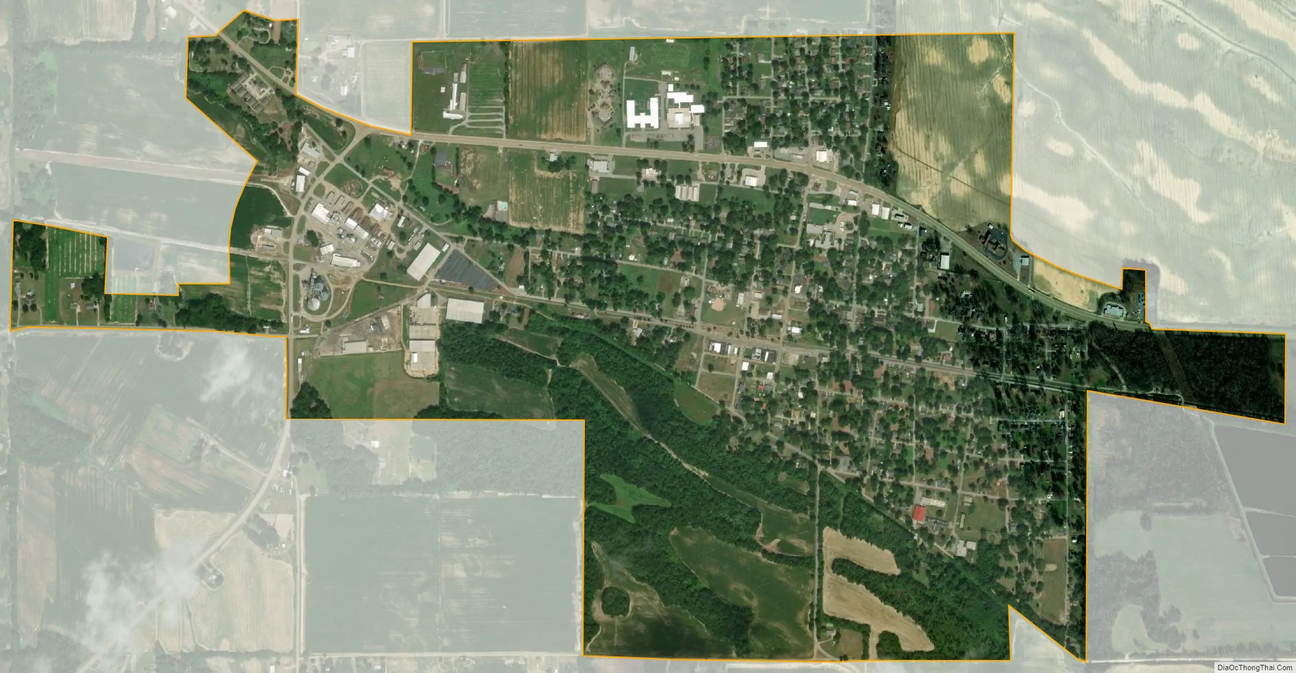
Marvell city Satellite Map
Geography
According to the United States Census Bureau, the city has a total area of 1.4 square miles (3.6 km), all land.
See also
Map of Arkansas State and its subdivision:- Arkansas
- Ashley
- Baxter
- Benton
- Boone
- Bradley
- Calhoun
- Carroll
- Chicot
- Clark
- Clay
- Cleburne
- Cleveland
- Columbia
- Conway
- Craighead
- Crawford
- Crittenden
- Cross
- Dallas
- Desha
- Drew
- Faulkner
- Franklin
- Fulton
- Garland
- Grant
- Greene
- Hempstead
- Hot Spring
- Howard
- Independence
- Izard
- Jackson
- Jefferson
- Johnson
- Lafayette
- Lawrence
- Lee
- Lincoln
- Little River
- Logan
- Lonoke
- Madison
- Marion
- Miller
- Mississippi
- Monroe
- Montgomery
- Nevada
- Newton
- Ouachita
- Perry
- Phillips
- Pike
- Poinsett
- Polk
- Pope
- Prairie
- Pulaski
- Randolph
- Saint Francis
- Saline
- Scott
- Searcy
- Sebastian
- Sevier
- Sharp
- Stone
- Union
- Van Buren
- Washington
- White
- Woodruff
- Yell
- Alabama
- Alaska
- Arizona
- Arkansas
- California
- Colorado
- Connecticut
- Delaware
- District of Columbia
- Florida
- Georgia
- Hawaii
- Idaho
- Illinois
- Indiana
- Iowa
- Kansas
- Kentucky
- Louisiana
- Maine
- Maryland
- Massachusetts
- Michigan
- Minnesota
- Mississippi
- Missouri
- Montana
- Nebraska
- Nevada
- New Hampshire
- New Jersey
- New Mexico
- New York
- North Carolina
- North Dakota
- Ohio
- Oklahoma
- Oregon
- Pennsylvania
- Rhode Island
- South Carolina
- South Dakota
- Tennessee
- Texas
- Utah
- Vermont
- Virginia
- Washington
- West Virginia
- Wisconsin
- Wyoming