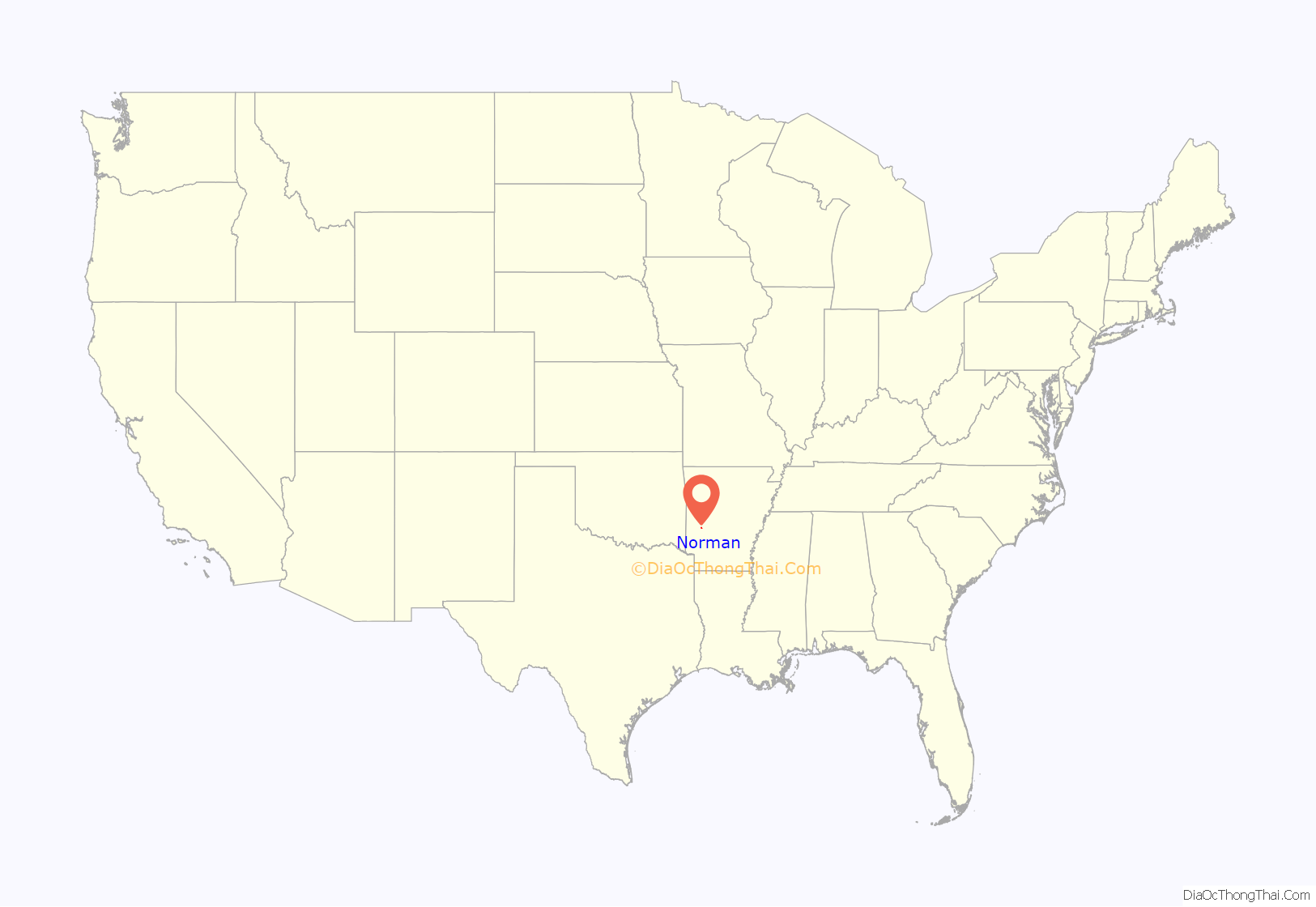
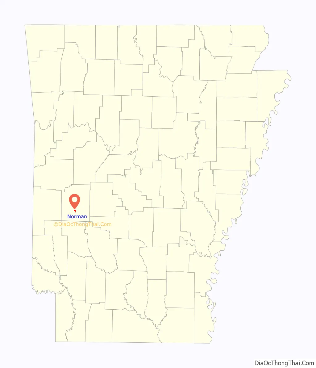
Norman is a town in Montgomery County, Arkansas, United States. It was known as Womble until 1925. The population was 303 at the 2020 census, down from 378 in 2010.
| Name: | Norman town |
|---|---|
| LSAD Code: | 43 |
| LSAD Description: | town (suffix) |
| State: | Arkansas |
| County: | Montgomery County |
| Elevation: | 692 ft (211 m) |
| Total Area: | 1.14 sq mi (2.95 km²) |
| Land Area: | 1.13 sq mi (2.91 km²) |
| Water Area: | 0.01 sq mi (0.04 km²) |
| Total Population: | 303 |
| Population Density: | 269.33/sq mi (104.02/km²) |
| ZIP code: | 71960 |
| Area code: | 870 |
| FIPS code: | 0550030 |
Online Interactive Map
Click on ![]() to view map in "full screen" mode.
to view map in "full screen" mode.
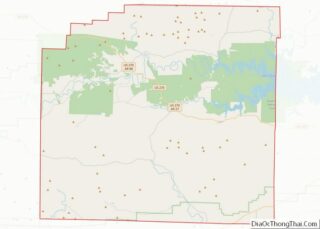
Norman location map. Where is Norman town?
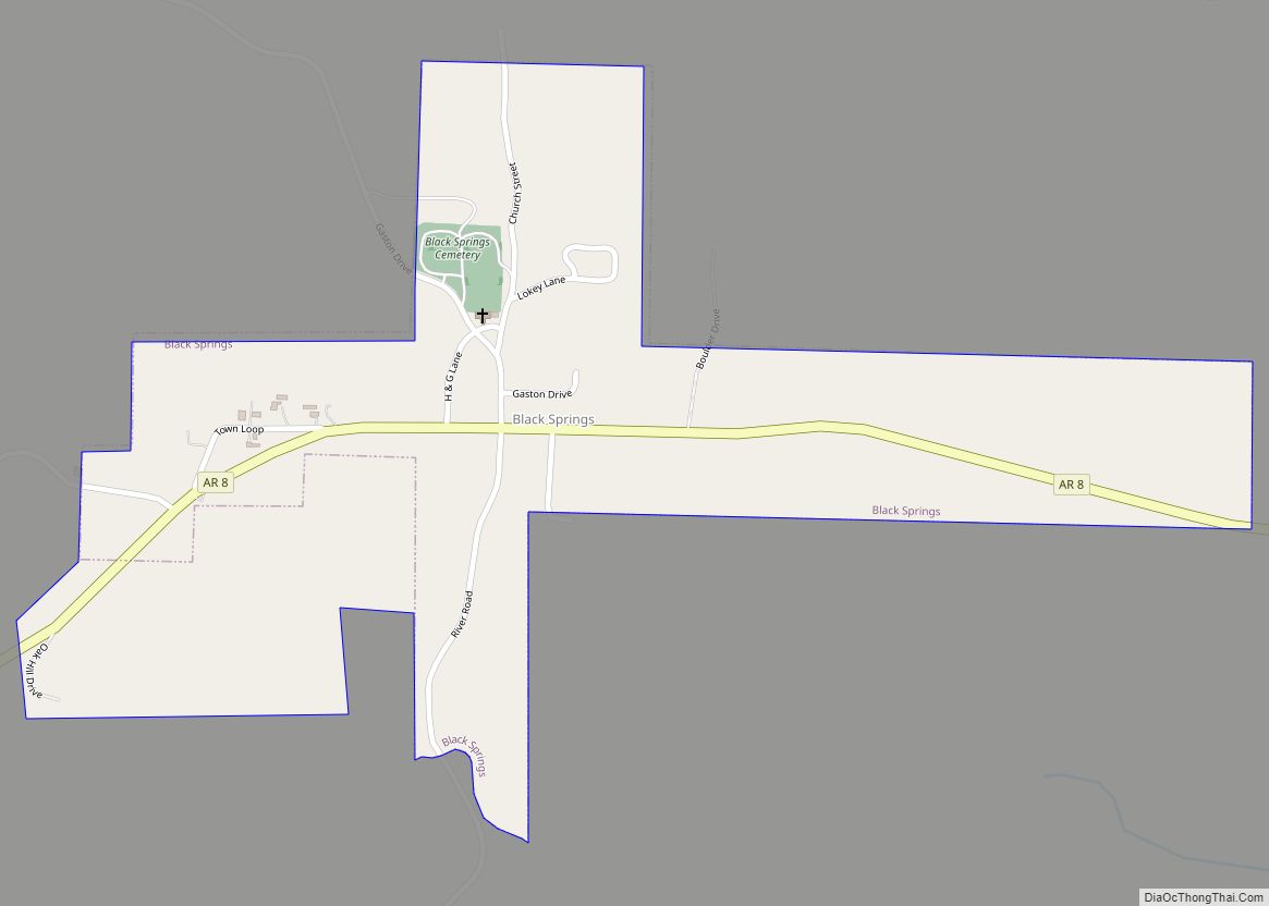
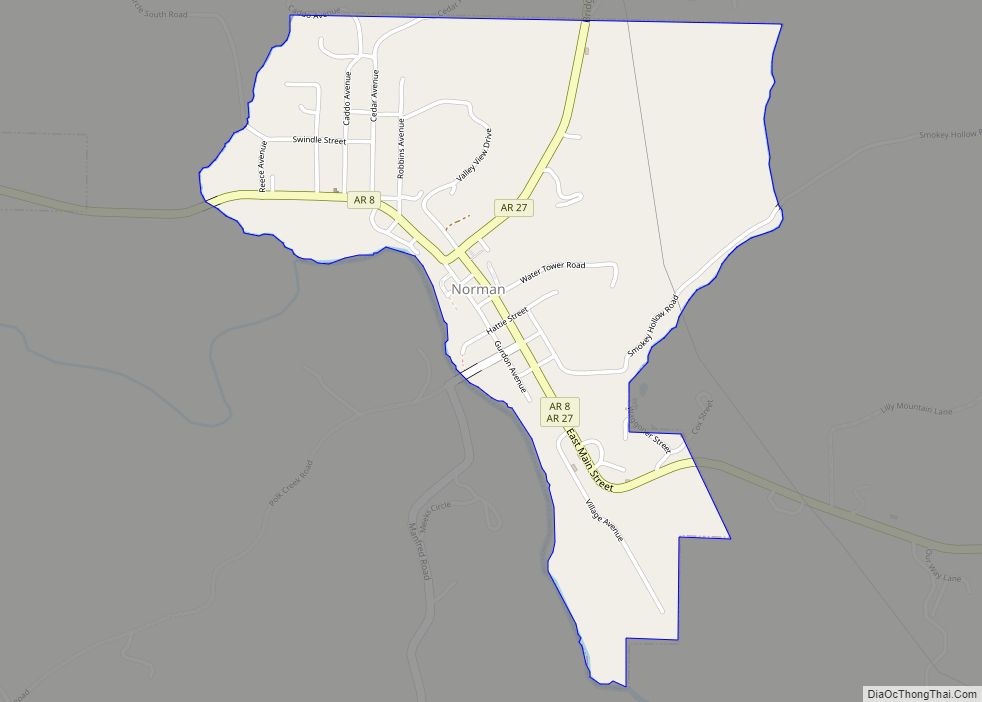
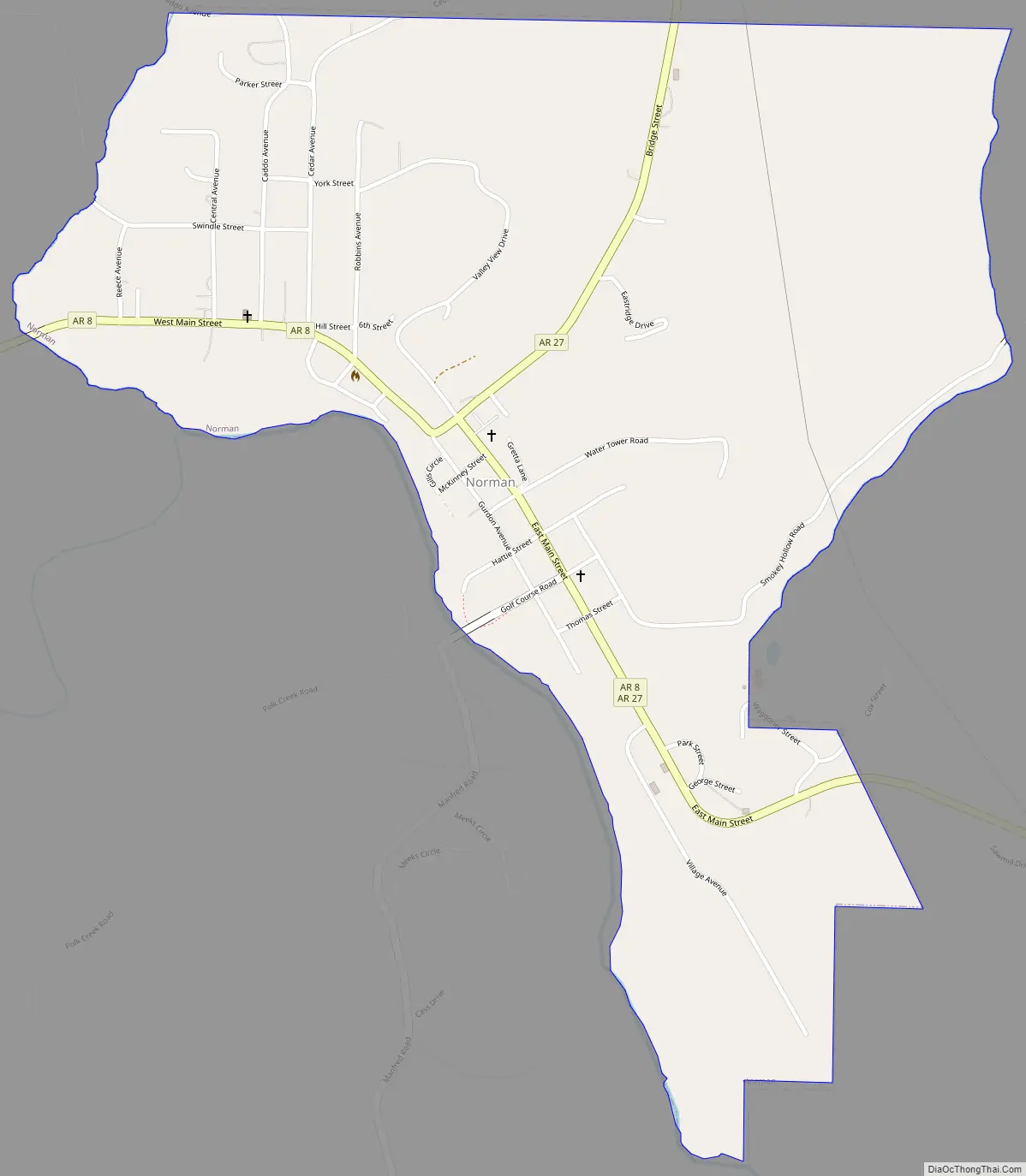
Norman Road Map
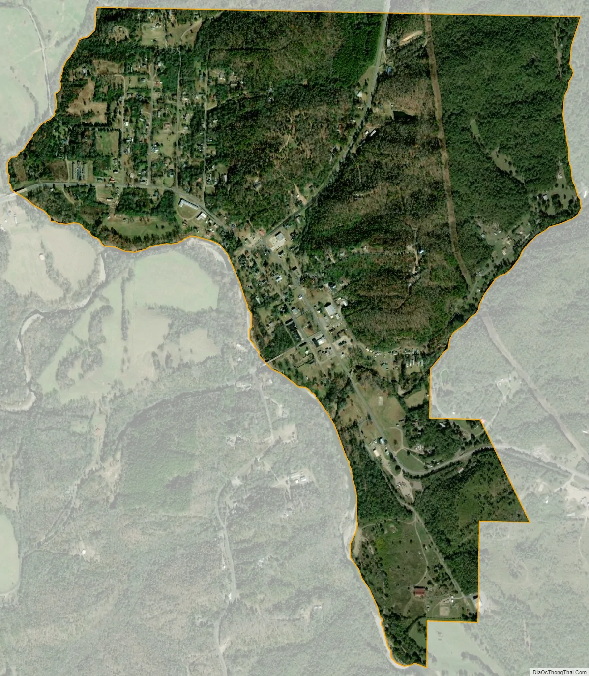
Norman city Satellite Map
Geography
The community is in southern Montgomery County at the intersection of Arkansas highways 8 and 27. It is 9 miles (14 km) south of Mount Ida, the county seat, and 13 miles (21 km) northwest of Glenwood. Norman is situated on the northeast bank of the Caddo River (which defines the town’s southwestern city limits) and is surrounded by the Ouachita National Forest.
According to the United States Census Bureau, the town has a total area of 1.14 square miles (3.0 km), of which 0.014 square miles (0.036 km), or 1.23%, are water.
Norman is part of a local region that was formerly known as Womble. The west end of the town is unofficially known as Middlebuster and was in the past known as “Poor Horse”.
There is a Caddo Native American burial ground on the southern end of town. It was discovered by city officials, led by then-mayor Duane Cox, who protected it with a wooden fence. Recently, descendants of the Caddo added to the site a footpath and benches as well as plaques containing historical information regarding the living habits of Native Americans.
See also
Map of Arkansas State and its subdivision:- Arkansas
- Ashley
- Baxter
- Benton
- Boone
- Bradley
- Calhoun
- Carroll
- Chicot
- Clark
- Clay
- Cleburne
- Cleveland
- Columbia
- Conway
- Craighead
- Crawford
- Crittenden
- Cross
- Dallas
- Desha
- Drew
- Faulkner
- Franklin
- Fulton
- Garland
- Grant
- Greene
- Hempstead
- Hot Spring
- Howard
- Independence
- Izard
- Jackson
- Jefferson
- Johnson
- Lafayette
- Lawrence
- Lee
- Lincoln
- Little River
- Logan
- Lonoke
- Madison
- Marion
- Miller
- Mississippi
- Monroe
- Montgomery
- Nevada
- Newton
- Ouachita
- Perry
- Phillips
- Pike
- Poinsett
- Polk
- Pope
- Prairie
- Pulaski
- Randolph
- Saint Francis
- Saline
- Scott
- Searcy
- Sebastian
- Sevier
- Sharp
- Stone
- Union
- Van Buren
- Washington
- White
- Woodruff
- Yell
- Alabama
- Alaska
- Arizona
- Arkansas
- California
- Colorado
- Connecticut
- Delaware
- District of Columbia
- Florida
- Georgia
- Hawaii
- Idaho
- Illinois
- Indiana
- Iowa
- Kansas
- Kentucky
- Louisiana
- Maine
- Maryland
- Massachusetts
- Michigan
- Minnesota
- Mississippi
- Missouri
- Montana
- Nebraska
- Nevada
- New Hampshire
- New Jersey
- New Mexico
- New York
- North Carolina
- North Dakota
- Ohio
- Oklahoma
- Oregon
- Pennsylvania
- Rhode Island
- South Carolina
- South Dakota
- Tennessee
- Texas
- Utah
- Vermont
- Virginia
- Washington
- West Virginia
- Wisconsin
- Wyoming