Mount Ida is a city in and county seat of Montgomery County, Arkansas, United States. Founded in 1842, the city saw a silver boom in the 1880s bring early prosperity and economic development to the area. Today, the economy is largely ranching, poultry farming, silviculture, and tourism around Lake Ouachita. It is known as the quartz crystal capital of the U.S. and is known worldwide for its quartz deposits. The population was 996 as of the 2020 census.
| Name: | Mount Ida city |
|---|---|
| LSAD Code: | 25 |
| LSAD Description: | city (suffix) |
| State: | Arkansas |
| County: | Montgomery County |
| Elevation: | 643 ft (196 m) |
| Total Area: | 1.60 sq mi (4.14 km²) |
| Land Area: | 1.57 sq mi (4.06 km²) |
| Water Area: | 0.03 sq mi (0.08 km²) |
| Total Population: | 996 |
| Population Density: | 634.80/sq mi (245.06/km²) |
| ZIP code: | 71957 |
| Area code: | 870 |
| FIPS code: | 0547690 |
| GNISfeature ID: | 0077718 |
Online Interactive Map
Click on ![]() to view map in "full screen" mode.
to view map in "full screen" mode.
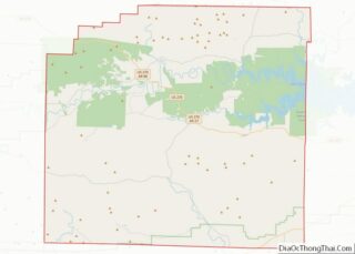
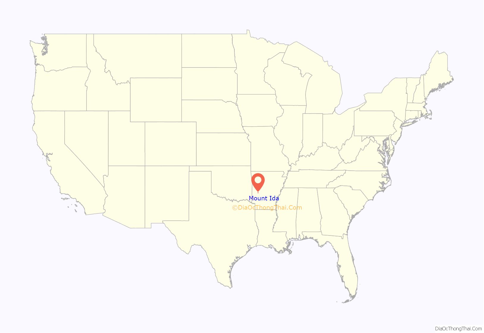
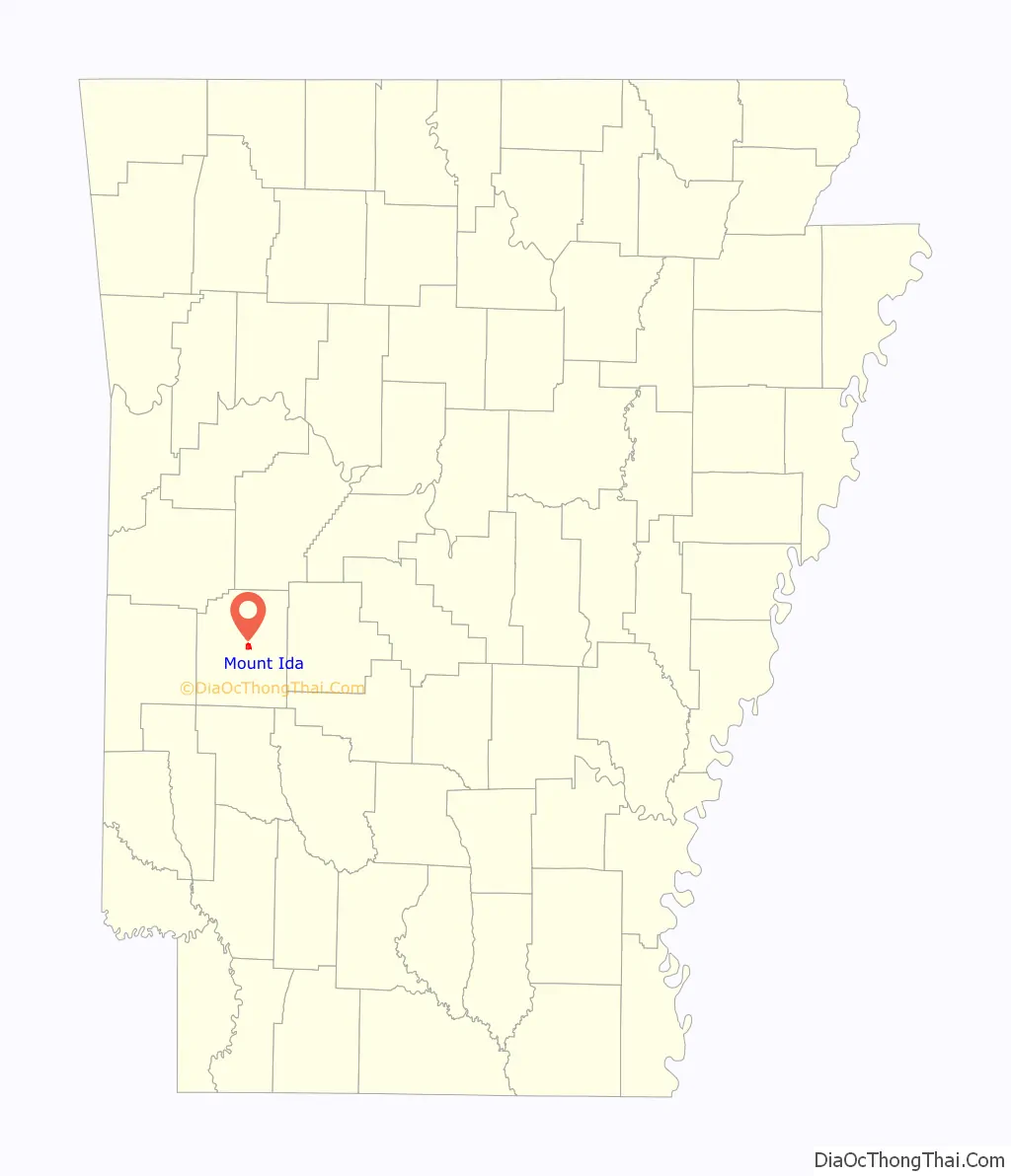
Mount Ida location map. Where is Mount Ida city?
History
Mount Ida was incorporated on May 30, 1890.
Episode 133, entitled “What’s in my Pocket?”, of the popular podcast Small Town Murder, hosted by James Pietragallo and Jimmie Whisman, featured Mount Ida on August 22, 2019.
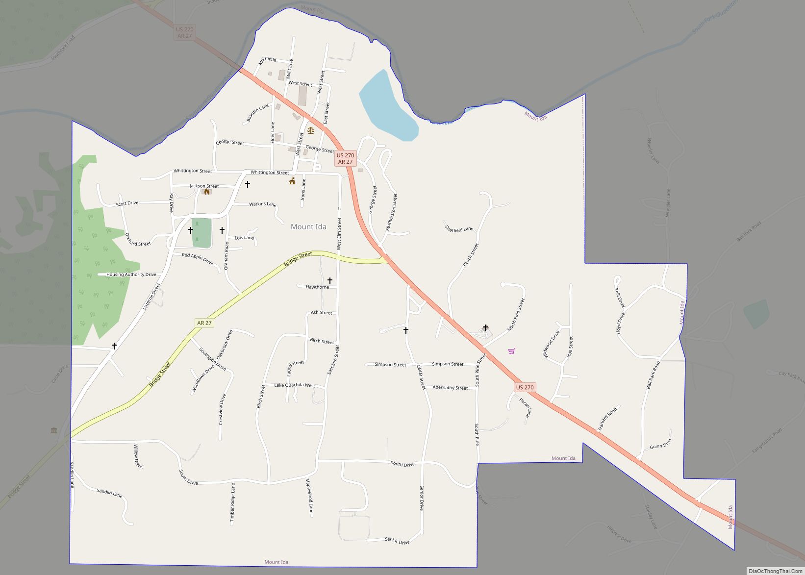
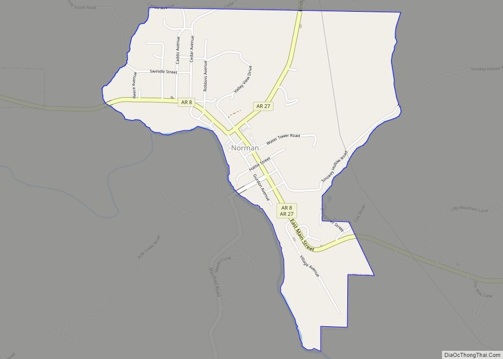
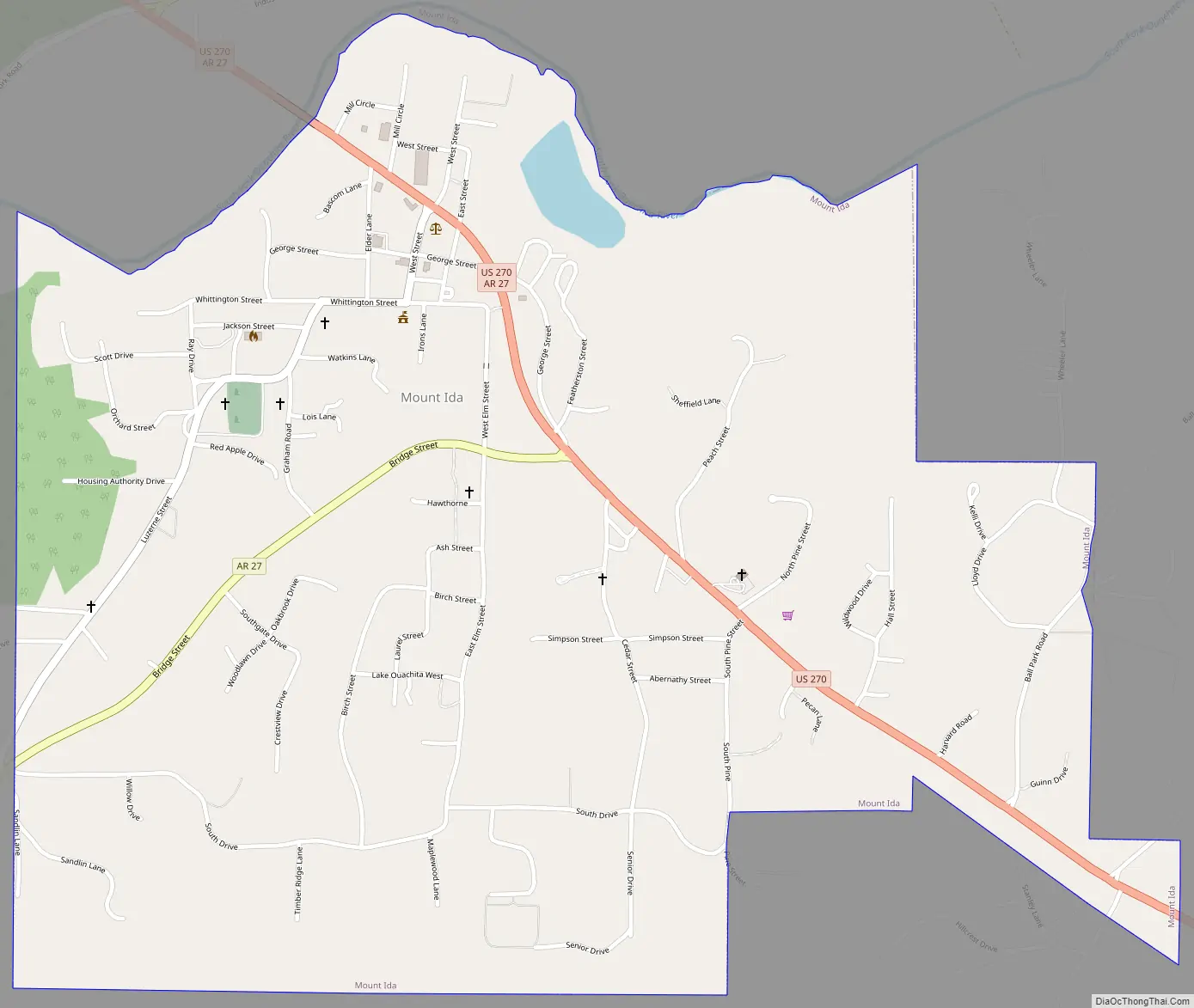
Mount Ida Road Map
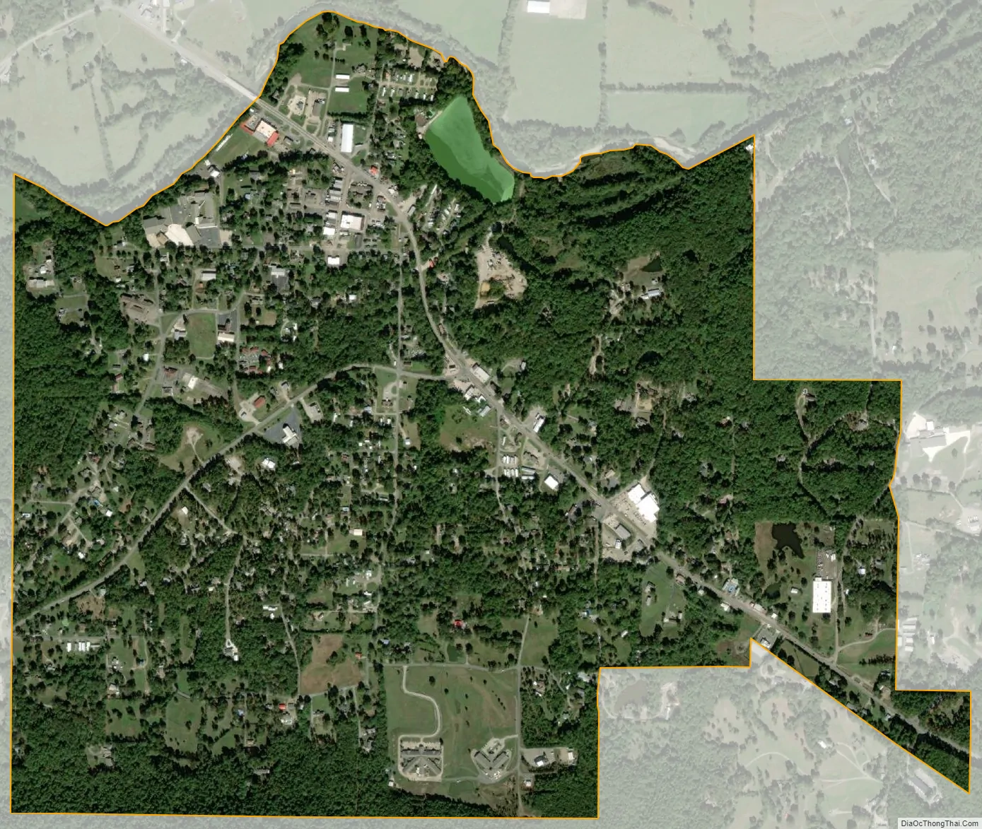
Mount Ida city Satellite Map
Geography
Mount Ida is located in central Montgomery County on the south bank of the South Fork of the Ouachita River. US Route 270 and Arkansas Highway 27 pass through the town. US 270 leads east 36 miles (58 km) to Hot Springs and northwest 86 miles (138 km) to Heavener, Oklahoma, while AR 27 leads northeast 46 miles (74 km) to Danville and southwest 9 miles (14 km) to Norman. Mount Ida, the mountain, is about 5 miles (8 km) southwest of the town along Route 27.
According to the United States Census Bureau, the city of Mount Ida has a total area of 1.60 square miles (4.14 km), of which 0.03 square miles (0.08 km), or 1.94%, are water.
Climate
The climate in this area is characterized by hot, humid summers and generally mild to cool winters. According to the Köppen Climate Classification system, Mount Ida has a humid subtropical climate, abbreviated “Cfa” on climate maps.
See also
Map of Arkansas State and its subdivision:- Arkansas
- Ashley
- Baxter
- Benton
- Boone
- Bradley
- Calhoun
- Carroll
- Chicot
- Clark
- Clay
- Cleburne
- Cleveland
- Columbia
- Conway
- Craighead
- Crawford
- Crittenden
- Cross
- Dallas
- Desha
- Drew
- Faulkner
- Franklin
- Fulton
- Garland
- Grant
- Greene
- Hempstead
- Hot Spring
- Howard
- Independence
- Izard
- Jackson
- Jefferson
- Johnson
- Lafayette
- Lawrence
- Lee
- Lincoln
- Little River
- Logan
- Lonoke
- Madison
- Marion
- Miller
- Mississippi
- Monroe
- Montgomery
- Nevada
- Newton
- Ouachita
- Perry
- Phillips
- Pike
- Poinsett
- Polk
- Pope
- Prairie
- Pulaski
- Randolph
- Saint Francis
- Saline
- Scott
- Searcy
- Sebastian
- Sevier
- Sharp
- Stone
- Union
- Van Buren
- Washington
- White
- Woodruff
- Yell
- Alabama
- Alaska
- Arizona
- Arkansas
- California
- Colorado
- Connecticut
- Delaware
- District of Columbia
- Florida
- Georgia
- Hawaii
- Idaho
- Illinois
- Indiana
- Iowa
- Kansas
- Kentucky
- Louisiana
- Maine
- Maryland
- Massachusetts
- Michigan
- Minnesota
- Mississippi
- Missouri
- Montana
- Nebraska
- Nevada
- New Hampshire
- New Jersey
- New Mexico
- New York
- North Carolina
- North Dakota
- Ohio
- Oklahoma
- Oregon
- Pennsylvania
- Rhode Island
- South Carolina
- South Dakota
- Tennessee
- Texas
- Utah
- Vermont
- Virginia
- Washington
- West Virginia
- Wisconsin
- Wyoming