Pea Ridge is a city in Benton County, Arkansas, United States. The name Pea Ridge is derived from a combination of the physical location of the original settlement of the town, across the crest of an Ozark Mountains ridge, and for the hog peanuts or turkey peas that had been originally cultivated by Native American tribes centuries before European settlement, which later helped to provide basic subsistence once those pioneer settlers arrived.
The rural town is best known as the location of the pivotal American Civil War engagement the Battle of Pea Ridge, or, as it is locally known, the Battle of Elkhorn Tavern, which took place approximately 5 miles (8 km) east of the town. The site of the battle is preserved as the Pea Ridge National Military Park.
The town’s downtown business district is on the National Register of Historic Places and largely comprises commercial structures from the late 19th and early 20th centuries. The population of Pea Ridge was 6,559 as of the 2020 census. It is part of the Northwest Arkansas region. The local weekly newspaper is the Times of Northeast Benton County.
| Name: | Pea Ridge city |
|---|---|
| LSAD Code: | 25 |
| LSAD Description: | city (suffix) |
| State: | Arkansas |
| County: | Benton County |
| Elevation: | 1,293 ft (394 m) |
| Total Area: | 7.58 sq mi (19.64 km²) |
| Land Area: | 7.58 sq mi (19.64 km²) |
| Water Area: | 0.00 sq mi (0.00 km²) |
| Total Population: | 6,559 |
| Population Density: | 864.96/sq mi (333.94/km²) |
| ZIP code: | 72751 |
| Area code: | 479 |
| FIPS code: | 0554200 |
| GNISfeature ID: | 0077964 |
| Website: | cityofpearidge.com |
Online Interactive Map
Click on ![]() to view map in "full screen" mode.
to view map in "full screen" mode.
Pea Ridge location map. Where is Pea Ridge city?
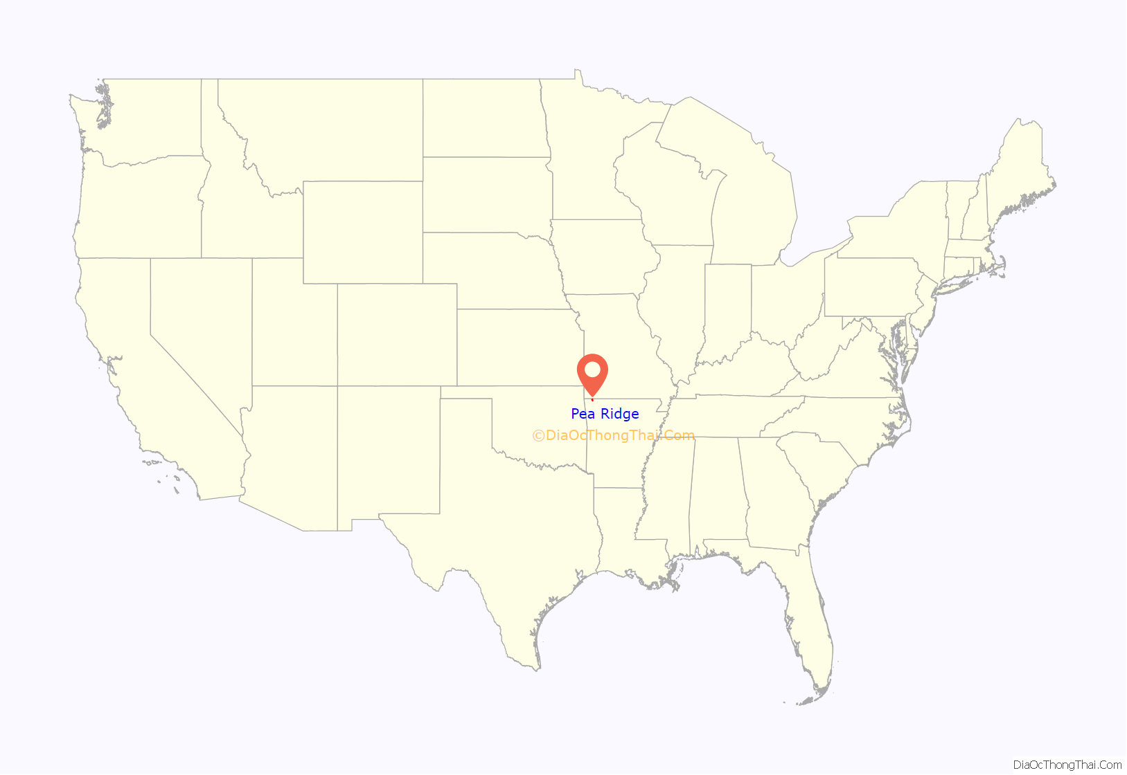
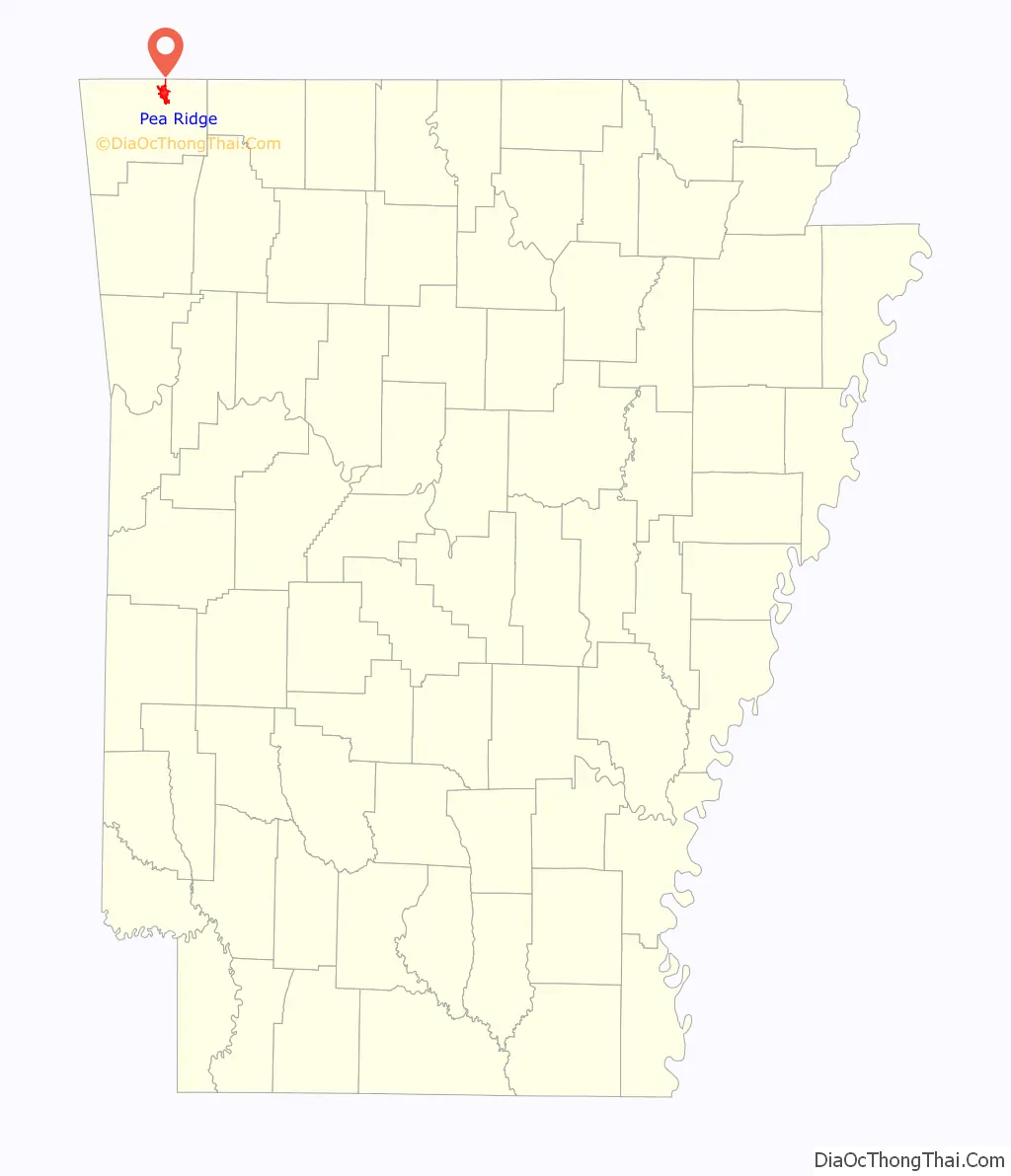
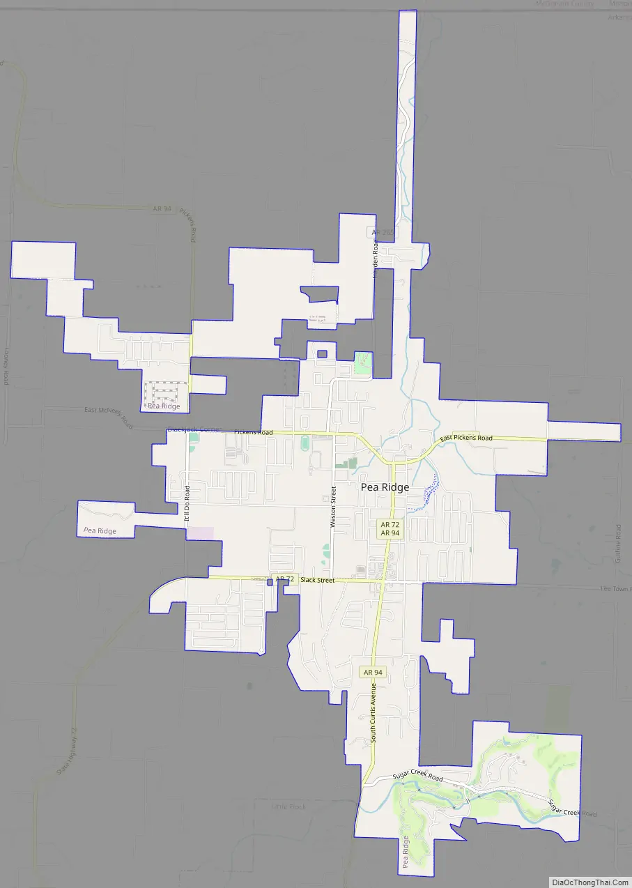
Pea Ridge Road Map
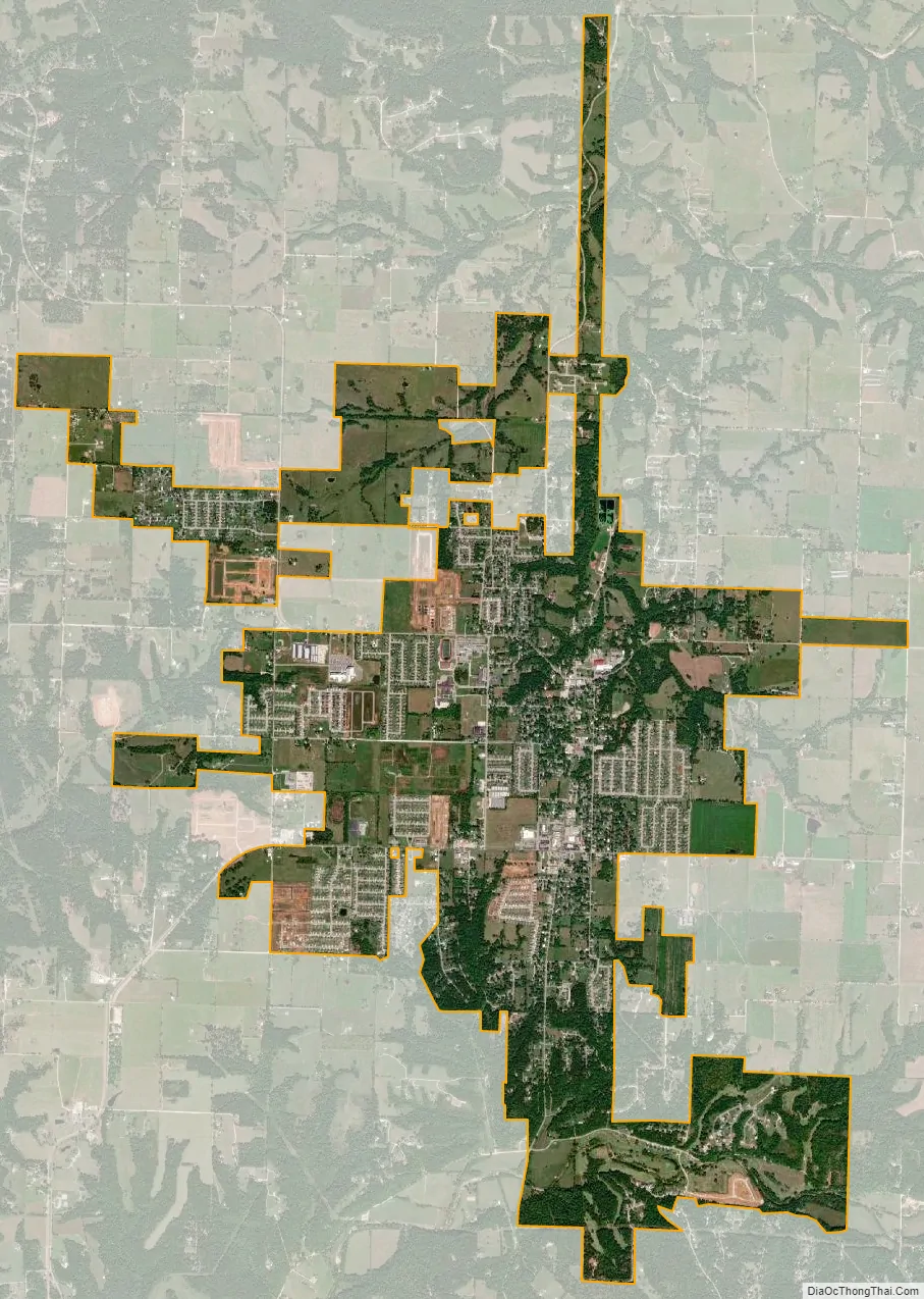
Pea Ridge city Satellite Map
Geography
Pea Ridge is located in northern Benton County at 36°26′52″N 94°7′0″W / 36.44778°N 94.11667°W / 36.44778; -94.11667 (36.447822, -94.116691). Arkansas Highway 94 is the main road through the city, leading south 8 miles (13 km) to the center of Rogers and northwest 6 miles (10 km) to the Missouri border. Arkansas Highway 72 leads east 5 miles (8 km) to U.S. Route 62 at Pea Ridge National Military Park, and southwest 9 miles (14 km) to Bentonville.
According to the United States Census Bureau, the city has a total area of 7.4 square miles (19.1 km), all land.
See also
Map of Arkansas State and its subdivision:- Arkansas
- Ashley
- Baxter
- Benton
- Boone
- Bradley
- Calhoun
- Carroll
- Chicot
- Clark
- Clay
- Cleburne
- Cleveland
- Columbia
- Conway
- Craighead
- Crawford
- Crittenden
- Cross
- Dallas
- Desha
- Drew
- Faulkner
- Franklin
- Fulton
- Garland
- Grant
- Greene
- Hempstead
- Hot Spring
- Howard
- Independence
- Izard
- Jackson
- Jefferson
- Johnson
- Lafayette
- Lawrence
- Lee
- Lincoln
- Little River
- Logan
- Lonoke
- Madison
- Marion
- Miller
- Mississippi
- Monroe
- Montgomery
- Nevada
- Newton
- Ouachita
- Perry
- Phillips
- Pike
- Poinsett
- Polk
- Pope
- Prairie
- Pulaski
- Randolph
- Saint Francis
- Saline
- Scott
- Searcy
- Sebastian
- Sevier
- Sharp
- Stone
- Union
- Van Buren
- Washington
- White
- Woodruff
- Yell
- Alabama
- Alaska
- Arizona
- Arkansas
- California
- Colorado
- Connecticut
- Delaware
- District of Columbia
- Florida
- Georgia
- Hawaii
- Idaho
- Illinois
- Indiana
- Iowa
- Kansas
- Kentucky
- Louisiana
- Maine
- Maryland
- Massachusetts
- Michigan
- Minnesota
- Mississippi
- Missouri
- Montana
- Nebraska
- Nevada
- New Hampshire
- New Jersey
- New Mexico
- New York
- North Carolina
- North Dakota
- Ohio
- Oklahoma
- Oregon
- Pennsylvania
- Rhode Island
- South Carolina
- South Dakota
- Tennessee
- Texas
- Utah
- Vermont
- Virginia
- Washington
- West Virginia
- Wisconsin
- Wyoming