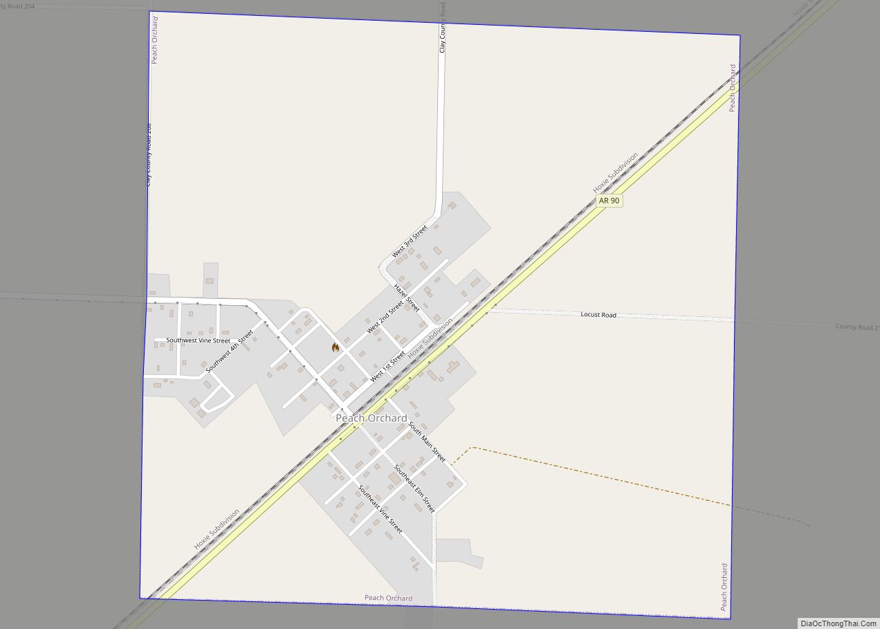
Peach Orchard is a city in Clay County, Arkansas, United States. The population was 135 at the 2010 census.
| Name: | Peach Orchard city |
|---|---|
| LSAD Code: | 25 |
| LSAD Description: | city (suffix) |
| State: | Arkansas |
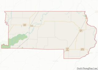
| County: | Clay County |
| Elevation: | 285 ft (87 m) |
| Total Area: | 1.03 sq mi (2.67 km²) |
| Land Area: | 1.03 sq mi (2.67 km²) |
| Water Area: | 0.00 sq mi (0.00 km²) |
| Total Population: | 105 |
| Population Density: | 101.94/sq mi (39.36/km²) |
| ZIP code: | 72453 |
| Area code: | 870 |
| FIPS code: | 0554140 |
| GNISfeature ID: | 2404493 |
Online Interactive Map
Click on ![]() to view map in "full screen" mode.
to view map in "full screen" mode.
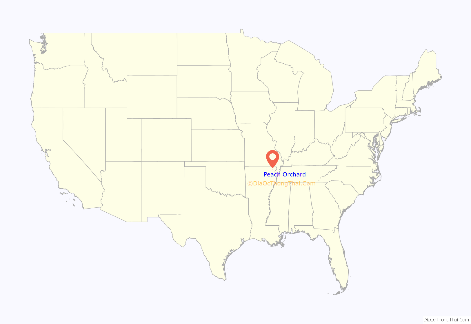
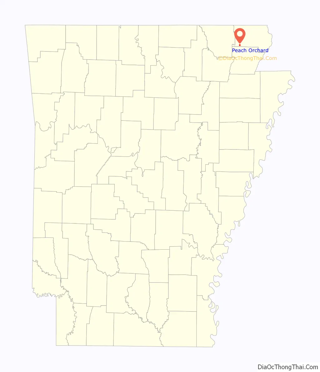
Peach Orchard location map. Where is Peach Orchard city?
History
Peach Orchard is rooted in an estate known as “Petit Baril,” established by French explorer Pierre Le Mieux in the early 19th century. Local English-speakers were calling it “Peach Orchard” by the time Le Mieux sold the estate in 1816. A trading post operated at Peach Orchard during the mid-19th century, and was frequently raided by guerrilla forces during the Civil War.
The construction of the St. Louis, Iron Mountain and Southern Railway in the 1870s brought increased development to Peach Orchard, focused primarily on the railroad and the timber industry. A post office opened in 1873, and a depot was constructed. The city incorporated in 1910.
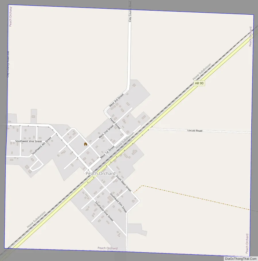
Peach Orchard Road Map
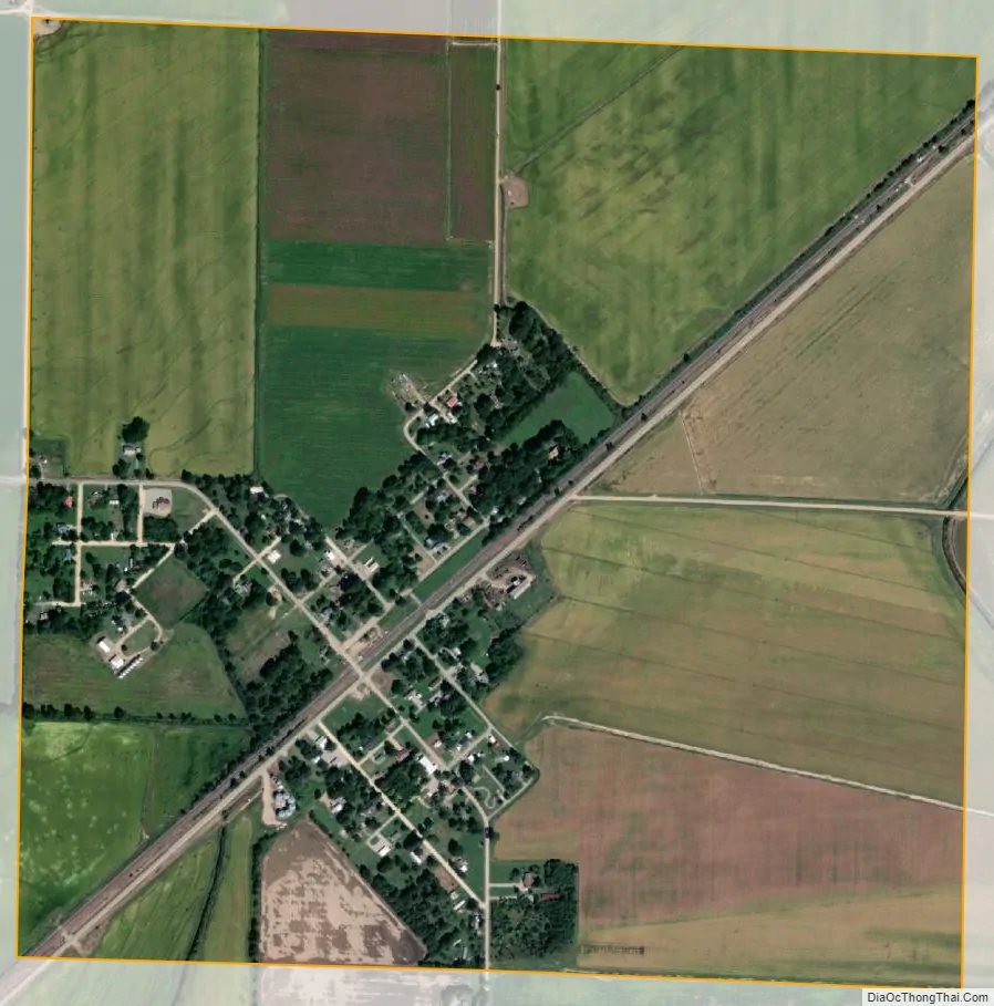
Peach Orchard city Satellite Map
Geography
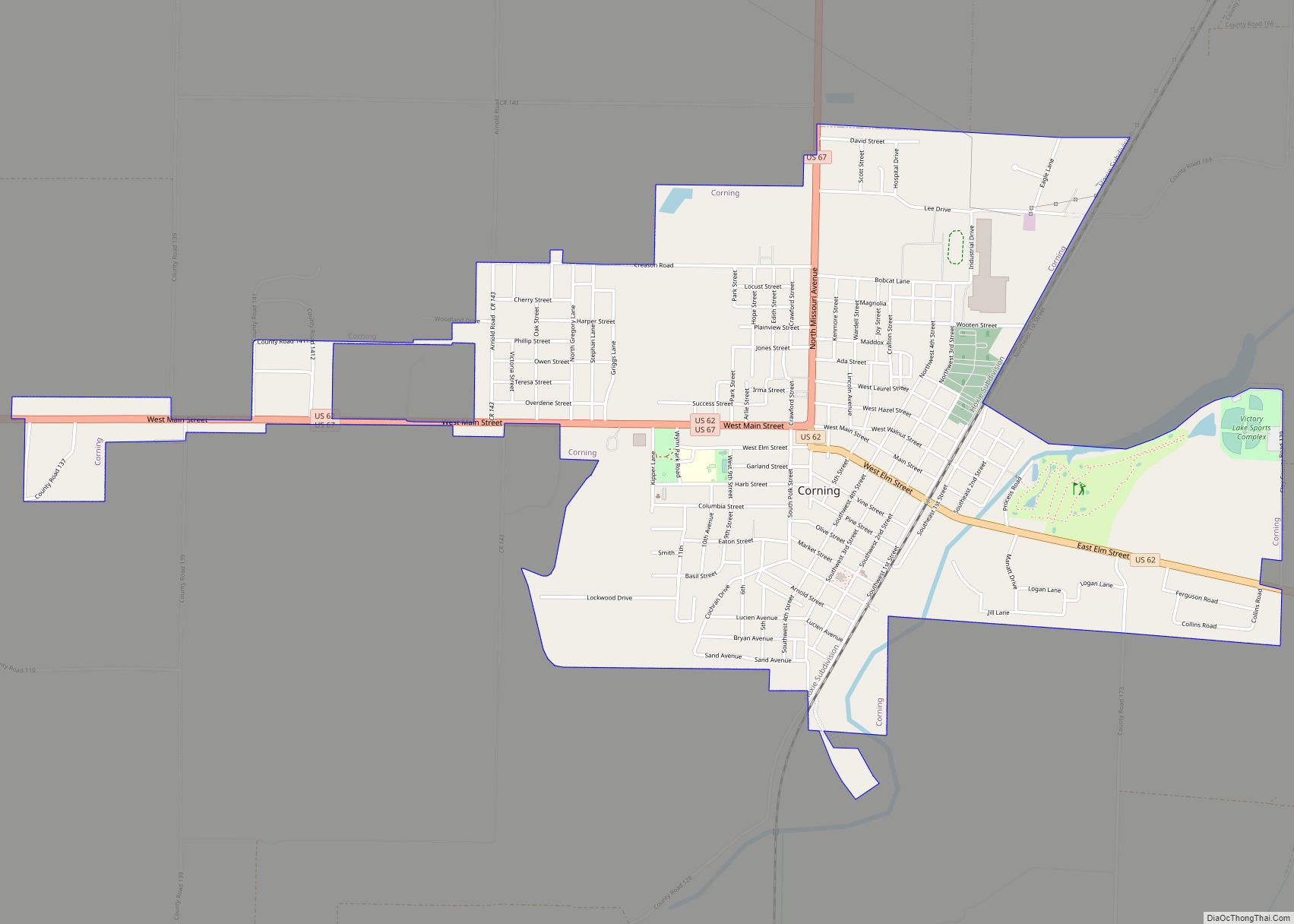
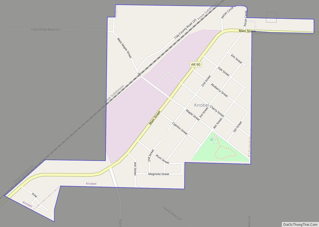
Peach Orchard is located southwest of Corning along Arkansas Highway 90, between Knobel and Delaplaine.
According to the United States Census Bureau, the town has a total area of 1.0 square mile (2.6 km), all land.
See also
Map of Arkansas State and its subdivision:- Arkansas
- Ashley
- Baxter
- Benton
- Boone
- Bradley
- Calhoun
- Carroll
- Chicot
- Clark
- Clay
- Cleburne
- Cleveland
- Columbia
- Conway
- Craighead
- Crawford
- Crittenden
- Cross
- Dallas
- Desha
- Drew
- Faulkner
- Franklin
- Fulton
- Garland
- Grant
- Greene
- Hempstead
- Hot Spring
- Howard
- Independence
- Izard
- Jackson
- Jefferson
- Johnson
- Lafayette
- Lawrence
- Lee
- Lincoln
- Little River
- Logan
- Lonoke
- Madison
- Marion
- Miller
- Mississippi
- Monroe
- Montgomery
- Nevada
- Newton
- Ouachita
- Perry
- Phillips
- Pike
- Poinsett
- Polk
- Pope
- Prairie
- Pulaski
- Randolph
- Saint Francis
- Saline
- Scott
- Searcy
- Sebastian
- Sevier
- Sharp
- Stone
- Union
- Van Buren
- Washington
- White
- Woodruff
- Yell
- Alabama
- Alaska
- Arizona
- Arkansas
- California
- Colorado
- Connecticut
- Delaware
- District of Columbia
- Florida
- Georgia
- Hawaii
- Idaho
- Illinois
- Indiana
- Iowa
- Kansas
- Kentucky
- Louisiana
- Maine
- Maryland
- Massachusetts
- Michigan
- Minnesota
- Mississippi
- Missouri
- Montana
- Nebraska
- Nevada
- New Hampshire
- New Jersey
- New Mexico
- New York
- North Carolina
- North Dakota
- Ohio
- Oklahoma
- Oregon
- Pennsylvania
- Rhode Island
- South Carolina
- South Dakota
- Tennessee
- Texas
- Utah
- Vermont
- Virginia
- Washington
- West Virginia
- Wisconsin
- Wyoming