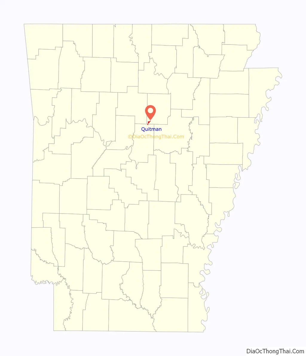
Quitman is a city in Cleburne and Faulkner counties in the U.S. state of Arkansas. Its population was 762 at the 2010 census. The portion of the city in Faulkner County is part of the Little Rock–North Little Rock–Conway Metropolitan Statistical Area.
| Name: | Quitman city |
|---|---|
| LSAD Code: | 25 |
| LSAD Description: | city (suffix) |
| State: | Arkansas |
| County: | Cleburne County, Faulkner County |
| Elevation: | 591 ft (180 m) |
| Total Area: | 1.90 sq mi (4.91 km²) |
| Land Area: | 1.90 sq mi (4.91 km²) |
| Water Area: | 0.00 sq mi (0.00 km²) |
| Total Population: | 694 |
| Population Density: | 366.23/sq mi (141.42/km²) |
| ZIP code: | 72131 |
| Area code: | 501 |
| FIPS code: | 0557950 |
| GNISfeature ID: | 0053864 |
Online Interactive Map
Click on ![]() to view map in "full screen" mode.
to view map in "full screen" mode.
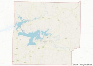
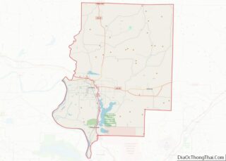
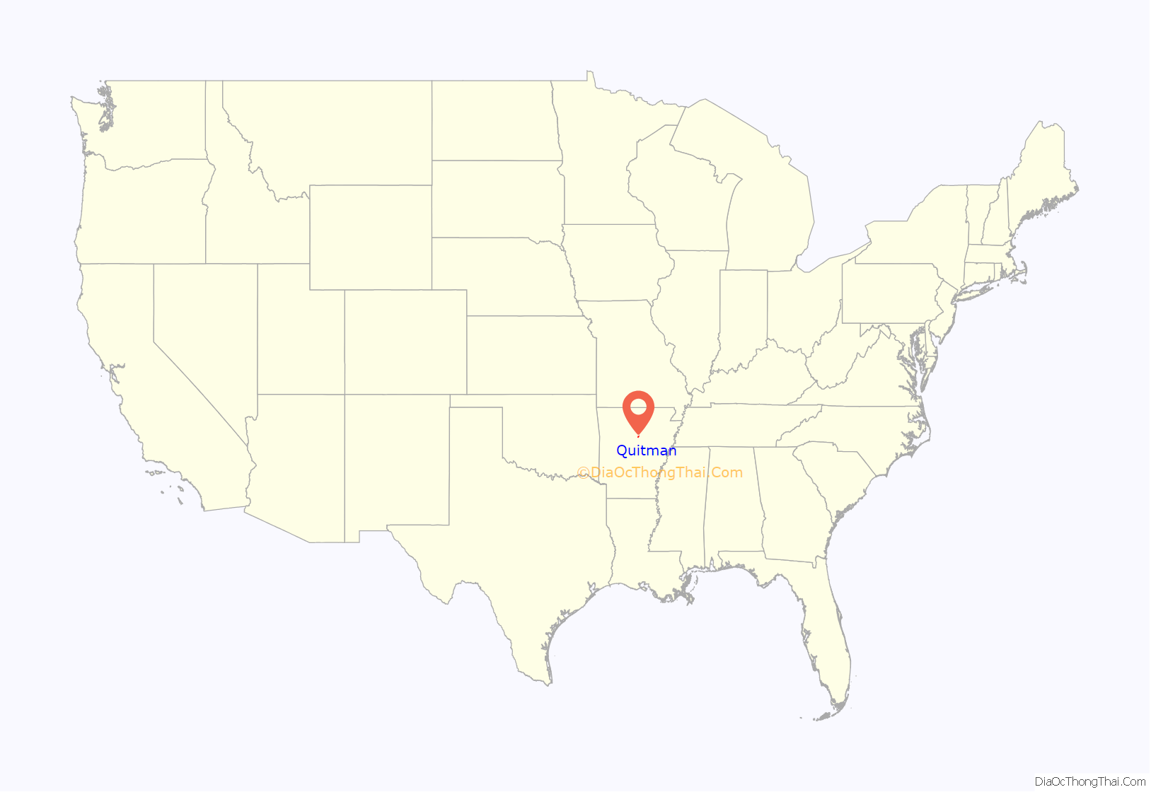
Quitman location map. Where is Quitman city?
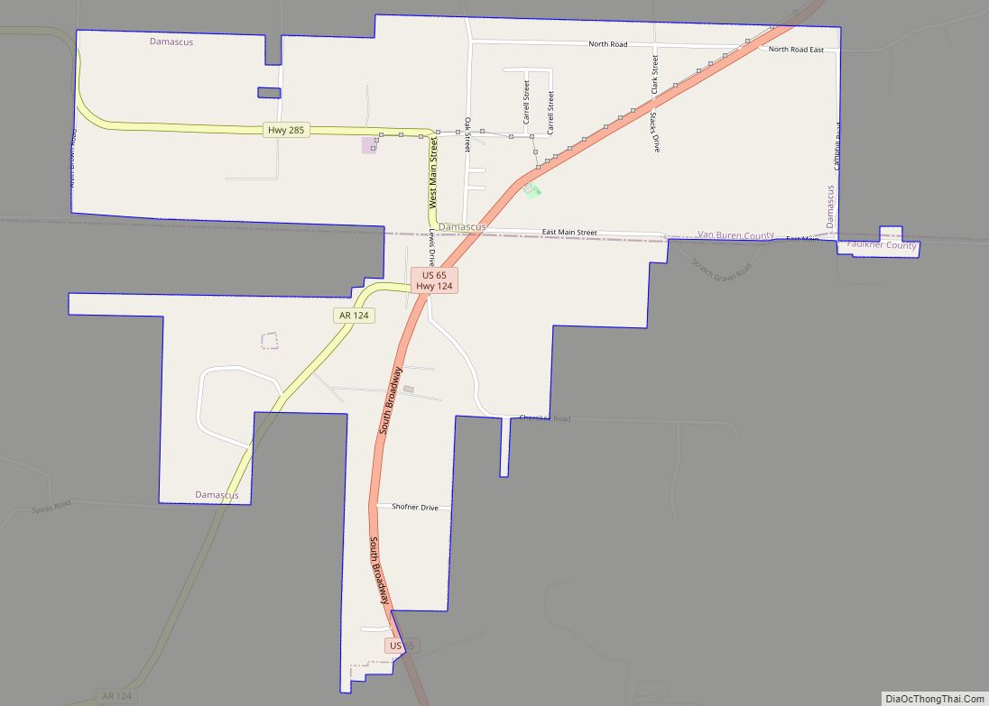
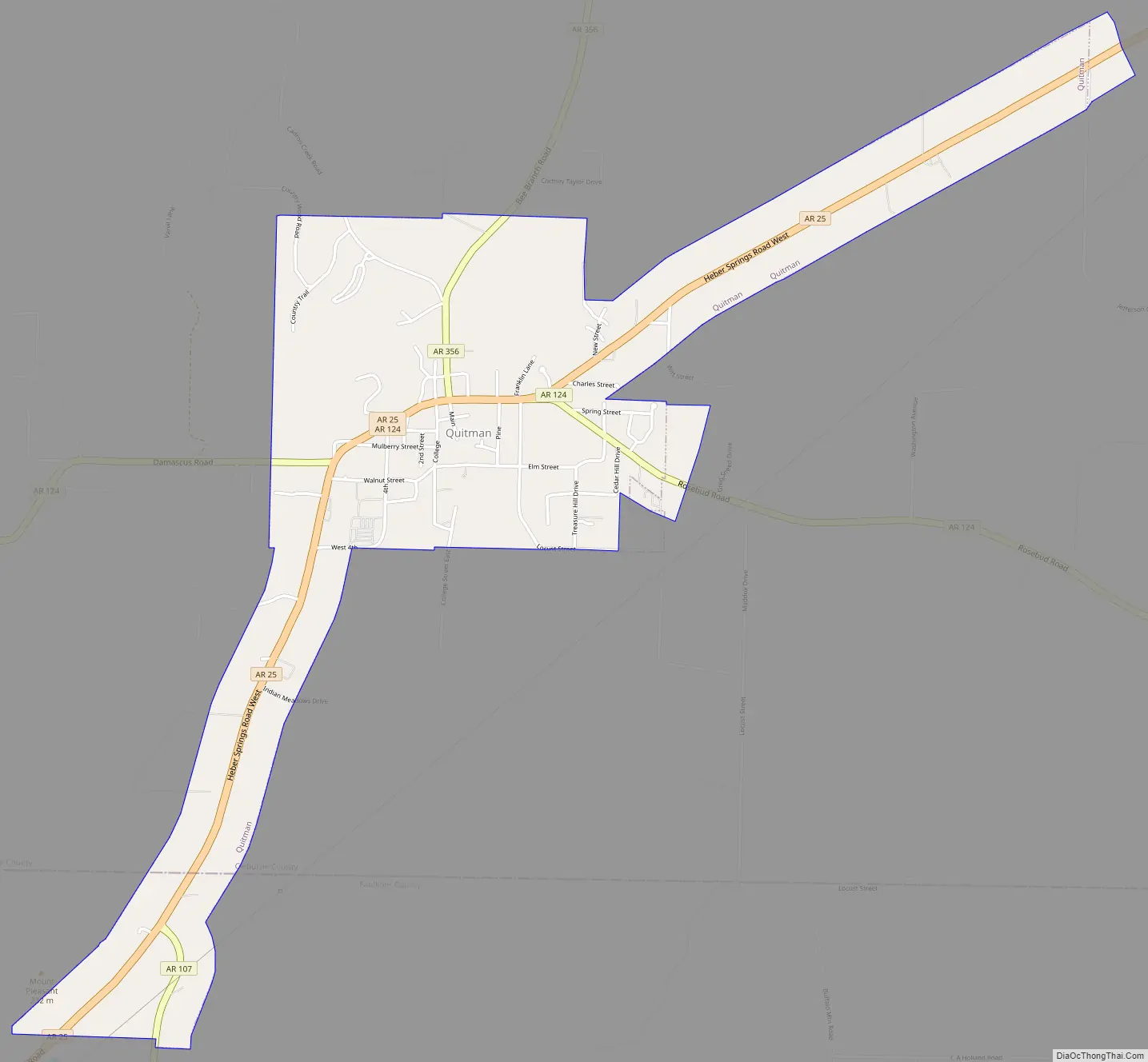
Quitman Road Map
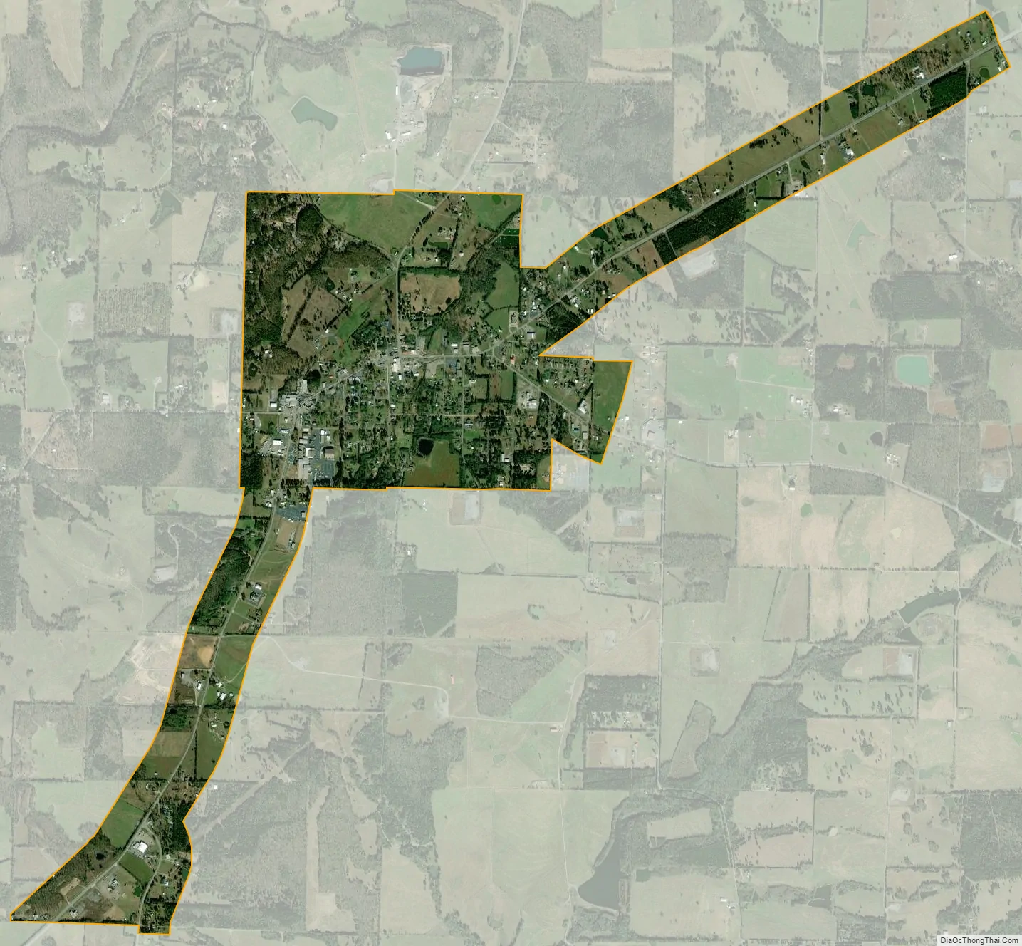
Quitman city Satellite Map
Geography
Quitman is located in southwestern Cleburne County at 35°22′52″N 92°13′5″W / 35.38111°N 92.21806°W / 35.38111; -92.21806 (35.381231, -92.218190). It extends southwest along Arkansas Highway 25 into Faulkner County. Highway 25 leads 15 miles (24 km) northeast to Heber Springs, the Cleburne County seat, and southwest 14 miles (23 km) to U.S. Route 65 north of Greenbrier.
According to the United States Census Bureau, Quitman has a total area of 2.0 square miles (5.1 km), all land.
See also
Map of Arkansas State and its subdivision:- Arkansas
- Ashley
- Baxter
- Benton
- Boone
- Bradley
- Calhoun
- Carroll
- Chicot
- Clark
- Clay
- Cleburne
- Cleveland
- Columbia
- Conway
- Craighead
- Crawford
- Crittenden
- Cross
- Dallas
- Desha
- Drew
- Faulkner
- Franklin
- Fulton
- Garland
- Grant
- Greene
- Hempstead
- Hot Spring
- Howard
- Independence
- Izard
- Jackson
- Jefferson
- Johnson
- Lafayette
- Lawrence
- Lee
- Lincoln
- Little River
- Logan
- Lonoke
- Madison
- Marion
- Miller
- Mississippi
- Monroe
- Montgomery
- Nevada
- Newton
- Ouachita
- Perry
- Phillips
- Pike
- Poinsett
- Polk
- Pope
- Prairie
- Pulaski
- Randolph
- Saint Francis
- Saline
- Scott
- Searcy
- Sebastian
- Sevier
- Sharp
- Stone
- Union
- Van Buren
- Washington
- White
- Woodruff
- Yell
- Alabama
- Alaska
- Arizona
- Arkansas
- California
- Colorado
- Connecticut
- Delaware
- District of Columbia
- Florida
- Georgia
- Hawaii
- Idaho
- Illinois
- Indiana
- Iowa
- Kansas
- Kentucky
- Louisiana
- Maine
- Maryland
- Massachusetts
- Michigan
- Minnesota
- Mississippi
- Missouri
- Montana
- Nebraska
- Nevada
- New Hampshire
- New Jersey
- New Mexico
- New York
- North Carolina
- North Dakota
- Ohio
- Oklahoma
- Oregon
- Pennsylvania
- Rhode Island
- South Carolina
- South Dakota
- Tennessee
- Texas
- Utah
- Vermont
- Virginia
- Washington
- West Virginia
- Wisconsin
- Wyoming