Rison is a city in and the county seat of Cleveland County, Arkansas, United States. Its population was 1,344 at the 2010 U.S. census. It is included in the Pine Bluff, Arkansas Metropolitan Statistical Area. Rison is a bedroom community for people who work in Pine Bluff (in neighboring Jefferson County). The largest employers are the city and county governments, the Cleveland County School District, the Cleveland County Nursing Home. There are two banks, eight churches, and about forty-five businesses within the city limits. Among the local properties listed on the National Register of Historic Places are the Rison Cities Service Station and the Rison Texaco Service Station.
| Name: | Rison city |
|---|---|
| LSAD Code: | 25 |
| LSAD Description: | city (suffix) |
| State: | Arkansas |
| County: | Cleveland County |
| Elevation: | 269 ft (82 m) |
| Total Area: | 3.27 sq mi (8.48 km²) |
| Land Area: | 3.27 sq mi (8.48 km²) |
| Water Area: | 0.00 sq mi (0.00 km²) |
| Total Population: | 967 |
| Population Density: | 295.27/sq mi (113.99/km²) |
| ZIP code: | 71665 |
| Area code: | 870 |
| FIPS code: | 0559480 |
| GNISfeature ID: | 0058495 |
Online Interactive Map
Click on ![]() to view map in "full screen" mode.
to view map in "full screen" mode.
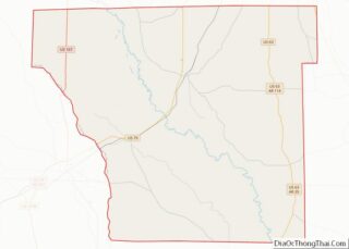
Rison location map. Where is Rison city?


History
The Texas and St. Louis Railroad gave rise to Rison. The county seat of Dorsey (later Cleveland) County was originally at Toledo. When the railroad was routed through the county in 1882, Rison did not exist as a place name. Samuel Wesley Fordyce of Huntsville, Alabama, a former Union army officer, was authorized to determine the route of the railroad from Texarkana (Miller County) to Birds Point, Missouri. According to unsubstantiated legend, when the leading citizens of Toledo snubbed his plans to route the railroad through that community, he planned a route three miles north through land that later became the town of Rison.
Samuel W. Fordyce named the growing community in honor of William Richard Rison, his former partner in a banking venture in Alabama, who had fought on the opposite side of the Civil War from Samuel. The first home erected in the community that became Rison was built in 1880 by lawyer and farmer James M. McMurtrey. In 1883, the Southwest Improvement Association, a subsidiary of the railroad company, presented a parcel of land for use by the inhabitants of the area that became Rison. Rison was incorporated in 1890 with J. T. Renfrow as mayor. The name of the county was changed from Dorsey to Cleveland in 1885; the popularity of U.S. Senator Stephen Dorsey had waned, and President Grover Cleveland’s name was substituted. The state Supreme Court moved the county seat from Toledo to Rison in 1891 after a spirited battle among the leading contenders, Toledo, Kingsland, and Rison.
The railroad remained Rison’s point of reference for decades. “Rison on the Cotton Belt” was the affectionate way residents referred to their community. The commercial value of the railroad was felt from the beginning. The economy depended on the production of cotton, lumber, and, ultimately, a wide variety of wood products, including pulpwood, piling, pallets, broom handle squares, ammunition boxes, and U.S. Army pup tent poles.
The financial make-up of the community was divided for several decades into owners and sharecroppers. The emergence of the timber-related wood products business ultimately skewed that economic picture, with the corresponding rise of the merchant entrepreneurs also affecting it somewhat. Nevertheless, family fortunes were built on the owner/sharecropper system, and they influenced the financial and social structure of the town. Sharecropping was the prevailing structure of the primary business enterprise in the county until the land became depleted by failure to rotate crops adequately.
The Cleveland County Courthouse was built in 1911 after two contested elections. Two years later, the Phoenix Hotel was built and served as a popular gathering spot for the local community.
Three cotton gins operated in and around Rison. The largest and most efficient gin was owned by Ira E. Moore. That gin was built in 1933 to replace one owned by Moore that was built in 1926 and burned in 1933. The more modern and efficient all-electric gin built in 1933 was the first of its kind in the area.
Residents of Rison owned and operated a dozen or more sawmills. The largest lumber mills were the J. I. Porter Lumber Company and the Clio Lumber Company. The Clio mill was built in 1887 five miles north of Rison. According to a 1909 issue of Lumberman’s Magazine, the Clio mill owned several thousand acres of timberland and had 432 employees in the sawmill, 130 on the woods crew, and eighty operating the tramlines that transported the logs to the mill. Other mills that added significantly to the economy were the J. L. Sadler Lumber Company, the C. L. Garner & Sons Lumber Company, and the Elrod Lumber Company. In the 1950s, Elrod employed about one-third of Rison’s population, more than 300.
During World War II, many Rison residents secured war-related jobs in nearby towns. These included the Pine Bluff Arsenal (Jefferson County) and the Naval Ammunition Depot at Camden (Ouachita County). Others went to California to work in the shipbuilding industry. The Rison high school’s football program was suspended until the end of the war due to a lack of players and coaches, as well as financial constraints. One of Rison’s citizens, Airman Roy Martin, was shot down over occupied France and classified as missing in action. The French underground secured his freedom by hiding him in attics, barns, and other places not known to the German occupying forces. When the news of Martin’s survival reached Rison, a wild celebration broke out in streets and homes.
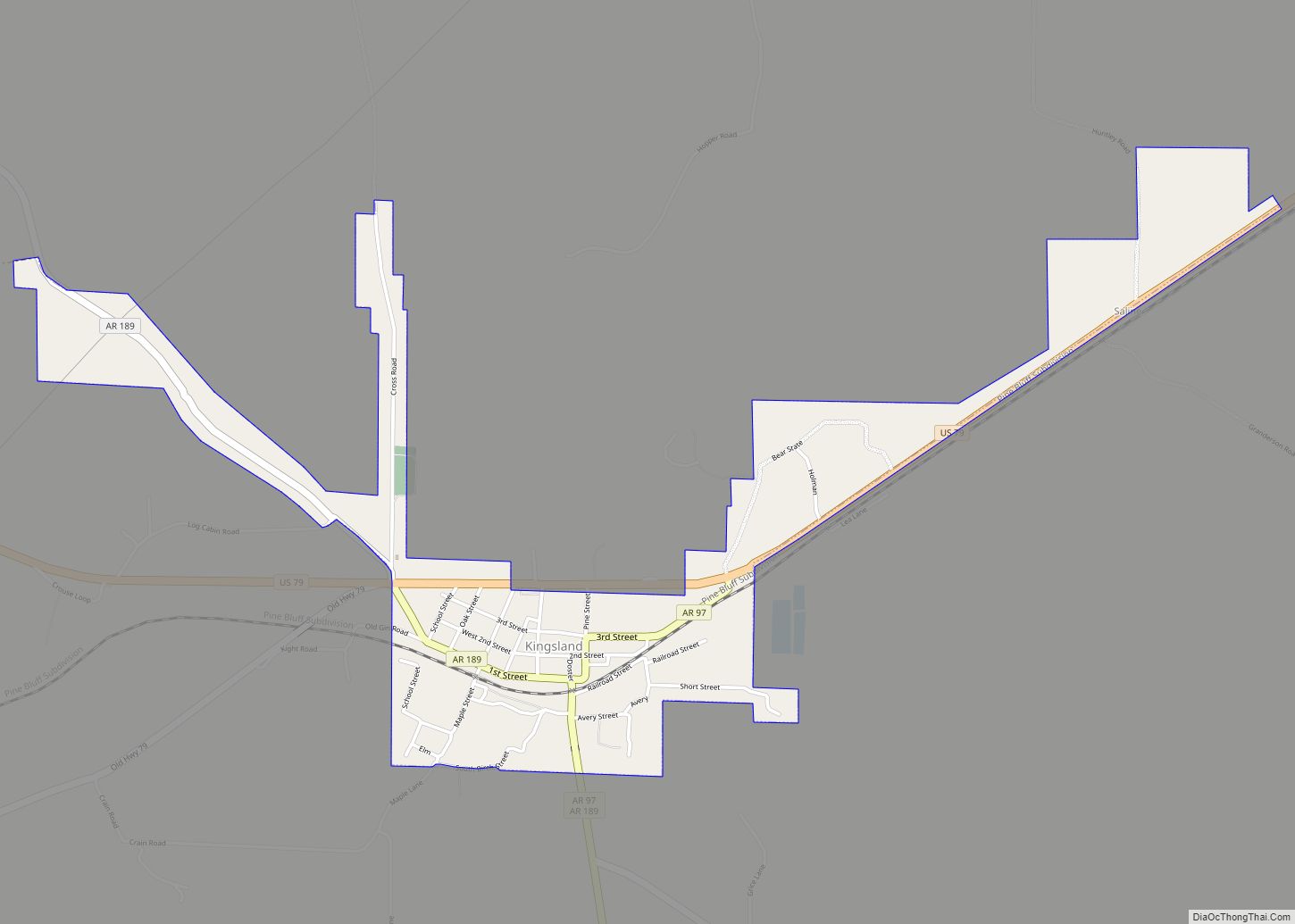
Rison Road Map
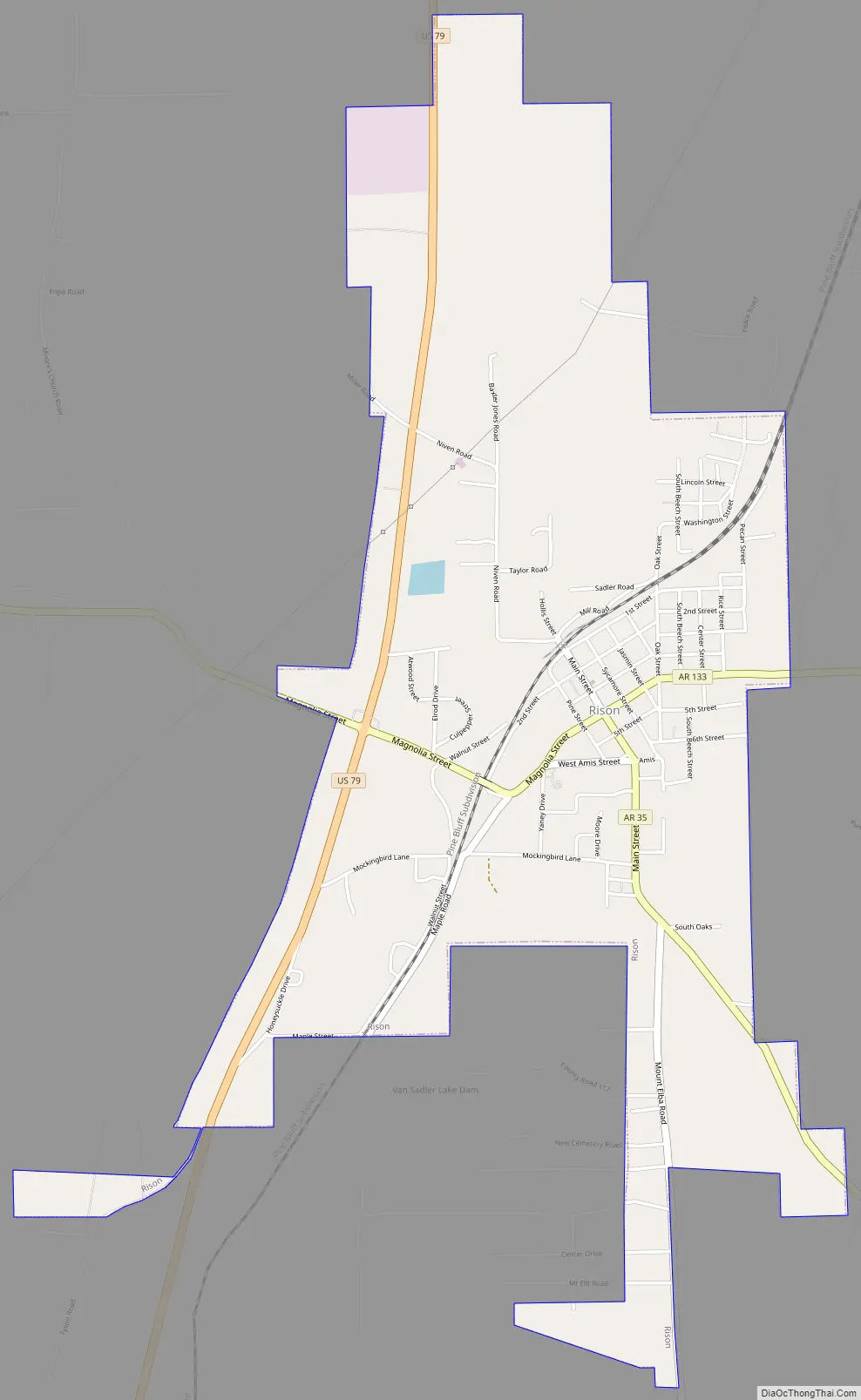
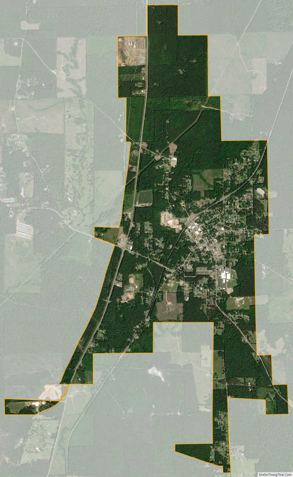
Rison city Satellite Map
Geography
Rison is located in north-central Cleveland County at 33°57′26″N 92°11′23″W / 33.957089°N 92.189711°W / 33.957089; -92.189711. U.S. Route 79 passes through the western side of the city, leading northeast 25 miles (40 km) to Pine Bluff and southwest 17 miles (27 km) to Fordyce.
According to the United States Census Bureau, the city has a total area of 2.6 square miles (6.8 km), all land.
See also
Map of Arkansas State and its subdivision:- Arkansas
- Ashley
- Baxter
- Benton
- Boone
- Bradley
- Calhoun
- Carroll
- Chicot
- Clark
- Clay
- Cleburne
- Cleveland
- Columbia
- Conway
- Craighead
- Crawford
- Crittenden
- Cross
- Dallas
- Desha
- Drew
- Faulkner
- Franklin
- Fulton
- Garland
- Grant
- Greene
- Hempstead
- Hot Spring
- Howard
- Independence
- Izard
- Jackson
- Jefferson
- Johnson
- Lafayette
- Lawrence
- Lee
- Lincoln
- Little River
- Logan
- Lonoke
- Madison
- Marion
- Miller
- Mississippi
- Monroe
- Montgomery
- Nevada
- Newton
- Ouachita
- Perry
- Phillips
- Pike
- Poinsett
- Polk
- Pope
- Prairie
- Pulaski
- Randolph
- Saint Francis
- Saline
- Scott
- Searcy
- Sebastian
- Sevier
- Sharp
- Stone
- Union
- Van Buren
- Washington
- White
- Woodruff
- Yell
- Alabama
- Alaska
- Arizona
- Arkansas
- California
- Colorado
- Connecticut
- Delaware
- District of Columbia
- Florida
- Georgia
- Hawaii
- Idaho
- Illinois
- Indiana
- Iowa
- Kansas
- Kentucky
- Louisiana
- Maine
- Maryland
- Massachusetts
- Michigan
- Minnesota
- Mississippi
- Missouri
- Montana
- Nebraska
- Nevada
- New Hampshire
- New Jersey
- New Mexico
- New York
- North Carolina
- North Dakota
- Ohio
- Oklahoma
- Oregon
- Pennsylvania
- Rhode Island
- South Carolina
- South Dakota
- Tennessee
- Texas
- Utah
- Vermont
- Virginia
- Washington
- West Virginia
- Wisconsin
- Wyoming