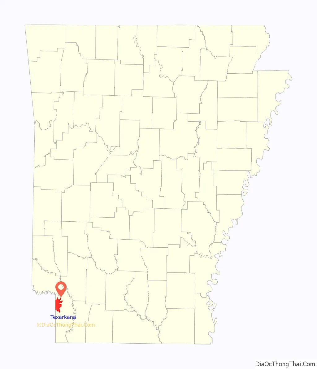
Texarkana is a city in the U.S. state of Arkansas and the county seat of Miller County, on the southwest border of the state. As of the 2020 census, it had a population of 29,387. The city is located across the state line from its twin city of Texarkana, Texas. The city was founded at a railroad intersection on December 8, 1873, and was incorporated in Arkansas on August 10, 1880. Texarkana and its Texas counterpart are the principal cities of the Texarkana metropolitan area, which in 2021 was ranked 289th in the United States with a population of 147,174, according to the United States Census Bureau.
Within the Ark-La-Tex subregion of southwest Arkansas, Texarkana is located in the Piney Woods, an oak–hickory forest that dominates the flat Gulf Coastal Plain. Texarkana’s economy is based on agriculture. The city has long been a trading center, first located at the intersection of major railroads serving Texas, Arkansas and north into Missouri. Since then three major Interstate highways constructed crossroads here: Interstate 30 (I-30), I-49, and the future I-69. Outdoor tourism, such as fishing at Lake Millwood and related activities, is important economically in the region. The Red River Army Depot & Tenants comprise the largest single employer in the city.
The Texarkana Arkansas School District is the largest public school district on the Arkansas side. The city has a branch campus of the University of Arkansas Community College at Hope (UACCH). On the Texas side is located Texarkana College.
| Name: | Texarkana city |
|---|---|
| LSAD Code: | 25 |
| LSAD Description: | city (suffix) |
| State: | Arkansas |
| County: | Miller County |
| Incorporated: | August 10, 1880 |
| Elevation: | 361 ft (110 m) |
| Total Area: | 42.21 sq mi (109.31 km²) |
| Land Area: | 41.98 sq mi (108.72 km²) |
| Water Area: | 0.23 sq mi (0.59 km²) |
| Total Population: | 29,387 |
| Population Density: | 700.06/sq mi (270.30/km²) |
| ZIP code: | 71854 |
| Area code: | 870 |
| FIPS code: | 0568810 |
| GNISfeature ID: | 0078542 |
| Website: | cityoftexarkanaar.com |
Online Interactive Map
Click on ![]() to view map in "full screen" mode.
to view map in "full screen" mode.
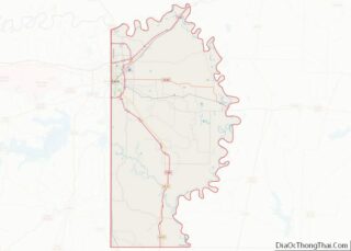
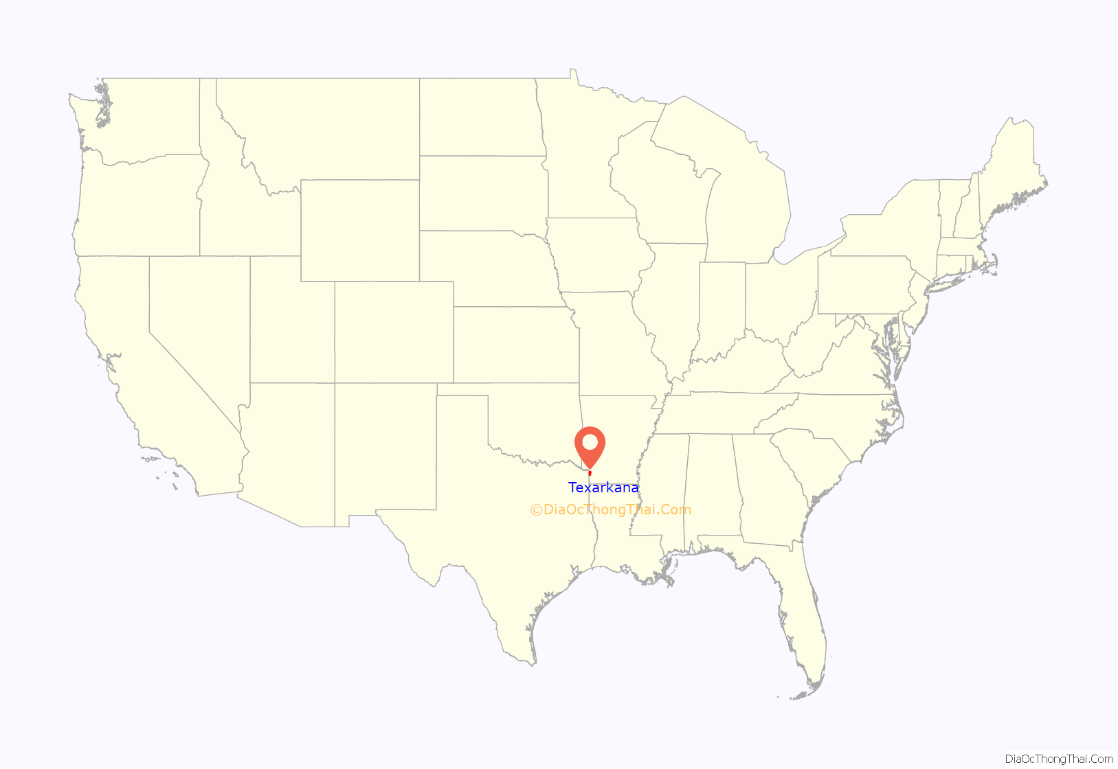
Texarkana location map. Where is Texarkana city?
History
Miller County was formed in 1820 in the Arkansas Territory; it was named in honor of James Miller, Arkansas’ first territorial governor and a general during the War of 1812. Much of its eastern border is formed by the Red River. At the time, there was considerable uncertainty among Americans as to the location of the boundary between the county (and the United States) and national territory of Mexico, which then included Texas.
Consequently, settlers believed that Arkansas levied and collected taxes on land that eventually might be held by Mexico. Moreover, many who resented what they considered Mexican oppression of European-American Texans were openly declaring allegiance to the Texans.
After the Texas Republic gained independence from Mexico, regional unrest increased. In 1838, Governor James Conway proposed that the “easiest and most effective remedy is the abolition of Miller County to an area which is more patriotic.” Miller County was dissolved and its land was made part of Lafayette County, Arkansas.
In 1873 town lots were sold in Texarkana, Arkansas, at the intersection of two railroads, which stimulated its growth as a trading center. In this area and time period, railroads had replaced rivers as the preferred method of transportation and shipping, and new towns were sited for best advantage via the railroad. The next year (1874), Texarkana, Texas, was founded on the rail line on June 12 across the state border.
That same year, the Arkansas legislature re-established Miller County. Efforts of the young town in Arkansas to be incorporated were not realized until October 17, 1880, nearly seven years after Texarkana, Texas, was formed. Both Texarkana cities generally recognize December 8, 1873, as the date of organization.
On February 11, 1922, masked men lynched Mr. Norman, an African-American man, in Texarkana, Miller County, Arkansas. Lynchings were perpetrated by white men primarily against black males, although some black women were also lynched in the South.
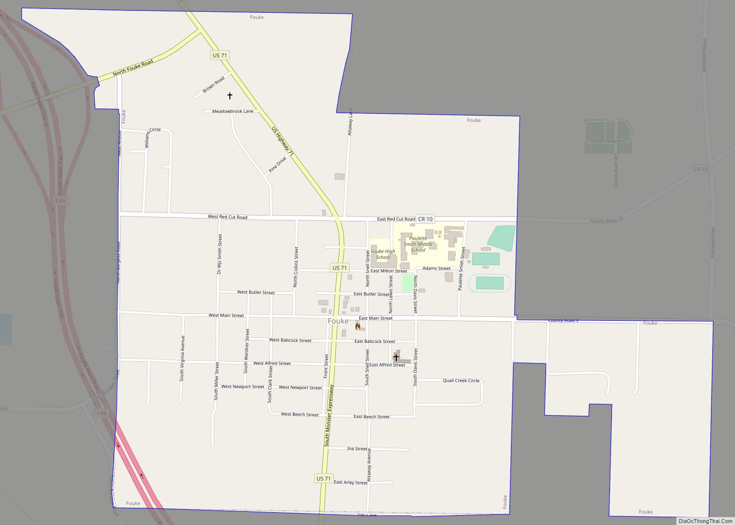
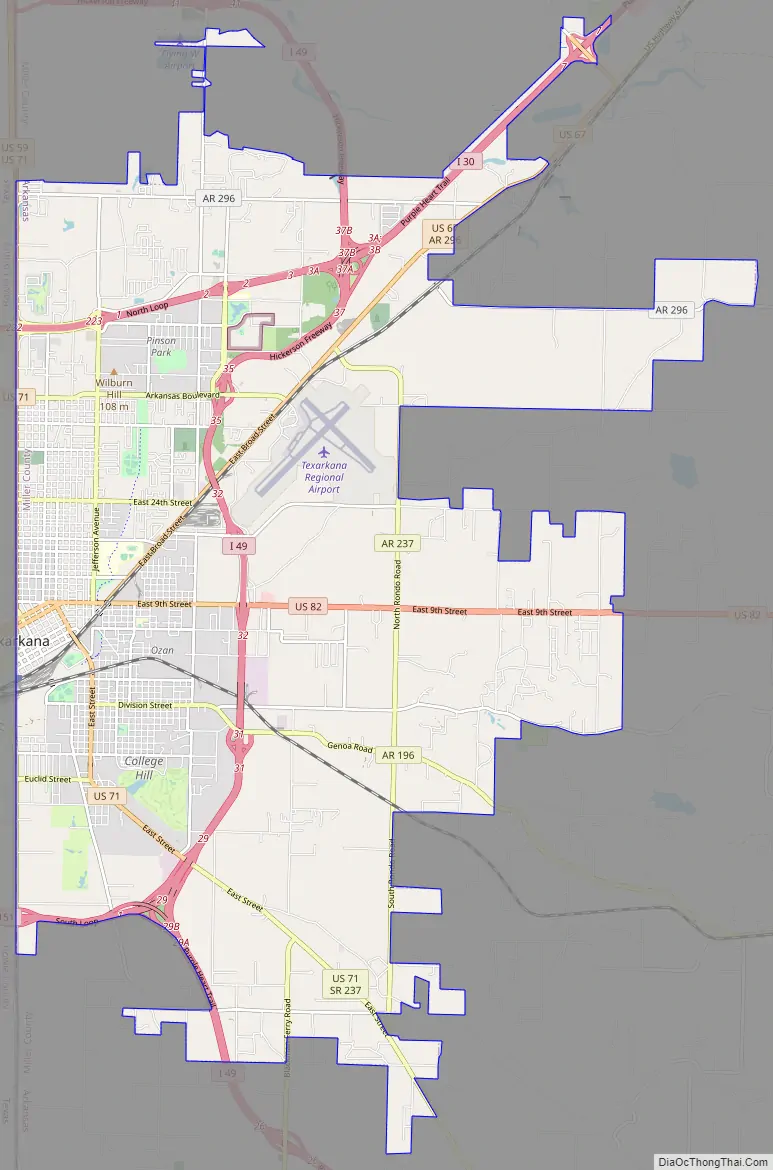
Texarkana Road Map
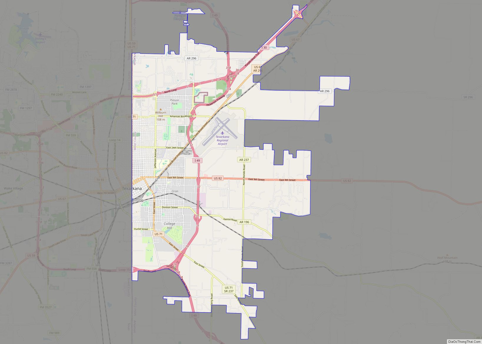
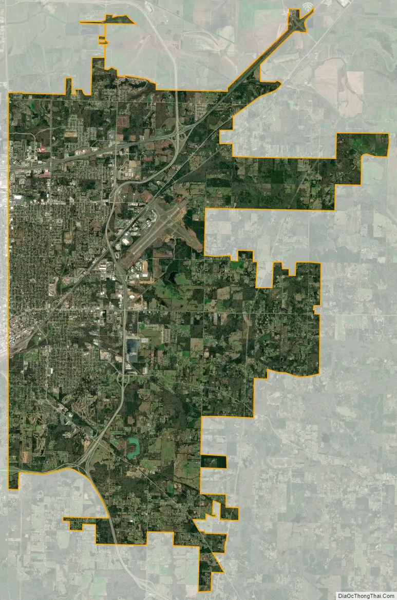
Texarkana city Satellite Map
Geography
Texarkana, Arkansas, is located at 33°25′59″N 94°1′14″W / 33.43306°N 94.02056°W / 33.43306; -94.02056 (33.433075, -94.020514). It is 143 miles (230 km) southwest of Little Rock, 72 miles (116 km) north of Shreveport, Louisiana, and 180 miles (290 km) northeast of Dallas, Texas. According to the United States Census Bureau, Texarkana has a total area of 42.2 square miles (109 km), of which 42.0 square miles (109 km) are land and 0.2 square miles (0.5 km), or 0.54%, are water. The city is mainly drained by Nix Creek, a southwest-flowing tributary of Days Creek, part of the Sulphur River watershed leading to the Red River.
Climate
The climate in this area is characterized by hot, humid summers and generally mild to cool winters. According to the Köppen Climate Classification system, Texarkana has a humid subtropical climate, abbreviated “Cfa” on climate maps.
See also
Map of Arkansas State and its subdivision:- Arkansas
- Ashley
- Baxter
- Benton
- Boone
- Bradley
- Calhoun
- Carroll
- Chicot
- Clark
- Clay
- Cleburne
- Cleveland
- Columbia
- Conway
- Craighead
- Crawford
- Crittenden
- Cross
- Dallas
- Desha
- Drew
- Faulkner
- Franklin
- Fulton
- Garland
- Grant
- Greene
- Hempstead
- Hot Spring
- Howard
- Independence
- Izard
- Jackson
- Jefferson
- Johnson
- Lafayette
- Lawrence
- Lee
- Lincoln
- Little River
- Logan
- Lonoke
- Madison
- Marion
- Miller
- Mississippi
- Monroe
- Montgomery
- Nevada
- Newton
- Ouachita
- Perry
- Phillips
- Pike
- Poinsett
- Polk
- Pope
- Prairie
- Pulaski
- Randolph
- Saint Francis
- Saline
- Scott
- Searcy
- Sebastian
- Sevier
- Sharp
- Stone
- Union
- Van Buren
- Washington
- White
- Woodruff
- Yell
- Alabama
- Alaska
- Arizona
- Arkansas
- California
- Colorado
- Connecticut
- Delaware
- District of Columbia
- Florida
- Georgia
- Hawaii
- Idaho
- Illinois
- Indiana
- Iowa
- Kansas
- Kentucky
- Louisiana
- Maine
- Maryland
- Massachusetts
- Michigan
- Minnesota
- Mississippi
- Missouri
- Montana
- Nebraska
- Nevada
- New Hampshire
- New Jersey
- New Mexico
- New York
- North Carolina
- North Dakota
- Ohio
- Oklahoma
- Oregon
- Pennsylvania
- Rhode Island
- South Carolina
- South Dakota
- Tennessee
- Texas
- Utah
- Vermont
- Virginia
- Washington
- West Virginia
- Wisconsin
- Wyoming