Texarkana is a city in Bowie County, Texas, United States, in the Ark-La-Tex region. Located approximately 180 miles (290 km) from Dallas, Texarkana is a twin city with neighboring Texarkana, Arkansas. The Texas city’s population was 36,193 at the 2020 census.
The city and its Arkansas counterpart form the core of the Texarkana Metropolitan Statistical Area, encompassing all of Bowie County, Texas, and Miller County, Arkansas. The two cities had a combined population of 65,580 in the 2020 decennial census, and the metropolitan area had a population of 149,482.
| Name: | Texarkana city |
|---|---|
| LSAD Code: | 25 |
| LSAD Description: | city (suffix) |
| State: | Texas |
| County: | Bowie County |
| Elevation: | 299 ft (91 m) |
| Total Area: | 29.47 sq mi (76.33 km²) |
| Land Area: | 29.03 sq mi (75.20 km²) |
| Water Area: | 0.44 sq mi (1.13 km²) |
| Total Population: | 36,193 |
| Population Density: | 1,228.13/sq mi (474.16/km²) |
| ZIP code: | 755XX. |
| FIPS code: | 4872368 |
| GNISfeature ID: | 1369752 |
| Website: | ci.texarkana.tx.us |
Online Interactive Map
Click on ![]() to view map in "full screen" mode.
to view map in "full screen" mode.
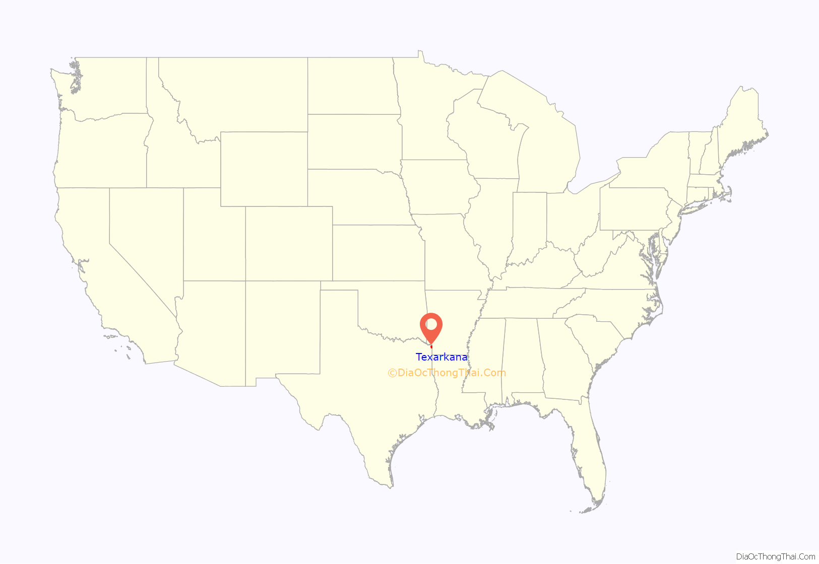
Texarkana location map. Where is Texarkana city?
History
Railroads were quick to see the possibilities of connecting markets in this vast area. In the late 1850s, the builders of the Cairo and Fulton Railroad were pushing their line steadily south across Arkansas. By 1874, they crossed the Red River and reached the Texas state line. Between February 16 and March 19, 1874, trains ran between the Texas border and the Red River, whence passengers and freight were ferried north to Fulton, Arkansas to continue by rail. The Red River Bridge opened on March 20, 1874. Since then, trains have run directly from Texarkana to St. Louis, Missouri.
Keen rivalry existed between the 1870s railroad builders. The Texas and Pacific Railroad reached across Texas to the Arkansas state line. The border was the logical place for the different railways to connect. On December 8, 1873, the Texas and Pacific sold the first town lots for the future city. The first buyer was J. W. Davis, who purchased the land where today’s Hotel McCartney now stands on the Texas side of the border, opposite Union Station which is split between both the Arkansas and Texas border.
The name Texarkana is known to be a portmanteau of Texas, Arkansas, and nearby Louisiana. However, accounts of the name’s origin differ, and it had been in use some time before the town was founded. The most popular tradition is that when the St. Louis, Iron Mountain and Southern Railway was building its line through the area, Col. Gus Knobel, a railroad surveyor, coined the name. He is said to have painted it on a plank and nailed it to a tree, saying “This is the name of a town which is to be built here.” Another story tells of a Red River steamboat named The Texarkana, c. 1860. A third account relates that a storekeeper named Swindle in Red Land, Louisiana, concocted a drink called “Texarkana Bitters”.
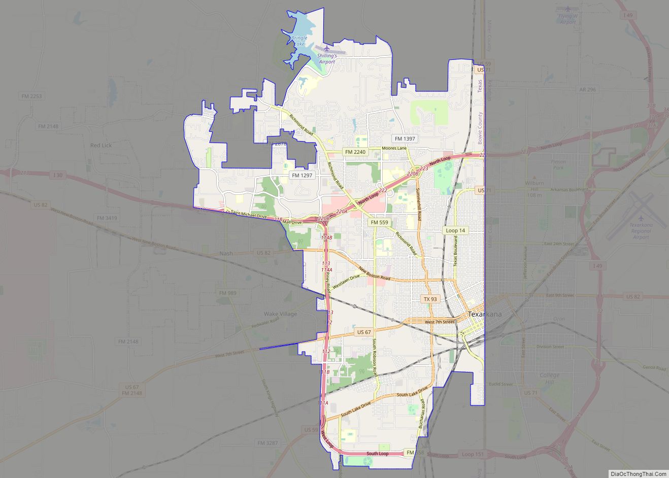
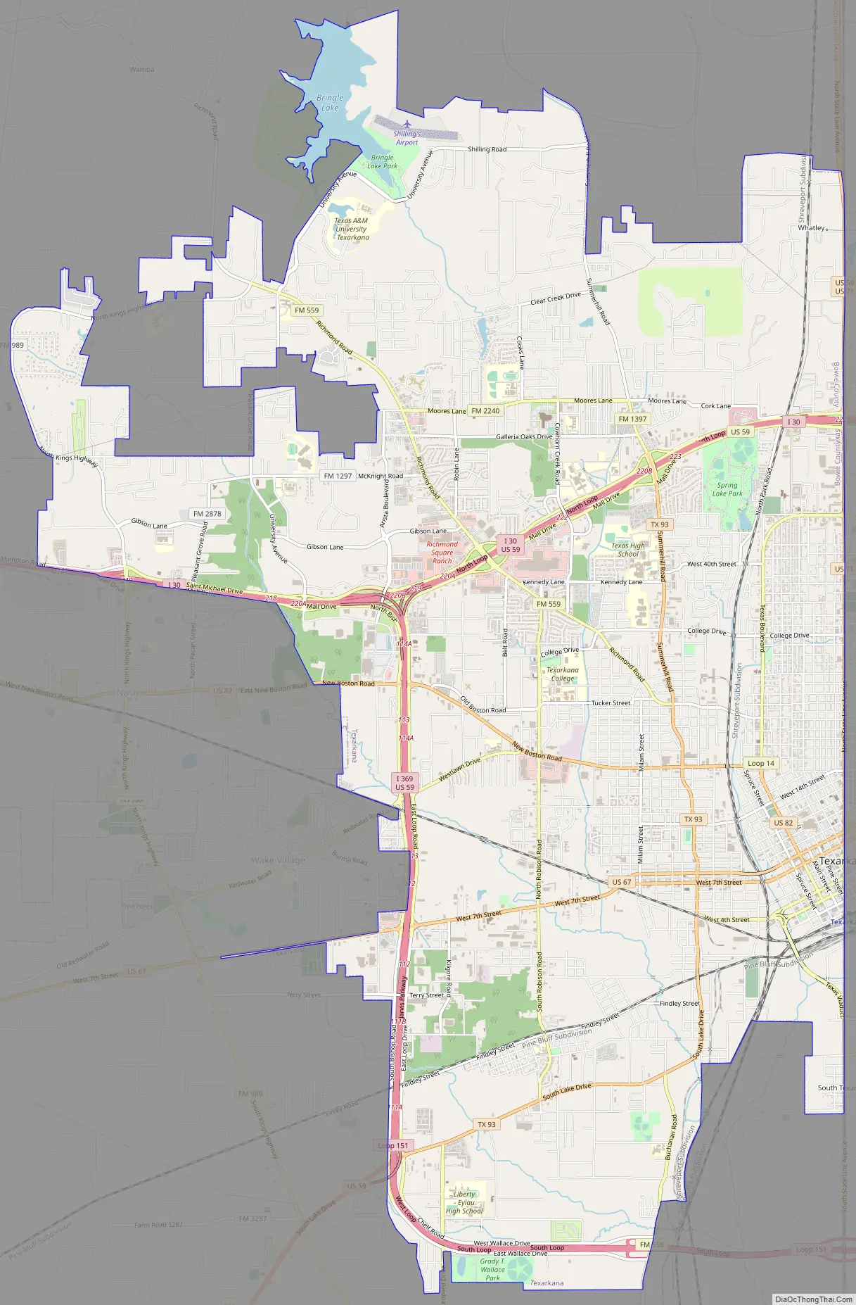
Texarkana Road Map
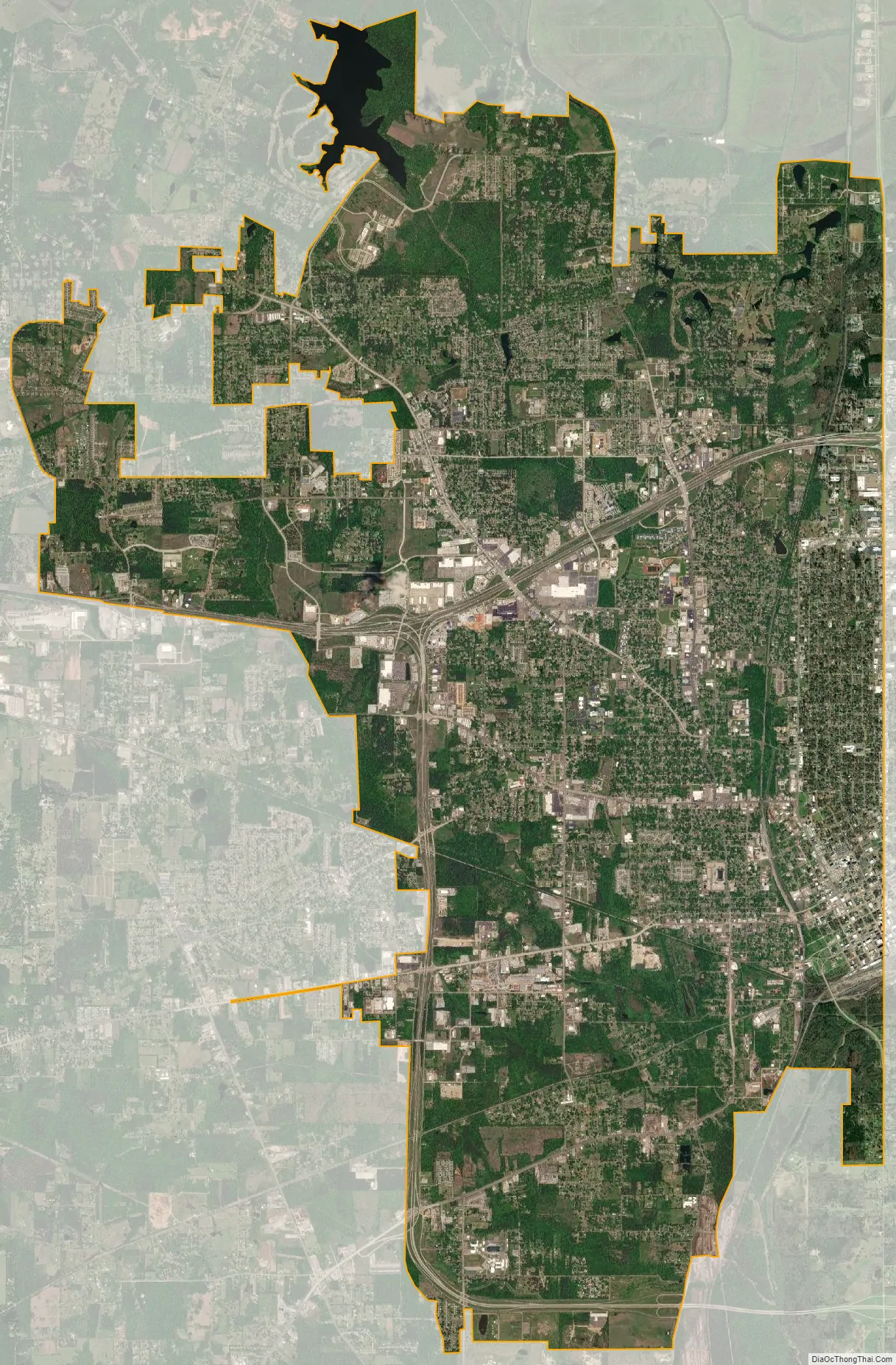
Texarkana city Satellite Map
Geography
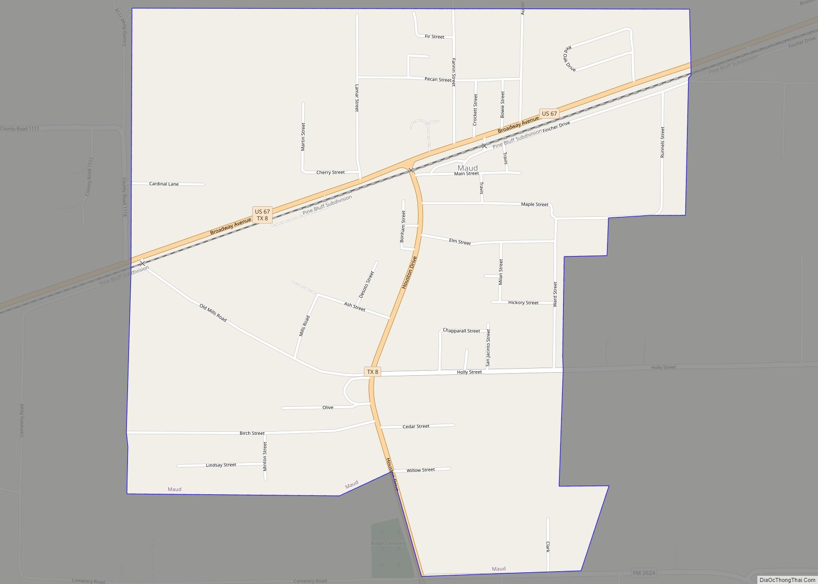
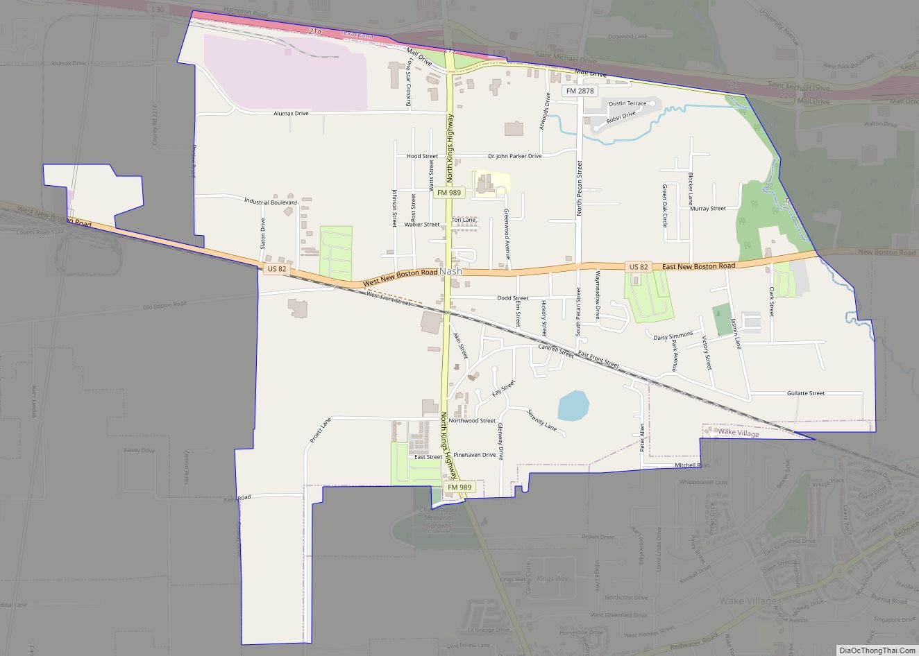
Texarkana is located at the junction of Interstate 30 and US highways 59, 67, 71, and 82 in extreme northeast Texas on the Texas-Arkansas border, at 33°26′14″N 94°4′3″W / 33.43722°N 94.06750°W / 33.43722; -94.06750 (33.437170, –94.067394). It is bordered by the city of Texarkana, Arkansas, to the east, and by the smaller cities of Nash, Wake Village and Liberty Eylau, Texas to the west. It is in the Central Time Zone.
According to the United States Census Bureau, the Texas city has a total area of 29.5 square miles (76.3 km), of which 29.0 square miles (75.2 km) is land and 0.42 square miles (1.1 km), or 1.39%, is covered by water. The city is roughly 180 miles northeast of Dallas.
Climate
- The warmest month is August.
- The highest recorded temperature was 112 °F (47 °C) on August 4–5, 2011.
- On average, the coolest month is January.
- The lowest recorded temperature was –6 °F (–21 °C) on December 22–23, 1989.
- The most precipitation on average occurs in December.
- A humid subtropical climate (Cfa) exists in the region.
On May 22, 2008, a microburst producing winds up to 100 mph occurred over Stateline Avenue and surrounding communities. An analysis of radar data leading up to the damage showed that two severe thunderstorms came together on the south side of the city. One severe storm was moving northeastward from southern Bowie County, while the other was moving northwestward through Miller County. Both storms collided in an area just south of downtown Texarkana.
On May 16, 2020, a waterspout tornado formed in adjacent Lake Wright Patman.
On December 31, 2021, a rare weather phenomenon called “animal rain” caused fish to fall out of the sky and land in pedestrian’s yards, sidewalks and business lots.
See also
Map of Texas State and its subdivision:- Anderson
- Andrews
- Angelina
- Aransas
- Archer
- Armstrong
- Atascosa
- Austin
- Bailey
- Bandera
- Bastrop
- Baylor
- Bee
- Bell
- Bexar
- Blanco
- Borden
- Bosque
- Bowie
- Brazoria
- Brazos
- Brewster
- Briscoe
- Brooks
- Brown
- Burleson
- Burnet
- Caldwell
- Calhoun
- Callahan
- Cameron
- Camp
- Carson
- Cass
- Castro
- Chambers
- Cherokee
- Childress
- Clay
- Cochran
- Coke
- Coleman
- Collin
- Collingsworth
- Colorado
- Comal
- Comanche
- Concho
- Cooke
- Coryell
- Cottle
- Crane
- Crockett
- Crosby
- Culberson
- Dallam
- Dallas
- Dawson
- Deaf Smith
- Delta
- Denton
- Dewitt
- Dickens
- Dimmit
- Donley
- Duval
- Eastland
- Ector
- Edwards
- El Paso
- Ellis
- Erath
- Falls
- Fannin
- Fayette
- Fisher
- Floyd
- Foard
- Fort Bend
- Franklin
- Freestone
- Frio
- Gaines
- Galveston
- Garza
- Gillespie
- Glasscock
- Goliad
- Gonzales
- Gray
- Grayson
- Gregg
- Grimes
- Guadalupe
- Hale
- Hall
- Hamilton
- Hansford
- Hardeman
- Hardin
- Harris
- Harrison
- Hartley
- Haskell
- Hays
- Hemphill
- Henderson
- Hidalgo
- Hill
- Hockley
- Hood
- Hopkins
- Houston
- Howard
- Hudspeth
- Hunt
- Hutchinson
- Irion
- Jack
- Jackson
- Jasper
- Jeff Davis
- Jefferson
- Jim Hogg
- Jim Wells
- Johnson
- Jones
- Karnes
- Kaufman
- Kendall
- Kenedy
- Kent
- Kerr
- Kimble
- King
- Kinney
- Kleberg
- Knox
- La Salle
- Lamar
- Lamb
- Lampasas
- Lavaca
- Lee
- Leon
- Liberty
- Limestone
- Lipscomb
- Live Oak
- Llano
- Loving
- Lubbock
- Lynn
- Madison
- Marion
- Martin
- Mason
- Matagorda
- Maverick
- McCulloch
- McLennan
- McMullen
- Medina
- Menard
- Midland
- Milam
- Mills
- Mitchell
- Montague
- Montgomery
- Moore
- Morris
- Motley
- Nacogdoches
- Navarro
- Newton
- Nolan
- Nueces
- Ochiltree
- Oldham
- Orange
- Palo Pinto
- Panola
- Parker
- Parmer
- Pecos
- Polk
- Potter
- Presidio
- Rains
- Randall
- Reagan
- Real
- Red River
- Reeves
- Refugio
- Roberts
- Robertson
- Rockwall
- Runnels
- Rusk
- Sabine
- San Augustine
- San Jacinto
- San Patricio
- San Saba
- Schleicher
- Scurry
- Shackelford
- Shelby
- Sherman
- Smith
- Somervell
- Starr
- Stephens
- Sterling
- Stonewall
- Sutton
- Swisher
- Tarrant
- Taylor
- Terrell
- Terry
- Throckmorton
- Titus
- Tom Green
- Travis
- Trinity
- Tyler
- Upshur
- Upton
- Uvalde
- Val Verde
- Van Zandt
- Victoria
- Walker
- Waller
- Ward
- Washington
- Webb
- Wharton
- Wheeler
- Wichita
- Wilbarger
- Willacy
- Williamson
- Wilson
- Winkler
- Wise
- Wood
- Yoakum
- Young
- Zapata
- Zavala
- Alabama
- Alaska
- Arizona
- Arkansas
- California
- Colorado
- Connecticut
- Delaware
- District of Columbia
- Florida
- Georgia
- Hawaii
- Idaho
- Illinois
- Indiana
- Iowa
- Kansas
- Kentucky
- Louisiana
- Maine
- Maryland
- Massachusetts
- Michigan
- Minnesota
- Mississippi
- Missouri
- Montana
- Nebraska
- Nevada
- New Hampshire
- New Jersey
- New Mexico
- New York
- North Carolina
- North Dakota
- Ohio
- Oklahoma
- Oregon
- Pennsylvania
- Rhode Island
- South Carolina
- South Dakota
- Tennessee
- Texas
- Utah
- Vermont
- Virginia
- Washington
- West Virginia
- Wisconsin
- Wyoming