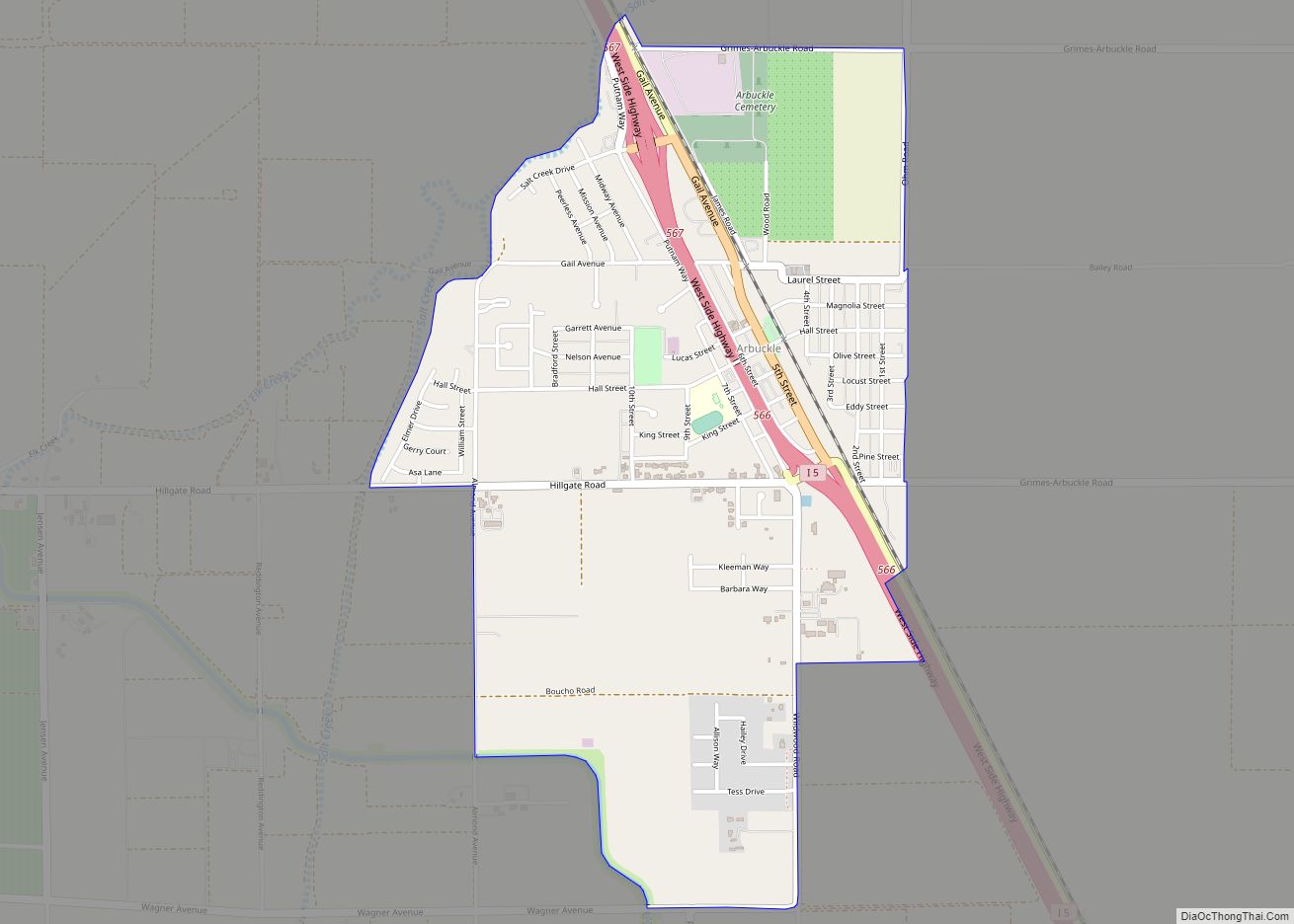
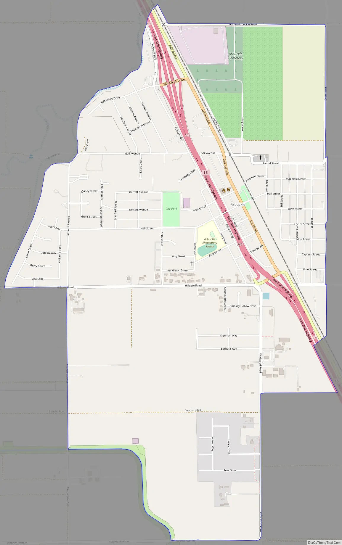
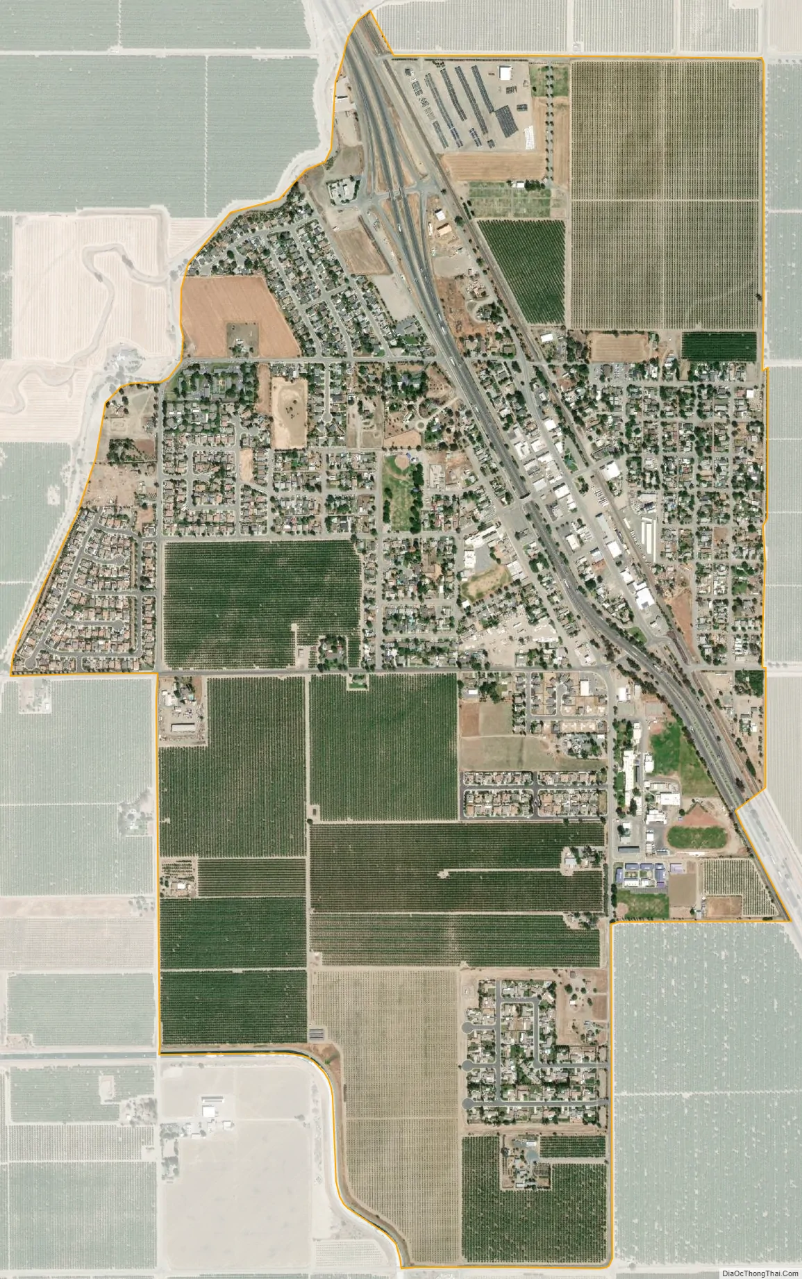
Arbuckle is a census-designated place (CDP) in Colusa County, California, United States. The population was 3,028 at the 2010 census, up from 2,332 at the 2000 census. Arbuckle is situated in the southerly portion of Colusa County, approximately 20 miles (32 km) southwest of the City of Colusa, the county seat. The town is characterized by single-family residences, multiple-family units, some mobile homes, and commercial activities. Land surrounding Arbuckle is agriculture including cultivated annual crops, and both active and unmaintained orchards (primarily almond). Various almond hullers may be found near the area. Regional access is provided by the north-south running Interstate 5, along with Old Highway 99 West running alongside Interstate 5.
| Name: | Arbuckle CDP |
|---|---|
| LSAD Code: | 57 |
| LSAD Description: | CDP (suffix) |
| State: | California |
| County: | Colusa County |
| Elevation: | 141 ft (43 m) |
| Total Area: | 1.76 sq mi (4.56 km²) |
| Land Area: | 1.76 sq mi (4.56 km²) |
| Water Area: | 0.00 sq mi (0.00 km²) 0% |
| Total Population: | 3,484 |
| Population Density: | 1,978.42/sq mi (764.05/km²) |
| ZIP code: | 95912 |
| Area code: | 530 |
| FIPS code: | 0602420 |
| Website: | https://www.countyofcolusa.org/index.aspx?NID=217 |
Online Interactive Map
Click on ![]() to view map in "full screen" mode.
to view map in "full screen" mode.
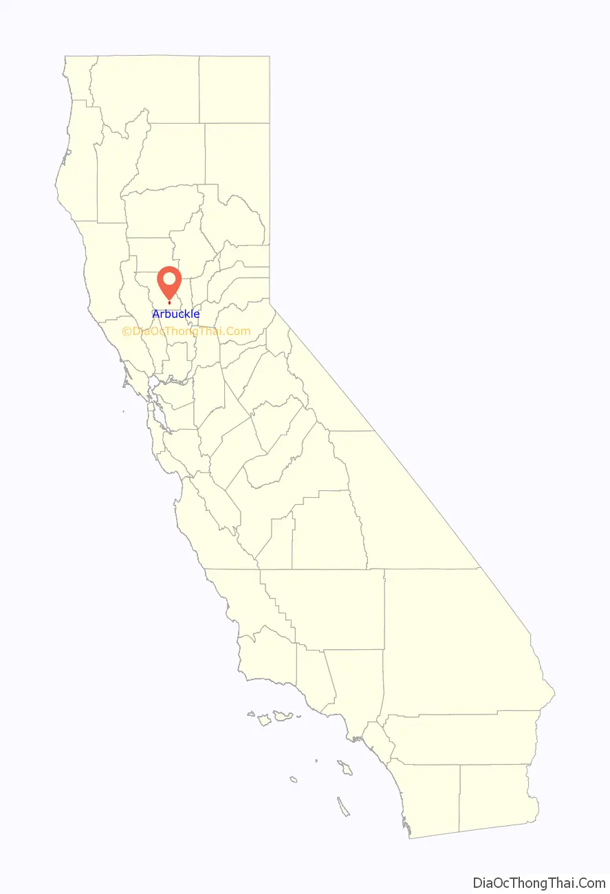
Arbuckle location map. Where is Arbuckle CDP?

History
Tacitus R. Arbuckle initially established a ranch here in 1866. The railroad came in 1875 and the town was founded and named for Arbuckle, on whose land it was built. The post office was established the following year, 1876.
Arbuckle Road Map
Arbuckle city Satellite Map
Geography
Two streams drain the area, the Salt and Elk Creeks. The Salt Creek flows north in the area, then bends east, and is joined by Elk Creek. Both streams join Sand Creek a half mile northeast of the town and flow in a northeast direction. Salt Creek is subject to periodic flooding during heavy rainfall.
The town sank 2.14 feet (0.65 m) between 2008 and 2017 according to a report issued by the California Department of Water Resources in coordination with 19 local and state agencies. A study that analyzed over 300 sites across the Sacramento Valley found that this area had sank due to groundwater-related subsidence more than any other area in the study. Subsidence occurred as water was removed from the underground aquifers and the surrounding soil collapsed upon itself.
See also
Map of California State and its subdivision:- Alameda
- Alpine
- Amador
- Butte
- Calaveras
- Colusa
- Contra Costa
- Del Norte
- El Dorado
- Fresno
- Glenn
- Humboldt
- Imperial
- Inyo
- Kern
- Kings
- Lake
- Lassen
- Los Angeles
- Madera
- Marin
- Mariposa
- Mendocino
- Merced
- Modoc
- Mono
- Monterey
- Napa
- Nevada
- Orange
- Placer
- Plumas
- Riverside
- Sacramento
- San Benito
- San Bernardino
- San Diego
- San Francisco
- San Joaquin
- San Luis Obispo
- San Mateo
- Santa Barbara
- Santa Clara
- Santa Cruz
- Shasta
- Sierra
- Siskiyou
- Solano
- Sonoma
- Stanislaus
- Sutter
- Tehama
- Trinity
- Tulare
- Tuolumne
- Ventura
- Yolo
- Yuba
- Alabama
- Alaska
- Arizona
- Arkansas
- California
- Colorado
- Connecticut
- Delaware
- District of Columbia
- Florida
- Georgia
- Hawaii
- Idaho
- Illinois
- Indiana
- Iowa
- Kansas
- Kentucky
- Louisiana
- Maine
- Maryland
- Massachusetts
- Michigan
- Minnesota
- Mississippi
- Missouri
- Montana
- Nebraska
- Nevada
- New Hampshire
- New Jersey
- New Mexico
- New York
- North Carolina
- North Dakota
- Ohio
- Oklahoma
- Oregon
- Pennsylvania
- Rhode Island
- South Carolina
- South Dakota
- Tennessee
- Texas
- Utah
- Vermont
- Virginia
- Washington
- West Virginia
- Wisconsin
- Wyoming