Arvin is a city in Kern County, California. Arvin is located 15 miles (24 km) southeast of Bakersfield, at an elevation of 449 feet (137 m). As of the 2010 census, the population was 19,304, up from 12,956 at the 2000 census.
In 2007, the United States Environmental Protection Agency (EPA) listed Arvin as having the highest levels of smog of any community in the United States. The city’s level of ozone, smog’s primary component, exceeded the EPA’s acceptable limits on an average of 73 days per year between 2004 and 2006.
Wired telephone numbers in Arvin follow the format (661) 854-xxxx or (661) 855-xxxx and the ZIP Code is 93203.
| Name: | Arvin city |
|---|---|
| LSAD Code: | 25 |
| LSAD Description: | city (suffix) |
| State: | California |
| County: | Kern County |
| Incorporated: | December 21, 1960 |
| Elevation: | 449 ft (137 m) |
| Total Area: | 4.82 sq mi (12.48 km²) |
| Land Area: | 4.82 sq mi (12.48 km²) |
| Water Area: | 0.00 sq mi (0.00 km²) 0% |
| Total Population: | 19,495 |
| Population Density: | 4,045.45/sq mi (1,561.84/km²) |
| ZIP code: | 93203 |
| Area code: | 661 |
| FIPS code: | 0602924 |
| Website: | www.arvin.org |
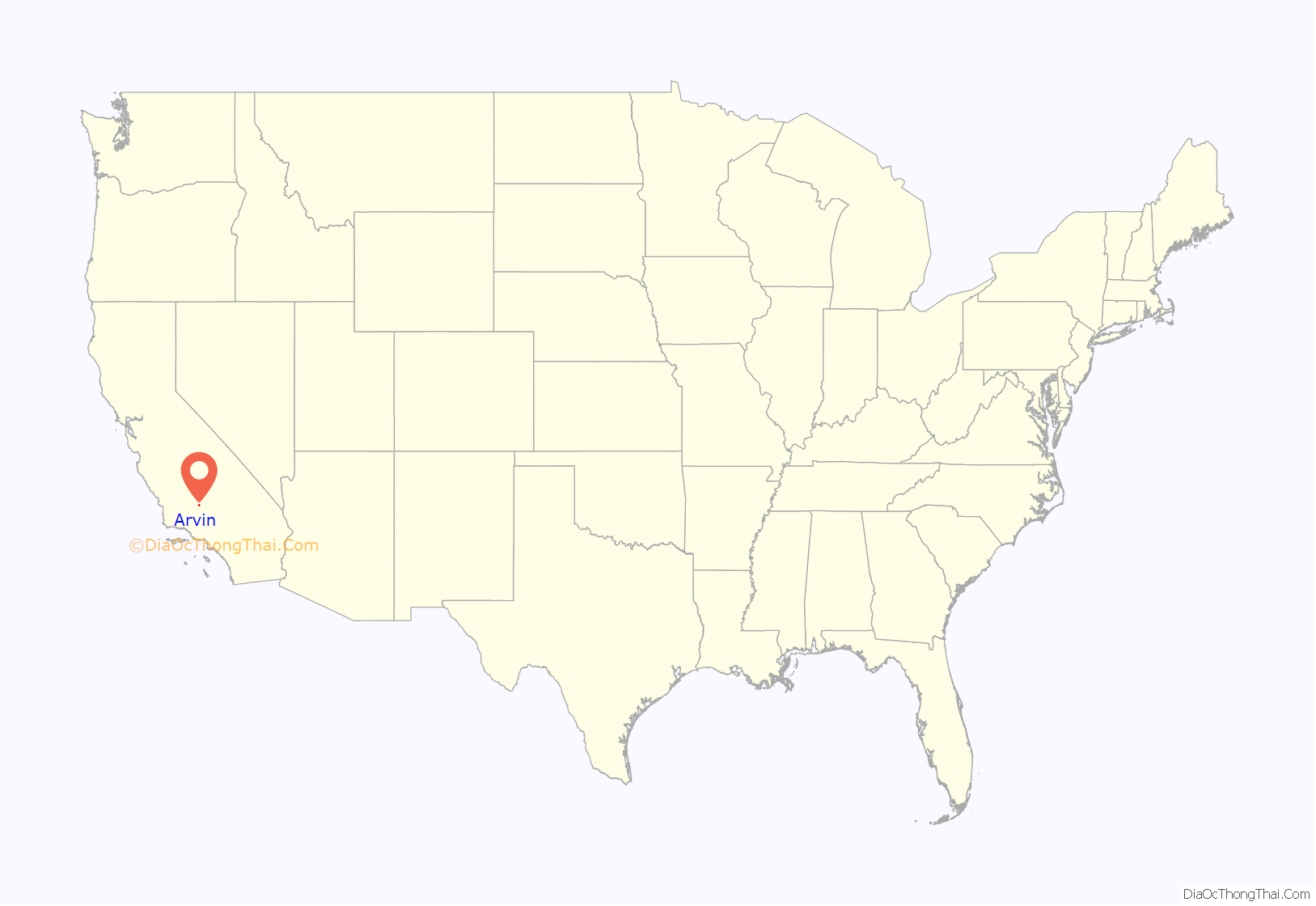
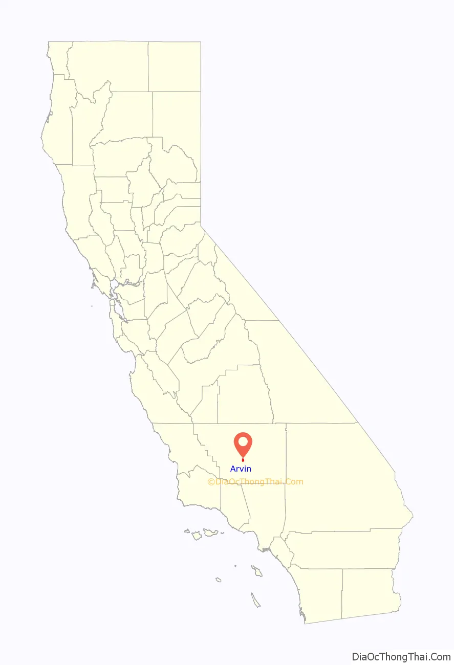
Online Interactive Map
Click on ![]() to view map in "full screen" mode.
to view map in "full screen" mode.
Arvin location map. Where is Arvin city?
History
Property sales of lots in present-day Arvin began in 1906. The Arvin Post Office was established in 1914 and the community incorporated as a city in 1960. The city was named after Arvin Richardson, who was the son of one of the original settling families from San Bernardino. Birdie Heard petitioned for the addition of the post office in 1914 and submitted proposed names, including Bear Mountain, Walnut, and Arvin. Officials in Washington, D.C., chose Arvin as it was the only proposed name which was not already in use in California. Birdie was the city’s first postmaster. She initially set up the post office in her living room, but it was later moved to the general store owned by the Staples family. The in-store post office was also the area’s first informal library until an official branch of the Kern County Library system was established in 1927.
Pedro Subia, a Mexican striker in the California agricultural strikes of 1933, was murdered at a strike in Arvin.
The Mountain View Oil Field, which underlies the town and much of the surrounding area, was discovered in 1933 and developed extensively in the 1930s. Many oil wells still surround the town; some are slant-drilled to reach formations directly underneath inhabited areas.
In the 1930s and 1940s the area east of Arvin became popular for recreational gliding and soaring, and the hillsides of the Tejon Ranch were used annually for a Western Soaring Championship in the spring. These significant events were later memorialized as a National Landmark of Soaring by the National Soaring Museum in 2000.
The Arvin Tiller started publication in 1939 and Arvin High School was built in 1949. The city was nearly destroyed on July 21, 1952, during the M7.3 Kern County earthquake (a rupture of the White Wolf Fault). Arvin suffered further damage on December 20, 1977, when a dust storm hit the area.
The Arvin Migratory Labor Camp was the first federally operated farm labor camp opened by the Farm Security Administration in 1937, one of many New Deal programs created during the presidency of Franklin D. Roosevelt to respond to the Great Depression. This agricultural camp was considered a model, and was built by the Resettlement Administration.
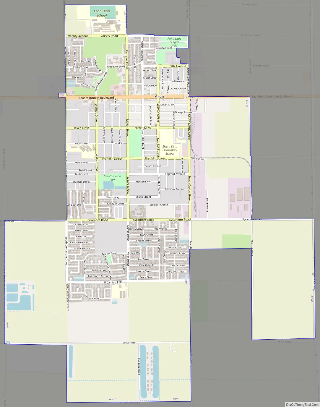
Arvin Road Map
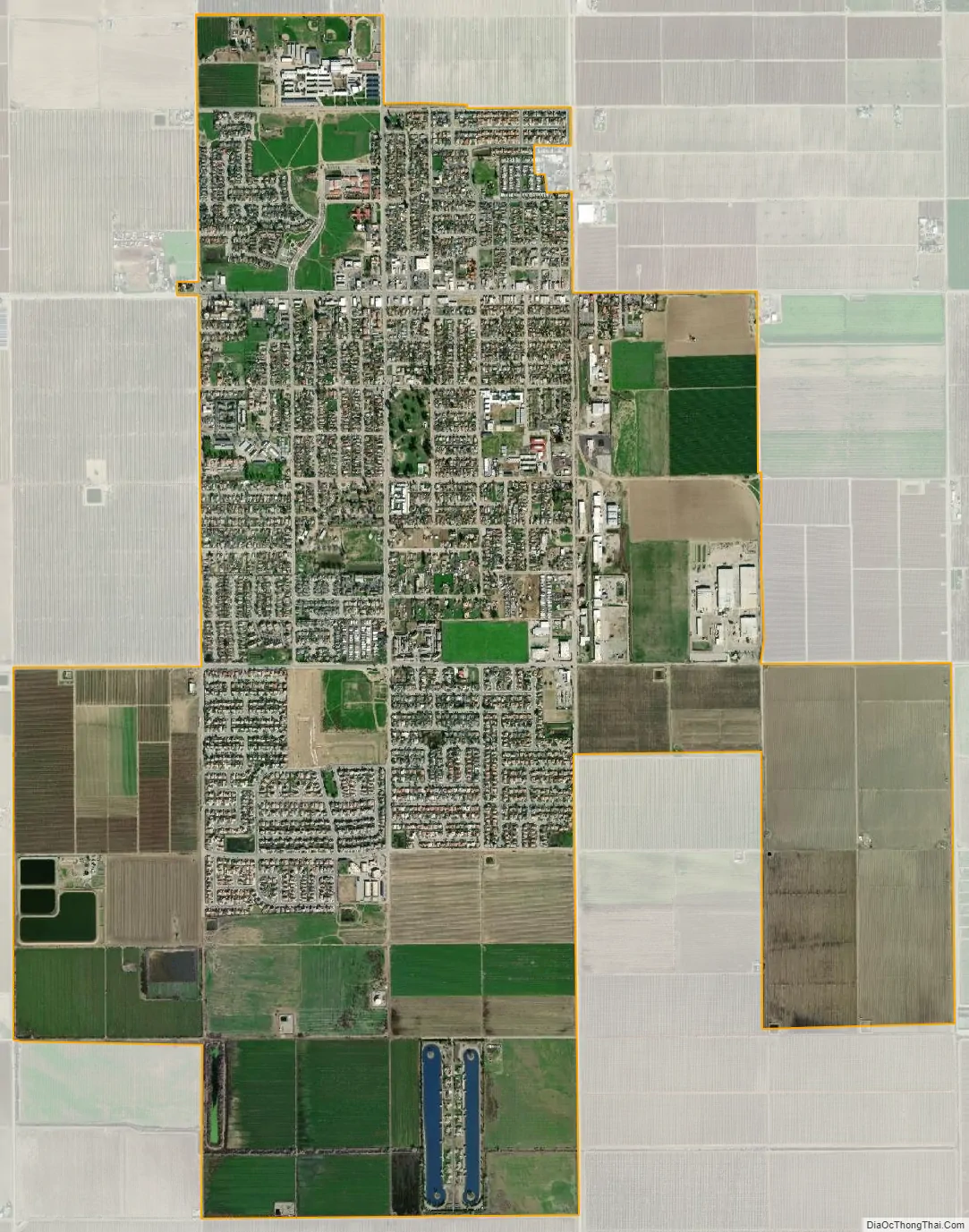
Arvin city Satellite Map
Geography
According to the United States Census Bureau, the city has a total area of 4.9 square miles (13 km), all of it land.
Climate
According to the Köppen Climate Classification system, Arvin has a semi-arid climate, abbreviated “BSk” on climate maps.
See also
Map of California State and its subdivision:- Alameda
- Alpine
- Amador
- Butte
- Calaveras
- Colusa
- Contra Costa
- Del Norte
- El Dorado
- Fresno
- Glenn
- Humboldt
- Imperial
- Inyo
- Kern
- Kings
- Lake
- Lassen
- Los Angeles
- Madera
- Marin
- Mariposa
- Mendocino
- Merced
- Modoc
- Mono
- Monterey
- Napa
- Nevada
- Orange
- Placer
- Plumas
- Riverside
- Sacramento
- San Benito
- San Bernardino
- San Diego
- San Francisco
- San Joaquin
- San Luis Obispo
- San Mateo
- Santa Barbara
- Santa Clara
- Santa Cruz
- Shasta
- Sierra
- Siskiyou
- Solano
- Sonoma
- Stanislaus
- Sutter
- Tehama
- Trinity
- Tulare
- Tuolumne
- Ventura
- Yolo
- Yuba
- Alabama
- Alaska
- Arizona
- Arkansas
- California
- Colorado
- Connecticut
- Delaware
- District of Columbia
- Florida
- Georgia
- Hawaii
- Idaho
- Illinois
- Indiana
- Iowa
- Kansas
- Kentucky
- Louisiana
- Maine
- Maryland
- Massachusetts
- Michigan
- Minnesota
- Mississippi
- Missouri
- Montana
- Nebraska
- Nevada
- New Hampshire
- New Jersey
- New Mexico
- New York
- North Carolina
- North Dakota
- Ohio
- Oklahoma
- Oregon
- Pennsylvania
- Rhode Island
- South Carolina
- South Dakota
- Tennessee
- Texas
- Utah
- Vermont
- Virginia
- Washington
- West Virginia
- Wisconsin
- Wyoming


