Bodega is an unincorporated community and census-designated place (CDP) in Sonoma County in the U.S. state of California. The town had a population of 220 as of the 2010 Census.
Bodega is located on Bodega Highway, about 5 mi (8 km) west of Freestone, California. Salmon Creek flows through the town.
| Name: | Bodega CDP |
|---|---|
| LSAD Code: | 57 |
| LSAD Description: | CDP (suffix) |
| State: | California |
| County: | Sonoma County |
| Elevation: | 118 ft (36 m) |
| Total Area: | 2.90 sq mi (7.52 km²) |
| Land Area: | 2.90 sq mi (7.52 km²) |
| Water Area: | 0.00 sq mi (0.00 km²) 0% |
| Total Population: | 211 |
| Population Density: | 72.71/sq mi (28.07/km²) |
| ZIP code: | 94922 |
| Area code: | 707 |
| FIPS code: | 0607246 |
| GNISfeature ID: | 219574 |
Online Interactive Map
Click on ![]() to view map in "full screen" mode.
to view map in "full screen" mode.
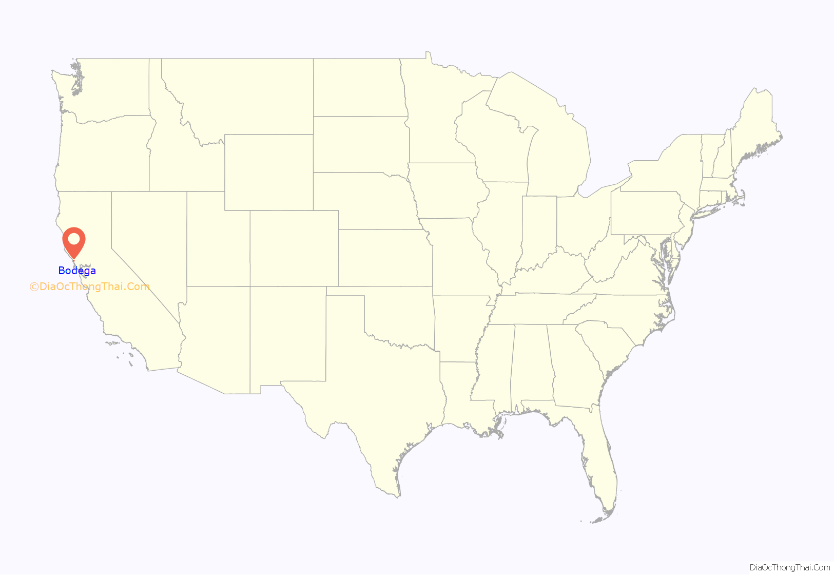
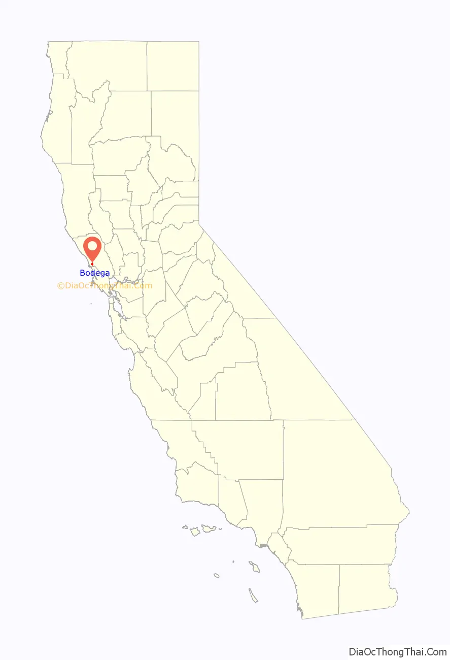
Bodega location map. Where is Bodega CDP?
History
The town of Bodega was known historically as Bodega Corners or Bodega Roads, to distinguish it from the Port of Bodega or Bodega Bay, as it is known today, which is about four miles from Bodega. Bodega and Bodega Bay are named for discoverer of the bay, Juan Francisco Bodega y Caudra, who first sailed into the harbor in 1775. There were formerly two Coast Miwok villages in the area: one (called Kennekono) sited near the current town and another (called Suwutenne) further north. The first Europeans in the area were Russians who established temporary settlements at Bodega Bay and the Salmon Creek Valley, in the vicinity of Bodega, in 1809.
In 1843, Captain Stephen Smith established the first West Coast lumber mill near Bodega. Around the same time, John A. Sutter bought land from the Russians, an area that included Bodega. His land purchase included “some hunting rights, a small boat, several rusty cannons, and some old muskets.” In 1859, shipbuilders constructed Saint Teresa of Avila Church. Open from 1856 to 1967, Watson School, once served as Bodega’s school, and is located in a Sonoma County Regional Parks Department historic park about 2 miles east of Bodega.
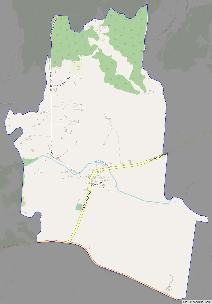
Bodega Road Map
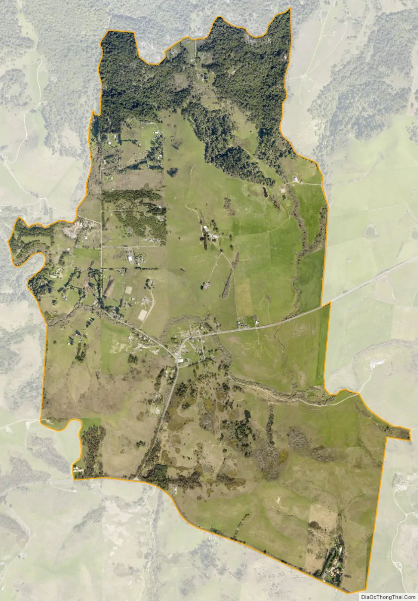
Bodega city Satellite Map
Geography
According to the United States Census Bureau, the CDP covers an area of 2.9 square miles (7.5 km), all of it land. The Phacelia distans is known for blossoming in Bodega between April and June.
See also
Map of California State and its subdivision:- Alameda
- Alpine
- Amador
- Butte
- Calaveras
- Colusa
- Contra Costa
- Del Norte
- El Dorado
- Fresno
- Glenn
- Humboldt
- Imperial
- Inyo
- Kern
- Kings
- Lake
- Lassen
- Los Angeles
- Madera
- Marin
- Mariposa
- Mendocino
- Merced
- Modoc
- Mono
- Monterey
- Napa
- Nevada
- Orange
- Placer
- Plumas
- Riverside
- Sacramento
- San Benito
- San Bernardino
- San Diego
- San Francisco
- San Joaquin
- San Luis Obispo
- San Mateo
- Santa Barbara
- Santa Clara
- Santa Cruz
- Shasta
- Sierra
- Siskiyou
- Solano
- Sonoma
- Stanislaus
- Sutter
- Tehama
- Trinity
- Tulare
- Tuolumne
- Ventura
- Yolo
- Yuba
- Alabama
- Alaska
- Arizona
- Arkansas
- California
- Colorado
- Connecticut
- Delaware
- District of Columbia
- Florida
- Georgia
- Hawaii
- Idaho
- Illinois
- Indiana
- Iowa
- Kansas
- Kentucky
- Louisiana
- Maine
- Maryland
- Massachusetts
- Michigan
- Minnesota
- Mississippi
- Missouri
- Montana
- Nebraska
- Nevada
- New Hampshire
- New Jersey
- New Mexico
- New York
- North Carolina
- North Dakota
- Ohio
- Oklahoma
- Oregon
- Pennsylvania
- Rhode Island
- South Carolina
- South Dakota
- Tennessee
- Texas
- Utah
- Vermont
- Virginia
- Washington
- West Virginia
- Wisconsin
- Wyoming


