Boron (formerly Amargo, Baker, Borate, and Kern) is a census-designated place (CDP) in Kern County, California, United States. Boron is 15 miles (24 km) southwest of Red Rock Mountain at an elevation of 2,467 feet (752 m). The population was 2,086 at the 2020 census, up from 2,025 at the 2000 census. Boron is named after the element boron and is the site of the world’s largest source of the boron compound boric acid.
Boron is a hinterland community on the western edge of the Mojave Desert. Within a half day’s drive one can view the highest and lowest points in the contiguous 48 states of the United States (Mount Whitney and Death Valley), the world’s oldest tree, the bristlecone pine, and the cities of Los Angeles and Las Vegas.
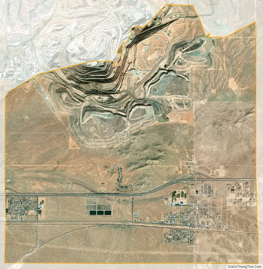
Boron is home to the U.S. Borax Boron Mine (35°2′34.44″N 117°40′45.41″W / 35.0429000°N 117.6792806°W / 35.0429000; -117.6792806 (U.S. Borax Boron Mine)), California’s largest open-pit mine, which is also the largest borax mine in the world.
| Name: | Boron CDP |
|---|---|
| LSAD Code: | 57 |
| LSAD Description: | CDP (suffix) |
| State: | California |
| County: | Kern County |
| Elevation: | 2,467 ft (752 m) |
| Total Area: | 13.72 sq mi (35.54 km²) |
| Land Area: | 13.71 sq mi (35.52 km²) |
| Water Area: | 0.01 sq mi (0.02 km²) 0.15% |
| Total Population: | 2,086 |
| Population Density: | 152.12/sq mi (58.73/km²) |
| ZIP code: | 93516, 93596 |
| FIPS code: | 0607568 |
| GNISfeature ID: | 1652674 |
Online Interactive Map
Click on ![]() to view map in "full screen" mode.
to view map in "full screen" mode.
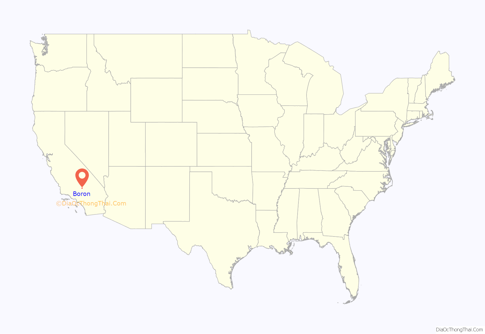
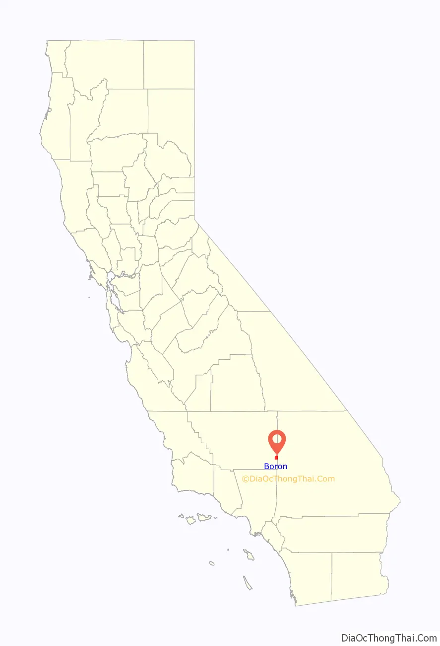
Boron location map. Where is Boron CDP?
History
Borate evaporites in the form of colemanite was first reported in 1913 during drilling of a water well. Claims were acquired by the Pacific Coast Borax Company and exploration continued. In 1925 commercial colemanite production began. In the 1920s and 30s borates were produced from the Baker and West Baker mines.
The first post office at Boron opened in 1938.
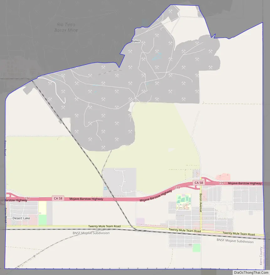
Boron Road Map
Boron city Satellite Map
Geography
Boron is on the border of Kern and San Bernardino Counties along State Route 58. The coordinates are: 34°59′58″N 117°38′59″W / 34.99944°N 117.64972°W / 34.99944; -117.64972. Boron is 65 miles (105 km) north of Palmdale, 85 miles (137 km) east of Bakersfield, and 40 miles (64 km) west of Barstow in the Antelope Valley region of California’s Mojave Desert. According to the United States Census Bureau, the CDP has a total area of 13.82 square miles (35.8 km), over 99 percent of which is land.
See also
Map of California State and its subdivision:- Alameda
- Alpine
- Amador
- Butte
- Calaveras
- Colusa
- Contra Costa
- Del Norte
- El Dorado
- Fresno
- Glenn
- Humboldt
- Imperial
- Inyo
- Kern
- Kings
- Lake
- Lassen
- Los Angeles
- Madera
- Marin
- Mariposa
- Mendocino
- Merced
- Modoc
- Mono
- Monterey
- Napa
- Nevada
- Orange
- Placer
- Plumas
- Riverside
- Sacramento
- San Benito
- San Bernardino
- San Diego
- San Francisco
- San Joaquin
- San Luis Obispo
- San Mateo
- Santa Barbara
- Santa Clara
- Santa Cruz
- Shasta
- Sierra
- Siskiyou
- Solano
- Sonoma
- Stanislaus
- Sutter
- Tehama
- Trinity
- Tulare
- Tuolumne
- Ventura
- Yolo
- Yuba
- Alabama
- Alaska
- Arizona
- Arkansas
- California
- Colorado
- Connecticut
- Delaware
- District of Columbia
- Florida
- Georgia
- Hawaii
- Idaho
- Illinois
- Indiana
- Iowa
- Kansas
- Kentucky
- Louisiana
- Maine
- Maryland
- Massachusetts
- Michigan
- Minnesota
- Mississippi
- Missouri
- Montana
- Nebraska
- Nevada
- New Hampshire
- New Jersey
- New Mexico
- New York
- North Carolina
- North Dakota
- Ohio
- Oklahoma
- Oregon
- Pennsylvania
- Rhode Island
- South Carolina
- South Dakota
- Tennessee
- Texas
- Utah
- Vermont
- Virginia
- Washington
- West Virginia
- Wisconsin
- Wyoming


