Boyes Hot Springs (also called Boyes Springs or The Springs)is a census-designated place (CDP) in Sonoma Valley, Sonoma County, California, United States. The population was 6,656 people at the 2010 census. Resorts in Boyes Hot Springs, El Verano, Fetters Hot Springs, and Agua Caliente were popular health retreats for tourists from San Francisco and points beyond until the middle of the 20th century because of the geothermic hot springs that still well up from deep within the earth.
| Name: | Boyes Hot Springs CDP |
|---|---|
| LSAD Code: | 57 |
| LSAD Description: | CDP (suffix) |
| State: | California |
| County: | Sonoma County |
| Elevation: | 135 ft (41 m) |
| Total Area: | 1.06 sq mi (2.75 km²) |
| Land Area: | 1.06 sq mi (2.75 km²) |
| Water Area: | 0.00 sq mi (0.00 km²) 0% |
| Total Population: | 6,215 |
| Population Density: | 5,863.21/sq mi (2,262.97/km²) |
| ZIP code: | 95416 (PO boxes), 95476 (Street addresses) |
| Area code: | 707 |
| FIPS code: | 0607848 |
| GNISfeature ID: | 1658122 |
Online Interactive Map
Click on ![]() to view map in "full screen" mode.
to view map in "full screen" mode.
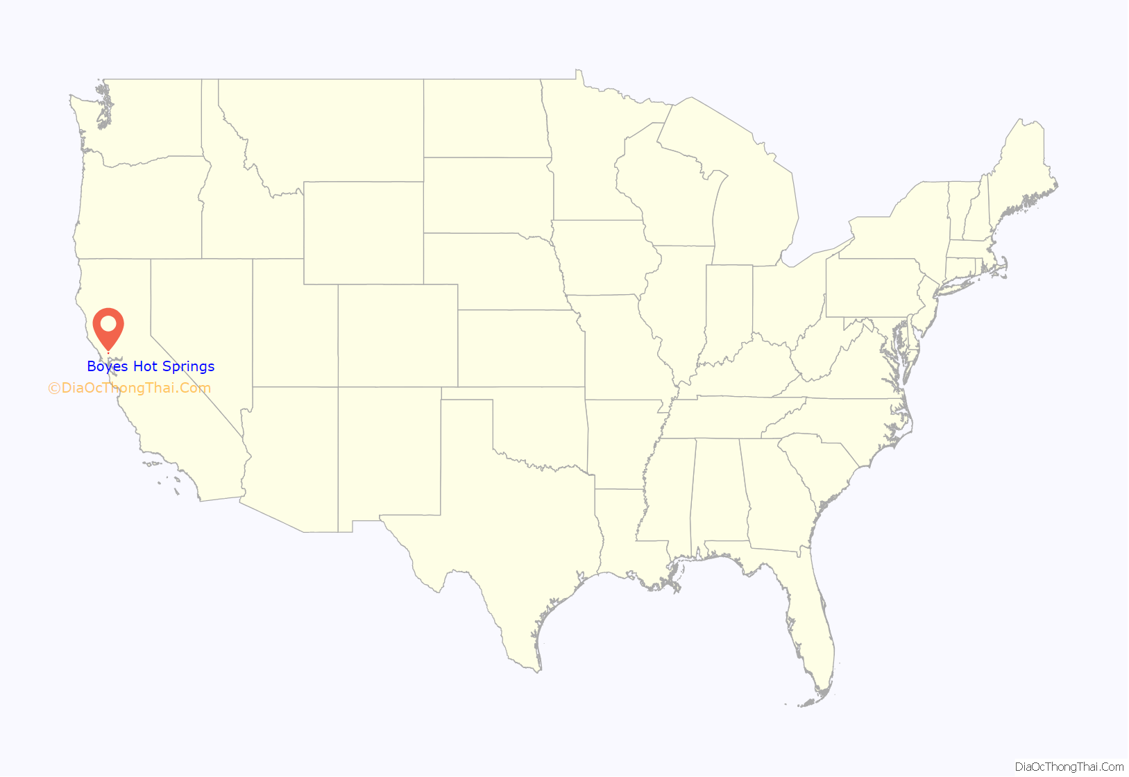
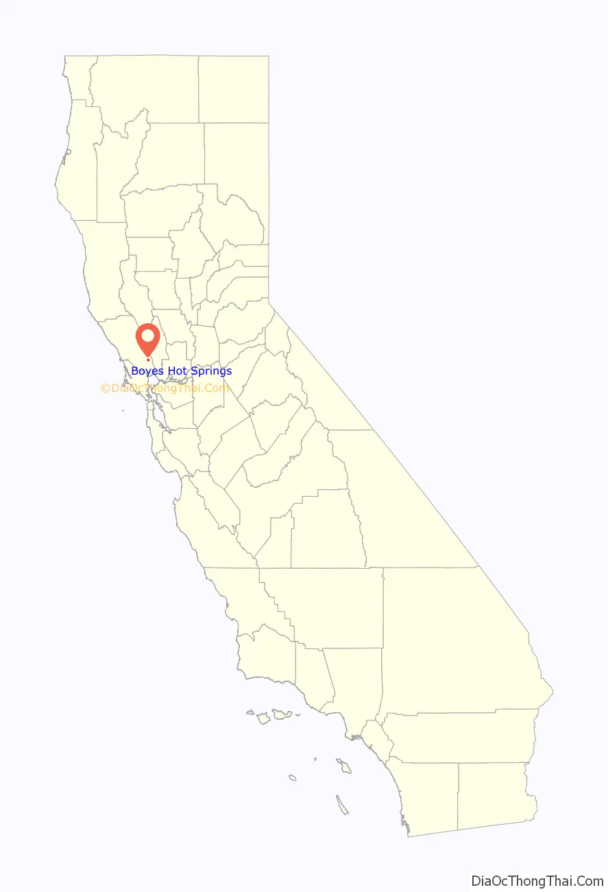
Boyes Hot Springs location map. Where is Boyes Hot Springs CDP?
History
The area was first occupied by Indigenous peoples, who discovered and used the hot springs that the area is named after. Under Mexican rule, in July 1840, Lazaro Piña was deeded 50,000 acres as Rancho Agua Caliente. Sometime in 1849 Thaddeus M. Leavenworth acquired 320 acres of the Rancho in what became present-day Agua Caliente, Fetters Hot Springs, Boyes Hot Springs, and part of Maxwell Farm. In 1889, property was being sold in the area as being near the “celebrated old Indian Medicine Spring.” Henry Ernest Boyes discovered hot springs in 1895 in the central part of the area. He and his wife called the area Agua Rica. and started the Boyes Hot Springs Hotel, now the site of the Fairmont Sonoma Mission Inn & Spa. The area became popular with tourists, with over 70,000 visiting each year. A railroad serviced the area during this period.
A wildfire in September 1923 destroyed the settlement.
During the Great Depression, the area’s tourism business stopped and the hotel closed. During that period, the Oakland Oaks and San Francisco Seals did their spring training in Boyes Hot Springs. Tourism became the region’s main economic focus again later in the 1930s, then during World War II it was taken over by the United States Navy, who sent sailors to the area for recreation. Railroad service stopped in 1942.
Today, the area is primarily residential with a large Latino population. Boyes Hot Springs is part of an area called “The Springs”, which also includes Fetters Hot Springs and Agua Caliente.
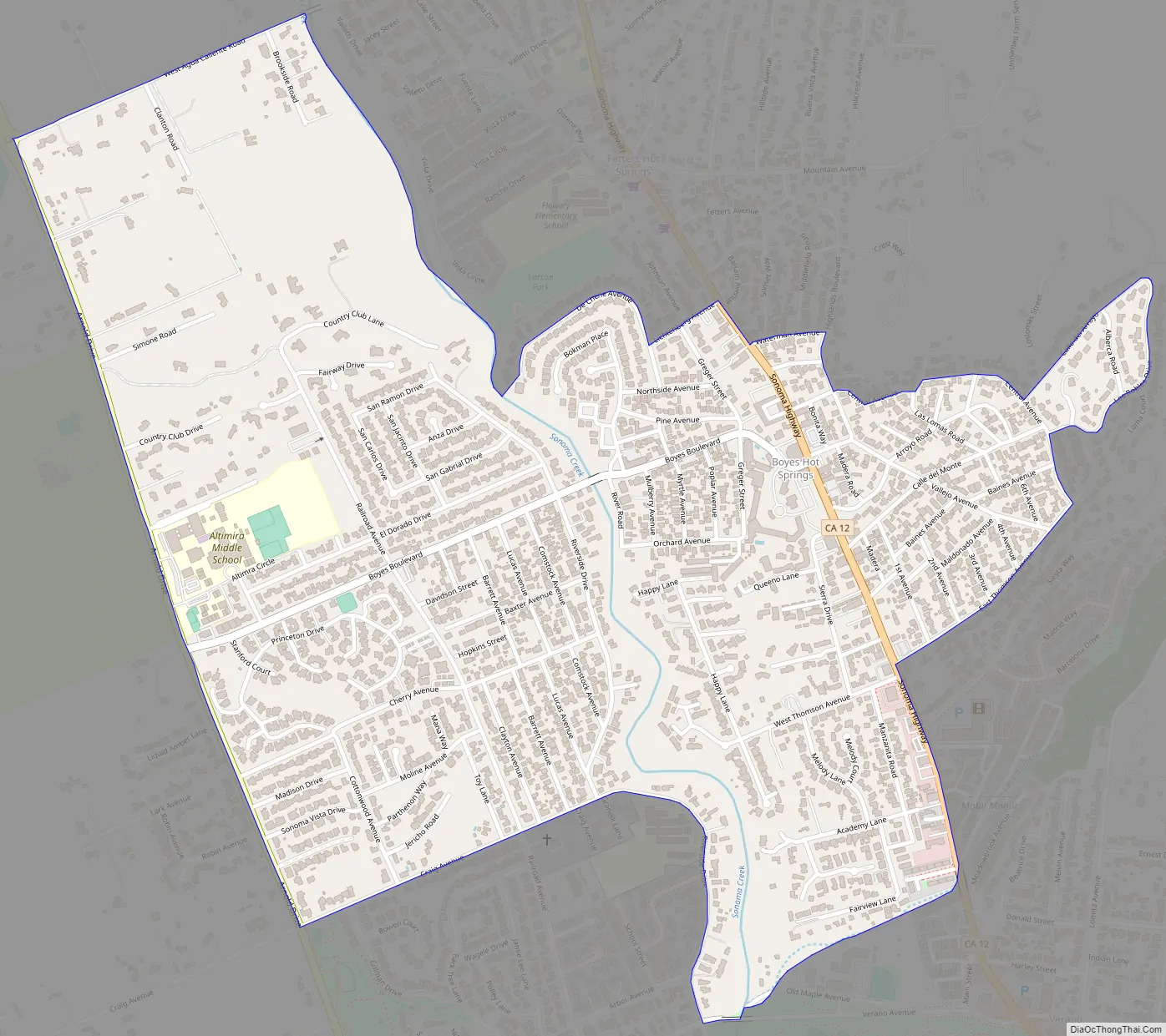
Boyes Hot Springs Road Map
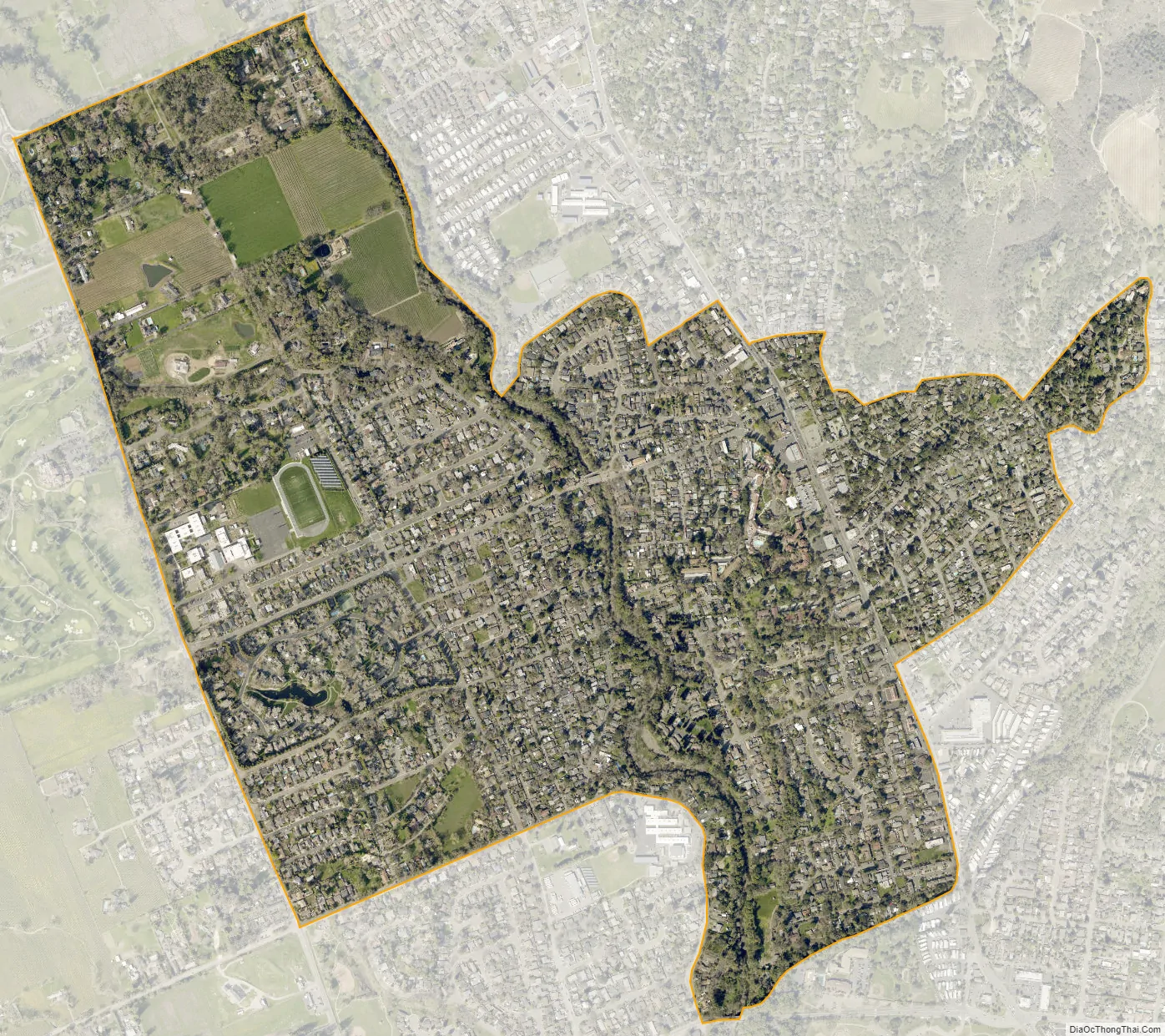
Boyes Hot Springs city Satellite Map
Geography
According to the United States Census Bureau, the CDP has a total area of 1.1 square miles (2.8 km), all of it land. Boyes Hot Springs is known for, and named after, the hot springs that run 1,100 feet below the surface. Today, the springs are accessible through the Fairmont Hotel and Spa located in the area. The springs run at 135 degrees.
See also
Map of California State and its subdivision:- Alameda
- Alpine
- Amador
- Butte
- Calaveras
- Colusa
- Contra Costa
- Del Norte
- El Dorado
- Fresno
- Glenn
- Humboldt
- Imperial
- Inyo
- Kern
- Kings
- Lake
- Lassen
- Los Angeles
- Madera
- Marin
- Mariposa
- Mendocino
- Merced
- Modoc
- Mono
- Monterey
- Napa
- Nevada
- Orange
- Placer
- Plumas
- Riverside
- Sacramento
- San Benito
- San Bernardino
- San Diego
- San Francisco
- San Joaquin
- San Luis Obispo
- San Mateo
- Santa Barbara
- Santa Clara
- Santa Cruz
- Shasta
- Sierra
- Siskiyou
- Solano
- Sonoma
- Stanislaus
- Sutter
- Tehama
- Trinity
- Tulare
- Tuolumne
- Ventura
- Yolo
- Yuba
- Alabama
- Alaska
- Arizona
- Arkansas
- California
- Colorado
- Connecticut
- Delaware
- District of Columbia
- Florida
- Georgia
- Hawaii
- Idaho
- Illinois
- Indiana
- Iowa
- Kansas
- Kentucky
- Louisiana
- Maine
- Maryland
- Massachusetts
- Michigan
- Minnesota
- Mississippi
- Missouri
- Montana
- Nebraska
- Nevada
- New Hampshire
- New Jersey
- New Mexico
- New York
- North Carolina
- North Dakota
- Ohio
- Oklahoma
- Oregon
- Pennsylvania
- Rhode Island
- South Carolina
- South Dakota
- Tennessee
- Texas
- Utah
- Vermont
- Virginia
- Washington
- West Virginia
- Wisconsin
- Wyoming


