Camp Nelson is a census-designated place in Tulare County, California. Camp Nelson is 12 miles (19 km) east of Springville. Camp Nelson has a post office with ZIP code 93208. The population was 109 at the 2020 census, up from 97 at the 2010 census. Camp Nelson can be reached from Porterville by 33 curvy miles on California State Route 190 with an elevation gain of 4,439 feet.
| Name: | Camp Nelson CDP |
|---|---|
| LSAD Code: | 57 |
| LSAD Description: | CDP (suffix) |
| State: | California |
| County: | Tulare County |
| Elevation: | 4,898 ft (1,493 m) |
| Total Area: | 1.24 sq mi (3.21 km²) |
| Land Area: | 1.24 sq mi (3.21 km²) |
| Water Area: | 0.00 sq mi (0.00 km²) 0% |
| Total Population: | 106 |
| Population Density: | 85.62/sq mi (33.05/km²) |
| ZIP code: | 93265 |
| Area code: | 559 |
| FIPS code: | 0610494 |
Online Interactive Map
Click on ![]() to view map in "full screen" mode.
to view map in "full screen" mode.
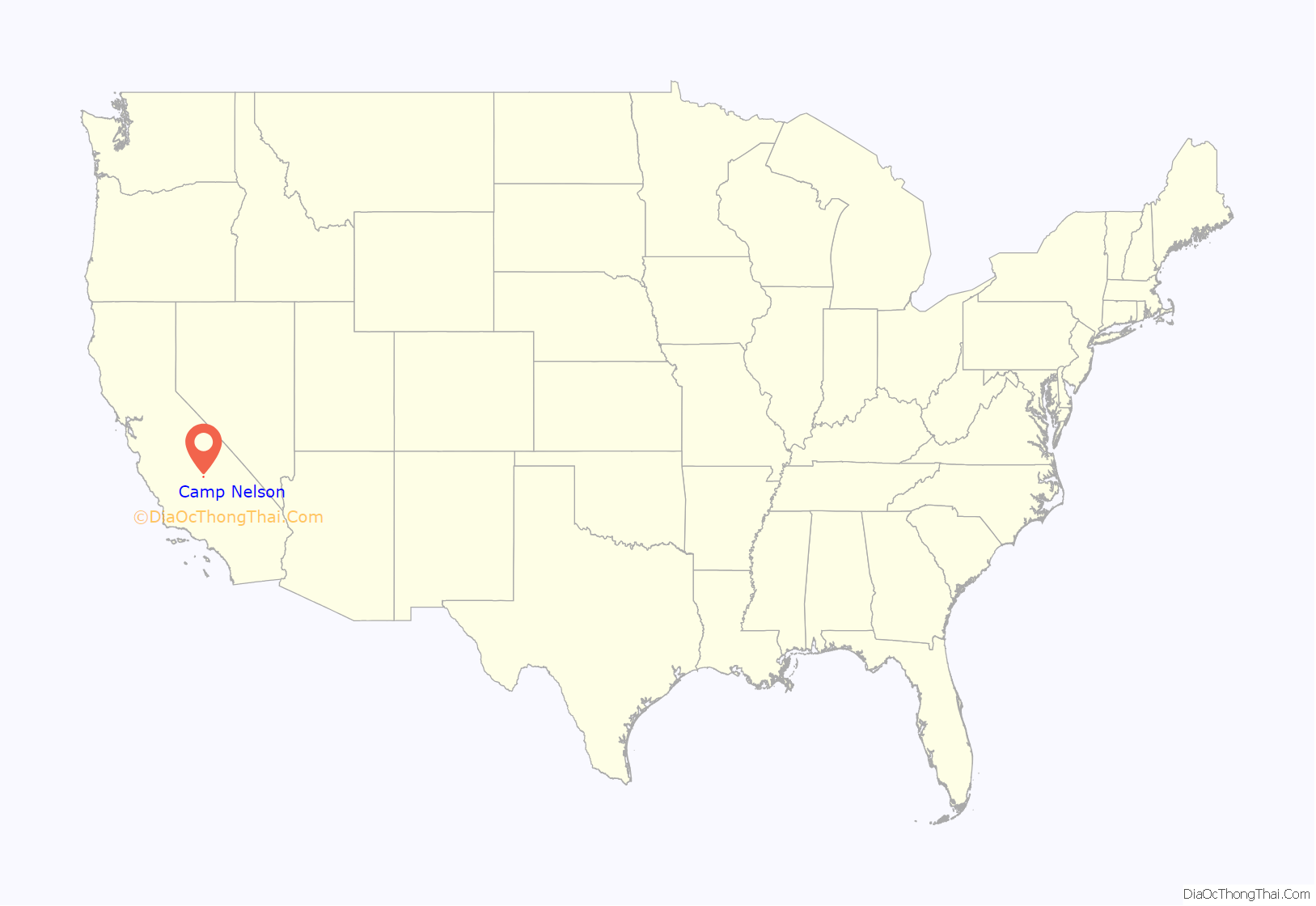
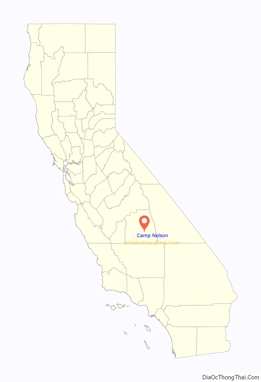
Camp Nelson location map. Where is Camp Nelson CDP?
History
In 1886, John Nelson began to homestead land above Porterville that became Nelson’s Camp. This became a popular stopover spot for cattlemen, sheepmen, hunters, and fishermen. Nelson soon enlarged his house and remodeled it into a two-story hotel. Afterwards, a few cabins were added and the spot became known as Nelson’s Camp. John Nelson died August 3, 1909, aged 79. With his death, his daughter, Emma, and her husband took over the operation. In 1922, a road suitable for automobiles was completed to the camp. The camp was sold in 1937 and operated by different families over the years. Electricity reached Camp Nelson in 1951 and in the mid-1960’s, the road was upgraded to all year access. From 1976 to 1979, the Civil War Re-Enactment Society held Civil War skirmishes in Nelson Meadow with a “Blue and Grey” ball later at the Lodge.
After some complicated financial dealings, the property and business were sold to Jim and Bonnie Hood in June 1987. In a case that attracted national attention, Bonnie Hood was murdered August 19, 1990 as she slept at the lodge. Bruce Beauchamp, an employee of Jim Hood, was acquitted of her murder on March 29, 1991. Jim Hood later shot Beauchamp to death and he was convicted of that murder in a second trial.
Later, Jim Hood deeded the Lodge to his attorney, Philip Bourdette. Ron Peterson, who held the mortgage on the Lodge, foreclosed and won the proceedings. Ron Peterson sold the Lodge to Steven Huth and Mike Quatacker. The Lodge and motel were later sold to Len Aten. Aten held a few conferences and special events in the Lodge, but it was never open to the general public.
The John M Nelson Conservancy (a California non-profit public benefit corporation) was created in 1985 due to the breakup of the Camp Nelson Resort properties. The primary aim of the Conservancy was to acquire the six and a half acre Camp Nelson meadow. After raising $85,000 in public donations, the Conservancy acquired the meadow in December, 1997. Special events are held in the meadow from time to time.
In September, 2020, Camp Nelson was spared the destruction of other small communities in the area by the naturally sparked Sequoia Complex Fire (SQF Complex)
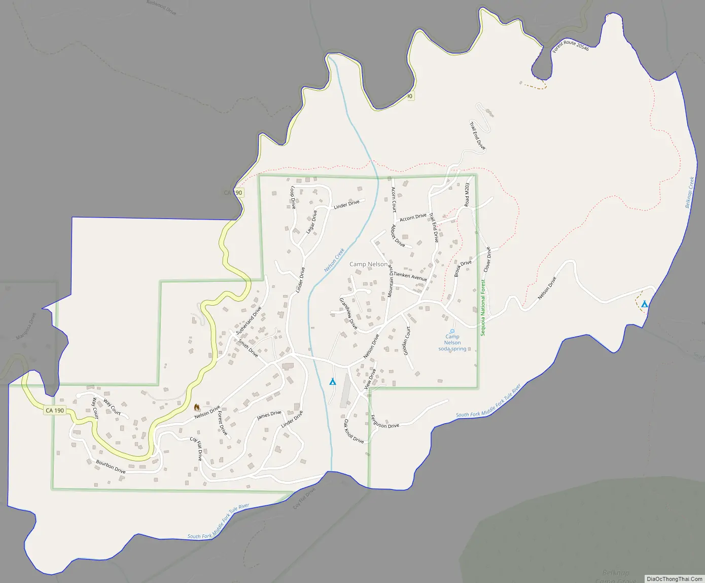
Camp Nelson Road Map
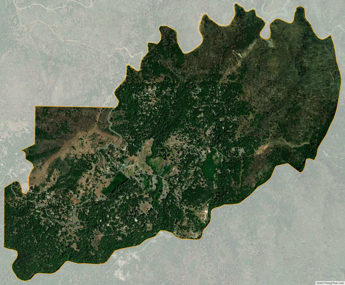
Camp Nelson city Satellite Map
Geography
According to the United States Census Bureau, the CDP covers an area of 1.2 square miles (3.2 km), all of it land.
Climate
This region experiences warm (but not hot) and dry summers, with no average monthly temperatures above 71.6 °F. According to the Köppen Climate Classification system, Camp Nelson has a warm-summer Mediterranean climate, abbreviated “Csb” on climate maps.
See also
Map of California State and its subdivision:- Alameda
- Alpine
- Amador
- Butte
- Calaveras
- Colusa
- Contra Costa
- Del Norte
- El Dorado
- Fresno
- Glenn
- Humboldt
- Imperial
- Inyo
- Kern
- Kings
- Lake
- Lassen
- Los Angeles
- Madera
- Marin
- Mariposa
- Mendocino
- Merced
- Modoc
- Mono
- Monterey
- Napa
- Nevada
- Orange
- Placer
- Plumas
- Riverside
- Sacramento
- San Benito
- San Bernardino
- San Diego
- San Francisco
- San Joaquin
- San Luis Obispo
- San Mateo
- Santa Barbara
- Santa Clara
- Santa Cruz
- Shasta
- Sierra
- Siskiyou
- Solano
- Sonoma
- Stanislaus
- Sutter
- Tehama
- Trinity
- Tulare
- Tuolumne
- Ventura
- Yolo
- Yuba
- Alabama
- Alaska
- Arizona
- Arkansas
- California
- Colorado
- Connecticut
- Delaware
- District of Columbia
- Florida
- Georgia
- Hawaii
- Idaho
- Illinois
- Indiana
- Iowa
- Kansas
- Kentucky
- Louisiana
- Maine
- Maryland
- Massachusetts
- Michigan
- Minnesota
- Mississippi
- Missouri
- Montana
- Nebraska
- Nevada
- New Hampshire
- New Jersey
- New Mexico
- New York
- North Carolina
- North Dakota
- Ohio
- Oklahoma
- Oregon
- Pennsylvania
- Rhode Island
- South Carolina
- South Dakota
- Tennessee
- Texas
- Utah
- Vermont
- Virginia
- Washington
- West Virginia
- Wisconsin
- Wyoming


