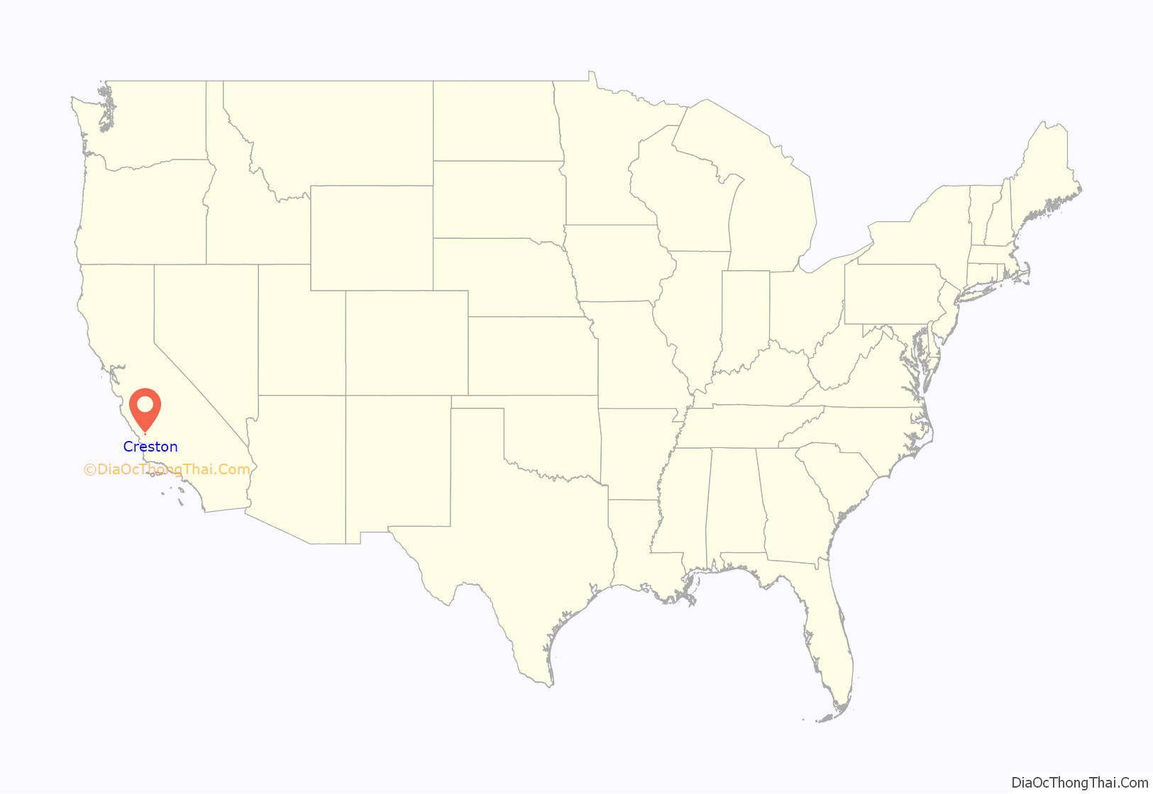
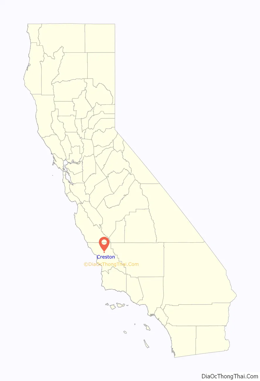
Creston is a census-designated place in San Luis Obispo County, California, about 10 miles east of Atascadero.
| Name: | Creston CDP |
|---|---|
| LSAD Code: | 57 |
| LSAD Description: | CDP (suffix) |
| State: | California |
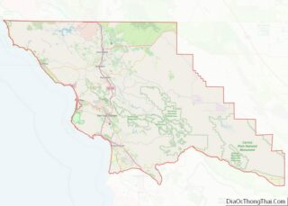
| County: | San Luis Obispo County |
| Total Area: | 0.57 sq mi (1.47 km²) |
| Land Area: | 0.56 sq mi (1.46 km²) |
| Water Area: | 0.01 sq mi (0.01 km²) 0.84% |
| Total Population: | 98 |
| Population Density: | 173.76/sq mi (67.11/km²) |
| ZIP code: | 93432 |
| FIPS code: | 0617232 |
Online Interactive Map
Click on ![]() to view map in "full screen" mode.
to view map in "full screen" mode.
Creston location map. Where is Creston CDP?
History
Creston (named after Calvin J. Cressy) was founded in 1884 on the Rancho Huerhuero Mexican land grant.
Creston was home to Creston Farm, where a number of retired American thoroughbred racehorses were boarded, including those listed below.
Notable retired racehorses who were stabled there include:
- Flying Paster (1976–1992)
- Golden Act (1976–2000)
- Skywalker (1982–2003)
- Itsallgreektome (1987–2007)
Writer and Scientology founder L. Ron Hubbard died at his ranch near Creston.
In 2014, Creston was made an American Viticultural Area called the Creston District AVA.
Creston Road Map
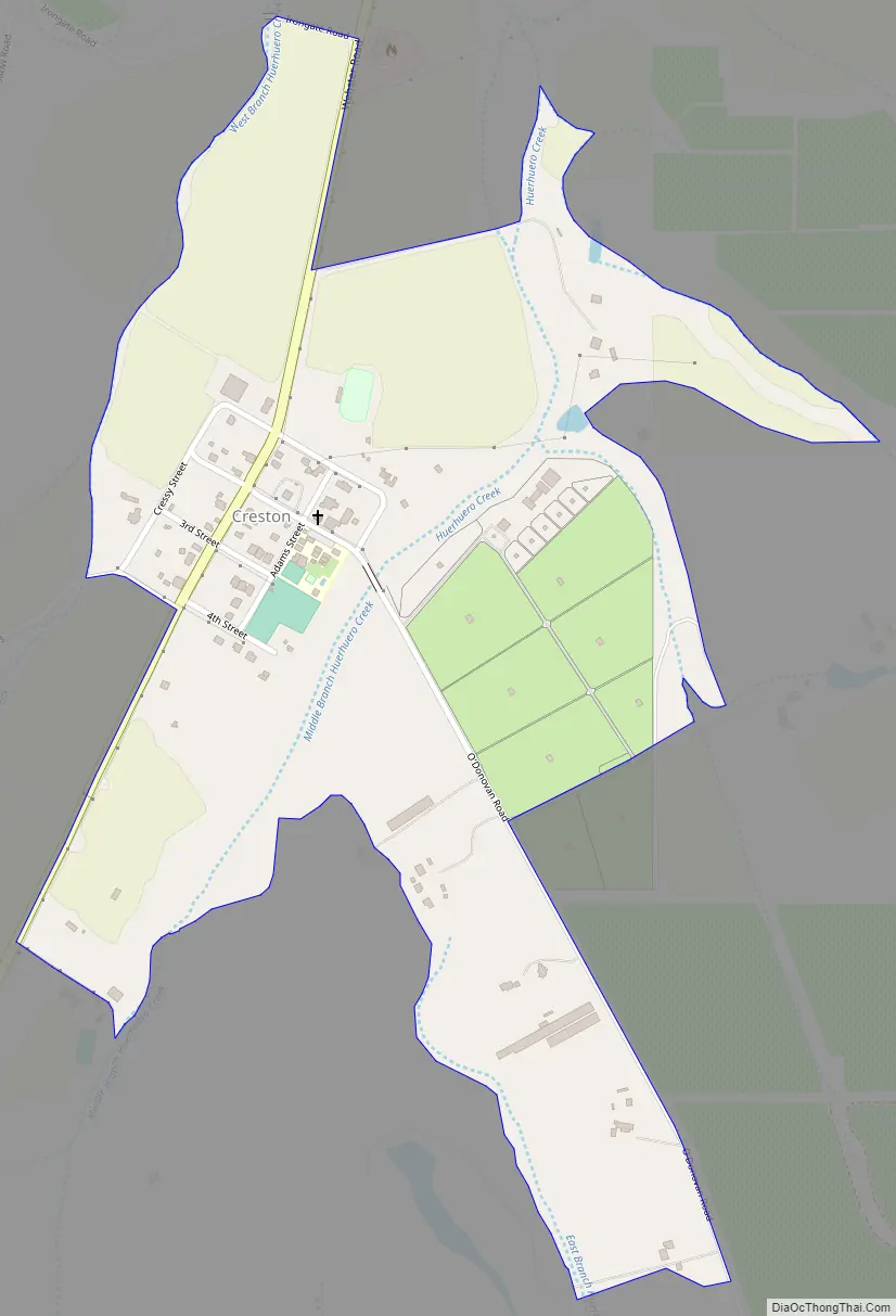
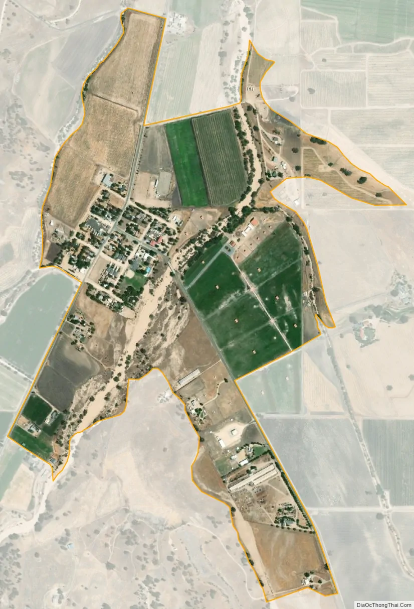
Creston city Satellite Map
See also
Map of California State and its subdivision:- Alameda
- Alpine
- Amador
- Butte
- Calaveras
- Colusa
- Contra Costa
- Del Norte
- El Dorado
- Fresno
- Glenn
- Humboldt
- Imperial
- Inyo
- Kern
- Kings
- Lake
- Lassen
- Los Angeles
- Madera
- Marin
- Mariposa
- Mendocino
- Merced
- Modoc
- Mono
- Monterey
- Napa
- Nevada
- Orange
- Placer
- Plumas
- Riverside
- Sacramento
- San Benito
- San Bernardino
- San Diego
- San Francisco
- San Joaquin
- San Luis Obispo
- San Mateo
- Santa Barbara
- Santa Clara
- Santa Cruz
- Shasta
- Sierra
- Siskiyou
- Solano
- Sonoma
- Stanislaus
- Sutter
- Tehama
- Trinity
- Tulare
- Tuolumne
- Ventura
- Yolo
- Yuba
- Alabama
- Alaska
- Arizona
- Arkansas
- California
- Colorado
- Connecticut
- Delaware
- District of Columbia
- Florida
- Georgia
- Hawaii
- Idaho
- Illinois
- Indiana
- Iowa
- Kansas
- Kentucky
- Louisiana
- Maine
- Maryland
- Massachusetts
- Michigan
- Minnesota
- Mississippi
- Missouri
- Montana
- Nebraska
- Nevada
- New Hampshire
- New Jersey
- New Mexico
- New York
- North Carolina
- North Dakota
- Ohio
- Oklahoma
- Oregon
- Pennsylvania
- Rhode Island
- South Carolina
- South Dakota
- Tennessee
- Texas
- Utah
- Vermont
- Virginia
- Washington
- West Virginia
- Wisconsin
- Wyoming