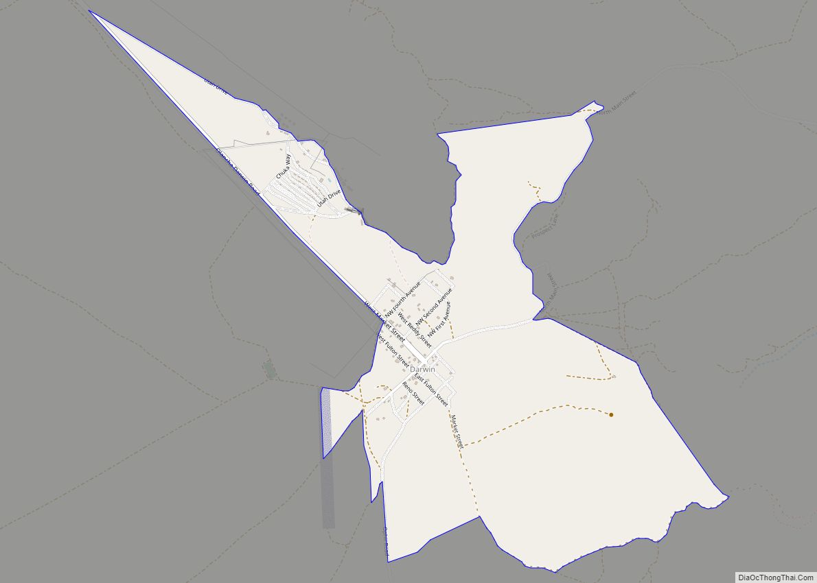
Darwin is an unincorporated mining community in Inyo County, California, United States. It is located 22 miles (35 km) southeast of Keeler, at an elevation of 4,790 ft (1,460 m). The population was 43 at the 2010 census, down from 54 at the 2000 census.
| Name: | Darwin CDP |
|---|---|
| LSAD Code: | 57 |
| LSAD Description: | CDP (suffix) |
| State: | California |
| County: | Inyo County |
| Elevation: | 4,790 ft (1,460 m) |
| Total Area: | 1.34 sq mi (3.48 km²) |
| Land Area: | 1.34 sq mi (3.48 km²) |
| Water Area: | 0.00 sq mi (0.00 km²) 0% |
| Total Population: | 36 |
| Population Density: | 26.77/sq mi (10.33/km²) |
| ZIP code: | 93522 |
| FIPS code: | 0618030 |
| GNISfeature ID: | 0241269 |
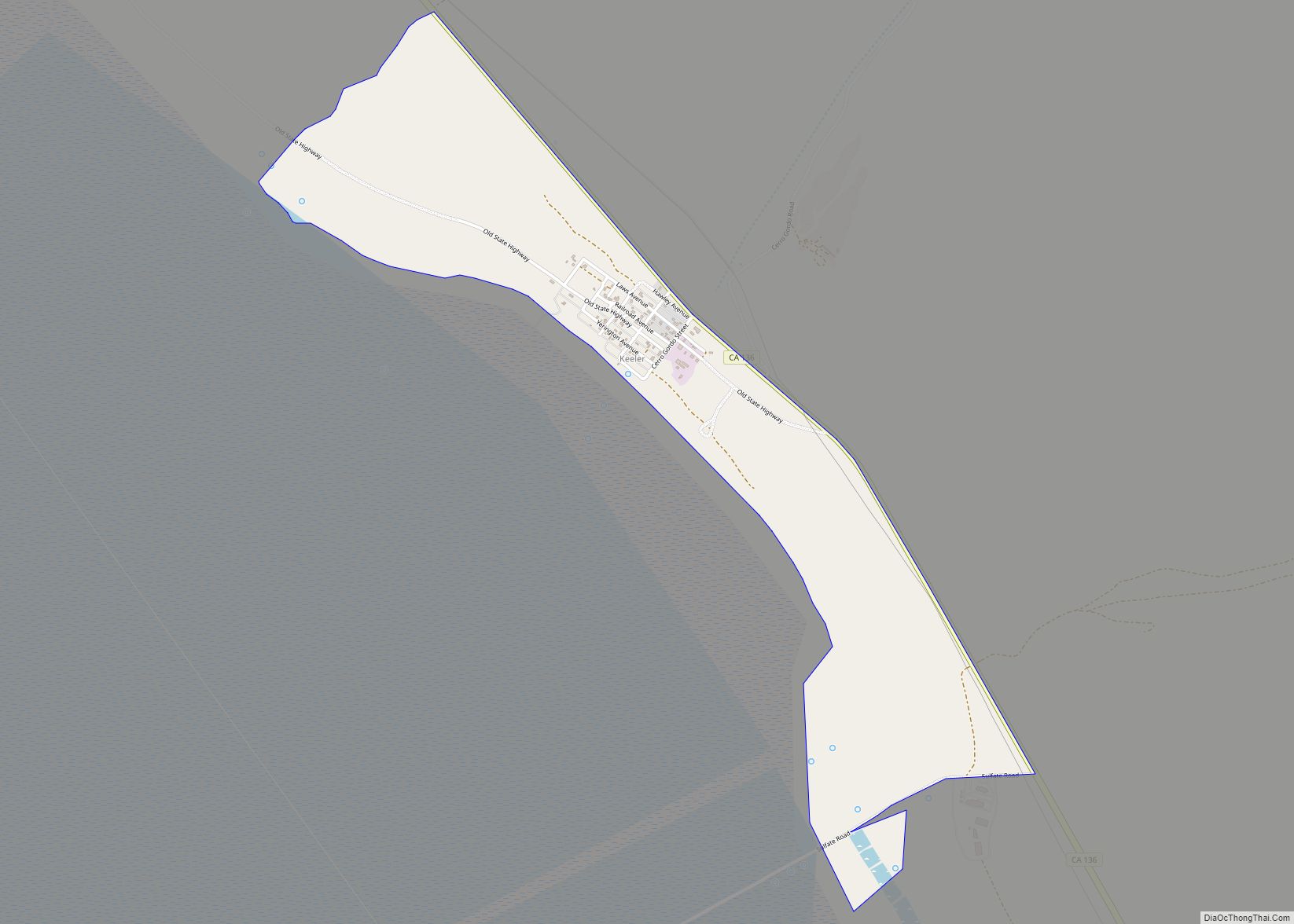
Online Interactive Map
Click on ![]() to view map in "full screen" mode.
to view map in "full screen" mode.
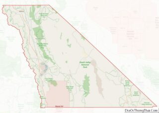
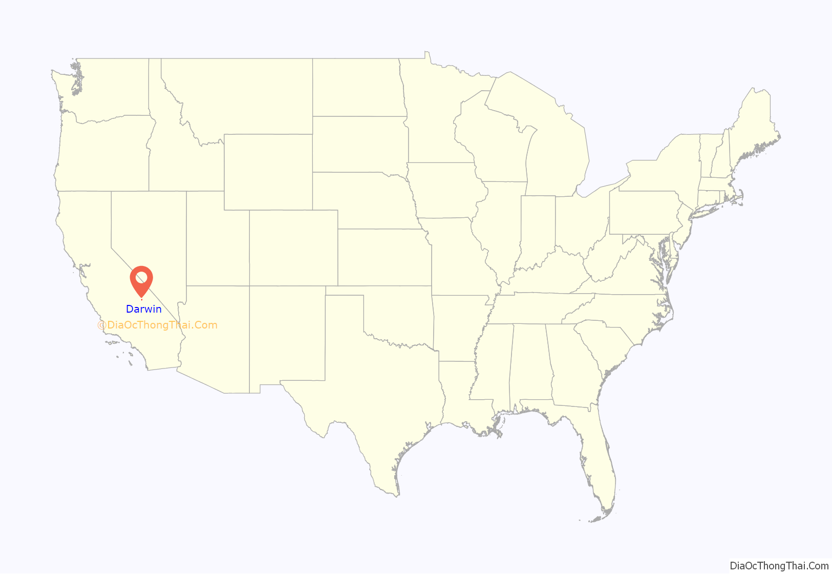
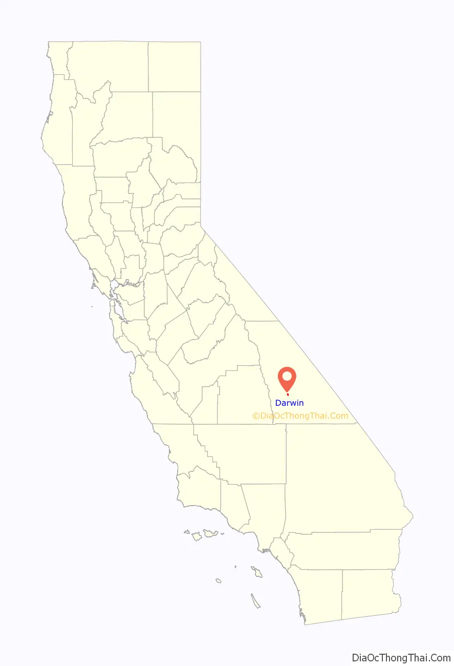
Darwin location map. Where is Darwin CDP?
History
It is named after Darwin French. According to Erwin Gudde, French of Fort Tejon was with a party of prospectors in the area during the fall of 1850. French also led a party into Death Valley in 1860 to search for the mythical Gunsight Lode via the local wash, lending his first name to the wash, canyon, and future town.
Silver and lead discovery at the place led to the founding of a settlement in 1874. A post office opened in 1875, closed for a time in 1902, and remains open. The town prospered when Eichbaum Toll Road opened in 1926, opening Death Valley from the west. When Death Valley became a National Monument in 1933, it was decided to buy the toll road to allow free access to the new park. In 1937, a new cutoff bypassed Darwin, isolating the town.
The town was the subject of a 2011 documentary film Darwin. In April 2012, BBC News featured a video of local residents describing their wishes to replace dial-up Internet access with broadband.
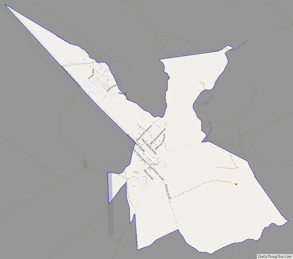
Darwin Road Map
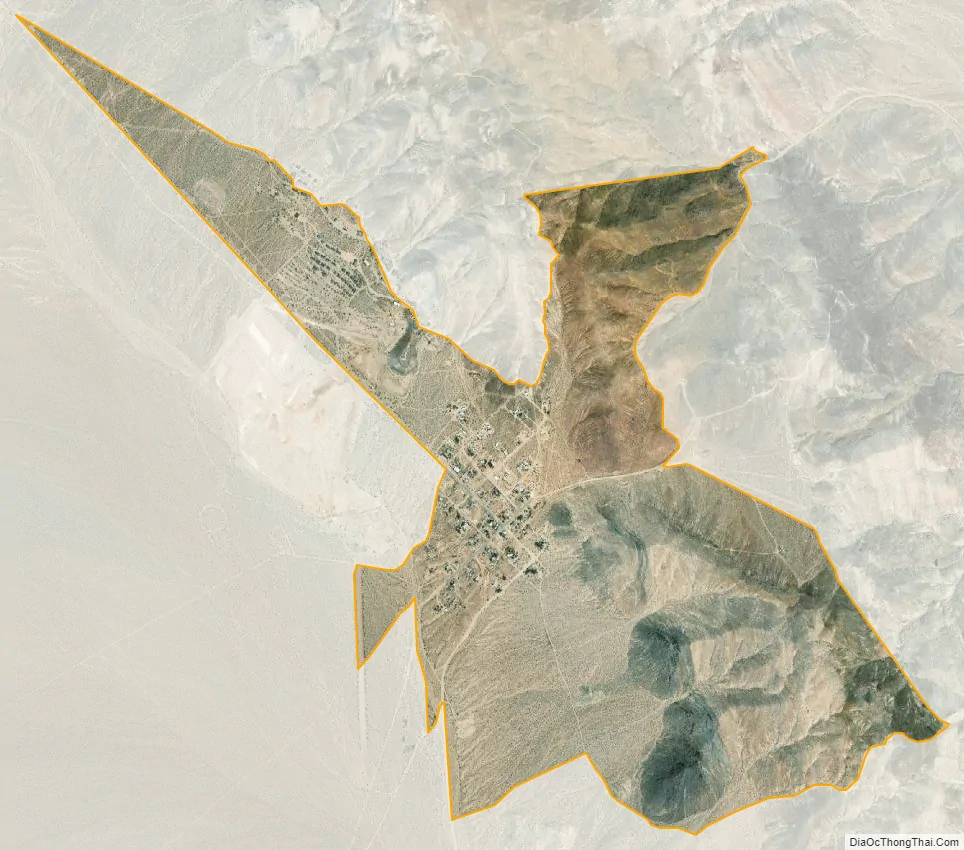
Darwin city Satellite Map
Geography
According to the United States Census Bureau, the CDP has a total area of 1.3 square miles (3.4 km), all of it land. The census definition of the area was created by the Census Bureau for statistical purposes and may not precisely correspond to local understanding of the area with the same name.
See also
Map of California State and its subdivision:- Alameda
- Alpine
- Amador
- Butte
- Calaveras
- Colusa
- Contra Costa
- Del Norte
- El Dorado
- Fresno
- Glenn
- Humboldt
- Imperial
- Inyo
- Kern
- Kings
- Lake
- Lassen
- Los Angeles
- Madera
- Marin
- Mariposa
- Mendocino
- Merced
- Modoc
- Mono
- Monterey
- Napa
- Nevada
- Orange
- Placer
- Plumas
- Riverside
- Sacramento
- San Benito
- San Bernardino
- San Diego
- San Francisco
- San Joaquin
- San Luis Obispo
- San Mateo
- Santa Barbara
- Santa Clara
- Santa Cruz
- Shasta
- Sierra
- Siskiyou
- Solano
- Sonoma
- Stanislaus
- Sutter
- Tehama
- Trinity
- Tulare
- Tuolumne
- Ventura
- Yolo
- Yuba
- Alabama
- Alaska
- Arizona
- Arkansas
- California
- Colorado
- Connecticut
- Delaware
- District of Columbia
- Florida
- Georgia
- Hawaii
- Idaho
- Illinois
- Indiana
- Iowa
- Kansas
- Kentucky
- Louisiana
- Maine
- Maryland
- Massachusetts
- Michigan
- Minnesota
- Mississippi
- Missouri
- Montana
- Nebraska
- Nevada
- New Hampshire
- New Jersey
- New Mexico
- New York
- North Carolina
- North Dakota
- Ohio
- Oklahoma
- Oregon
- Pennsylvania
- Rhode Island
- South Carolina
- South Dakota
- Tennessee
- Texas
- Utah
- Vermont
- Virginia
- Washington
- West Virginia
- Wisconsin
- Wyoming