Desert Hot Springs is a city in Riverside County, California, United States. The city is located within the Coachella Valley geographic region. The population was 25,938 at the 2010 census, up from 16,582 at the 2000 census. The city has experienced rapid growth since the 1970s when there were 2,700 residents.
It is named for its many natural hot springs. It is one of several places in the world with naturally occurring hot and cold mineral springs. More than 20 natural mineral spring lodgings can be found in town. Unlike hot springs with high sulfur content, the mineral springs in town are odorless.
| Name: | Desert Hot Springs city |
|---|---|
| LSAD Code: | 25 |
| LSAD Description: | city (suffix) |
| State: | California |
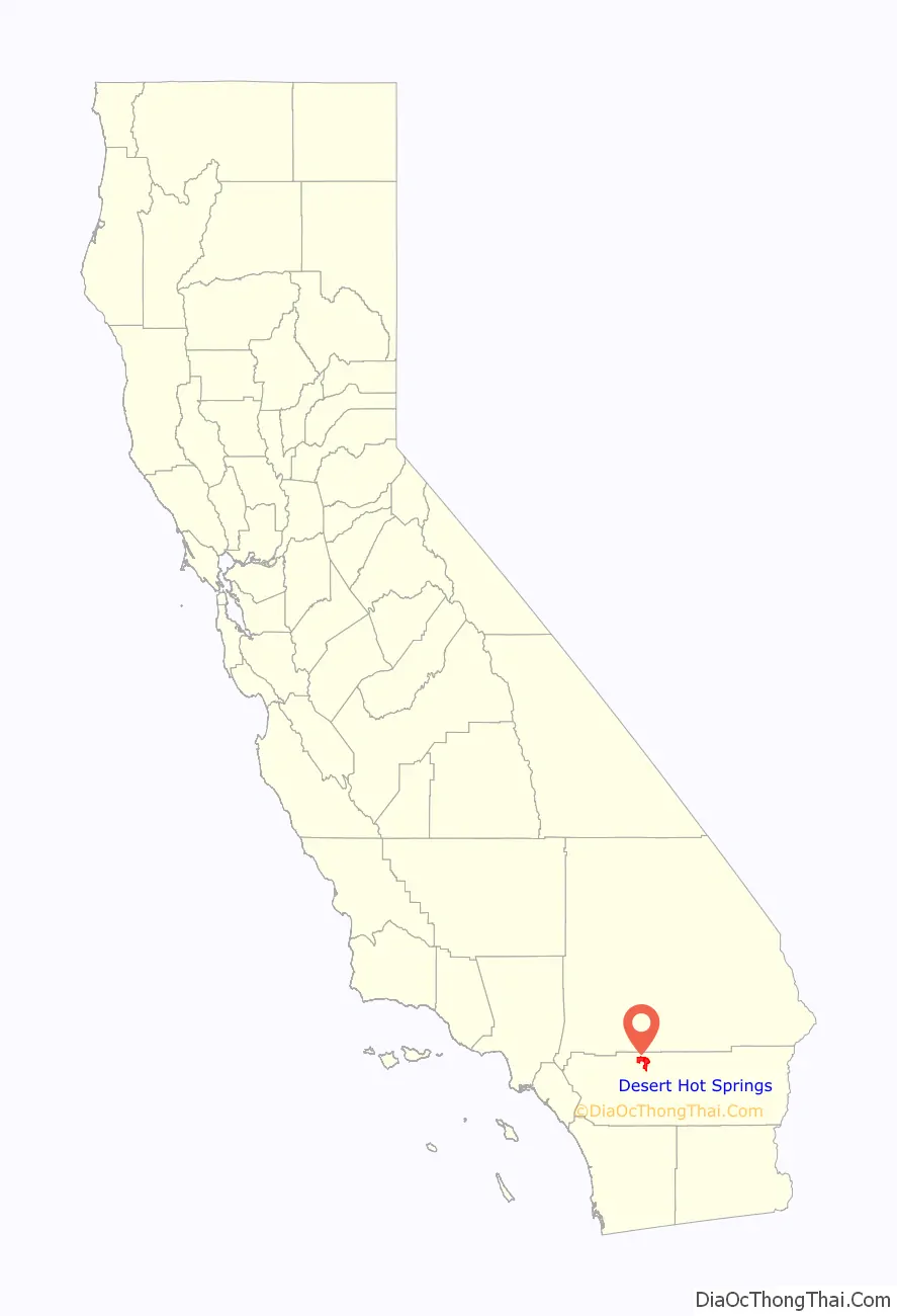
| County: | Riverside County |
| Incorporated: | September 25, 1963 |
| Elevation: | 1,076 ft (328 m) |
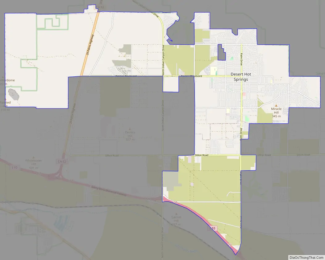
| Total Area: | 30.66 sq mi (79.41 km²) |
| Land Area: | 30.27 sq mi (78.40 km²) |
| Water Area: | 0.39 sq mi (1.01 km²) 0.11% |
| Total Population: | 32,512 |
| Population Density: | 1,074.03/sq mi (414.68/km²) |
| ZIP code: | 92240–92241 |
| FIPS code: | 0618996 |
| Website: | www.cityofdhs.org |
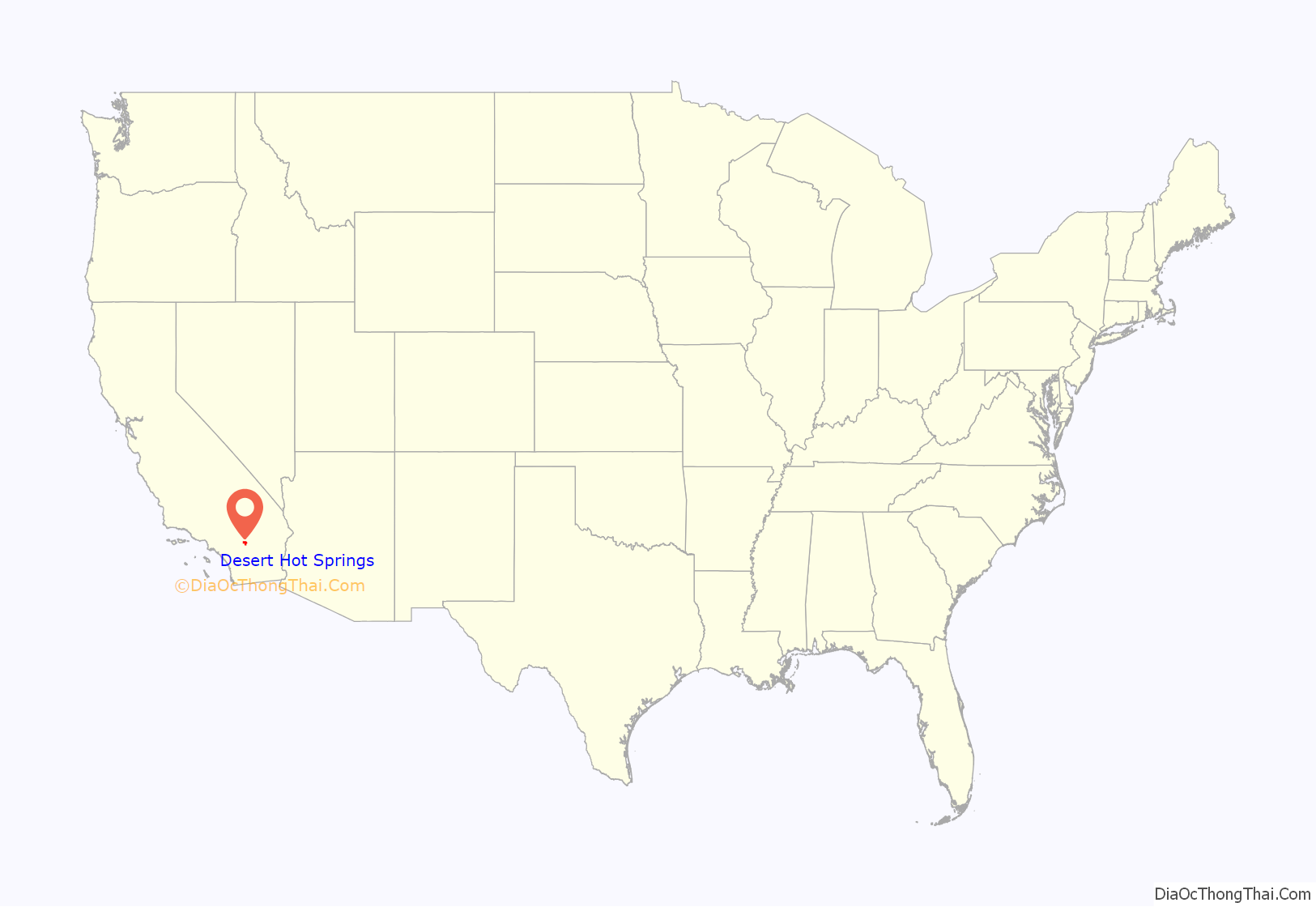
Online Interactive Map
Click on ![]() to view map in "full screen" mode.
to view map in "full screen" mode.
Desert Hot Springs location map. Where is Desert Hot Springs city?
History
The only people residing in areas north of Palm Springs before the 20th century were the Cahuilla Indians in the village of Seven Palms. Although Cahuilla people never settled permanently in today’s Desert Hot Springs, they often camped here during winter times due to the warm climate.
According to early homesteader and writer Cabot Yerxa in his newspaper columns published in The Desert Sentinel newspaper, the first homesteader in the area of the city of Desert Hot Springs was Hilda Maude Gray, who staked her claim in 1908. Cabot Yerxa arrived in 1913 and soon discovered the hot water aquifer on Miracle Hill. Due to the Mission Creek Branch of the San Andreas Fault bisecting the area, one side is a cold water aquifer, the other has a hot water aquifer. His large Pueblo Revival Style architecture structure, hand built over 20 years, is now one of the oldest adobe-style buildings in Riverside County and houses Cabot’s Pueblo Museum, designated a state historical site after his death in 1965. Cabot’s Trading Post & Gallery opened there in February 2008.
The town was founded by L. W. Coffee on July 12, 1941. The original town site was centered at the intersection of Palm Drive and Pierson Boulevard and was only one square mile. Coffee chose the name Desert Hot Springs because of the area’s natural hot springs.
Desert Hot Springs became a tourist destination in the 1950s because of its small spa hotels and boutique hotels. The city is popular with “snowbirds.” Realtors arrived to speculate, and thousands of lots were laid out over a six-square mile area. Some homes were bought by retirees, and the area was incorporated as a city in 1963, with 1,000 residents.
Desert Hot Springs experienced periods of significant growth in the 1980s and 1990s when most of the vacant lots were filled with new houses and duplex apartments. The city’s population doubled in the 1980s and increased by 5,000 in the 2000 census.
Desert Hot Springs High School opened in 1999.
Desert Hot Springs was the first city in Southern California to legalize medical marijuana cultivation and has since been overwhelmed by marijuana developers and growers. It was later featured in a CNBC special as California’s first city to permit the commercial cultivation of marijuana in 2014.
Desert Hot Springs Road Map
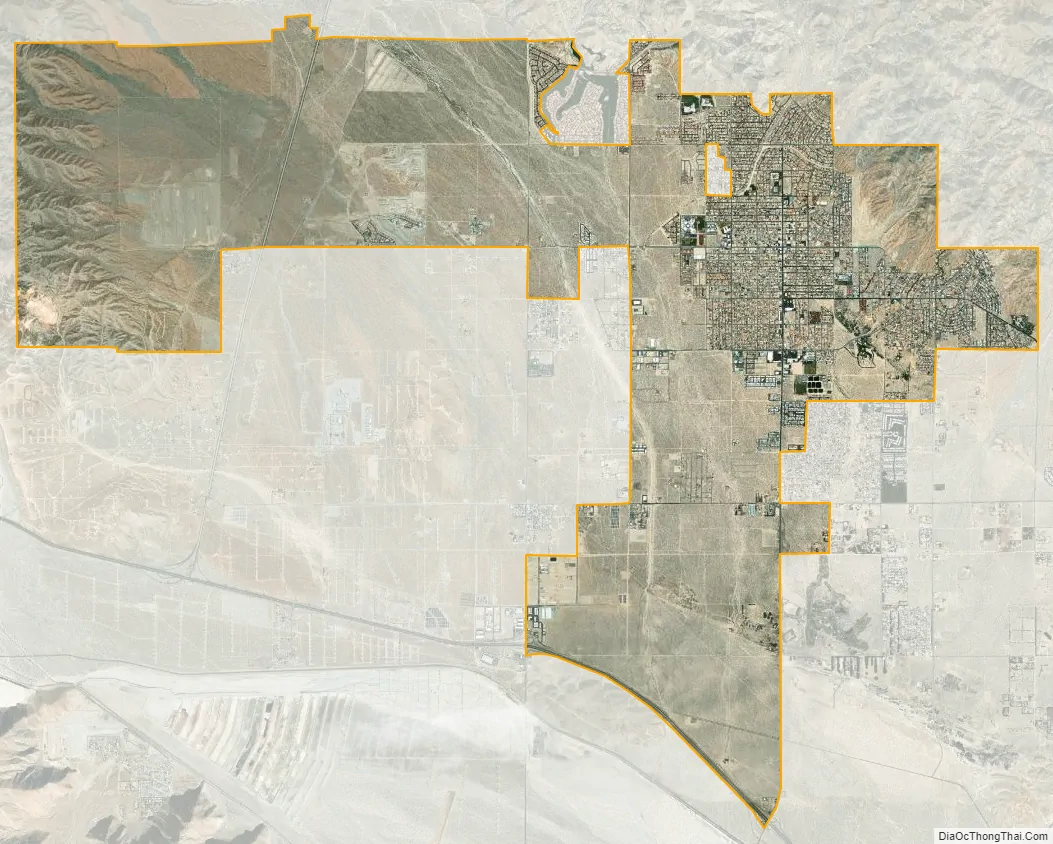
Desert Hot Springs city Satellite Map
Geography
Before the development of the city began in the 1930s, Desert Hot Springs was a treeless place in California’s Colorado Desert.
According to the United States Census Bureau, the city has a total area of 23.6 square miles (61 km), of which 99.89% is land, and 0.11% is water. Desert Hot Springs is nestled between two mountain ranges: San Bernardino Mountains and San Jacinto Mountains. It is located just south of Big Morongo Canyon Preserve and Joshua Tree National Park. It is located in the Colorado Desert region of the Sonoran Desert.
See also
Map of California State and its subdivision:- Alameda
- Alpine
- Amador
- Butte
- Calaveras
- Colusa
- Contra Costa
- Del Norte
- El Dorado
- Fresno
- Glenn
- Humboldt
- Imperial
- Inyo
- Kern
- Kings
- Lake
- Lassen
- Los Angeles
- Madera
- Marin
- Mariposa
- Mendocino
- Merced
- Modoc
- Mono
- Monterey
- Napa
- Nevada
- Orange
- Placer
- Plumas
- Riverside
- Sacramento
- San Benito
- San Bernardino
- San Diego
- San Francisco
- San Joaquin
- San Luis Obispo
- San Mateo
- Santa Barbara
- Santa Clara
- Santa Cruz
- Shasta
- Sierra
- Siskiyou
- Solano
- Sonoma
- Stanislaus
- Sutter
- Tehama
- Trinity
- Tulare
- Tuolumne
- Ventura
- Yolo
- Yuba
- Alabama
- Alaska
- Arizona
- Arkansas
- California
- Colorado
- Connecticut
- Delaware
- District of Columbia
- Florida
- Georgia
- Hawaii
- Idaho
- Illinois
- Indiana
- Iowa
- Kansas
- Kentucky
- Louisiana
- Maine
- Maryland
- Massachusetts
- Michigan
- Minnesota
- Mississippi
- Missouri
- Montana
- Nebraska
- Nevada
- New Hampshire
- New Jersey
- New Mexico
- New York
- North Carolina
- North Dakota
- Ohio
- Oklahoma
- Oregon
- Pennsylvania
- Rhode Island
- South Carolina
- South Dakota
- Tennessee
- Texas
- Utah
- Vermont
- Virginia
- Washington
- West Virginia
- Wisconsin
- Wyoming


