Palm Springs (Cahuilla: Séc-he) is a desert resort city in Riverside County, California, United States, within the Colorado Desert’s Coachella Valley. The city covers approximately 94 square miles (240 km), making it the largest city in Riverside County by land area. With multiple plots in checkerboard pattern, more than 10% of the city is part of the Agua Caliente Band of Cahuilla Indians reservation land and is the administrative capital of the most populated reservation in California.
The population of Palm Springs was 44,575 as of the 2020 census, but because Palm Springs is a retirement location and a winter snowbird destination, the city’s population triples between November and March.
The city is noted for its mid-century modern architecture, design elements, arts and cultural scene, and recreational activities.
| Name: | Palm Springs city |
|---|---|
| LSAD Code: | 25 |
| LSAD Description: | city (suffix) |
| State: | California |
| County: | Riverside County |
| Incorporated: | April 20, 1938 |
| Elevation: | 479 ft (146 m) |
| Total Area: | 94.68 sq mi (245.21 km²) |
| Land Area: | 94.54 sq mi (244.85 km²) |
| Water Area: | 0.14 sq mi (0.36 km²) 0.90% |
| Total Population: | 44,575 |
| Population Density: | 513.21/sq mi (198.15/km²) |
| FIPS code: | 0655254 |
| Website: | palmspringsca.gov |
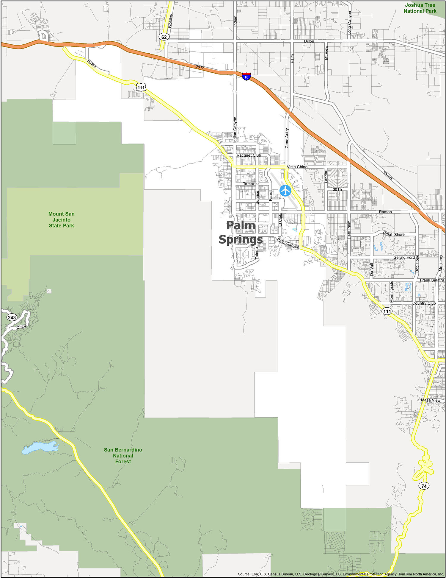
This Palm Springs map features highways, roads, and landmarks so you can get the most out of your next trip to the “Golf Capital of the World”. From its stunning desert landscape to its iconic golf courses, Palm Springs is a destination that you won’t want to miss.
Discover the beauty of Palm Springs with this interactive map of Palm Springs, California. Here you will find highways, roads, and landmarks so you can get the most out of your next trip to the “Golf Capital of the World”. From its stunning desert landscape to its iconic golf courses, Palm Springs is a destination that you won’t want to miss.
Online Interactive Map
Click on ![]() to view map in "full screen" mode.
to view map in "full screen" mode.
Palm Springs is one of America’s most captivating resort cities, and this interactive map will help you find the best hotels, restaurants, and attractions. It shows you everything from the best places to shop, where to eat, where to stay, and which sites to see. This map is interactive, so you can zoom in and out, and is easy to use and explore all the fine details of Palm Springs, California.
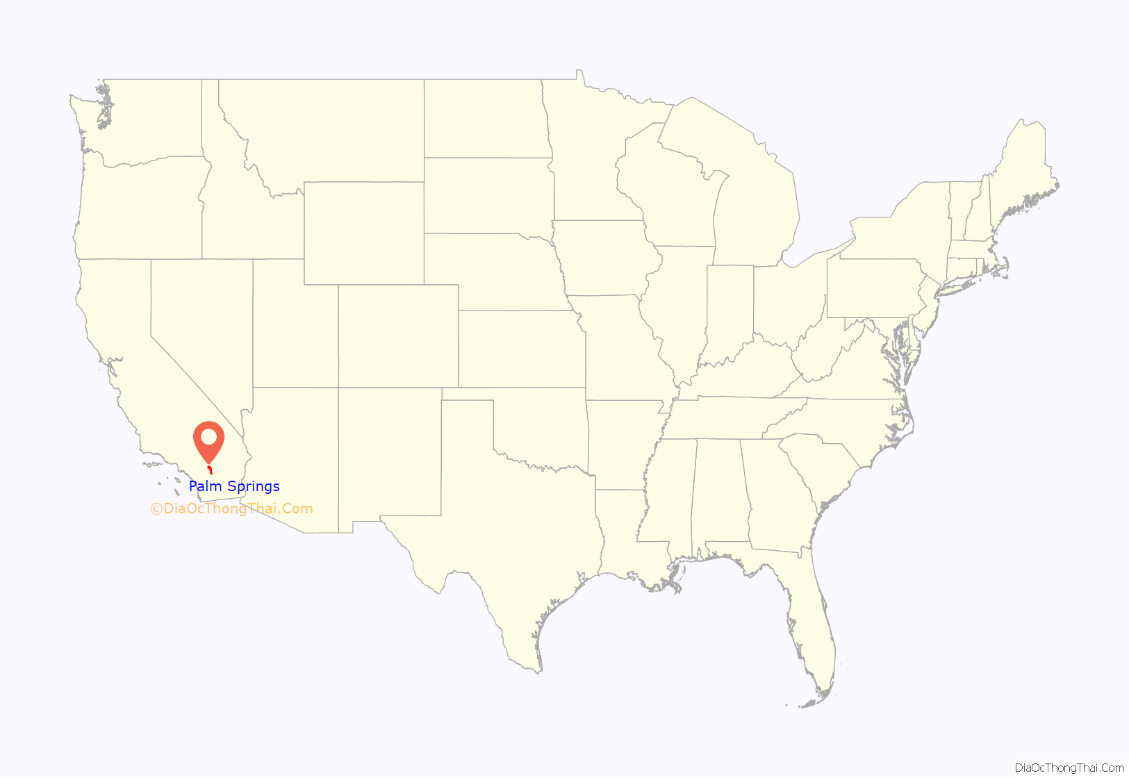
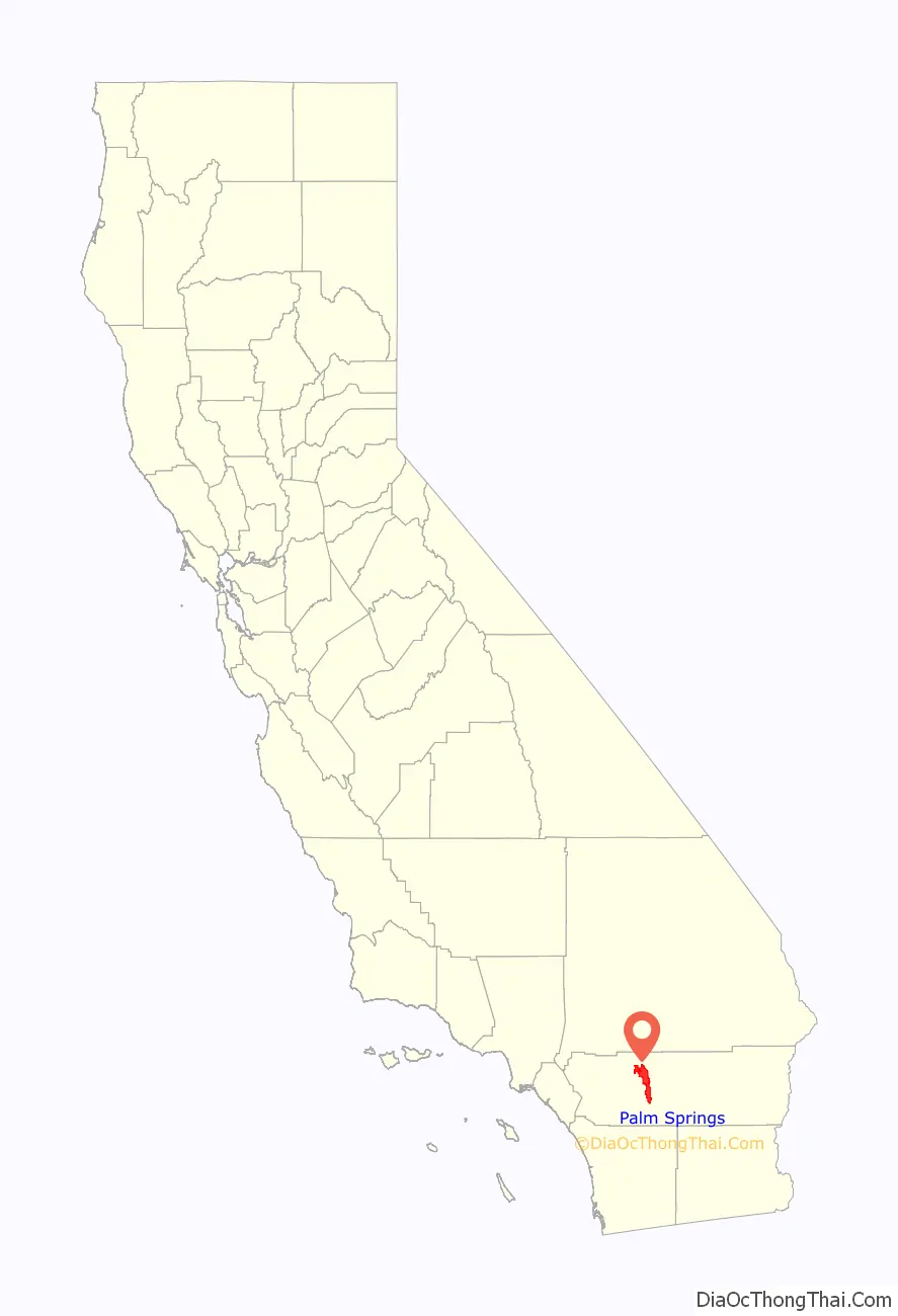
Palm Springs location map. Where is Palm Springs city?
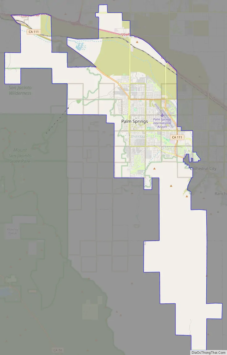
Palm Springs Road Map
From sightseeing to shopping, Palm Springs has something for everyone. With this Palm Springs road map, you can find your way around the city easily and make the most of your vacation. This map is color-coded to show the interstates, highways, and major roads. It is an invaluable tool for planning your trip to Palm Springs and finding your way around the city. If you plan to travel outside the city, check out our California road map for more highway information.
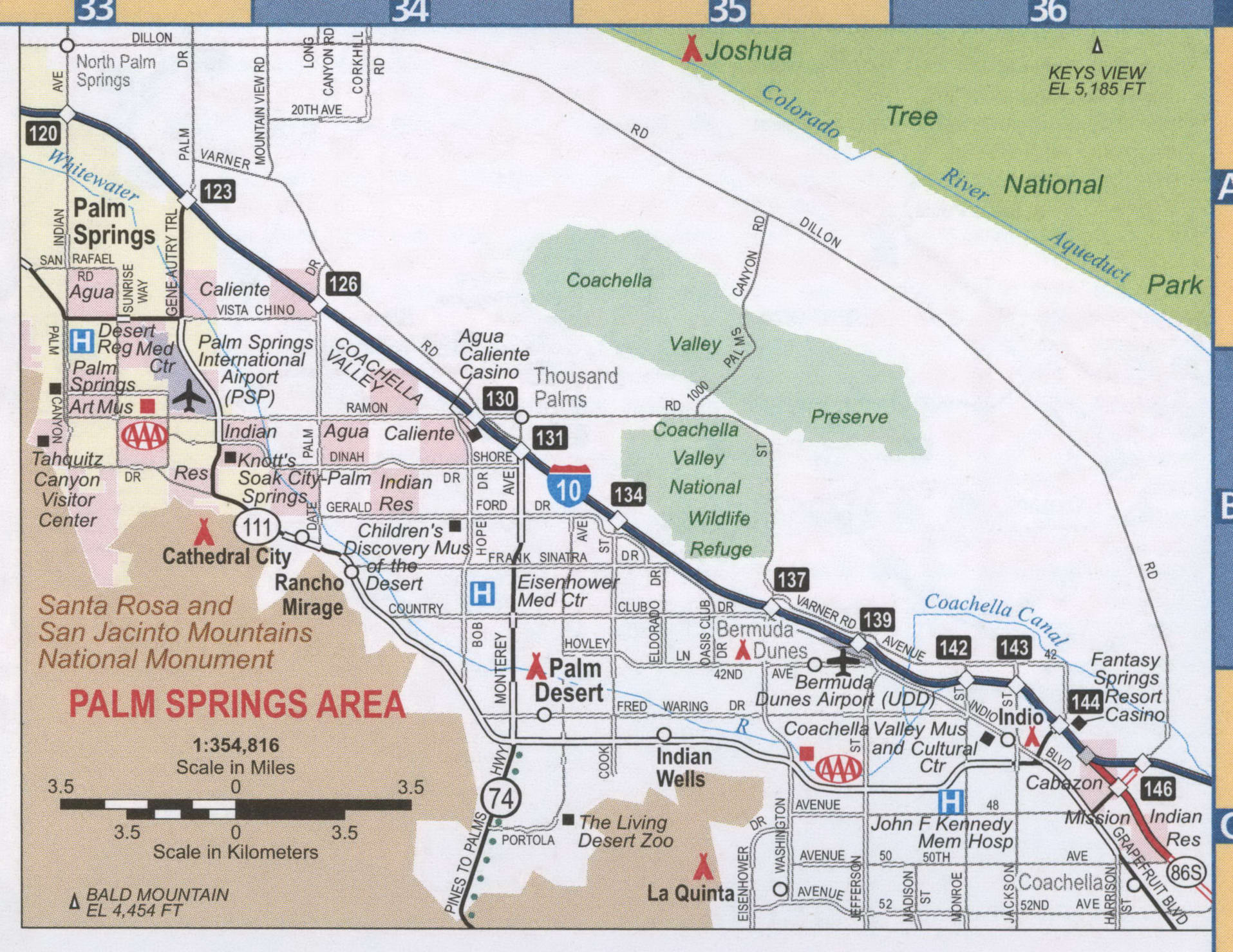
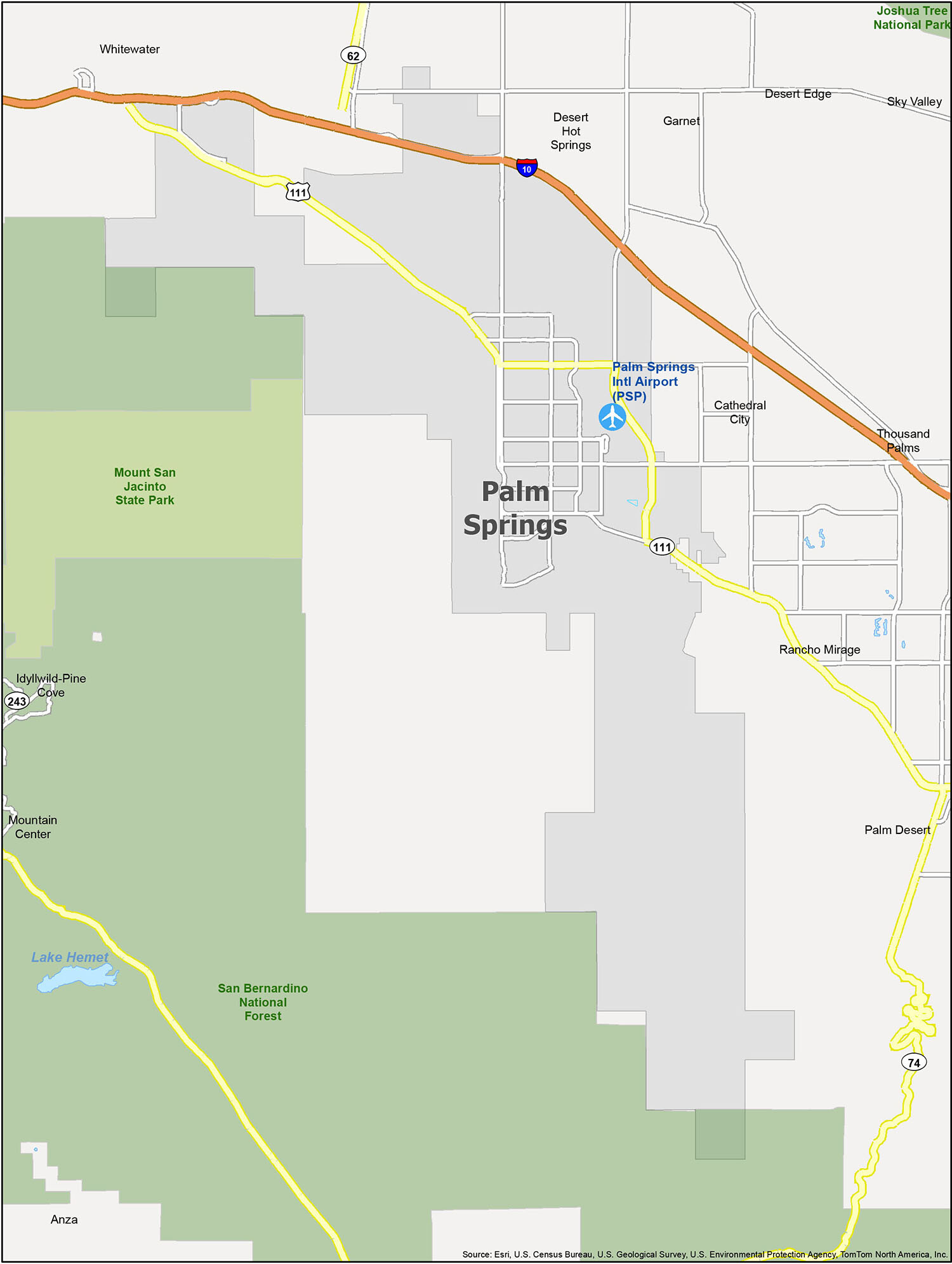
Palm Springs is an amazing destination with a lot to explore. From its airports and cities to its parks and forests, this reference map is the perfect tool to help you navigate the area. Whether you’re looking for a place to stay or just want to explore, this helpful guide is the perfect companion.
Discover the beauty of Palm Springs with this reference map. Explore the different neighborhoods, districts, parks, and forests. Travelers can find the helpful guide they need with the Palm Springs Reference Map. Airports, cities, and more are included in this map, making it the perfect tool to help you navigate the area.
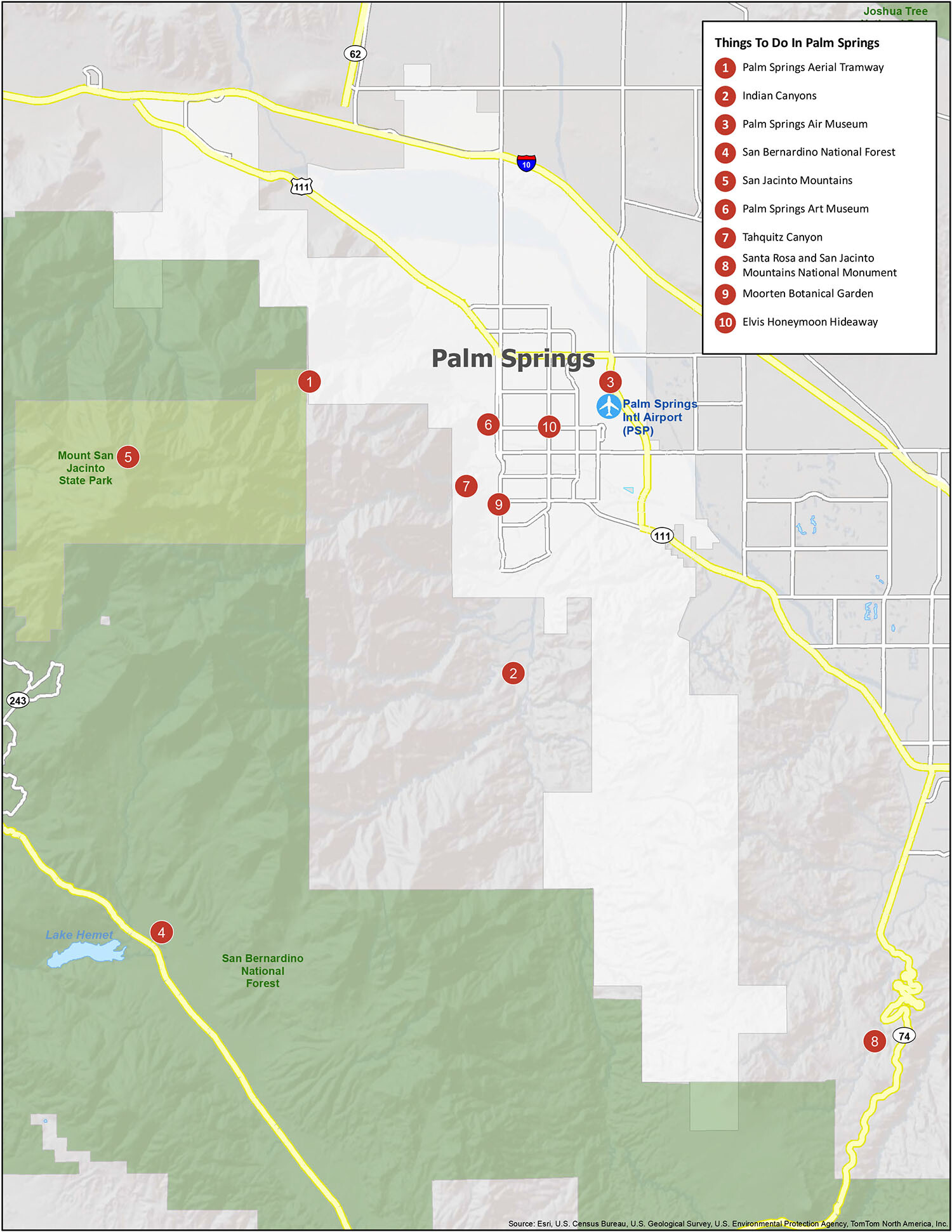
10 things to do in Palm Springs city
Discover the beauty of Palm Springs and all its hidden gems with this map of the city. From the Palm Springs Aerial Tramway to the San Bernardino National Forest, you’ll find something to explore in this desert city. Go on a journey of discovery and explore your home away from home. With the map of Palm Springs, you can uncover the sights, attractions, and hidden gems of the city.
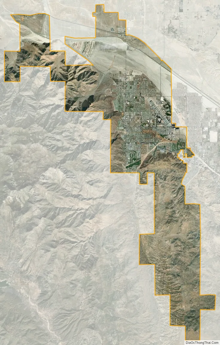
Palm Springs city Satellite Map
Geography
Palm Springs is located in the Sonoran Desert. According to the United States Census Bureau, the city has a total area of 95.0 square miles (246 km), of which 94.1 square miles (244 km) is land and 0.9 square miles (2.3 km) (1%) is water. Located in the Coachella Valley desert region, Palm Springs is sheltered by the San Bernardino Mountains to the north, the Santa Rosa Mountains to the south, by the San Jacinto Mountains to the west and by the Little San Bernardino Mountains to the east.
Climate
Palm Springs has a hot desert climate in Köppen-Geiger classification (BWh), with over 300 days of sunshine and 4.93 inches (125.2 mm) of precipitation annually. The winter months are warm, with a majority of days reaching 70 °F (21 °C) and in January and February days often see temperatures of 80 °F (27 °C) and on occasion reach over 90 °F (32 °C), while, on average, there are 17 nights annually dipping to or below 40 °F (4 °C); freezing temperatures occur in less than half of years. The lowest temperature recorded is 19 °F (−7 °C), on January 22, 1937.
Summers are extremely hot, with daytime temperatures consistently surpassing 110 °F (43 °C) while overnight temperatures often remain above 80 °F (27 °C). The mean annual temperature is 75.6 °F (24.2 °C). There are on average 180 days with a high reaching 90 °F (32 °C), and 100 °F (38 °C) can be seen on 116 days. The highest temperature on record in Palm Springs is 123 °F (51 °C), most recently achieved on June 17, 2021. The climate year-round is suitable for many palm trees in this area of California due to the number of sunny days annually, the average high temperatures, and daily low temperatures.
Ecology
The locale features a variety of native Low Desert flora and fauna. A notable tree occurring in the wild and under cultivation is the California Fan Palm, Washingtonia filifera.
Wildlife
The fauna of Palm Springs is mostly species adapted to desert, temperature extremes and to lack of moisture. It is located within the Nearctic faunistic realm in a region containing an assemblage of species similar to Northern Africa. Native fauna includes pronghorns, desert bighorn sheep, desert tortoise, kit fox, desert iguanas, horned lizards, chuckwalla, bobcats, mountain lions and Gila monsters. Other animals include ground squirrels, rock squirrels, porcupines, skunks, cactus mice, kangaroo rats, pocket gophers and raccoons. Desert birds here include the iconic roadrunner, which can run at speeds exceeding 15 mph (24 km/h). Other avifauna includes the ladder-backed woodpecker, flycatchers, elf owls, great horned owls, sparrow hawks and a variety of raptors.
The Sonoran Desert has more species of rattlesnakes (11) than anywhere else in the world. The most common species is the extremely venomous Mojave green, which is considered the world’s most dangerous rattlesnake. The largest rattle snake species here is the western diamondback rattlesnake, while other species include the black-tailed rattlesnake, tiger rattler and sidewinder rattler. Palm Springs is home to tarantulas and various scorpion species, including the vinegaroon.
Although black bears are not common in the Coachella Valley, bears have been observed in Palm Springs and other parts of California.
Today, jaguars roam the northern Mexican dry-lands; however, they were previously common throughout the Coachella Valley. The last documented jaguar sighting in Palm Springs, was in 1860.
Neighborhoods
The City of Palm Springs has developed a program to identify distinctive neighborhoods in the community. Of the 45 neighborhoods, 7 have historical and cultural significance.
The Movie Colony is just east of Palm Canyon Drive. The Movie Colony East neighborhood extends further east from the Ruth Hardy Park. These areas started growing in the 1930s as Hollywood movie stars built their smaller getaways from their Los Angeles area estates. Bob Hope, Frank Sinatra, Estée Lauder, Carmen Miranda and Bing Crosby built homes in these neighborhoods.
In the 1960s, Robert Fey built 70 homes designed by Donald Wexler and Ric Harrison in the El Rancho Vista Estates. Noted residents included Jack LaLanne and comic Andy Dick.
Historic homes in the Warm Sands area date from the 1920s and many were built from adobe. It also includes small resorts and the Ramon Mobile Home Park. Noted residents have included screenwriter Walter Koch, artist Paul A. Grimm, activist Cleve Jones and actor Wesley Eure.
The Mesa started off as a gated community developed in the 1920s near the Indian Canyons. Noted residents have included King Gillette, Zane Grey, Clark Gable, Carole Lombard, Suzanne Somers, Herman Wouk, Henry Fernandez, Barry Manilow and Trina Turk. Distinctive homes include Donald Wexler’s “butterfly houses” and the “Streamline Moderne Ship of the Desert”.
Some of the homes in this neighborhood date from the 1930s. The area was owned by Pearl McCallum McManus and she started building homes in the neighborhood after World War II ended. Dr. William Scholl (Dr. Scholl’s foot products) owned a 10-acre (4.0 ha) estate here. Today the neighborhood is the largest neighborhood organization with 600 homes and businesses within its boundaries.
During World War II, the original Sunmor Estates area was the western portion the Palm Springs Army Airfield. Homes here were developed by Robert Higgins and the Alexander Construction Company. Actor and former mayor Frank Bogert bought his home for $16,000 and lived there for more than 50 years.
Impoverished artist Carl Eytel first set up his cabin on what would become the Tennis Club in 1937. Another artist in the neighborhood, who built his Moroccan-style “Dar Marrac” estate in 1924, was Gordon Coutts. Other estates include Samuel Untermyer’s Mediterranean style villa (now the Willows Historic Palm Springs Inn), the Casa Cody Inn, built by Harriet and Harold William Cody (cousin of Buffalo Bill Cody) and the Ingleside Inn, built in the 1920s by the Humphrey Birge family. The neighborhood now has about 400 homes, condos, apartments, inns and restaurants.
To the west of Palm Canyon Drive are the Vista Las Palmas, Old Las Palmas, and Little Tuscany neighborhoods. These areas also feature distinctive homes, celebrity estates, and Albert Frey’s private residential complex Villa Hermosa.
Historic Racquet Club Estates, located north of Vista Chino, is home to over five hundred mid-century modern homes from the Alexander Construction Company. “Meiselman” homes, and the famed Donald Wexler steel homes (having Class One historic designation) are also prominent in the area. Racquet Club Estates was Palm Springs’ first middle income neighborhood and became popular with Hollywood’s elite in the 1950s and 60’s.
Deepwell Estates, the eastern portion of the square mile (2.6 km) defined by South/East Palm Canyon, Mesquite, and Sunrise, contains around 370 homes, including notable homes architecturally and of celebrity figures. Among the celebrities who lived in the neighborhood are Jerry Lewis, Loretta Young, Liberace, and William Holden.
See also
Map of California State and its subdivision:- Alameda
- Alpine
- Amador
- Butte
- Calaveras
- Colusa
- Contra Costa
- Del Norte
- El Dorado
- Fresno
- Glenn
- Humboldt
- Imperial
- Inyo
- Kern
- Kings
- Lake
- Lassen
- Los Angeles
- Madera
- Marin
- Mariposa
- Mendocino
- Merced
- Modoc
- Mono
- Monterey
- Napa
- Nevada
- Orange
- Placer
- Plumas
- Riverside
- Sacramento
- San Benito
- San Bernardino
- San Diego
- San Francisco
- San Joaquin
- San Luis Obispo
- San Mateo
- Santa Barbara
- Santa Clara
- Santa Cruz
- Shasta
- Sierra
- Siskiyou
- Solano
- Sonoma
- Stanislaus
- Sutter
- Tehama
- Trinity
- Tulare
- Tuolumne
- Ventura
- Yolo
- Yuba
- Alabama
- Alaska
- Arizona
- Arkansas
- California
- Colorado
- Connecticut
- Delaware
- District of Columbia
- Florida
- Georgia
- Hawaii
- Idaho
- Illinois
- Indiana
- Iowa
- Kansas
- Kentucky
- Louisiana
- Maine
- Maryland
- Massachusetts
- Michigan
- Minnesota
- Mississippi
- Missouri
- Montana
- Nebraska
- Nevada
- New Hampshire
- New Jersey
- New Mexico
- New York
- North Carolina
- North Dakota
- Ohio
- Oklahoma
- Oregon
- Pennsylvania
- Rhode Island
- South Carolina
- South Dakota
- Tennessee
- Texas
- Utah
- Vermont
- Virginia
- Washington
- West Virginia
- Wisconsin
- Wyoming


