Discovery Bay is a census-designated place (CDP) in eastern Contra Costa County, California in the United States, about 60 miles (97 km) from San Francisco. It is located in the San Francisco Bay Area. As of 2020, its population was 15,358, a 15% percent gain from 13,352 at the 2010 census.
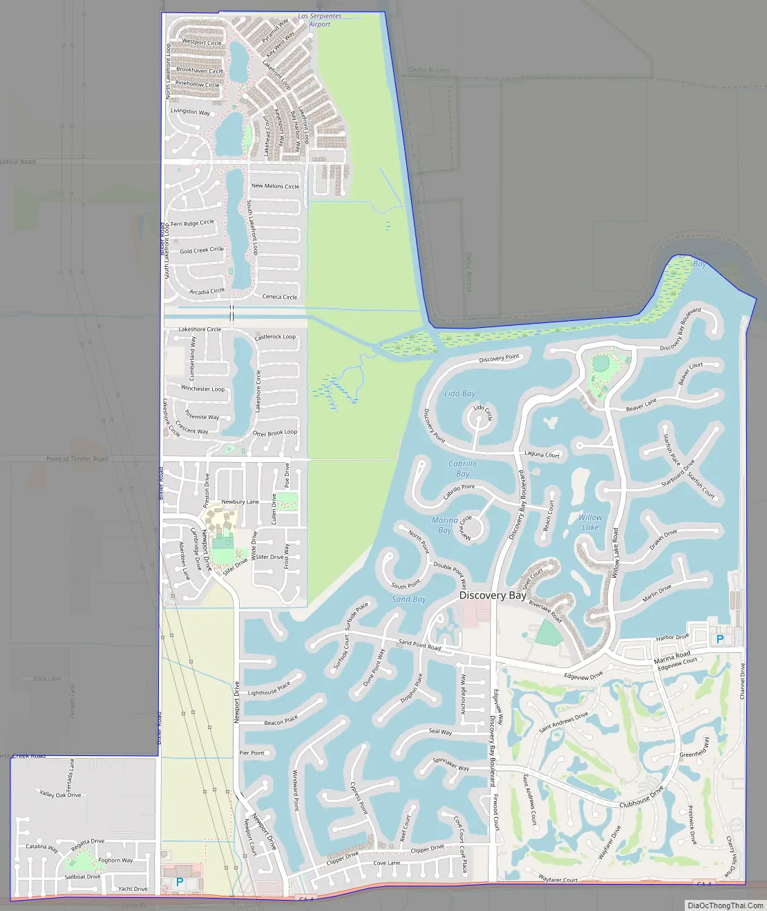
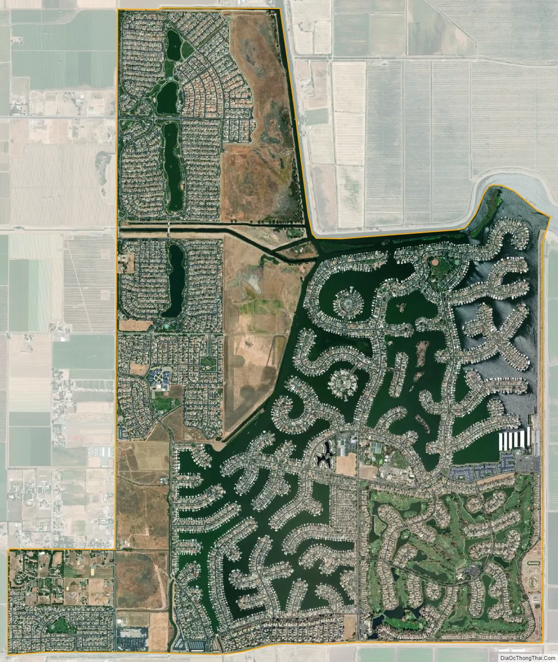
Discovery Bay was originally a waterfront community built on a network of man-made dikes, surrounded by fresh water, except for the southeast quadrant, which comprises the golf course of Discovery Bay Country Club. Some homes have private docks with access to the Sacramento–San Joaquin River Delta. Newer developments have been added on former agricultural land to the west of the initial town-site. Road access is via California State Route 4.
| Name: | Discovery Bay CDP |
|---|---|
| LSAD Code: | 57 |
| LSAD Description: | CDP (suffix) |
| State: | California |
| County: | Contra Costa County |
| Elevation: | 7 ft (2 m) |
| Total Area: | 6.95 sq mi (18.00 km²) |
| Land Area: | 5.59 sq mi (14.48 km²) |
| Water Area: | 1.36 sq mi (3.51 km²) 11.7% |
| Total Population: | 15,358 |
| Population Density: | 2,746.42/sq mi (1,060.47/km²) |
| ZIP code: | 94505 |
| Area code: | 925 |
| FIPS code: | 0619339 |
| Website: | https://www.todb.ca.gov/ |
Online Interactive Map
Click on ![]() to view map in "full screen" mode.
to view map in "full screen" mode.
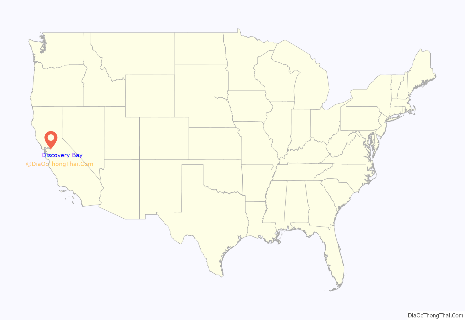
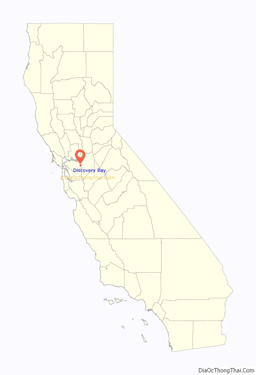
Discovery Bay location map. Where is Discovery Bay CDP?
History
Discovery Bay began as a planned community in 1964, and originally designated as “Riverside” and “River Lake.” It was built on land known as the Byron Tract, which was previously used for growing barley and potatoes. In 1968, Jurgen Lunding led an effort to give the community its current name.
In July 2007, Discovery Bay received its own ZIP code: 94505. Formerly, it had shared 94514 with Byron. The ensuing celebration included a paddle boat raft-up that set a world record.
Discovery Bay Road Map
Discovery Bay city Satellite Map
Geography
According to the United States Census Bureau, the CDP has a total area of 7.0 square miles (18 km), of which 6.2 square miles (16 km) of it is land and 0.8 square miles (2.1 km) of it (11.7%) is water.
See also
Map of California State and its subdivision:- Alameda
- Alpine
- Amador
- Butte
- Calaveras
- Colusa
- Contra Costa
- Del Norte
- El Dorado
- Fresno
- Glenn
- Humboldt
- Imperial
- Inyo
- Kern
- Kings
- Lake
- Lassen
- Los Angeles
- Madera
- Marin
- Mariposa
- Mendocino
- Merced
- Modoc
- Mono
- Monterey
- Napa
- Nevada
- Orange
- Placer
- Plumas
- Riverside
- Sacramento
- San Benito
- San Bernardino
- San Diego
- San Francisco
- San Joaquin
- San Luis Obispo
- San Mateo
- Santa Barbara
- Santa Clara
- Santa Cruz
- Shasta
- Sierra
- Siskiyou
- Solano
- Sonoma
- Stanislaus
- Sutter
- Tehama
- Trinity
- Tulare
- Tuolumne
- Ventura
- Yolo
- Yuba
- Alabama
- Alaska
- Arizona
- Arkansas
- California
- Colorado
- Connecticut
- Delaware
- District of Columbia
- Florida
- Georgia
- Hawaii
- Idaho
- Illinois
- Indiana
- Iowa
- Kansas
- Kentucky
- Louisiana
- Maine
- Maryland
- Massachusetts
- Michigan
- Minnesota
- Mississippi
- Missouri
- Montana
- Nebraska
- Nevada
- New Hampshire
- New Jersey
- New Mexico
- New York
- North Carolina
- North Dakota
- Ohio
- Oklahoma
- Oregon
- Pennsylvania
- Rhode Island
- South Carolina
- South Dakota
- Tennessee
- Texas
- Utah
- Vermont
- Virginia
- Washington
- West Virginia
- Wisconsin
- Wyoming


