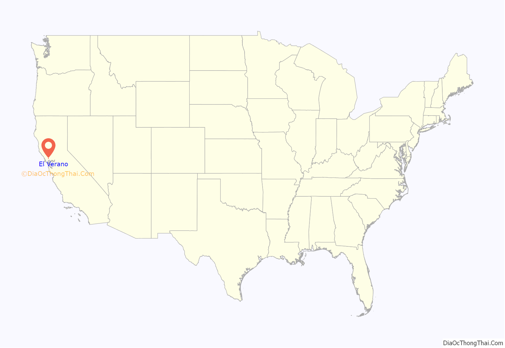
El Verano (Spanish for “The Summer”) is a census-designated place (CDP) in Sonoma Valley, Sonoma County, California, United States. The population was 4,123 at the 2010 census, falling to 3,867 at the 2020 census.
| Name: | El Verano CDP |
|---|---|
| LSAD Code: | 57 |
| LSAD Description: | CDP (suffix) |
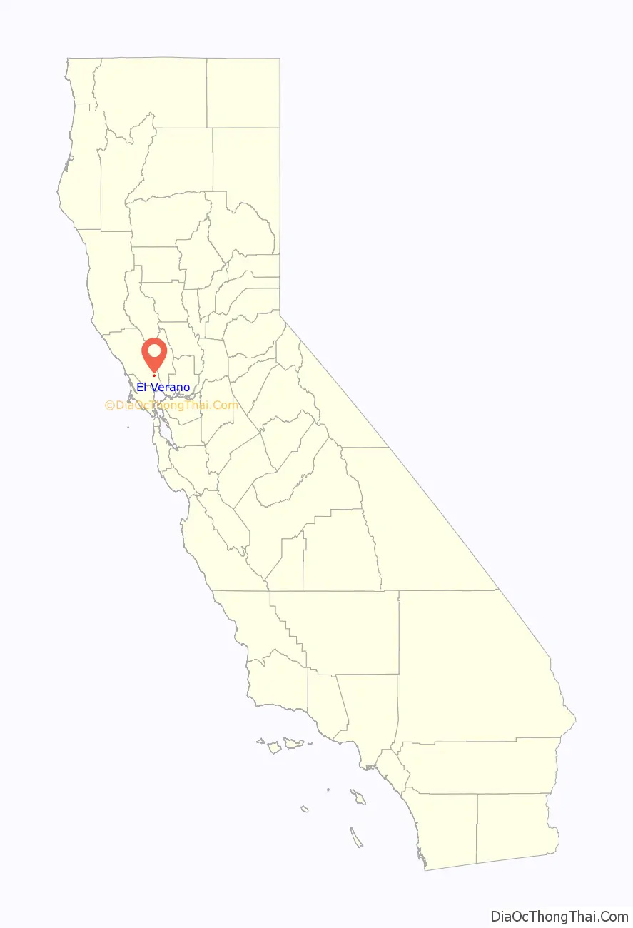
| State: | California |
| County: | Sonoma County |
| Elevation: | 108 ft (33 m) |
| Total Area: | 1.142 sq mi (2.958 km²) |
| Land Area: | 1.142 sq mi (2.958 km²) |
| Water Area: | 0 sq mi (0 km²) 0% |
| Total Population: | 3,867 |
| Population Density: | 3,400/sq mi (1,300/km²) |
| ZIP code: | 95433 |
| Area code: | 707 |
| FIPS code: | 0622510 |
| GNISfeature ID: | 0277505 |
Online Interactive Map
Click on ![]() to view map in "full screen" mode.
to view map in "full screen" mode.
El Verano location map. Where is El Verano CDP?
History
El Verano’s name is Spanish and means “The Summer.” Resorts in El Verano, and the other nearby communities of Boyes Hot Springs, Fetters Hot Springs, and Agua Caliente were popular health retreats for tourists from San Francisco and points beyond until the middle of the 20th century because of the geothermic hot springs found in the area.
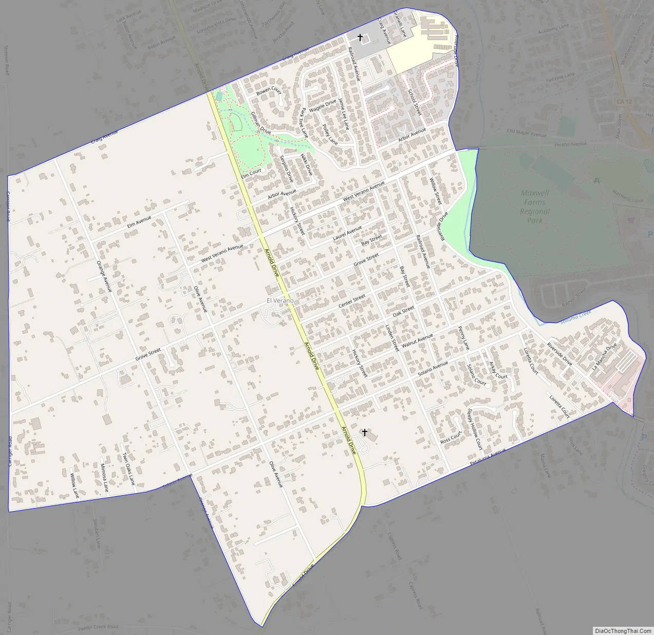
El Verano Road Map
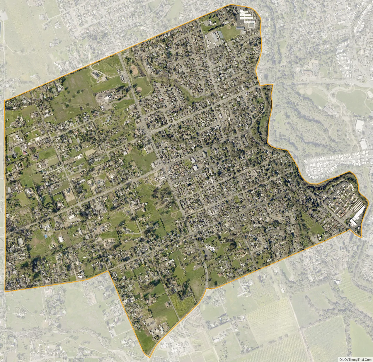
El Verano city Satellite Map
Geography
El Verano is a western suburb of the City of Sonoma. According to the United States Census Bureau, the CDP has a total area of 1.1 square miles (2.8 km), all of it land.
See also
Map of California State and its subdivision:- Alameda
- Alpine
- Amador
- Butte
- Calaveras
- Colusa
- Contra Costa
- Del Norte
- El Dorado
- Fresno
- Glenn
- Humboldt
- Imperial
- Inyo
- Kern
- Kings
- Lake
- Lassen
- Los Angeles
- Madera
- Marin
- Mariposa
- Mendocino
- Merced
- Modoc
- Mono
- Monterey
- Napa
- Nevada
- Orange
- Placer
- Plumas
- Riverside
- Sacramento
- San Benito
- San Bernardino
- San Diego
- San Francisco
- San Joaquin
- San Luis Obispo
- San Mateo
- Santa Barbara
- Santa Clara
- Santa Cruz
- Shasta
- Sierra
- Siskiyou
- Solano
- Sonoma
- Stanislaus
- Sutter
- Tehama
- Trinity
- Tulare
- Tuolumne
- Ventura
- Yolo
- Yuba
- Alabama
- Alaska
- Arizona
- Arkansas
- California
- Colorado
- Connecticut
- Delaware
- District of Columbia
- Florida
- Georgia
- Hawaii
- Idaho
- Illinois
- Indiana
- Iowa
- Kansas
- Kentucky
- Louisiana
- Maine
- Maryland
- Massachusetts
- Michigan
- Minnesota
- Mississippi
- Missouri
- Montana
- Nebraska
- Nevada
- New Hampshire
- New Jersey
- New Mexico
- New York
- North Carolina
- North Dakota
- Ohio
- Oklahoma
- Oregon
- Pennsylvania
- Rhode Island
- South Carolina
- South Dakota
- Tennessee
- Texas
- Utah
- Vermont
- Virginia
- Washington
- West Virginia
- Wisconsin
- Wyoming


