Fairhaven (formerly Rolph) is an unincorporated community and census-designated place (CDP) adjacent to Humboldt Bay in Humboldt County, California, United States. It is located 2.25 miles (3.6 km) west-southwest of downtown Eureka, at an elevation of 10 feet (3.0 m) above sea level.
In 1867, Hans Ditlev Bendixsen opened a ship building yard in Fairhaven. Bendixsen built many vessels for the lumber trade. Bendixsen constructed 92 sailing vessels between 1869 and 1901, including 35 three-masters. These included the C.A. Thayer which is now preserved at the San Francisco Maritime National Historical Park.
The Rolph post office operated from 1918 to 1921. That name was for Governor James Rolph of California. The name “Fairhaven” was taken from Fair Haven, a neighborhood in New Haven, Connecticut.
| Name: | Fairhaven CDP |
|---|---|
| LSAD Code: | 57 |
| LSAD Description: | CDP (suffix) |
| State: | California |
| County: | Humboldt County |
| Elevation: | 10 ft (3 m) |
| Total Area: | 165 |
| ZIP code: | 95564 |
| Area code: | 707 |
| FIPS code: | 0623196 |
| GNISfeature ID: | 2628729 |
Online Interactive Map
Click on ![]() to view map in "full screen" mode.
to view map in "full screen" mode.
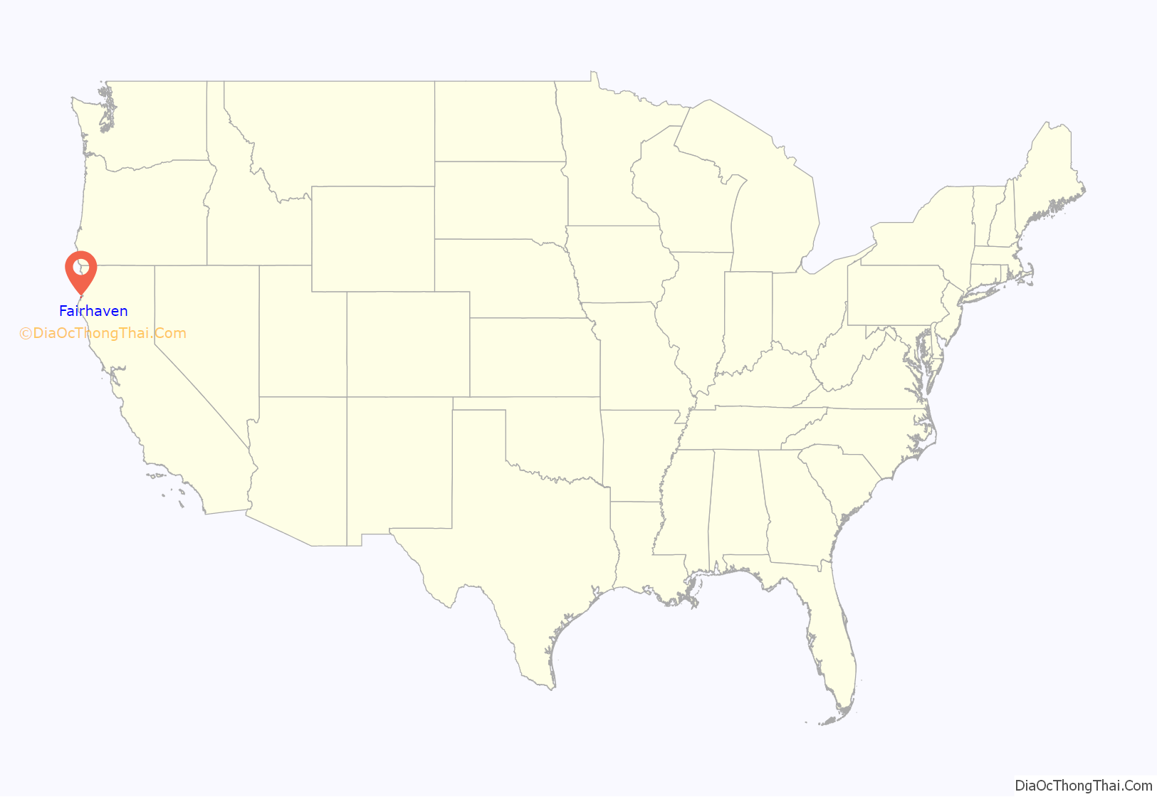
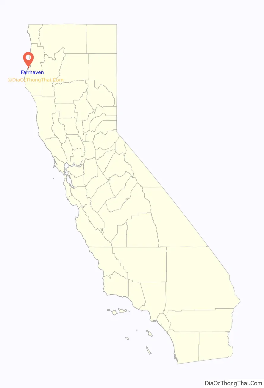
Fairhaven location map. Where is Fairhaven CDP?
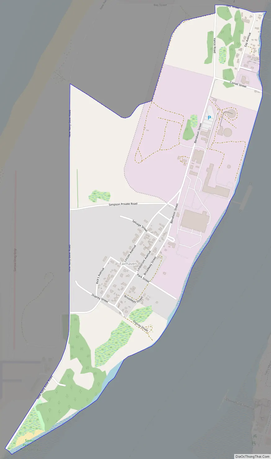
Fairhaven Road Map
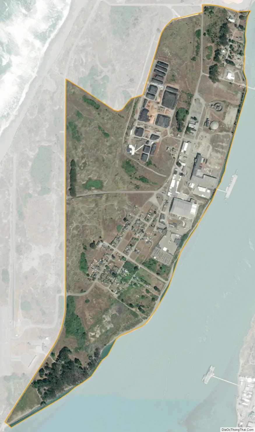
Fairhaven city Satellite Map
See also
Map of California State and its subdivision:- Alameda
- Alpine
- Amador
- Butte
- Calaveras
- Colusa
- Contra Costa
- Del Norte
- El Dorado
- Fresno
- Glenn
- Humboldt
- Imperial
- Inyo
- Kern
- Kings
- Lake
- Lassen
- Los Angeles
- Madera
- Marin
- Mariposa
- Mendocino
- Merced
- Modoc
- Mono
- Monterey
- Napa
- Nevada
- Orange
- Placer
- Plumas
- Riverside
- Sacramento
- San Benito
- San Bernardino
- San Diego
- San Francisco
- San Joaquin
- San Luis Obispo
- San Mateo
- Santa Barbara
- Santa Clara
- Santa Cruz
- Shasta
- Sierra
- Siskiyou
- Solano
- Sonoma
- Stanislaus
- Sutter
- Tehama
- Trinity
- Tulare
- Tuolumne
- Ventura
- Yolo
- Yuba
- Alabama
- Alaska
- Arizona
- Arkansas
- California
- Colorado
- Connecticut
- Delaware
- District of Columbia
- Florida
- Georgia
- Hawaii
- Idaho
- Illinois
- Indiana
- Iowa
- Kansas
- Kentucky
- Louisiana
- Maine
- Maryland
- Massachusetts
- Michigan
- Minnesota
- Mississippi
- Missouri
- Montana
- Nebraska
- Nevada
- New Hampshire
- New Jersey
- New Mexico
- New York
- North Carolina
- North Dakota
- Ohio
- Oklahoma
- Oregon
- Pennsylvania
- Rhode Island
- South Carolina
- South Dakota
- Tennessee
- Texas
- Utah
- Vermont
- Virginia
- Washington
- West Virginia
- Wisconsin
- Wyoming


