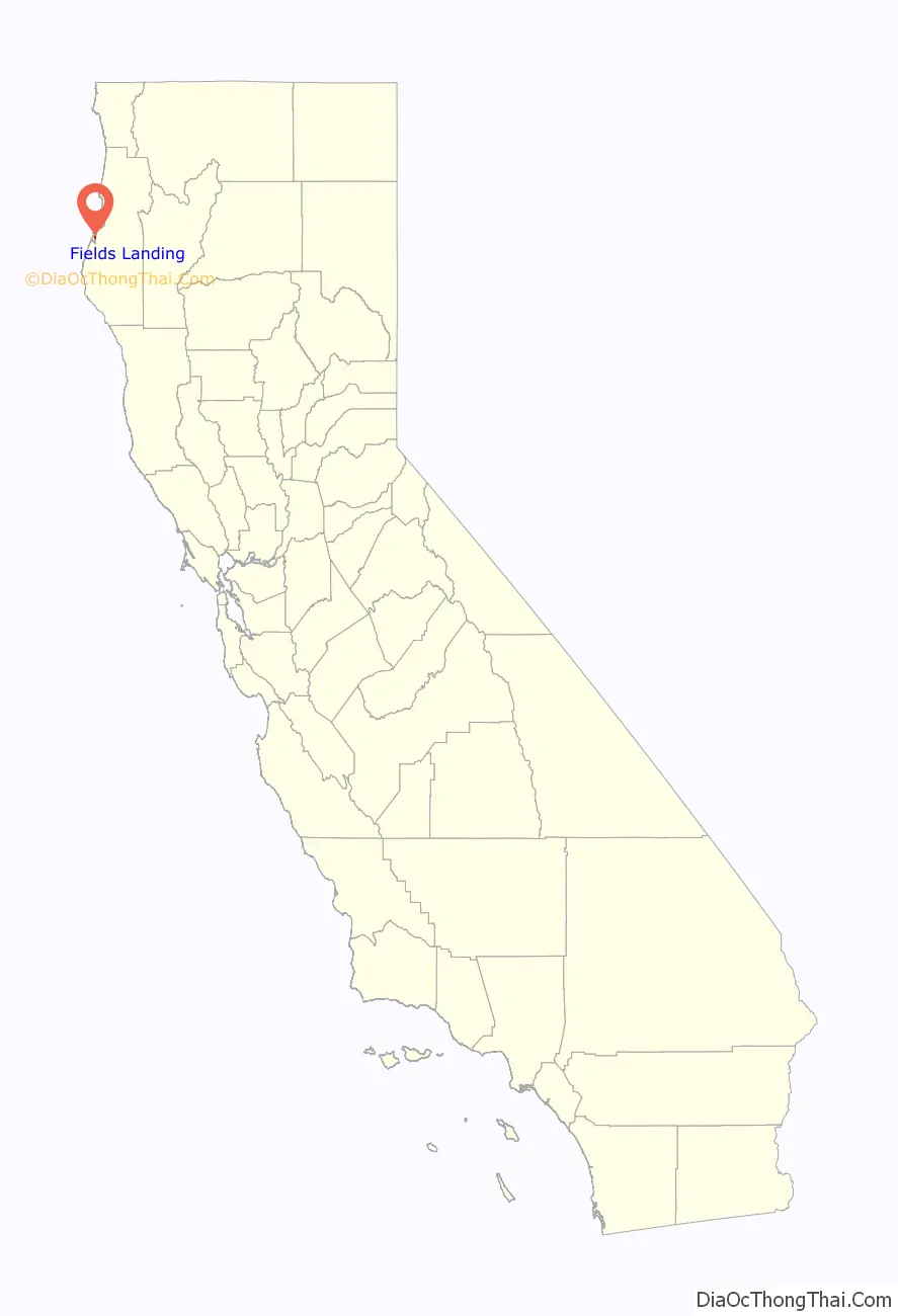
Fields Landing (formerly, South Bay, South Bay Station, and Adele) is a census-designated place in Humboldt County, California. It is located on Humboldt Bay 6 miles (9.7 km) south-southwest of downtown Eureka, at an elevation of 13 feet (4 m). The ZIP Code is 95537. The population was 276 at the 2010 census.
| Name: | Fields Landing CDP |
|---|---|
| LSAD Code: | 57 |
| LSAD Description: | CDP (suffix) |
| State: | California |
| County: | Humboldt County |
| Elevation: | 13 ft (4 m) |
| Total Area: | 0.280 sq mi (0.725 km²) |
| Land Area: | 0.277 sq mi (0.717 km²) |
| Water Area: | 0.003 sq mi (0.008 km²) 1.1% |
| Total Population: | 287 |
| Population Density: | 1,000/sq mi (400/km²) |
| ZIP code: | 95537 |
| Area code: | 707 |
| FIPS code: | 0624022 |
Online Interactive Map
Click on ![]() to view map in "full screen" mode.
to view map in "full screen" mode.
Fields Landing location map. Where is Fields Landing CDP?

History
Before the arrival of European settlers, the area now known as Humboldt County was occupied by a number of indigenous peoples, including the Wiyot, Yurok, Hupa, Karuk, Chilula, Whilkut, and the southern Athabascans. Fields Landing is located within the original territory of the Wiyot tribe.
The first recorded entrance into Humboldt Bay occurred in 1806 by members of a Russian-American company from Sitka. The Josiah Gregg party arrived by land in December 1849, and by 1850 the first ships came to the bay bringing men seeking gold. As the Gold Rush subsided, the economy shifted to the use of the surrounding natural resources, mainly timber, salmon, and agricultural land. The area was a prime exporter of agricultural products from 1857 to 1900.
Fields Landing was named for Waterman Field, a resident of Humboldt County since 1861. He established the town in 1862. Field owned 160 acres in what is currently known as Fields Landing. Waterman Field built a dock there to ship his farm products and the name “Fields Landing” was derived from this landing place for ships.
Fort Humboldt, built in 1853 to protect settlers from retaliatory attacks and keep peace between the settlers and the natives, was a failure, as the garrison did neither successfully. Indians were enslaved under the terms of the 1850 “Act for the Government and Protection of Indians” that provided legal basis for the continued Californio practice of capturing and using Native people as forced workers, particularly that of young women and children, which was carried on as a legal business enterprise. Intrusion of professional hunters and settlers and their herds of cattle and pigs into the hunting and gathering areas of the natives in the interior led the reduction of their food supplies and native resistance to this began the Bald Hills War. Development around the bay, disease, and the February 26, 1860 Indian Island Massacre, and consequences of the Bald Hills War, led to decimation of the peaceful Wiyot reducing their numbers from 3,000 to less than 100 survivors by 1865.
In the 1880s, docks were built in Fields Landing for shipping redwood and other timber. When the Northwestern Pacific Railroad was extended into the Humboldt Bay area in 1914, it functioned as a dike, and allowed the tidal marshes to be converted into agricultural lands. The construction of U.S. Route 101 in 1927 also created more fill, allowing most of the marshes to be drained and diked.
After World War II, a new Douglas fir and plywood industry brought in many out-of-state loggers and mill workers. From 1940 to 1951, a whaling station operated in Fields Landing. However, the timber industry continued to dominate life in the community into the 1970s. The demise of the timber industry in the 1980s forced a fresh perspective on resource use. New groups of people began to arrive, namely Hispanic workers and families, and refugees from the Vietnam War.
Fields Landing Road Map

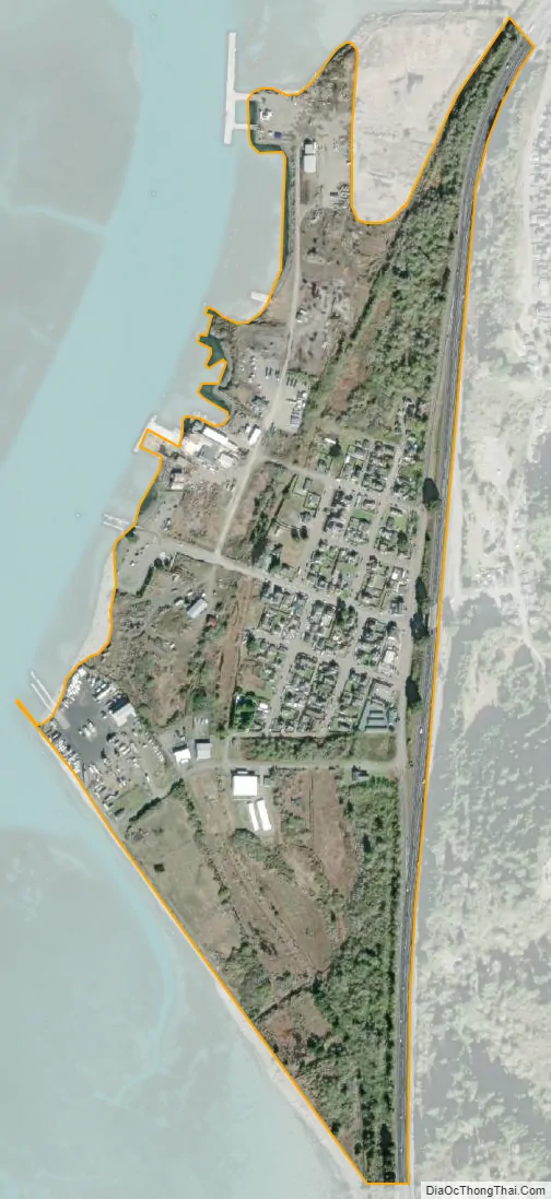
Fields Landing city Satellite Map
See also
Map of California State and its subdivision:- Alameda
- Alpine
- Amador
- Butte
- Calaveras
- Colusa
- Contra Costa
- Del Norte
- El Dorado
- Fresno
- Glenn
- Humboldt
- Imperial
- Inyo
- Kern
- Kings
- Lake
- Lassen
- Los Angeles
- Madera
- Marin
- Mariposa
- Mendocino
- Merced
- Modoc
- Mono
- Monterey
- Napa
- Nevada
- Orange
- Placer
- Plumas
- Riverside
- Sacramento
- San Benito
- San Bernardino
- San Diego
- San Francisco
- San Joaquin
- San Luis Obispo
- San Mateo
- Santa Barbara
- Santa Clara
- Santa Cruz
- Shasta
- Sierra
- Siskiyou
- Solano
- Sonoma
- Stanislaus
- Sutter
- Tehama
- Trinity
- Tulare
- Tuolumne
- Ventura
- Yolo
- Yuba
- Alabama
- Alaska
- Arizona
- Arkansas
- California
- Colorado
- Connecticut
- Delaware
- District of Columbia
- Florida
- Georgia
- Hawaii
- Idaho
- Illinois
- Indiana
- Iowa
- Kansas
- Kentucky
- Louisiana
- Maine
- Maryland
- Massachusetts
- Michigan
- Minnesota
- Mississippi
- Missouri
- Montana
- Nebraska
- Nevada
- New Hampshire
- New Jersey
- New Mexico
- New York
- North Carolina
- North Dakota
- Ohio
- Oklahoma
- Oregon
- Pennsylvania
- Rhode Island
- South Carolina
- South Dakota
- Tennessee
- Texas
- Utah
- Vermont
- Virginia
- Washington
- West Virginia
- Wisconsin
- Wyoming


