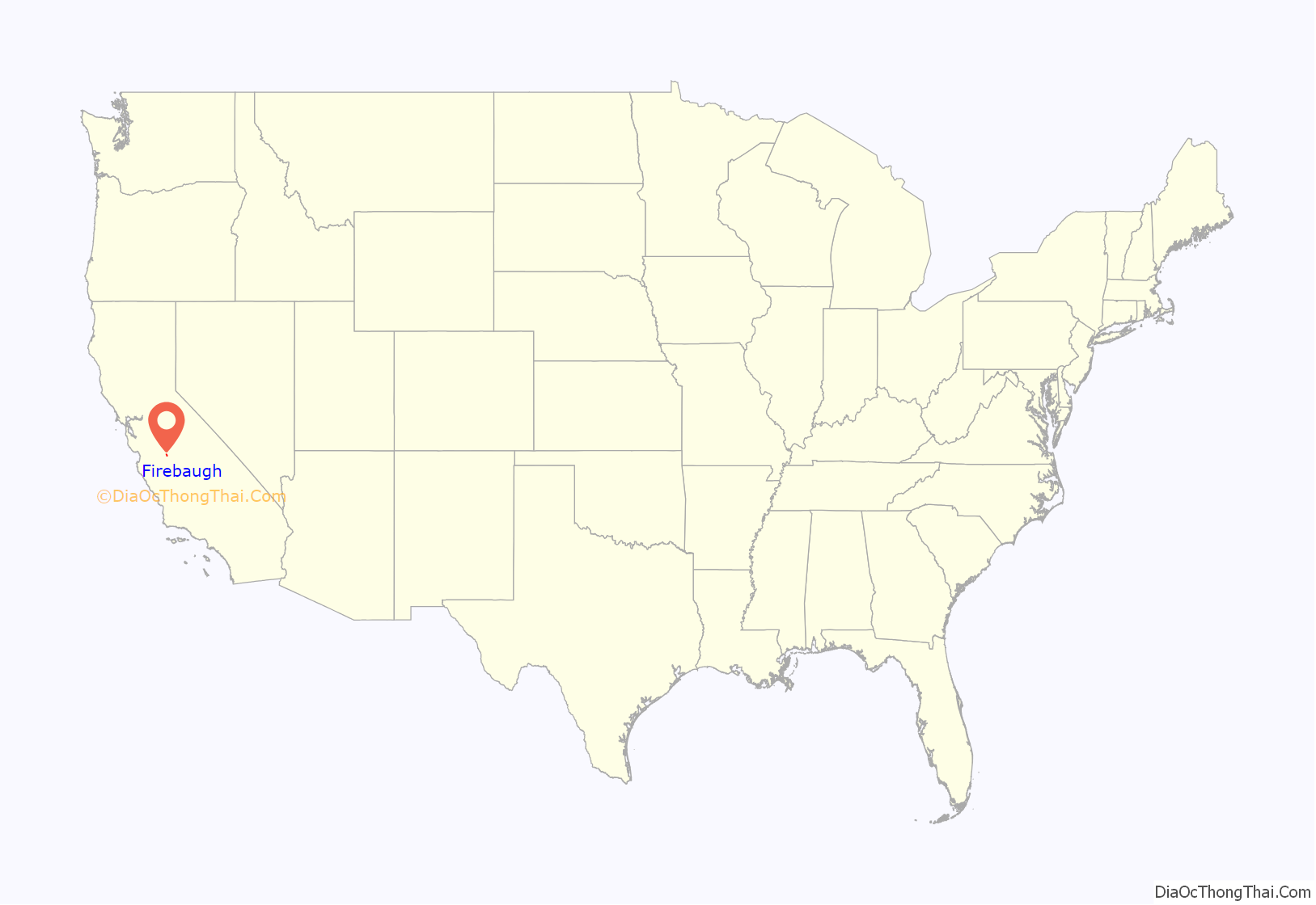
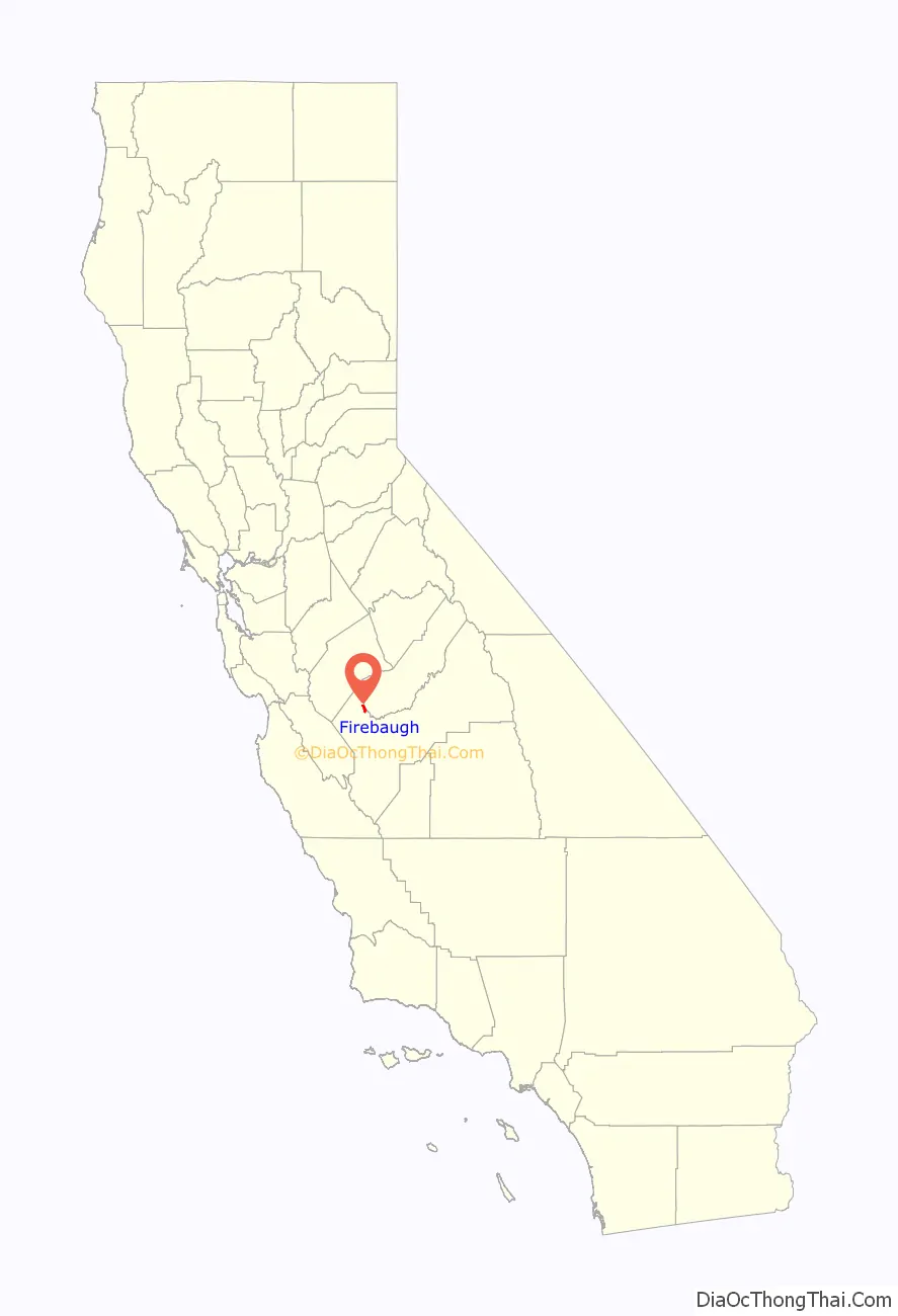
Firebaugh is a city in Fresno County, California, United States, on the west side of the San Joaquin River 38 miles (61 km) west of Fresno.
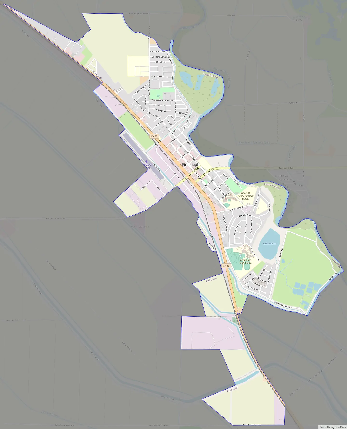
State Route 33 (SR 33) and the San Joaquin Valley Railroad, West Side Subdivision, pass through downtown. A small commercial district features the ubiquitous California Central Valley water tank painted with the city’s name.
Firebaugh lies at an elevation of 151 feet (46 m). The population was 7,549 at the 2010 census, up from 5,743 as of 2000.
Firebaugh hosts an annual Cantaloupe Round-Up Festival in Dunkle Park. The event aims at celebrating the peak harvest of the melon in late July and is an economic boost for local businesses.
| Name: | Firebaugh city |
|---|---|
| LSAD Code: | 25 |
| LSAD Description: | city (suffix) |
| State: | California |
| County: | Fresno County |
| Incorporated: | September 17, 1914 |
| Elevation: | 151 ft (46 m) |
| Total Area: | 3.57 sq mi (9.25 km²) |
| Land Area: | 3.52 sq mi (9.11 km²) |
| Water Area: | 0.06 sq mi (0.14 km²) 1.62% |
| Total Population: | 7,549 |
| Population Density: | 2,358.83/sq mi (910.74/km²) |
| ZIP code: | 93622 |
| Area code: | 559 |
| FIPS code: | 0624134 |
| Website: | www.firebaugh.org |
Online Interactive Map
Click on ![]() to view map in "full screen" mode.
to view map in "full screen" mode.
Firebaugh location map. Where is Firebaugh city?
History
The city, formerly Firebaugh’s Ferry, is named for Andrew D. Firebaugh (also spelled Fierbaugh, born in Virginia in 1823), an area entrepreneur. During the Gold Rush, Firebaugh’s most famous local enterprise was a ferry boat which shuttled people across the San Joaquin River. In 1857, he built a toll road for wagons, replacing an earlier horse trail that ran parallel to present-day State Route 152 from what became Bell Station over Pacheco Pass to the Rancho San Luis Gonzaga.
Firebaugh was a station on the Butterfield Overland Stage. The Firebaugh’s Ferry post office operated from 1860 to 1862. The Firebaugh post office opened in 1865.
In the 1880s, the area of Firebaugh was once part of the massive holdings of the Miller and Lux Company, which had a large cattle operation covering what today is Dos Palos to Mendota.
The city incorporated in 1914.
Firebaugh Road Map
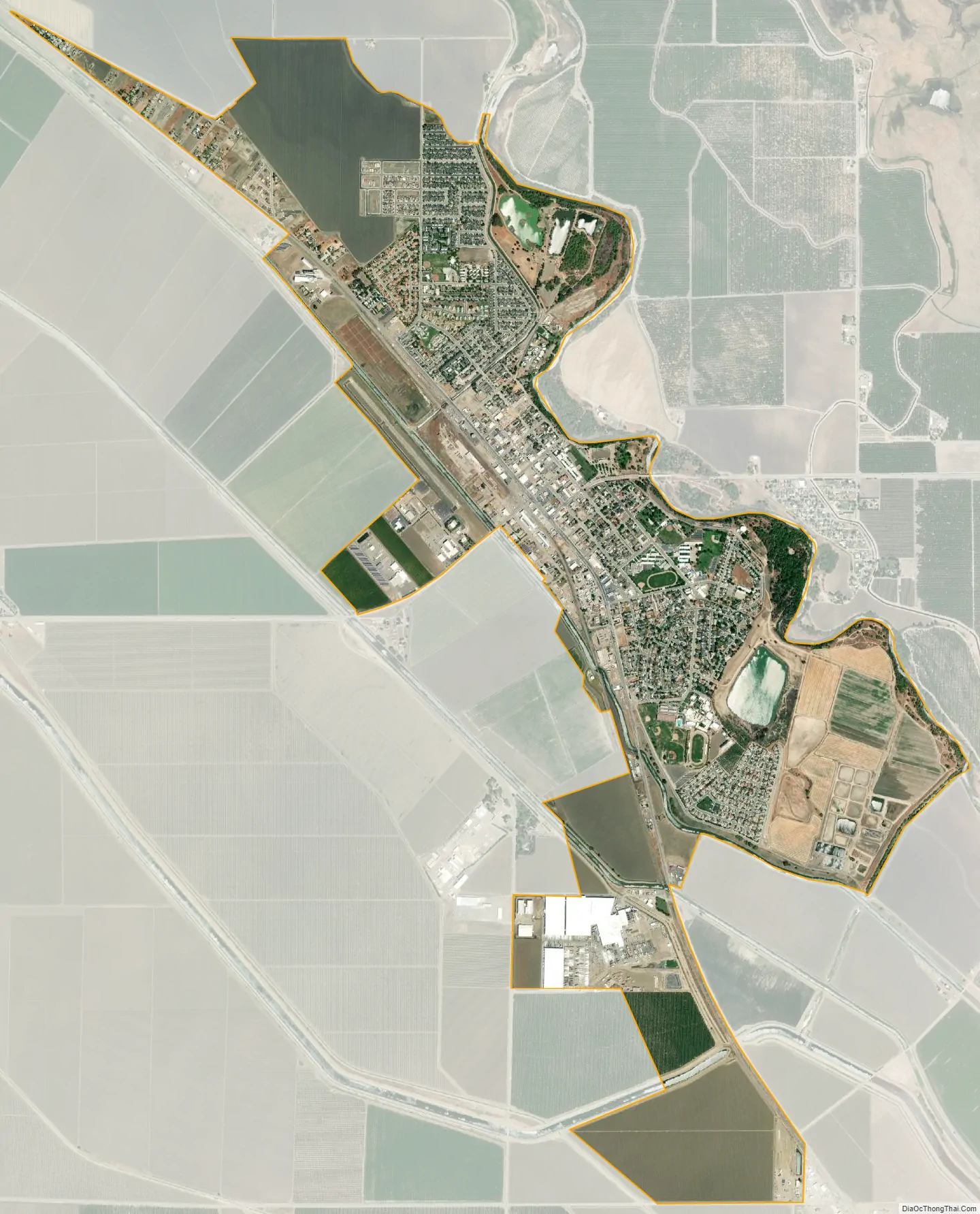
Firebaugh city Satellite Map
Geography
According to the United States Census Bureau, the city has a total area of 3.5 square miles (9.1 km), of which, 3.5 square miles (9.1 km) of it is land and 0.1 square miles (0.26 km) of it (1.62%) is water.
Climate
According to the Köppen Climate Classification system, Firebaugh has a semi-arid climate, abbreviated “BSk” on climate maps.
See also
Map of California State and its subdivision:- Alameda
- Alpine
- Amador
- Butte
- Calaveras
- Colusa
- Contra Costa
- Del Norte
- El Dorado
- Fresno
- Glenn
- Humboldt
- Imperial
- Inyo
- Kern
- Kings
- Lake
- Lassen
- Los Angeles
- Madera
- Marin
- Mariposa
- Mendocino
- Merced
- Modoc
- Mono
- Monterey
- Napa
- Nevada
- Orange
- Placer
- Plumas
- Riverside
- Sacramento
- San Benito
- San Bernardino
- San Diego
- San Francisco
- San Joaquin
- San Luis Obispo
- San Mateo
- Santa Barbara
- Santa Clara
- Santa Cruz
- Shasta
- Sierra
- Siskiyou
- Solano
- Sonoma
- Stanislaus
- Sutter
- Tehama
- Trinity
- Tulare
- Tuolumne
- Ventura
- Yolo
- Yuba
- Alabama
- Alaska
- Arizona
- Arkansas
- California
- Colorado
- Connecticut
- Delaware
- District of Columbia
- Florida
- Georgia
- Hawaii
- Idaho
- Illinois
- Indiana
- Iowa
- Kansas
- Kentucky
- Louisiana
- Maine
- Maryland
- Massachusetts
- Michigan
- Minnesota
- Mississippi
- Missouri
- Montana
- Nebraska
- Nevada
- New Hampshire
- New Jersey
- New Mexico
- New York
- North Carolina
- North Dakota
- Ohio
- Oklahoma
- Oregon
- Pennsylvania
- Rhode Island
- South Carolina
- South Dakota
- Tennessee
- Texas
- Utah
- Vermont
- Virginia
- Washington
- West Virginia
- Wisconsin
- Wyoming


