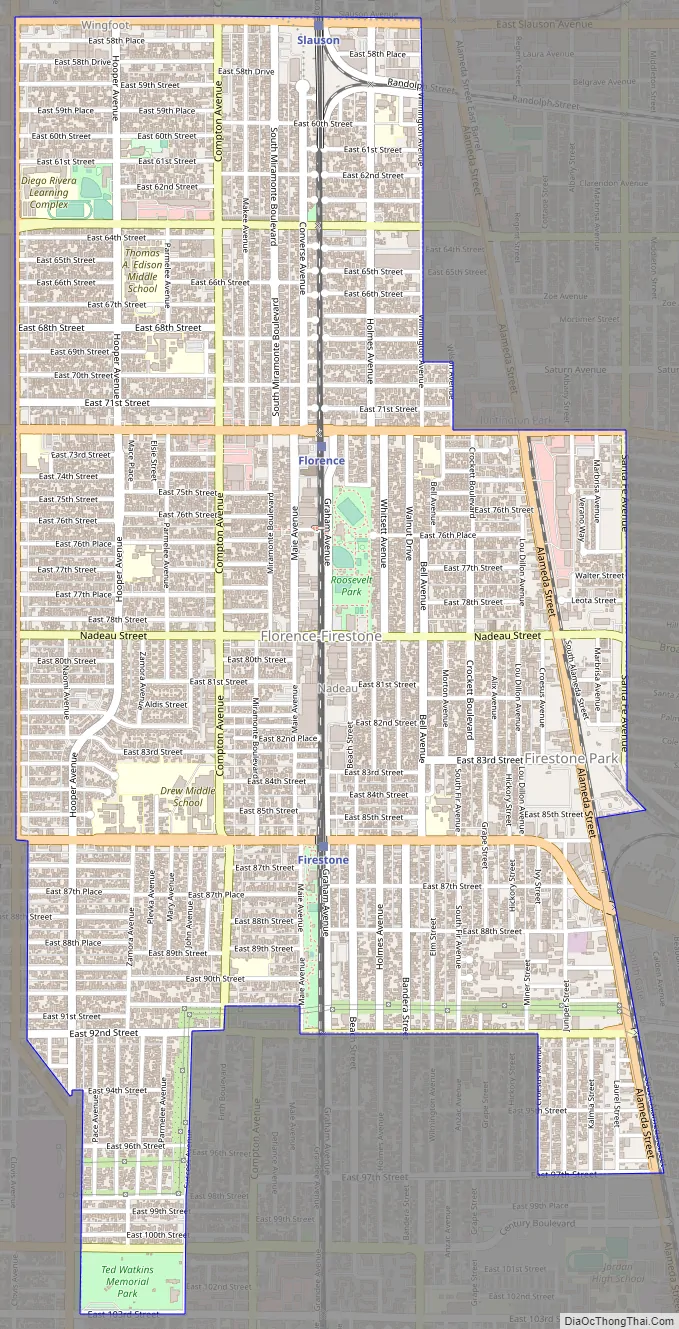
Florence-Graham (locally known as Florence-Firestone) is a community in Huntington Park. The population was 61,983 at the 2020 census, down from 63,387 at the 2010 census. The census area includes separate communities of Florence, Firestone Park, and Graham. It is located in the south central region of Los Angeles County. The neighboring communities are Central-Alameda, Florence, Huntington Park, Green Meadows, Lynwood, South Gate, South Park, Vernon, Walnut Park and Watts.
| Name: | Florence-Graham CDP |
|---|---|
| LSAD Code: | 57 |
| LSAD Description: | CDP (suffix) |
| State: | California |
| County: | Los Angeles County |
| Elevation: | 144 ft (44 m) |
| Total Area: | 3.580 sq mi (9.273 km²) |
| Land Area: | 3.580 sq mi (9.273 km²) |
| Water Area: | 0 sq mi (0 km²) 0% |
| Total Population: | 61,983 |
| Population Density: | 17,000/sq mi (6,700/km²) |
| ZIP code: | 90001 |
| Area code: | 323 |
| FIPS code: | 0624477 |
| GNISfeature ID: | 2408218 |
Online Interactive Map
Click on ![]() to view map in "full screen" mode.
to view map in "full screen" mode.
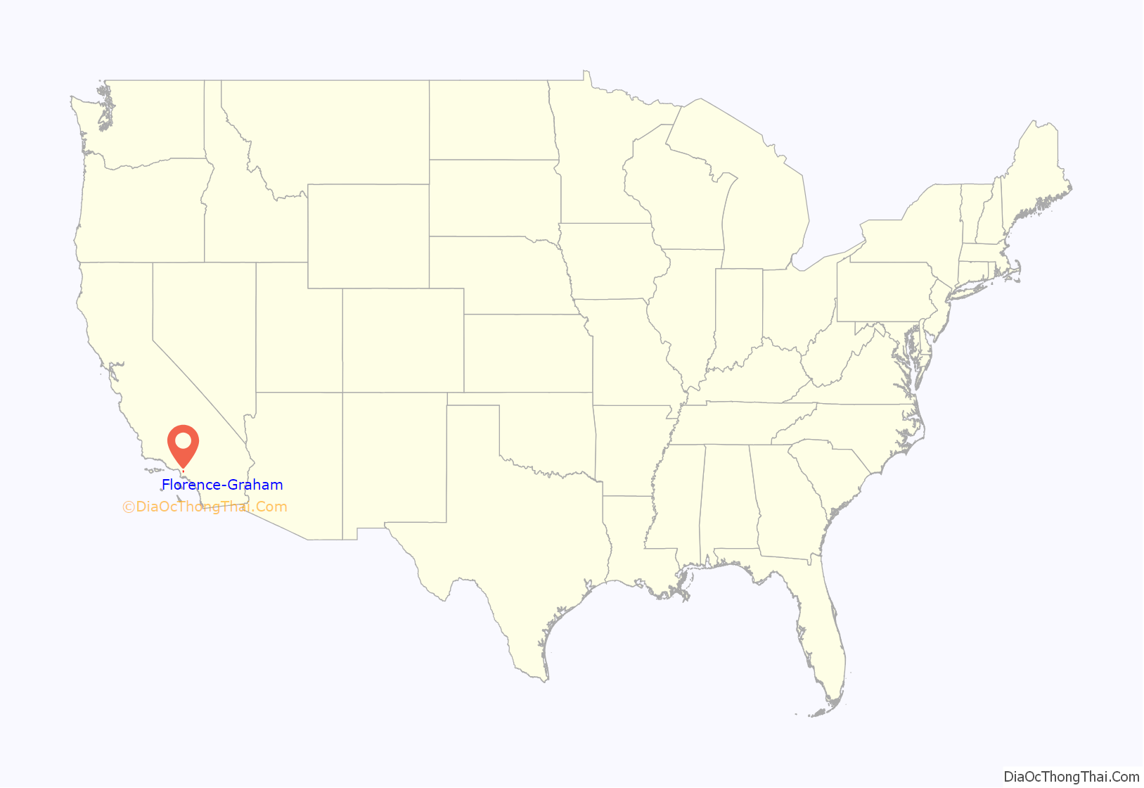
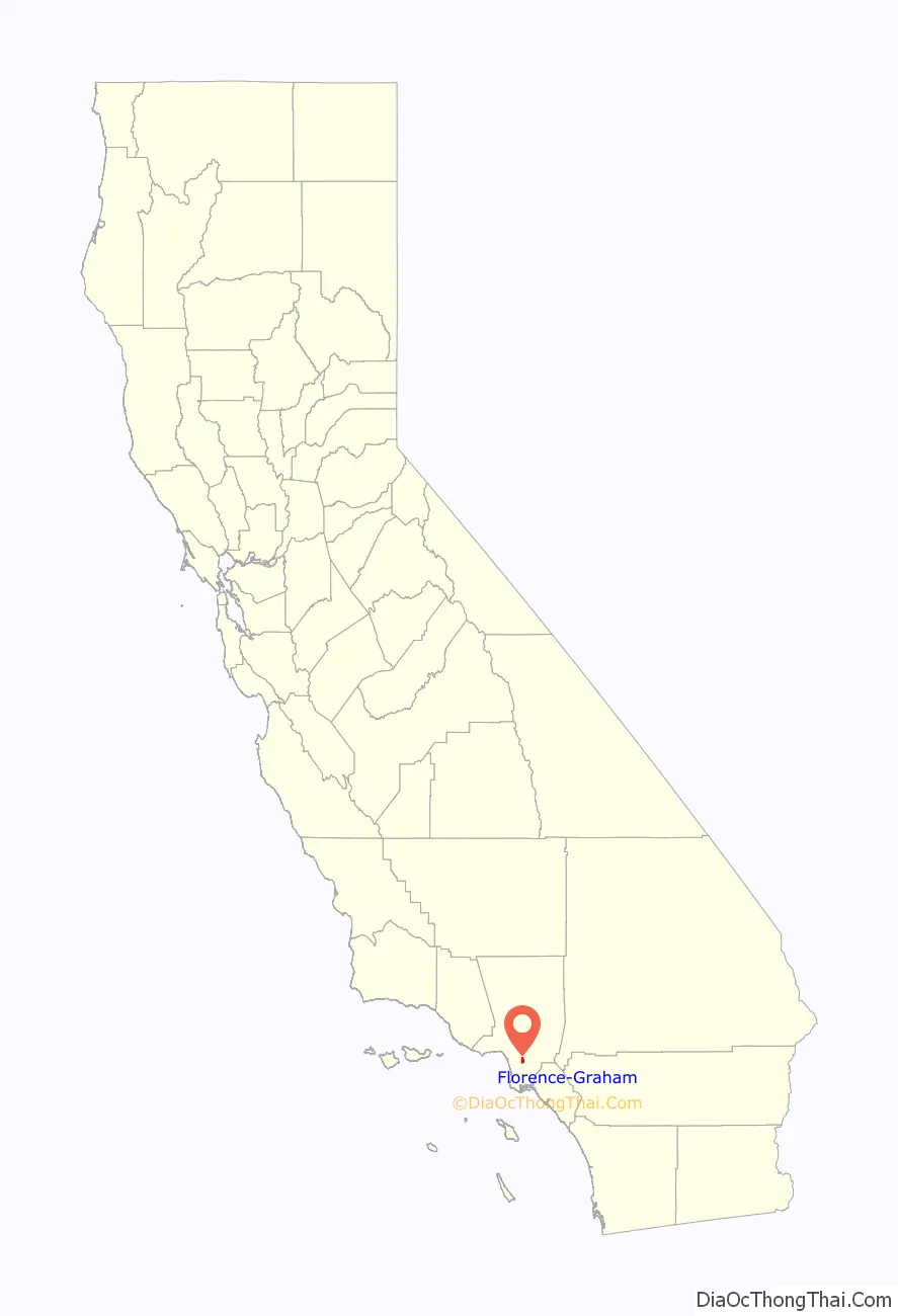
Florence-Graham location map. Where is Florence-Graham CDP?
Florence-Graham Road Map
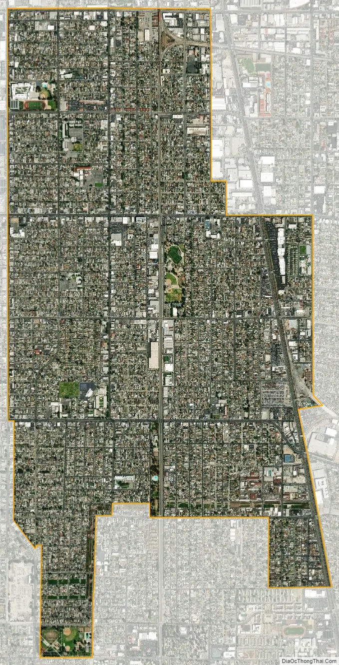
Florence-Graham city Satellite Map
Geography
Florence-Graham is located at 33°58′10″N 118°14′38″W / 33.969364°N 118.243881°W / 33.969364; -118.243881.
According to the United States Census Bureau, the CDP has a total area of 3.6 square miles (9.3 km), all land.
See also
Map of California State and its subdivision:- Alameda
- Alpine
- Amador
- Butte
- Calaveras
- Colusa
- Contra Costa
- Del Norte
- El Dorado
- Fresno
- Glenn
- Humboldt
- Imperial
- Inyo
- Kern
- Kings
- Lake
- Lassen
- Los Angeles
- Madera
- Marin
- Mariposa
- Mendocino
- Merced
- Modoc
- Mono
- Monterey
- Napa
- Nevada
- Orange
- Placer
- Plumas
- Riverside
- Sacramento
- San Benito
- San Bernardino
- San Diego
- San Francisco
- San Joaquin
- San Luis Obispo
- San Mateo
- Santa Barbara
- Santa Clara
- Santa Cruz
- Shasta
- Sierra
- Siskiyou
- Solano
- Sonoma
- Stanislaus
- Sutter
- Tehama
- Trinity
- Tulare
- Tuolumne
- Ventura
- Yolo
- Yuba
- Alabama
- Alaska
- Arizona
- Arkansas
- California
- Colorado
- Connecticut
- Delaware
- District of Columbia
- Florida
- Georgia
- Hawaii
- Idaho
- Illinois
- Indiana
- Iowa
- Kansas
- Kentucky
- Louisiana
- Maine
- Maryland
- Massachusetts
- Michigan
- Minnesota
- Mississippi
- Missouri
- Montana
- Nebraska
- Nevada
- New Hampshire
- New Jersey
- New Mexico
- New York
- North Carolina
- North Dakota
- Ohio
- Oklahoma
- Oregon
- Pennsylvania
- Rhode Island
- South Carolina
- South Dakota
- Tennessee
- Texas
- Utah
- Vermont
- Virginia
- Washington
- West Virginia
- Wisconsin
- Wyoming


