Fowler (formerly, Fowler’s Switch) is a city in Fresno County, California, United States. It is located within the San Joaquin Valley. It has a strong agricultural community, with lush grape vineyards and expansive farmland. Fowler is located 11 miles (18 km) southeast of downtown Fresno, at an elevation of 308 feet (94 m). The population was 5,570 at the 2010 census.
| Name: | Fowler city |
|---|---|
| LSAD Code: | 25 |
| LSAD Description: | city (suffix) |
| State: | California |
| County: | Fresno County |
| Incorporated: | June 15, 1908 |
| Elevation: | 308 ft (94 m) |
| Total Area: | 2.53 sq mi (6.56 km²) |
| Land Area: | 2.53 sq mi (6.56 km²) |
| Water Area: | 0.00 sq mi (0.00 km²) 0% |
| Total Population: | 5,570 |
| Population Density: | 2,681.67/sq mi (1,035.43/km²) |
| ZIP code: | 93625 |
| Area code: | 559 |
| FIPS code: | 0625436 |
| Website: | www.fowlercity.org |
Online Interactive Map
Click on ![]() to view map in "full screen" mode.
to view map in "full screen" mode.
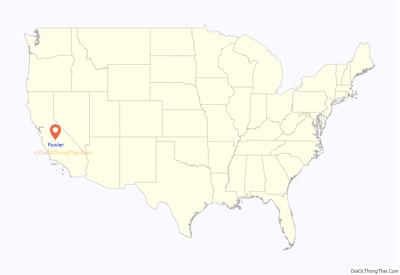
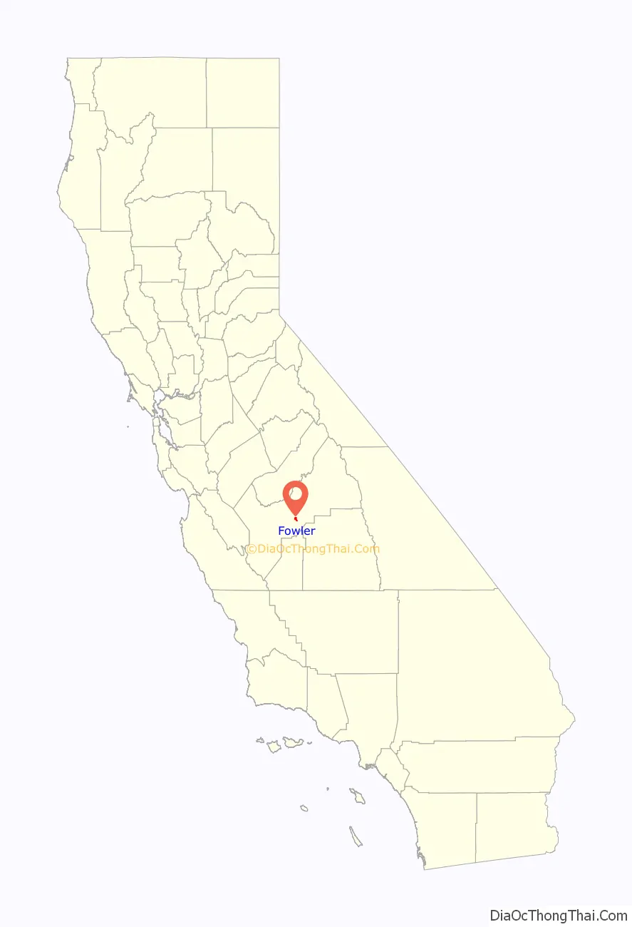
Fowler location map. Where is Fowler city?
History
Fowler’s first post office opened in 1882. Fowler was incorporated June 15, 1908. The community was named for rancher Thomas Fowler, an early 1870s California state senator.
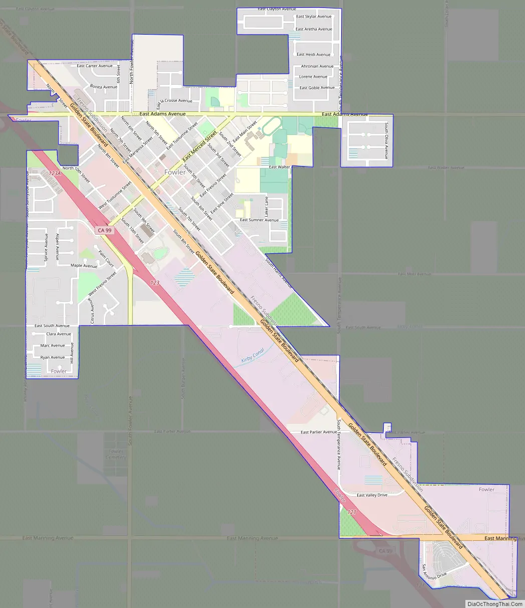
Fowler Road Map
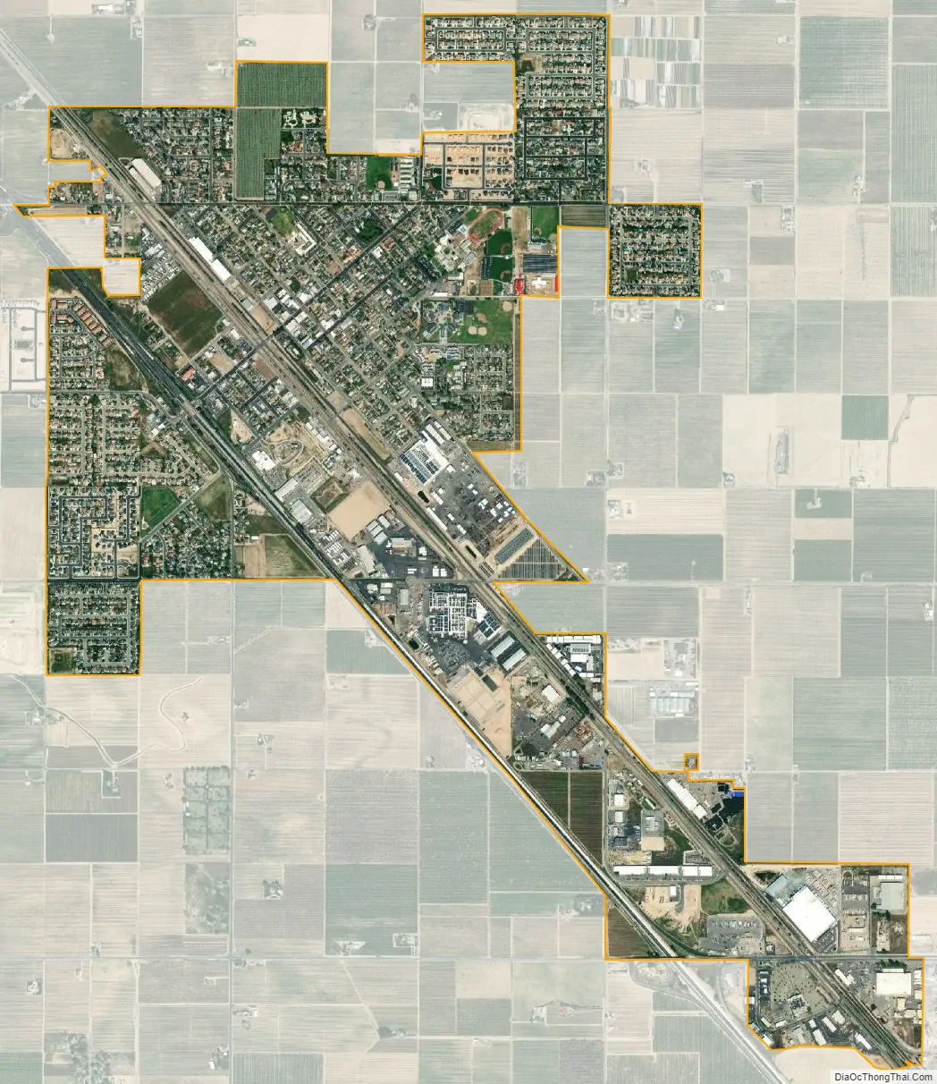
Fowler city Satellite Map
Geography
According to the United States Census Bureau, the city has a total area of 2.5 square miles (6.5 km), all of it land.
See also
Map of California State and its subdivision:- Alameda
- Alpine
- Amador
- Butte
- Calaveras
- Colusa
- Contra Costa
- Del Norte
- El Dorado
- Fresno
- Glenn
- Humboldt
- Imperial
- Inyo
- Kern
- Kings
- Lake
- Lassen
- Los Angeles
- Madera
- Marin
- Mariposa
- Mendocino
- Merced
- Modoc
- Mono
- Monterey
- Napa
- Nevada
- Orange
- Placer
- Plumas
- Riverside
- Sacramento
- San Benito
- San Bernardino
- San Diego
- San Francisco
- San Joaquin
- San Luis Obispo
- San Mateo
- Santa Barbara
- Santa Clara
- Santa Cruz
- Shasta
- Sierra
- Siskiyou
- Solano
- Sonoma
- Stanislaus
- Sutter
- Tehama
- Trinity
- Tulare
- Tuolumne
- Ventura
- Yolo
- Yuba
- Alabama
- Alaska
- Arizona
- Arkansas
- California
- Colorado
- Connecticut
- Delaware
- District of Columbia
- Florida
- Georgia
- Hawaii
- Idaho
- Illinois
- Indiana
- Iowa
- Kansas
- Kentucky
- Louisiana
- Maine
- Maryland
- Massachusetts
- Michigan
- Minnesota
- Mississippi
- Missouri
- Montana
- Nebraska
- Nevada
- New Hampshire
- New Jersey
- New Mexico
- New York
- North Carolina
- North Dakota
- Ohio
- Oklahoma
- Oregon
- Pennsylvania
- Rhode Island
- South Carolina
- South Dakota
- Tennessee
- Texas
- Utah
- Vermont
- Virginia
- Washington
- West Virginia
- Wisconsin
- Wyoming


