Hamilton City (formerly, Hamilton) is a census-designated place (CDP) in Glenn County, California, United States. The population was 1,759 at the 2010 census, down from 1,903 at the 2000 census. Hamilton City is located 9.5 miles (15 km) east of Orland, and 10 miles west of Chico at an elevation of 151 feet (46 m). The community is inside area code 530. The default prefix used for wired telephones in the Hamilton City area is 826. The postal ZIP Code is 95951.
| Name: | Hamilton City CDP |
|---|---|
| LSAD Code: | 57 |
| LSAD Description: | CDP (suffix) |
| State: | California |
| County: | Glenn County |
| Elevation: | 151 ft (46 m) |
| Total Area: | 0.312 sq mi (0.807 km²) |
| Land Area: | 0.312 sq mi (0.807 km²) |
| Water Area: | 0 sq mi (0 km²) 0% |
| Total Population: | 1,759 |
| Population Density: | 5,600/sq mi (2,200/km²) |
| ZIP code: | 95951 |
| Area code: | 530 |
| FIPS code: | 0631890 |
| GNISfeature ID: | 1658701 |
Online Interactive Map
Click on ![]() to view map in "full screen" mode.
to view map in "full screen" mode.
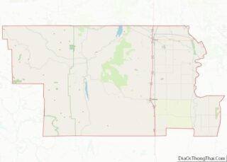
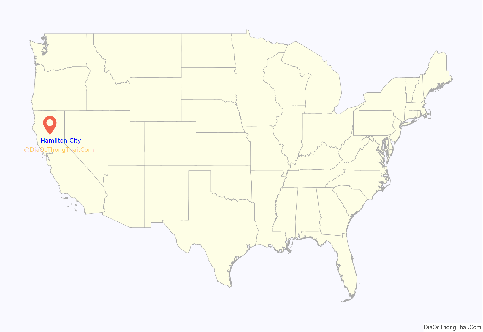
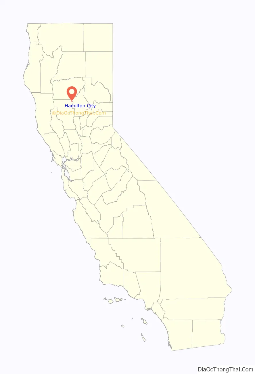
Hamilton City location map. Where is Hamilton City CDP?
History
The town began in 1905 with the founding of a large sugar beet processing plant later belonging to Holly Sugar Corporation. What is known today as the Holly Sugar Plant was built in 1906 by James Hamilton and the Alta California Sugar Beet Company. The name of the company was changed in 1908 to Sacramento Valley Sugar Company. It was sold in 1936 to Spreckels Sugar Company, which is the parent company of Holly Sugar. Spreckels was later purchased by Imperial Sugar The first post office at Hamilton City opened in 1906. As the population of the town grew, to make room for development the local cemetery was moved to a new location about 10 miles north of Artois, California.
The sugar plant closed in 2006.
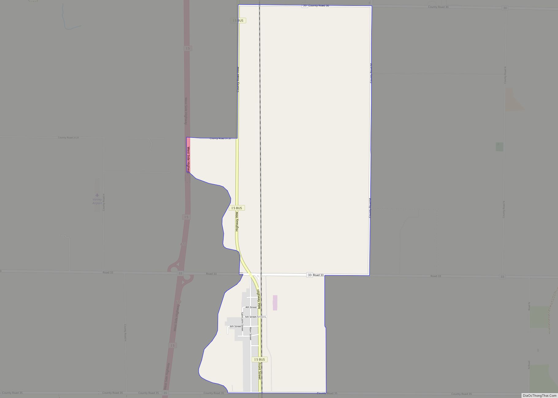
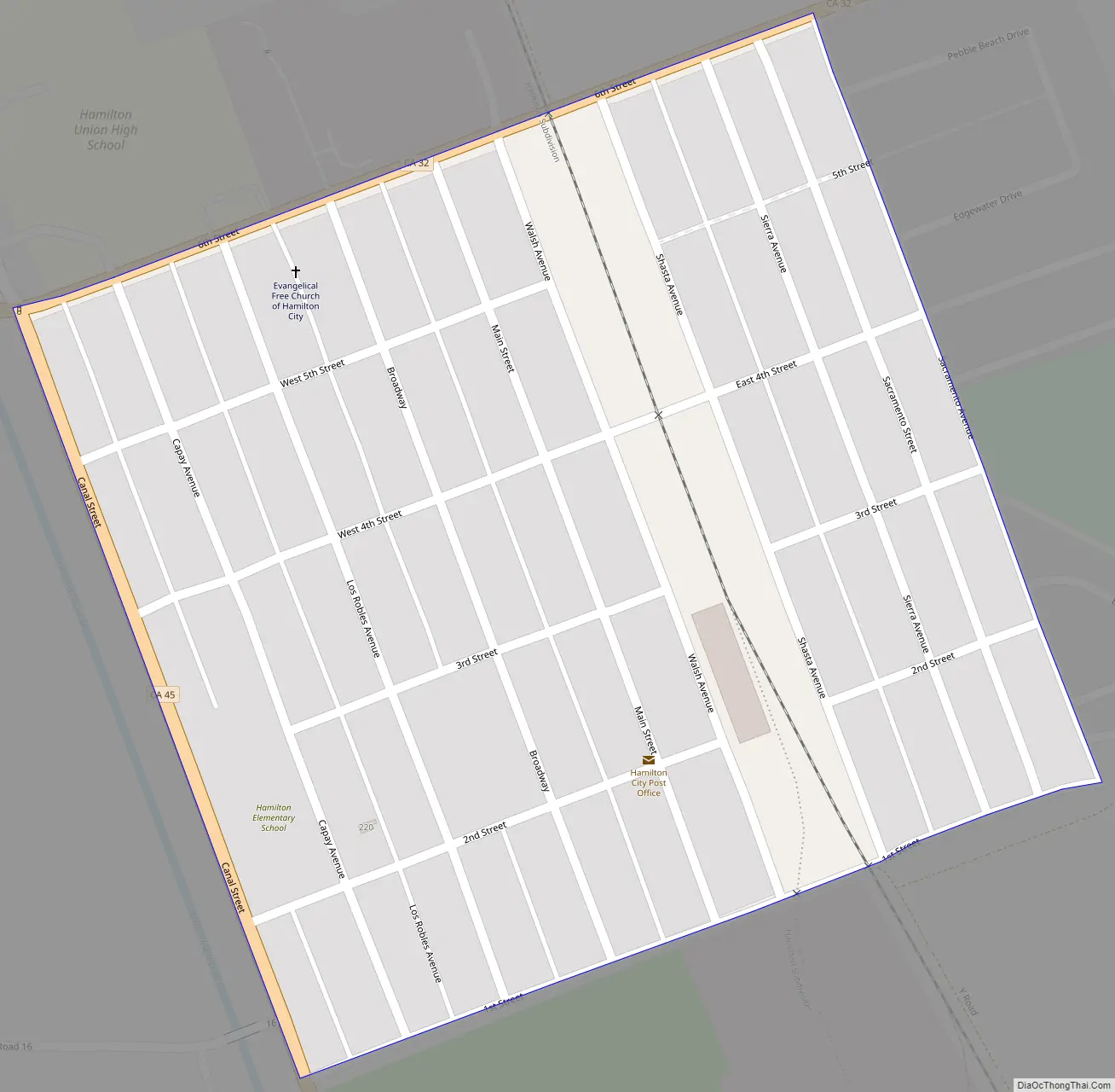
Hamilton City Road Map
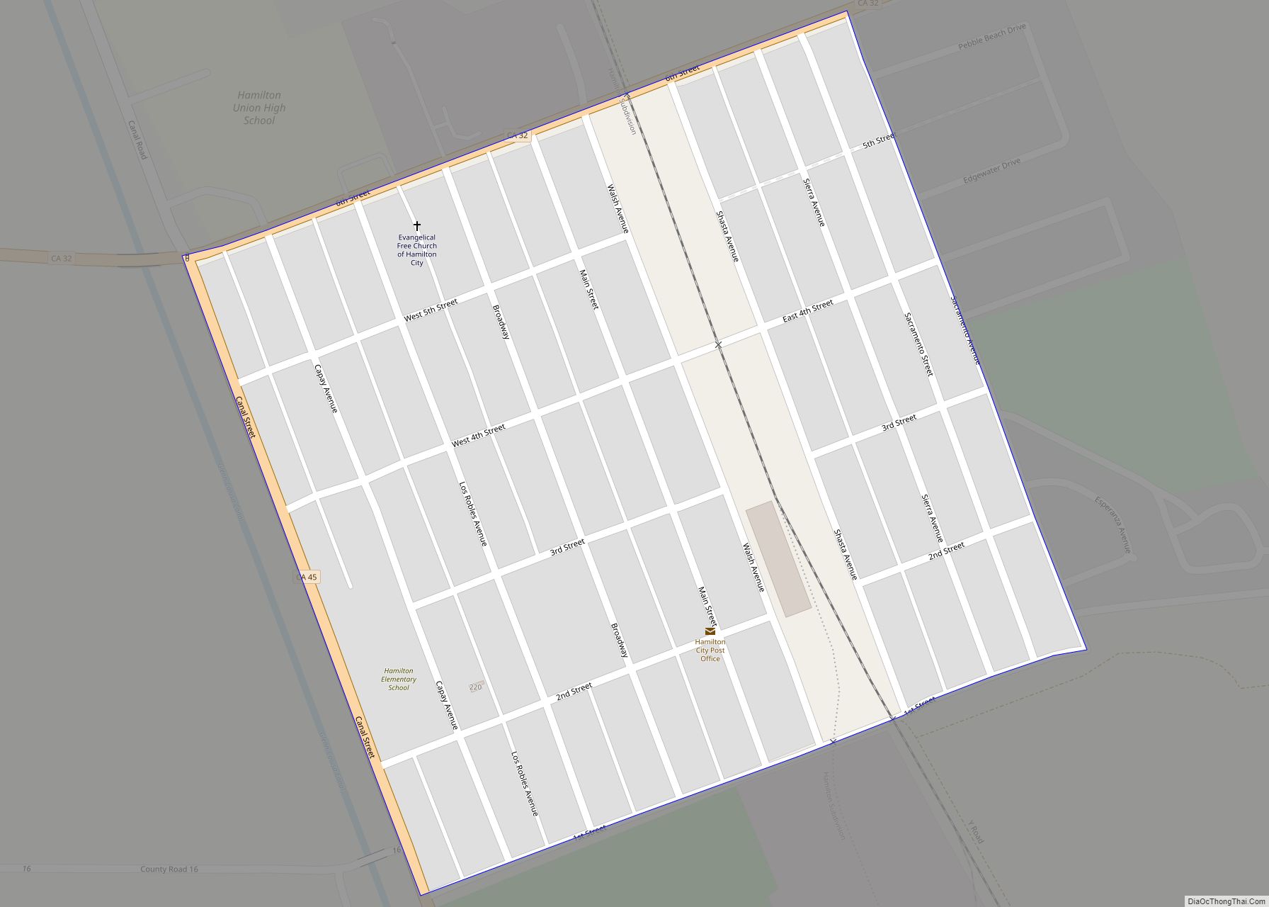
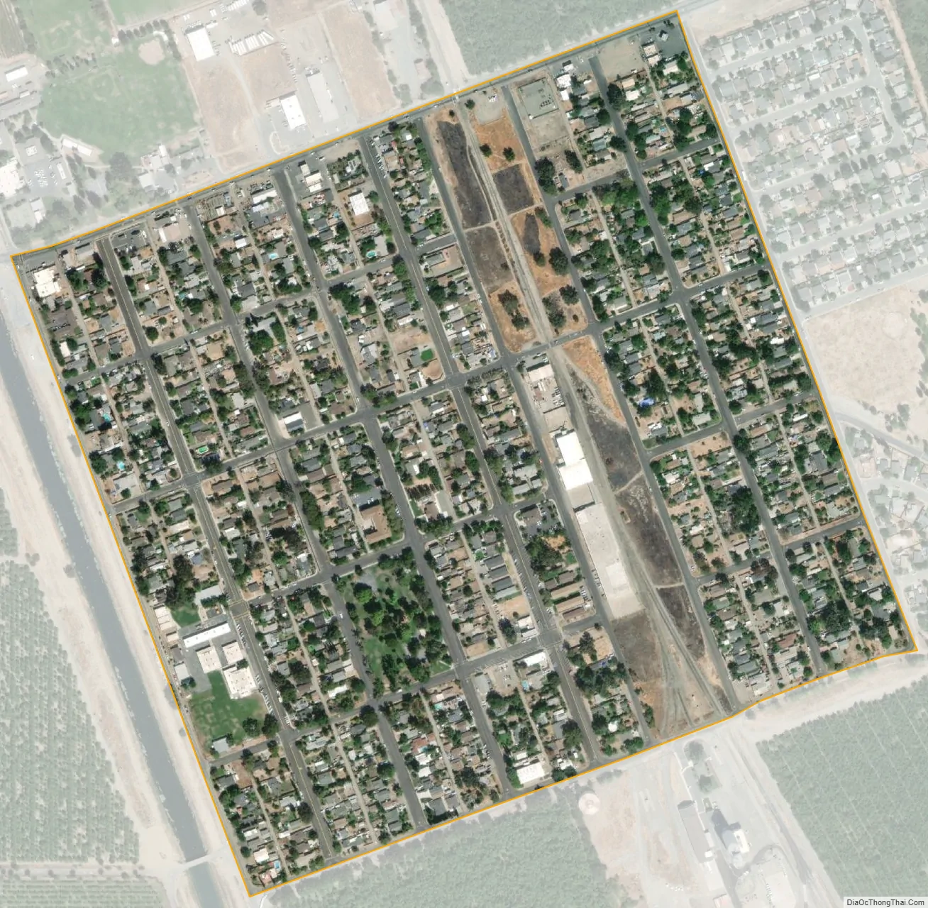
Hamilton City city Satellite Map
Geography
According to the United States Census Bureau, the CDP has a total area of 0.3 square miles (0.78 km), all of it land.
Climate
According to the Köppen Climate Classification system, Hamilton City has a warm-summer Mediterranean climate, abbreviated “Csa” on climate maps.
See also
Map of California State and its subdivision:- Alameda
- Alpine
- Amador
- Butte
- Calaveras
- Colusa
- Contra Costa
- Del Norte
- El Dorado
- Fresno
- Glenn
- Humboldt
- Imperial
- Inyo
- Kern
- Kings
- Lake
- Lassen
- Los Angeles
- Madera
- Marin
- Mariposa
- Mendocino
- Merced
- Modoc
- Mono
- Monterey
- Napa
- Nevada
- Orange
- Placer
- Plumas
- Riverside
- Sacramento
- San Benito
- San Bernardino
- San Diego
- San Francisco
- San Joaquin
- San Luis Obispo
- San Mateo
- Santa Barbara
- Santa Clara
- Santa Cruz
- Shasta
- Sierra
- Siskiyou
- Solano
- Sonoma
- Stanislaus
- Sutter
- Tehama
- Trinity
- Tulare
- Tuolumne
- Ventura
- Yolo
- Yuba
- Alabama
- Alaska
- Arizona
- Arkansas
- California
- Colorado
- Connecticut
- Delaware
- District of Columbia
- Florida
- Georgia
- Hawaii
- Idaho
- Illinois
- Indiana
- Iowa
- Kansas
- Kentucky
- Louisiana
- Maine
- Maryland
- Massachusetts
- Michigan
- Minnesota
- Mississippi
- Missouri
- Montana
- Nebraska
- Nevada
- New Hampshire
- New Jersey
- New Mexico
- New York
- North Carolina
- North Dakota
- Ohio
- Oklahoma
- Oregon
- Pennsylvania
- Rhode Island
- South Carolina
- South Dakota
- Tennessee
- Texas
- Utah
- Vermont
- Virginia
- Washington
- West Virginia
- Wisconsin
- Wyoming