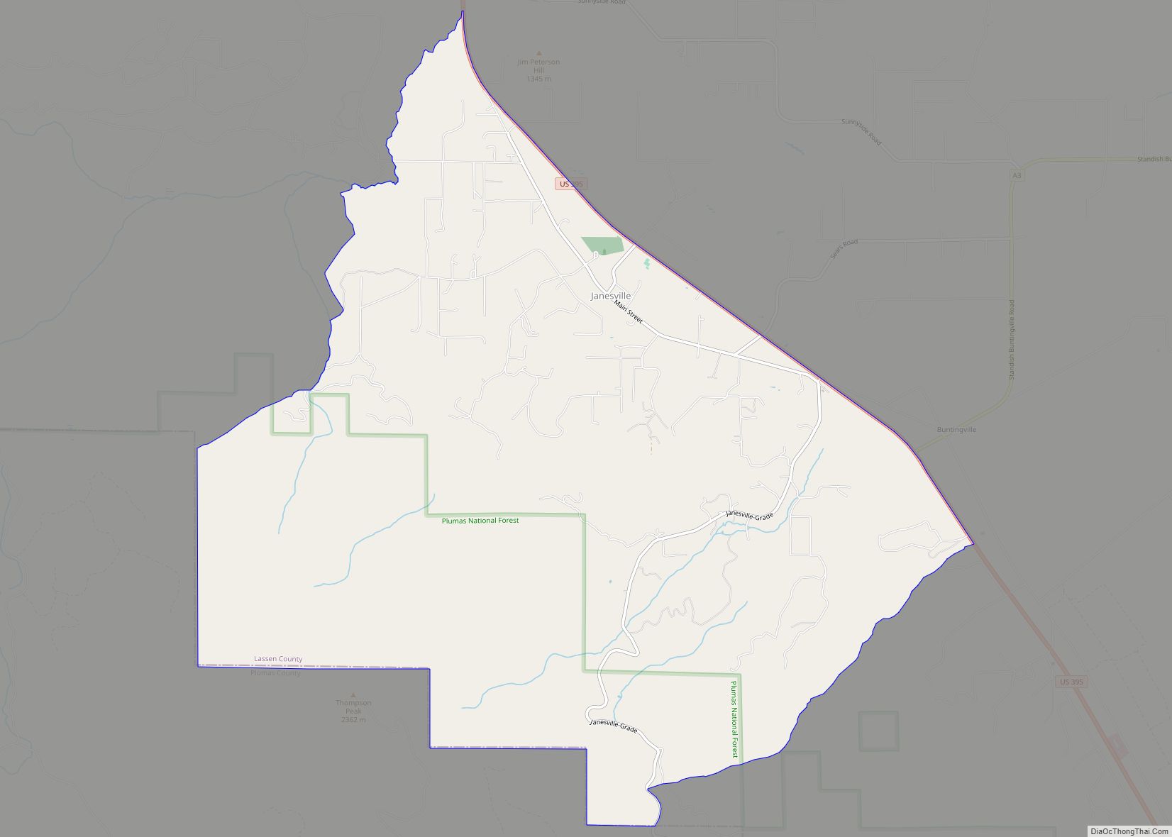
Janesville (also known as Lassen) is a census-designated place in Lassen County, California. It is located 11 miles (18 km) southeast of Susanville, at an elevation of 4239 feet (1292 m). Janesville is located on the eastern slopes of the Sierra Nevada Mountain range. Its population is 2,461 as of the 2020 census, up from 1,408 from the 2010 census.
The community consists of an elementary school, a park, four churches, two gas stations, a pizza parlor, a coffee shop, a veterinary hospital, a hardware store, a post office, and a few other businesses.
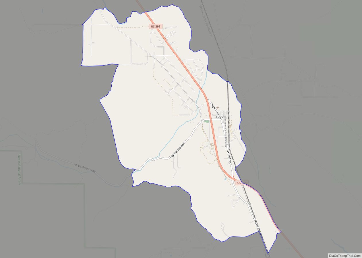
Janesville stretches over a distance of 8 miles (13 km). Its ZIP Code is 96114. The community is inside area code 530.
| Name: | Janesville CDP |
|---|---|
| LSAD Code: | 57 |
| LSAD Description: | CDP (suffix) |
| State: | California |
| County: | Lassen County |
| Elevation: | 4,239 ft (1,292 m) |
| Total Area: | 13.199 sq mi (34.186 km²) |
| Land Area: | 13.187 sq mi (34.154 km²) |
| Water Area: | 0.012 sq mi (0.032 km²) 0.09% |
| Total Population: | 2,461 |
| Population Density: | 190/sq mi (72/km²) |
| ZIP code: | 96114 |
| Area code: | 530 |
| FIPS code: | 0637134 |
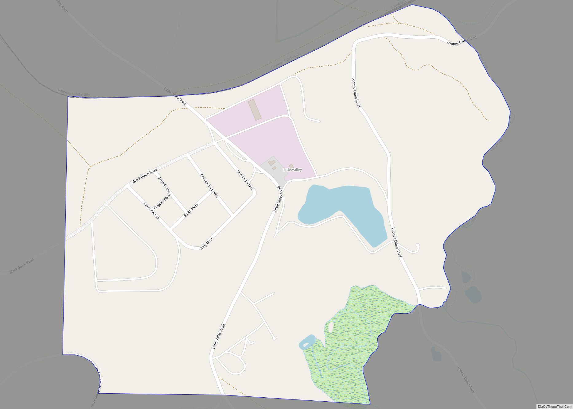
Online Interactive Map
Click on ![]() to view map in "full screen" mode.
to view map in "full screen" mode.
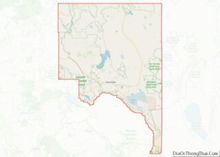
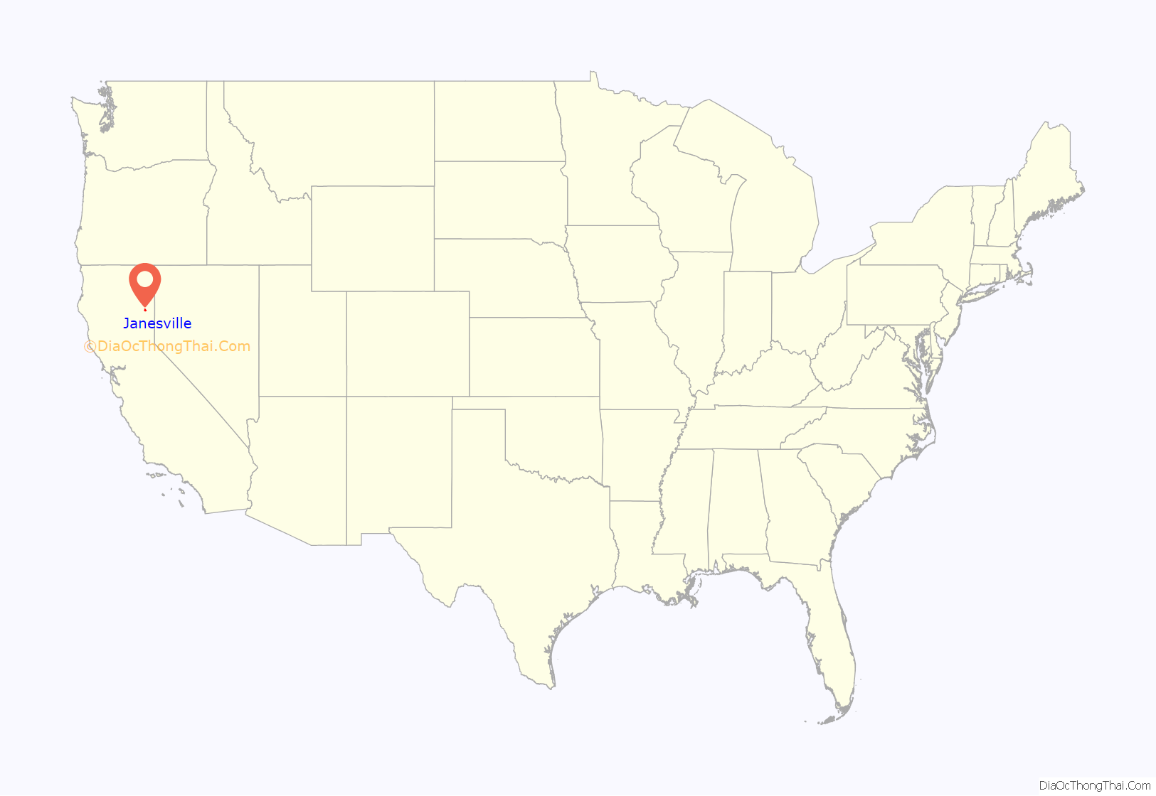
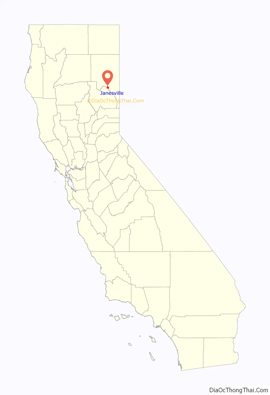
Janesville location map. Where is Janesville CDP?
History
Fort Janesville In 1860, after the First Battle of Pyramid Lake, settlers built a loopholed stockade for protection from an Indian attack that never materialized. The fort, which had a bastion, or block house, in its southwest angle, was less than a mile from the town of Janesville. The site of the fort is now a California Historic Landmark.
In 1864, Janesville lost to Susanville by one vote from becoming the county seat. The Janesville post office opened in 1861, closed for a time in 1864, changed its name to Lassen in 1914, and renamed to Janesville in 1923. The name honors Jane Bankhead, wife of an early settler.
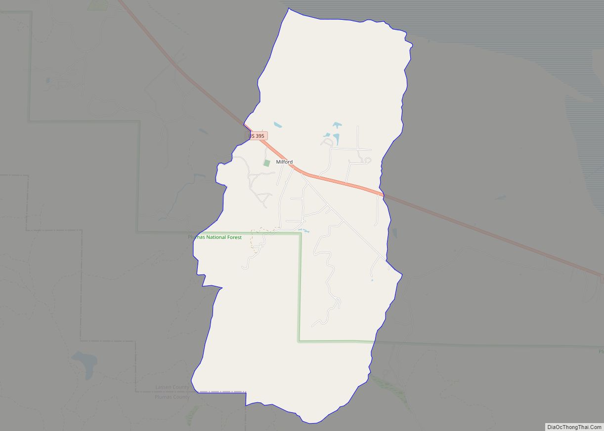
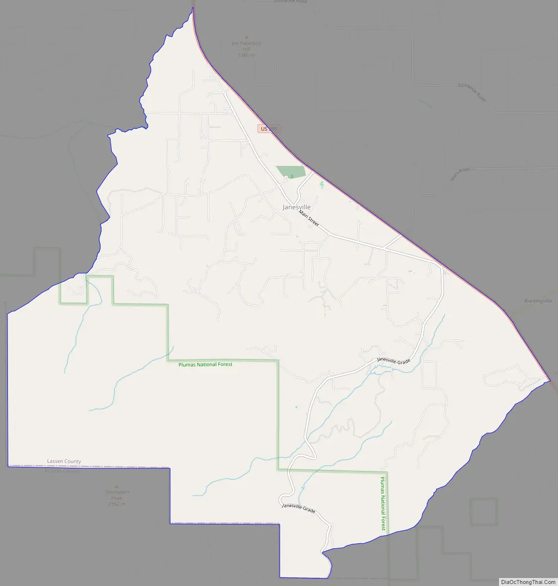
Janesville Road Map
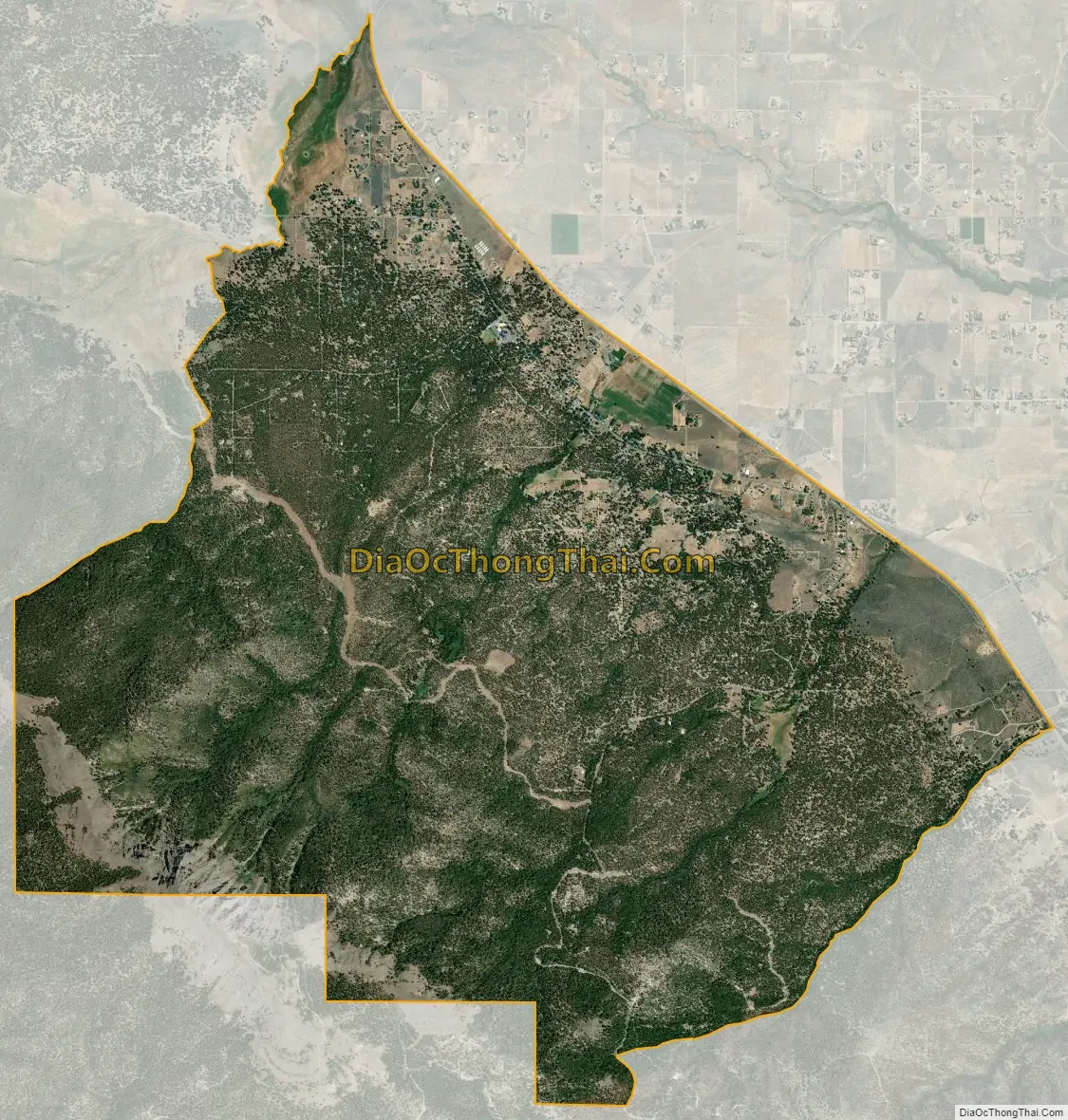
Janesville city Satellite Map
Geography
According to the United States Census Bureau, the CDP has a total area of 13.2 square miles (34.2 km), of which over 99% is land.
See also
Map of California State and its subdivision:- Alameda
- Alpine
- Amador
- Butte
- Calaveras
- Colusa
- Contra Costa
- Del Norte
- El Dorado
- Fresno
- Glenn
- Humboldt
- Imperial
- Inyo
- Kern
- Kings
- Lake
- Lassen
- Los Angeles
- Madera
- Marin
- Mariposa
- Mendocino
- Merced
- Modoc
- Mono
- Monterey
- Napa
- Nevada
- Orange
- Placer
- Plumas
- Riverside
- Sacramento
- San Benito
- San Bernardino
- San Diego
- San Francisco
- San Joaquin
- San Luis Obispo
- San Mateo
- Santa Barbara
- Santa Clara
- Santa Cruz
- Shasta
- Sierra
- Siskiyou
- Solano
- Sonoma
- Stanislaus
- Sutter
- Tehama
- Trinity
- Tulare
- Tuolumne
- Ventura
- Yolo
- Yuba
- Alabama
- Alaska
- Arizona
- Arkansas
- California
- Colorado
- Connecticut
- Delaware
- District of Columbia
- Florida
- Georgia
- Hawaii
- Idaho
- Illinois
- Indiana
- Iowa
- Kansas
- Kentucky
- Louisiana
- Maine
- Maryland
- Massachusetts
- Michigan
- Minnesota
- Mississippi
- Missouri
- Montana
- Nebraska
- Nevada
- New Hampshire
- New Jersey
- New Mexico
- New York
- North Carolina
- North Dakota
- Ohio
- Oklahoma
- Oregon
- Pennsylvania
- Rhode Island
- South Carolina
- South Dakota
- Tennessee
- Texas
- Utah
- Vermont
- Virginia
- Washington
- West Virginia
- Wisconsin
- Wyoming