Susanville (formerly known as Rooptown) is a town in and the county seat of Lassen County, California, United States. Susanville is located on the Susan River in the southern part of the county, at an elevation of 4,186 feet (1,276 m). Its population is 16,728 as of the 2020 census, down from 17,947 from the 2010 census.
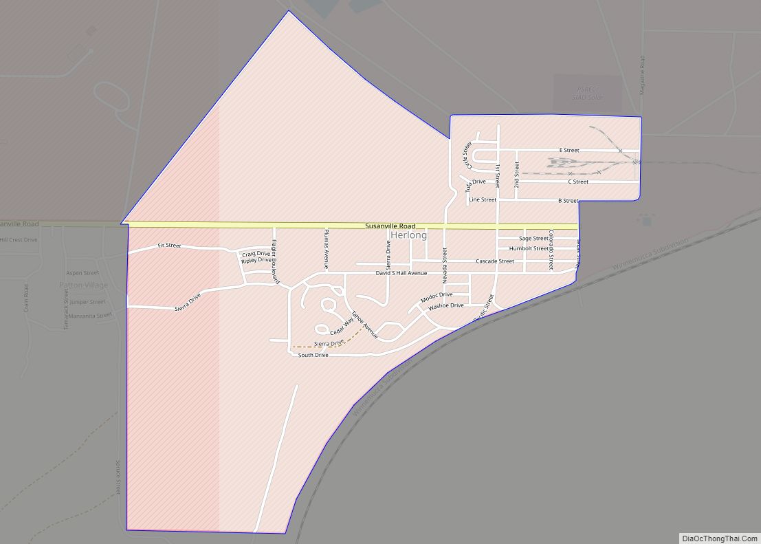
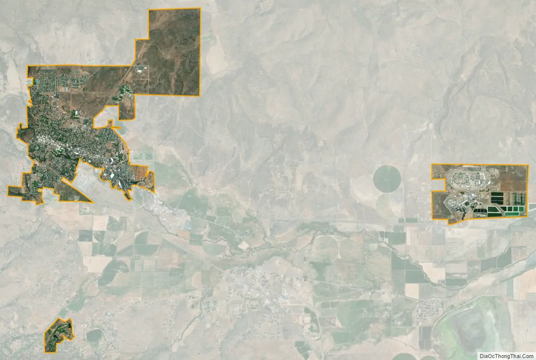
Susanville, a former logging and mining town, is the site of two state prisons: the California Correctional Center, a minimum-medium security facility, which opened in 1963; and the High Desert State Prison, California (not to be confused with High Desert State Prison, Nevada), which opened in 1995. The Federal Correctional Institution, Herlong is nearby, having opened in 2001.
The prisons and their effects on the community, including the addition of local jobs, were explored in the documentary Prison Town, USA (2007), aired on PBS. Nearly half the adult population of Susanville works at the three prisons in the area, where 6,000 people are incarcerated.
| Name: | Susanville city |
|---|---|
| LSAD Code: | 25 |
| LSAD Description: | city (suffix) |
| State: | California |
| County: | Lassen County |
| Incorporated: | August 24, 1900 |
| Elevation: | 4,186 ft (1,276 m) |
| Total Area: | 8.03 sq mi (20.80 km²) |
| Land Area: | 7.94 sq mi (20.58 km²) |
| Water Area: | 0.09 sq mi (0.22 km²) 1.07% |
| Total Population: | 16,728 |
| Population Density: | 2,106.80/sq mi (812.83/km²) |
| ZIP code: | 96127, 96130 |
| Area code: | 530 |
| FIPS code: | 0677364 |
| Website: | cityofsusanville.org |
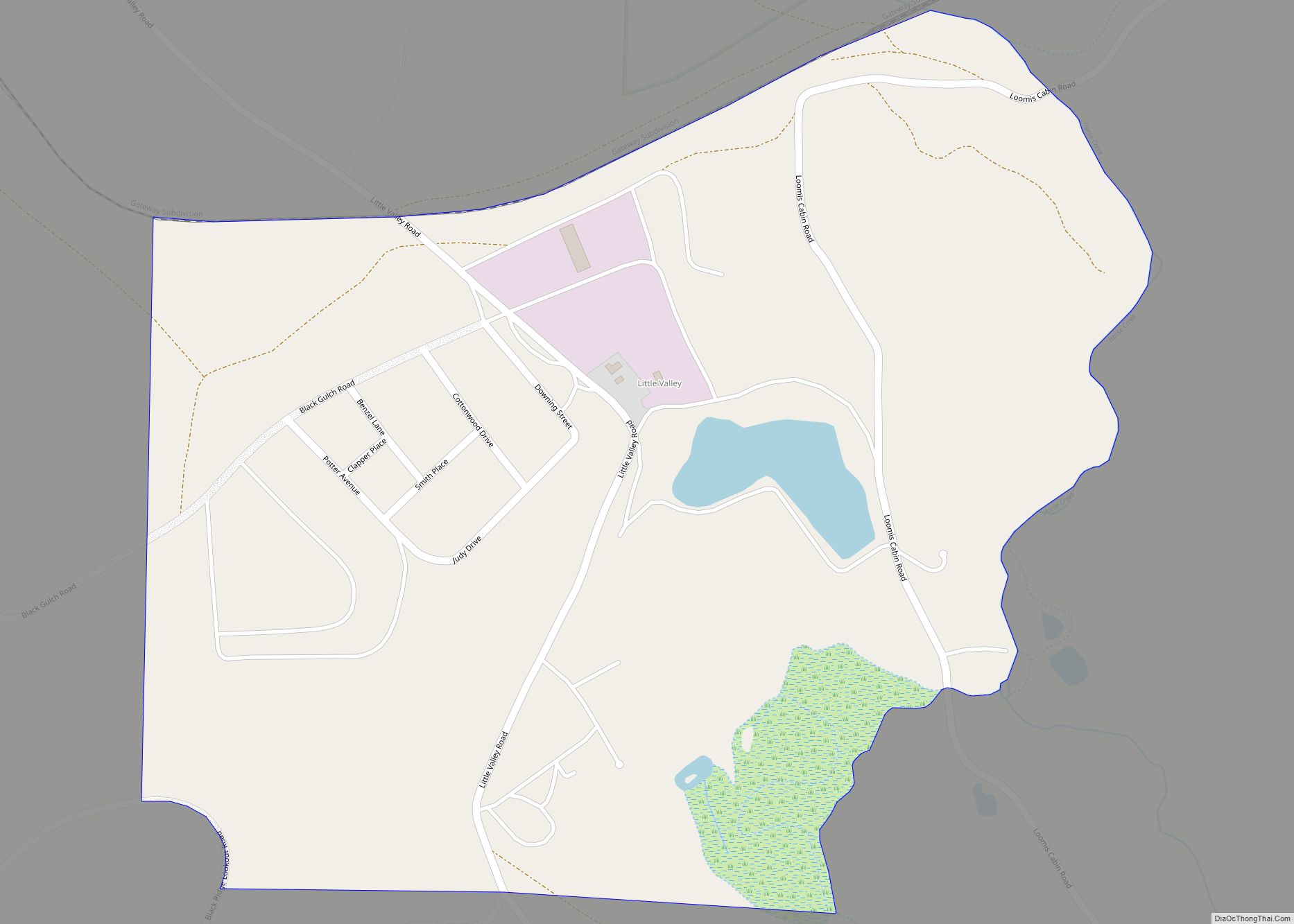
Online Interactive Map
Click on ![]() to view map in "full screen" mode.
to view map in "full screen" mode.
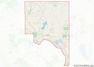
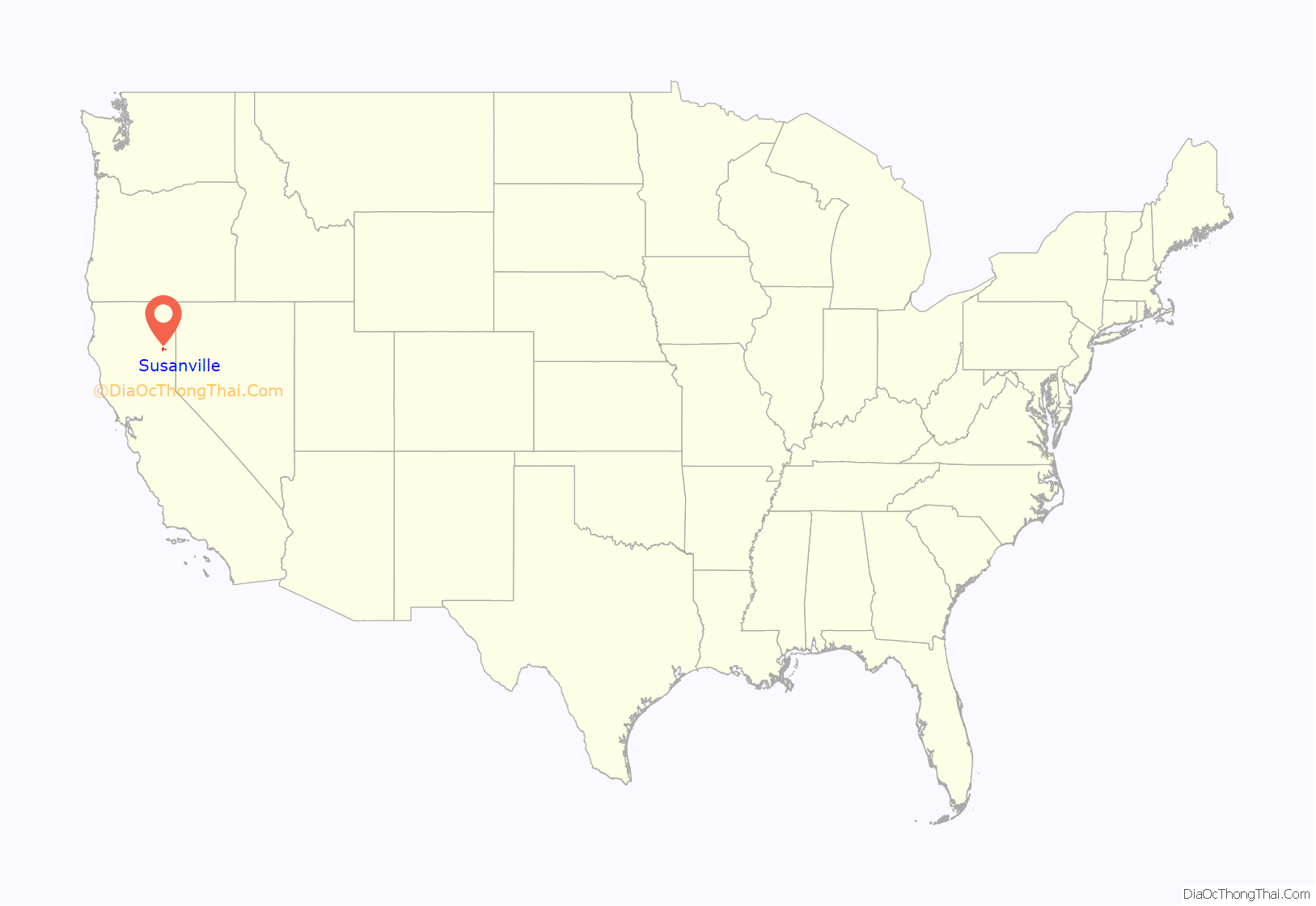
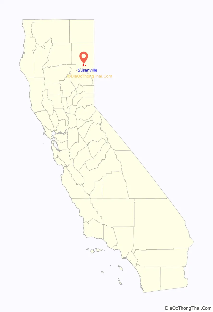
Susanville location map. Where is Susanville city?
History
The Susanville US post office was established in 1860. Susanville was incorporated in 1900.
Formerly the center of farming, mining and the lumber industry, Susanville suffered from the loss of jobs as these industries changed or declined in the 20th century. Since the late 20th century, the only area of growth in the economy has been associated with the construction and operation of two state prisons in the city and one federal prison in the area. In 2007, half of the adult population of Susanville worked in the prisons: the California Correctional Center, a minimum-medium security facility, which opened in 1963; the High Desert State Prison, California (not to be confused with High Desert State Prison, Nevada), which opened in 1995; and the Federal Correctional Institution, Herlong, which opened in 2007.
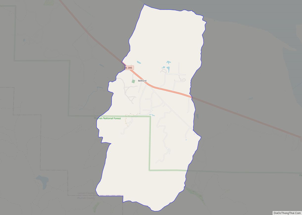
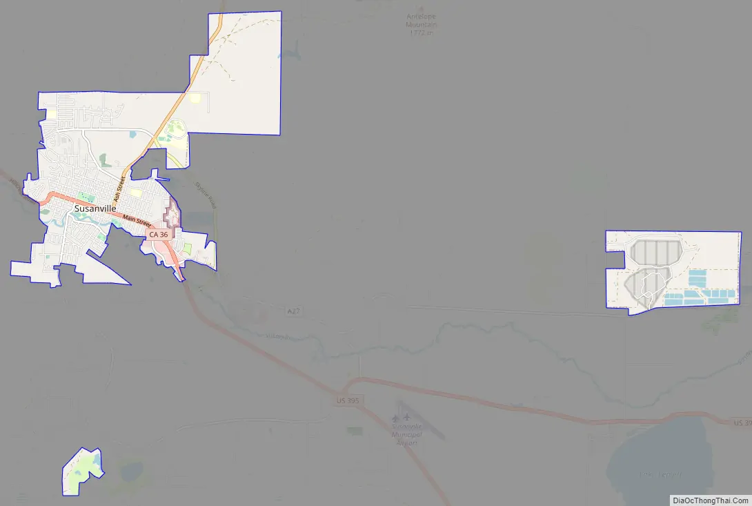
Susanville Road Map
Susanville city Satellite Map
Geography
Susanville is located at the head of Honey Lake Valley, 40 miles (64 km) east of Lassen Peak, The elevation is approximately 4,186 feet (1,276 m) above sea level. It is considered a gateway city to Reno on U.S. Route 395.
According to the United States Census Bureau, the city has a total area of 8.03 square miles (20.8 km), of which 7.95 square miles (20.58 km) or 98.93% is land and 0.09 square miles (0.22 km) or 1.07% is water.
Eagle Lake is located 15 miles (24 km) north of the town.
Geology
Susanville is underlain by igneous rock, which provides the parent material for its well-drained brown stony to gravelly sandy loams or loams. On the western outskirts under forest cover, the soils are often reddish brown. The most common soil series in Susanville’s urban area is Springmeyer gravelly fine sandy loam.
Climate
Susanville has an dry-summer humid continental climate (Köppen Dsb) with cool winters and hot, mostly dry summers, except for occasional afternoon thunderstorms. Records have been kept at several stations since 1895, including Susanville Airport and Susanville 2 SW, southwest of the town center, along with two other stations with shorter records.
Temperatures reach 90 °F (32 °C) or higher on an average of 30.8 days annually, and drop to 32 °F (0 °C) or lower on an average of 148.7 days annually. Freezing temperatures have been recorded in every month of the year, and summer nighttime temperatures are usually cool, but extreme cold is rare. The highest recorded temperature in Susanville was 106 °F (41 °C) on July 25, 1928 and July 19–20, 1931, and the lowest recorded temperature was −23 °F (−31 °C) on February 1, 1956.
Annual precipitation averages 13.02 inches (331 mm), with an average of 38.7 days with measurable precipitation. The wettest calendar year has been 1907 with 33.51 inches (851.2 mm) and the driest 1976 with 5.33 inches (135.4 mm), though the wettest “rain year” was from July 1937 to June 1938 with 33.01 inches (838.5 mm) as against 32.42 inches (823.5 mm) between July 1906 and June 1907 and 4.36 inches (110.7 mm) in the driest rain year from July 1975 to June 1976. The most precipitation in one month was 12.30 inches (312.4 mm) in March 1907, and the most in 24 hours 5.04 inches (128.0 mm) on January 31, 1897. The most snowfall in one year was 114 inches (289.6 cm) in 1937, with the most in one month being 65.5 inches (166 cm) in January 1895.
See also
Map of California State and its subdivision:- Alameda
- Alpine
- Amador
- Butte
- Calaveras
- Colusa
- Contra Costa
- Del Norte
- El Dorado
- Fresno
- Glenn
- Humboldt
- Imperial
- Inyo
- Kern
- Kings
- Lake
- Lassen
- Los Angeles
- Madera
- Marin
- Mariposa
- Mendocino
- Merced
- Modoc
- Mono
- Monterey
- Napa
- Nevada
- Orange
- Placer
- Plumas
- Riverside
- Sacramento
- San Benito
- San Bernardino
- San Diego
- San Francisco
- San Joaquin
- San Luis Obispo
- San Mateo
- Santa Barbara
- Santa Clara
- Santa Cruz
- Shasta
- Sierra
- Siskiyou
- Solano
- Sonoma
- Stanislaus
- Sutter
- Tehama
- Trinity
- Tulare
- Tuolumne
- Ventura
- Yolo
- Yuba
- Alabama
- Alaska
- Arizona
- Arkansas
- California
- Colorado
- Connecticut
- Delaware
- District of Columbia
- Florida
- Georgia
- Hawaii
- Idaho
- Illinois
- Indiana
- Iowa
- Kansas
- Kentucky
- Louisiana
- Maine
- Maryland
- Massachusetts
- Michigan
- Minnesota
- Mississippi
- Missouri
- Montana
- Nebraska
- Nevada
- New Hampshire
- New Jersey
- New Mexico
- New York
- North Carolina
- North Dakota
- Ohio
- Oklahoma
- Oregon
- Pennsylvania
- Rhode Island
- South Carolina
- South Dakota
- Tennessee
- Texas
- Utah
- Vermont
- Virginia
- Washington
- West Virginia
- Wisconsin
- Wyoming