Johannesburg is a census-designated place (CDP) in Kern County, California, in a mining district of the Rand Mountains. Johannesburg is located 1 mile (1.6 km) east-northeast of Randsburg, at an elevation of 3,517 feet (1,072 m). The terminus of the Randsburg Railway was here from 1897 to 1933. The population was 172 at the 2010 census, down from 176 at the 2000 census. Johannesburg is divided from the neighboring community of Randsburg by a ridge. The town is frequently referred to as “Jo-burg” by locals and frequent visitors to the northwest Mojave.
| Name: | Johannesburg CDP |
|---|---|
| LSAD Code: | 57 |
| LSAD Description: | CDP (suffix) |
| State: | California |
| County: | Kern County |
| Elevation: | 3,517 ft (1,072 m) |
| Total Area: | 2.415 sq mi (6.255 km²) |
| Land Area: | 2.415 sq mi (6.255 km²) |
| Water Area: | 0 sq mi (0 km²) 0% |
| Total Population: | 172 |
| Population Density: | 71/sq mi (27/km²) |
| ZIP code: | 93528, 93554 |
| FIPS code: | 0637400 |
| GNISfeature ID: | 0244074 |
Online Interactive Map
Click on ![]() to view map in "full screen" mode.
to view map in "full screen" mode.
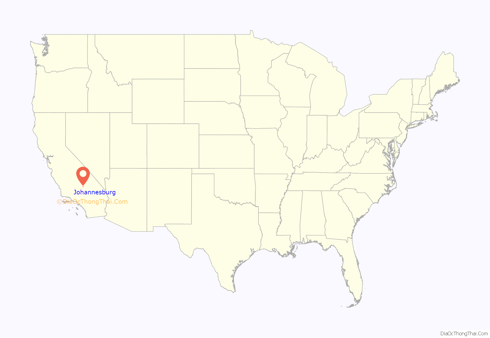
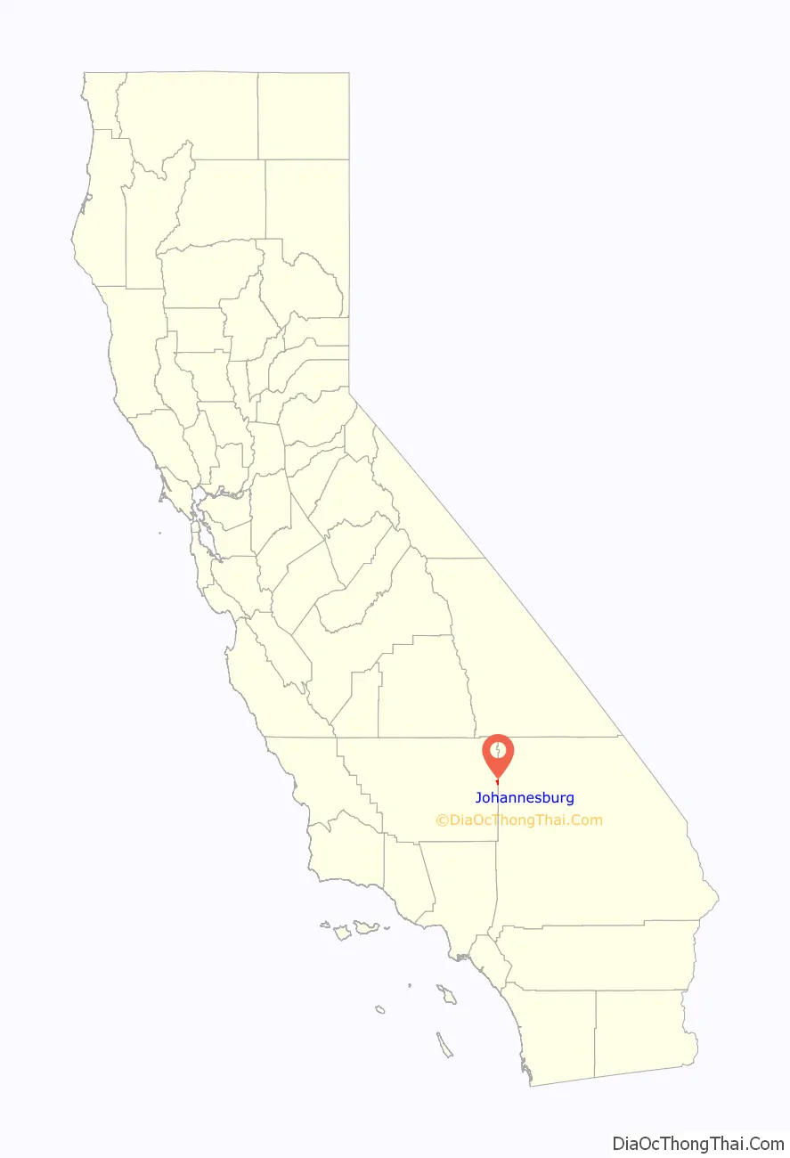
Johannesburg location map. Where is Johannesburg CDP?
History
Johannesburg was founded to support mining operations at Randsburg. In addition to providing rail access, the region’s first wells were operated by companies located in Johannesburg. During the first half of the 20th century, the Rand Mining District was the principal gold producing region of California. Activity centered on the Yellow Aster Mine, discovered in 1894. In 1919, the Rand Silver Mine was discovered east of town on Red Mountain. The Rand Mine produced more silver than any mine in California.
Johannesburg was named by miners who had previously worked in the gold-producing region of South Africa. Containing the city of Johannesburg, South Africa, this region is in the Witwatersrand, and is frequently referred to as “the Rand.”
The first post office at Johannesburg opened in 1897.
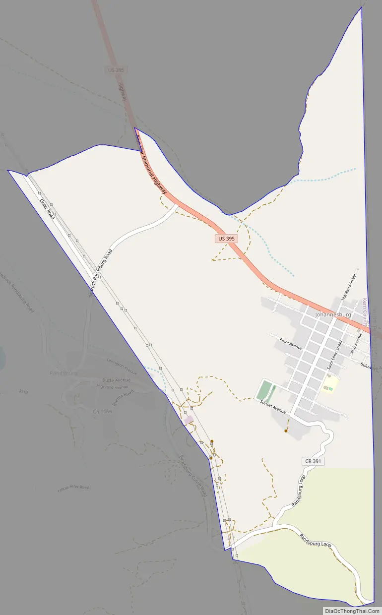
Johannesburg Road Map
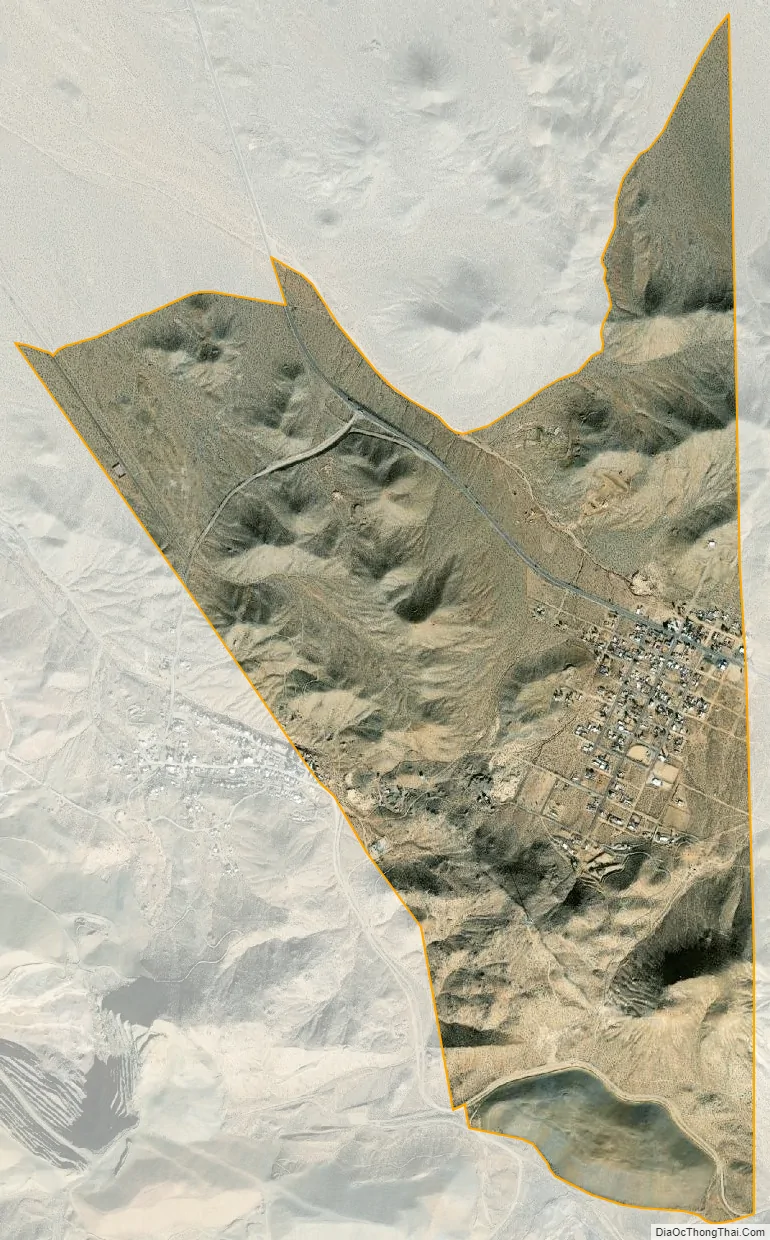
Johannesburg city Satellite Map
Geography
Johannesburg is located at 35°22′22″N 117°38′05″W / 35.37278°N 117.63472°W / 35.37278; -117.63472.
According to the United States Census Bureau, the CDP has a total area of 2.4 square miles (6.2 km), all of it land.
See also
Map of California State and its subdivision:- Alameda
- Alpine
- Amador
- Butte
- Calaveras
- Colusa
- Contra Costa
- Del Norte
- El Dorado
- Fresno
- Glenn
- Humboldt
- Imperial
- Inyo
- Kern
- Kings
- Lake
- Lassen
- Los Angeles
- Madera
- Marin
- Mariposa
- Mendocino
- Merced
- Modoc
- Mono
- Monterey
- Napa
- Nevada
- Orange
- Placer
- Plumas
- Riverside
- Sacramento
- San Benito
- San Bernardino
- San Diego
- San Francisco
- San Joaquin
- San Luis Obispo
- San Mateo
- Santa Barbara
- Santa Clara
- Santa Cruz
- Shasta
- Sierra
- Siskiyou
- Solano
- Sonoma
- Stanislaus
- Sutter
- Tehama
- Trinity
- Tulare
- Tuolumne
- Ventura
- Yolo
- Yuba
- Alabama
- Alaska
- Arizona
- Arkansas
- California
- Colorado
- Connecticut
- Delaware
- District of Columbia
- Florida
- Georgia
- Hawaii
- Idaho
- Illinois
- Indiana
- Iowa
- Kansas
- Kentucky
- Louisiana
- Maine
- Maryland
- Massachusetts
- Michigan
- Minnesota
- Mississippi
- Missouri
- Montana
- Nebraska
- Nevada
- New Hampshire
- New Jersey
- New Mexico
- New York
- North Carolina
- North Dakota
- Ohio
- Oklahoma
- Oregon
- Pennsylvania
- Rhode Island
- South Carolina
- South Dakota
- Tennessee
- Texas
- Utah
- Vermont
- Virginia
- Washington
- West Virginia
- Wisconsin
- Wyoming


