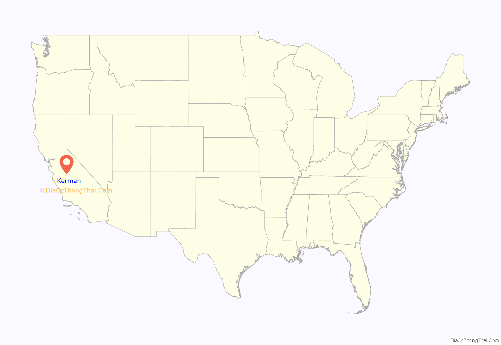
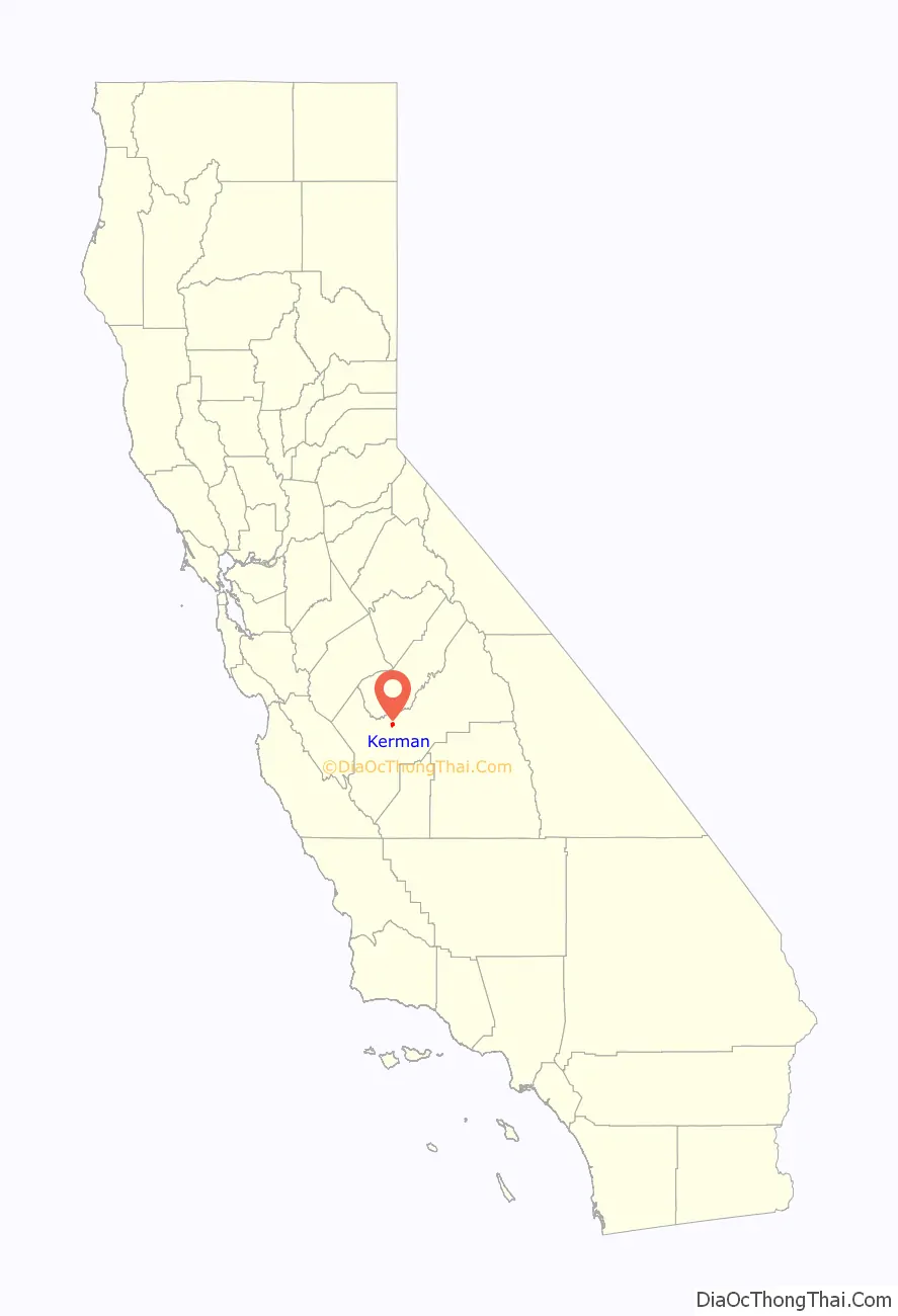
Kerman (formerly Collis) is a city at the intersection of State Route 180 and State Route 145 in Fresno County, California, United States. The population was 13,544 at the 2010 census. Kerman is located 15 miles (24 km) west of Fresno, at an elevation of 220 feet (67 m).
| Name: | Kerman city |
|---|---|
| LSAD Code: | 25 |
| LSAD Description: | city (suffix) |
| State: | California |
| County: | Fresno County |
| Incorporated: | July 2, 1946 |
| Elevation: | 220 ft (67 m) |
| Total Area: | 3.27 sq mi (8.46 km²) |
| Land Area: | 3.27 sq mi (8.46 km²) |
| Water Area: | 0.00 sq mi (0.00 km²) 0% |
| Total Population: | 13,544 |
| Population Density: | 4,677.69/sq mi (1,805.94/km²) |
| ZIP code: | 93630 |
| Area code: | 559 |
| FIPS code: | 0638226 |
| Website: | www.cityofkerman.net |
Online Interactive Map
Click on ![]() to view map in "full screen" mode.
to view map in "full screen" mode.
Kerman location map. Where is Kerman city?
History
Around 1891, the Southern Pacific Railroad constructed a new line between Tracy and Fresno. A watering tank and pump on that line was the beginning of Kerman, which was christened Collis in honor of the President of the road, Collis Potter Huntington. The first inhabitant, the caretaker of the pump and tank, kept the tank full of water for the thirsty engines with their long and lumbering trains. After some months, he resigned his job, not because of the work, he said, but because it was too lonesome and he was tired of being a hermit. He said he never saw anyone but the train crews and they were always in too big a hurry to carry on a conversation.
On August 3, 1892, the train bandits Chris Evans, John Sontag, and George Contant robbed a Southern Pacific train at Collis. Contant went to Folsom State Prison for the crime. Evans and John Sontag became fugitives for ten months before they were captured in 1893 in what is called the Battle of Stone Corral. John Sontag died of his wounds in custody, and Chris Evans was also sent to Folsom upon his conviction of the crime.
As a speculative venture, the old and very rich Bank of California purchased a huge tract of land in every County of California. The arid, barren land around Kerman seemed to be a good venture, so that happened to be the allotment for Fresno County.
After the death of its promoter, the bank became insolvent and its property was liquidated. The property here attracted the attention of two Los Angeles capitalists, William G. Kerckhoff and Jacob Mansar, who saw a chance to purchase a plentiful water supply from the newly constructed Enterprise Canal, which had its source in the Kings River. The men combined the first three letters of each of their names and christened the area “Kerman.” They pitched the property to Scandinavians and Germans settled in the Midwest.
The Collis post office was opened in 1894, closed in 1899, re-established in 1904, and renamed Kerman in 1906. Kerman incorporated in 1946. The independent Kerman Telephone company retired its four-position manual telephone switchboard, described by a state telephone association as the last of its kind in California, in 1991.
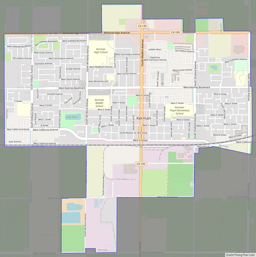
Kerman Road Map
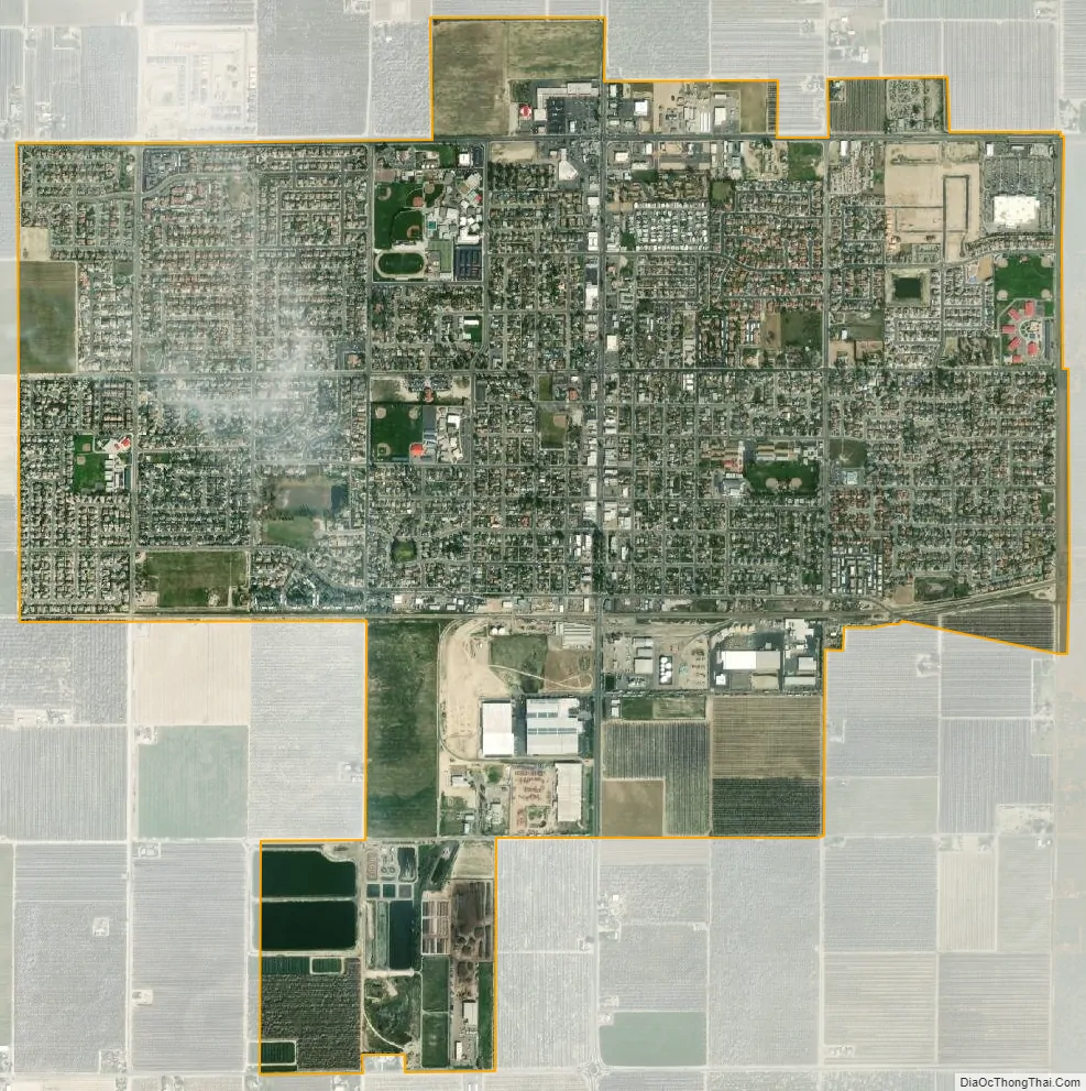
Kerman city Satellite Map
Geography
According to the United States Census Bureau, the city has a total area of 3.2 square miles (8.3 km), all of it land.
See also
Map of California State and its subdivision:- Alameda
- Alpine
- Amador
- Butte
- Calaveras
- Colusa
- Contra Costa
- Del Norte
- El Dorado
- Fresno
- Glenn
- Humboldt
- Imperial
- Inyo
- Kern
- Kings
- Lake
- Lassen
- Los Angeles
- Madera
- Marin
- Mariposa
- Mendocino
- Merced
- Modoc
- Mono
- Monterey
- Napa
- Nevada
- Orange
- Placer
- Plumas
- Riverside
- Sacramento
- San Benito
- San Bernardino
- San Diego
- San Francisco
- San Joaquin
- San Luis Obispo
- San Mateo
- Santa Barbara
- Santa Clara
- Santa Cruz
- Shasta
- Sierra
- Siskiyou
- Solano
- Sonoma
- Stanislaus
- Sutter
- Tehama
- Trinity
- Tulare
- Tuolumne
- Ventura
- Yolo
- Yuba
- Alabama
- Alaska
- Arizona
- Arkansas
- California
- Colorado
- Connecticut
- Delaware
- District of Columbia
- Florida
- Georgia
- Hawaii
- Idaho
- Illinois
- Indiana
- Iowa
- Kansas
- Kentucky
- Louisiana
- Maine
- Maryland
- Massachusetts
- Michigan
- Minnesota
- Mississippi
- Missouri
- Montana
- Nebraska
- Nevada
- New Hampshire
- New Jersey
- New Mexico
- New York
- North Carolina
- North Dakota
- Ohio
- Oklahoma
- Oregon
- Pennsylvania
- Rhode Island
- South Carolina
- South Dakota
- Tennessee
- Texas
- Utah
- Vermont
- Virginia
- Washington
- West Virginia
- Wisconsin
- Wyoming


