Lake Nacimiento is a census-designated place (CDP) in northern San Luis Obispo County, California, United States.
The population of Lake Nacimiento was 2,956 at the 2020 census, up from 2,411 at the 2010 census.
| Name: | Lake Nacimiento CDP |
|---|---|
| LSAD Code: | 57 |
| LSAD Description: | CDP (suffix) |
| State: | California |
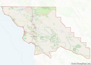
| County: | San Luis Obispo County |
| Elevation: | 984 ft (300 m) |
| Total Area: | 10.291 sq mi (26.654 km²) |
| Land Area: | 10.268 sq mi (26.594 km²) |
| Water Area: | 0.023 sq mi (0.061 km²) 0.23% |
| Total Population: | 2,956 |
| Population Density: | 290/sq mi (110/km²) |
| ZIP code: | 93446 |
| Area code: | 805 |
| FIPS code: | 0639670 |
| GNISfeature ID: | 1867034 |
Online Interactive Map
Click on ![]() to view map in "full screen" mode.
to view map in "full screen" mode.
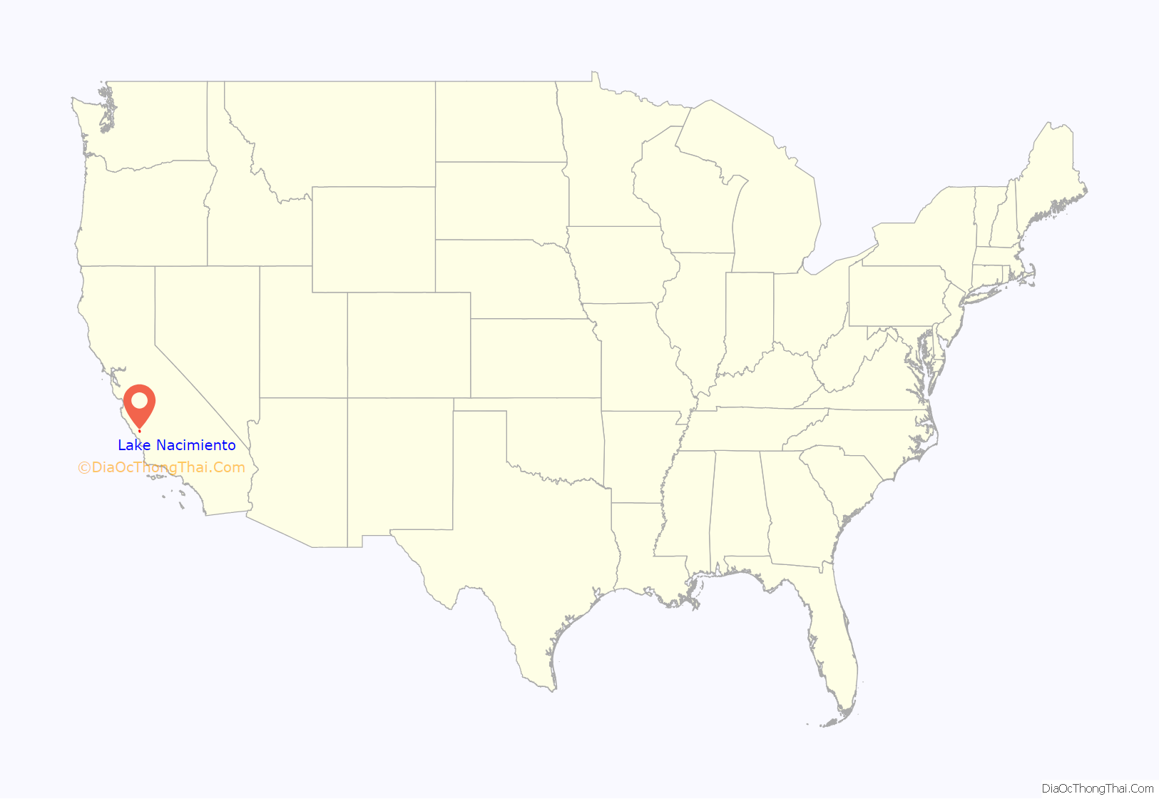
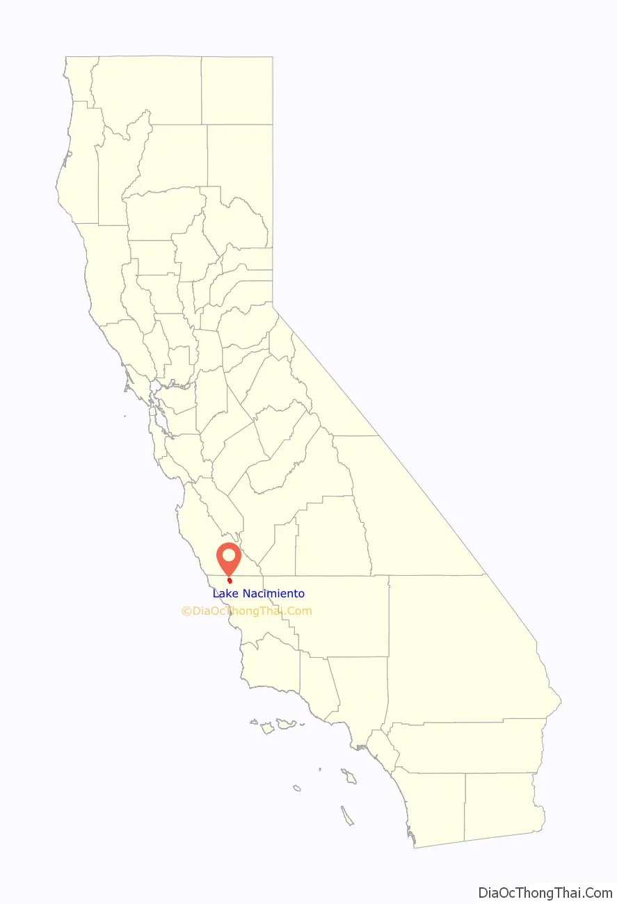
Lake Nacimiento location map. Where is Lake Nacimiento CDP?
Lake Nacimiento Road Map
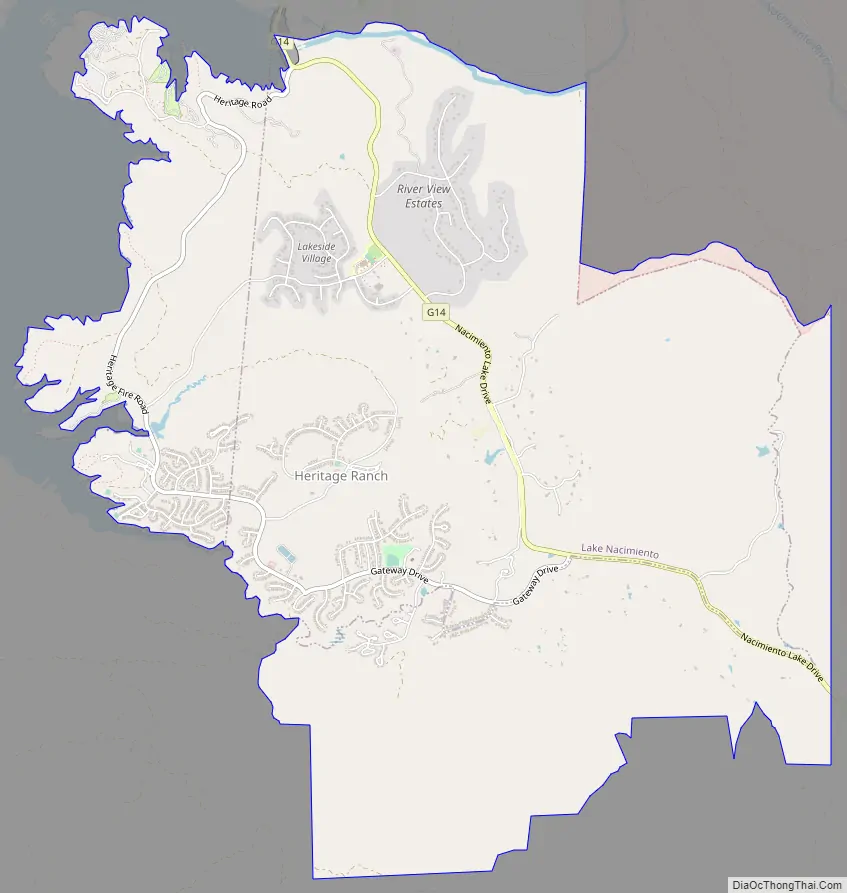
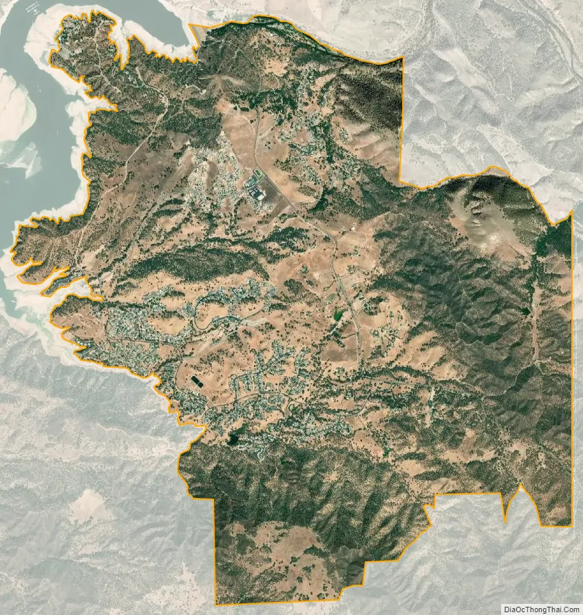
Lake Nacimiento city Satellite Map
Geography
The community of Lake Nacimiento is located at Lake Nacimiento reservoir, in the Santa Lucia Mountains, at 35°44′15″N 120°52′53″W / 35.73750°N 120.88139°W / 35.73750; -120.88139 (35.737585, -120.881328).
According to the United States Census Bureau, the CDP has a total area of 10.3 square miles (27 km), 99.77% of it land and 0.23% of it water. The lake is often referred to as Dragon Lake, due to its unusual but distinct shape.
Climate
The Köppen Climate Classification subtype for this climate is “Csb” (Mediterranean Climate).
See also
Map of California State and its subdivision:- Alameda
- Alpine
- Amador
- Butte
- Calaveras
- Colusa
- Contra Costa
- Del Norte
- El Dorado
- Fresno
- Glenn
- Humboldt
- Imperial
- Inyo
- Kern
- Kings
- Lake
- Lassen
- Los Angeles
- Madera
- Marin
- Mariposa
- Mendocino
- Merced
- Modoc
- Mono
- Monterey
- Napa
- Nevada
- Orange
- Placer
- Plumas
- Riverside
- Sacramento
- San Benito
- San Bernardino
- San Diego
- San Francisco
- San Joaquin
- San Luis Obispo
- San Mateo
- Santa Barbara
- Santa Clara
- Santa Cruz
- Shasta
- Sierra
- Siskiyou
- Solano
- Sonoma
- Stanislaus
- Sutter
- Tehama
- Trinity
- Tulare
- Tuolumne
- Ventura
- Yolo
- Yuba
- Alabama
- Alaska
- Arizona
- Arkansas
- California
- Colorado
- Connecticut
- Delaware
- District of Columbia
- Florida
- Georgia
- Hawaii
- Idaho
- Illinois
- Indiana
- Iowa
- Kansas
- Kentucky
- Louisiana
- Maine
- Maryland
- Massachusetts
- Michigan
- Minnesota
- Mississippi
- Missouri
- Montana
- Nebraska
- Nevada
- New Hampshire
- New Jersey
- New Mexico
- New York
- North Carolina
- North Dakota
- Ohio
- Oklahoma
- Oregon
- Pennsylvania
- Rhode Island
- South Carolina
- South Dakota
- Tennessee
- Texas
- Utah
- Vermont
- Virginia
- Washington
- West Virginia
- Wisconsin
- Wyoming