Lake Wildwood is a census-designated place (CDP) in Nevada County, California, United States. The population was 4,991 at the 2010 census, up from 4,868 at the 2000 census.
Lake Wildwood is mainly a gated community and news about the CDP is published in a twice a month newspaper, The Wildwood Independent. Local businesses and residences are listed in the annual “Penn Valley Area Directory” published by “Pine Tree Press”.
| Name: | Lake Wildwood CDP |
|---|---|
| LSAD Code: | 57 |
| LSAD Description: | CDP (suffix) |
| State: | California |
| County: | Nevada County |
| Elevation: | 1,529 ft (466 m) |
| Total Area: | 3.512 sq mi (9.095 km²) |
| Land Area: | 3.059 sq mi (7.923 km²) |
| Water Area: | 0.453 sq mi (1.172 km²) 12.89% |
| Total Population: | 4,991 |
| Population Density: | 1,400/sq mi (550/km²) |
| ZIP code: | 95946 |
| Area code: | 530 |
| FIPS code: | 0639885 |
| GNISfeature ID: | 1682906 |
Online Interactive Map
Click on ![]() to view map in "full screen" mode.
to view map in "full screen" mode.
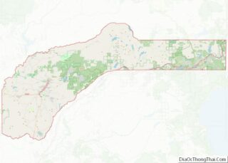
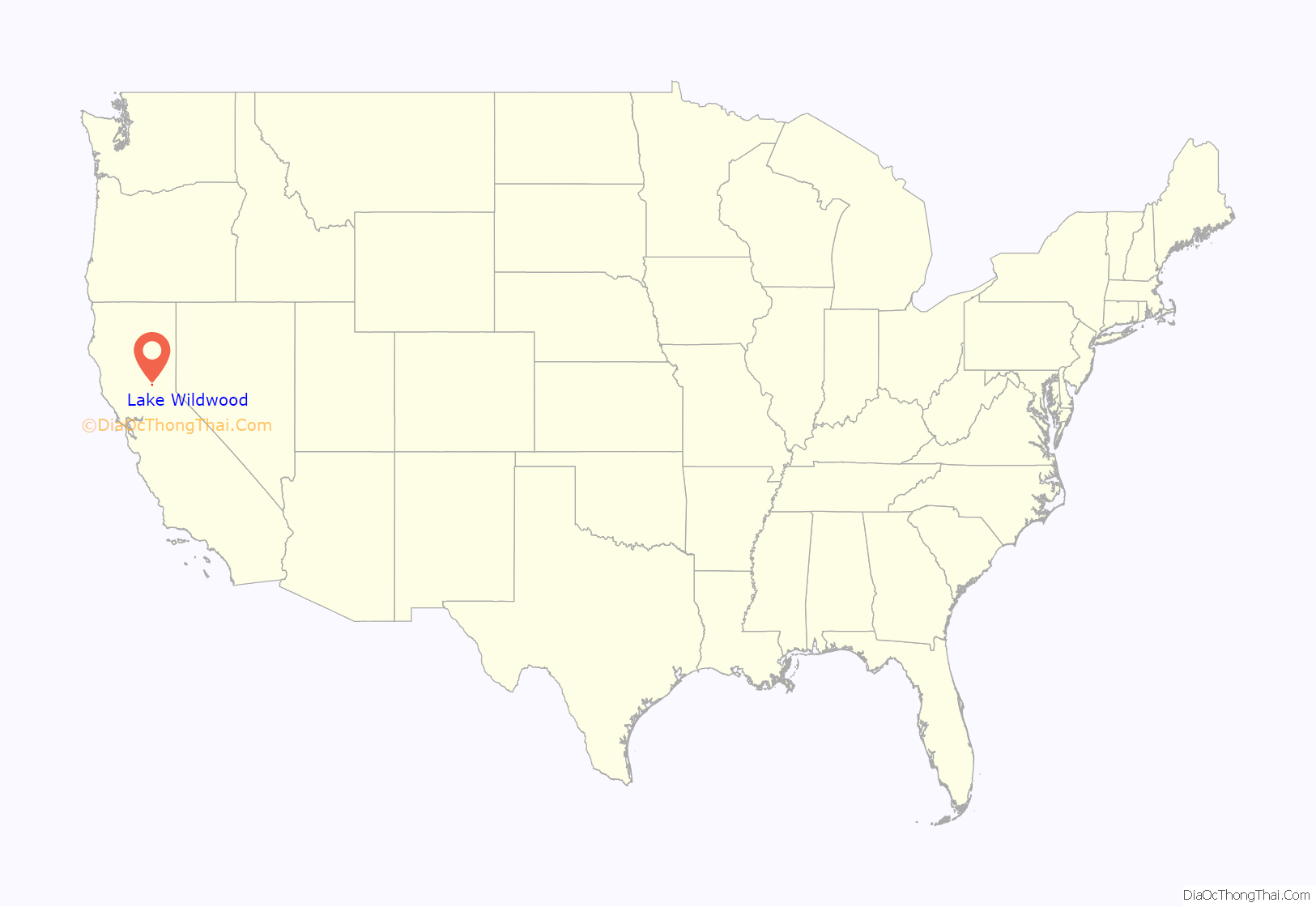
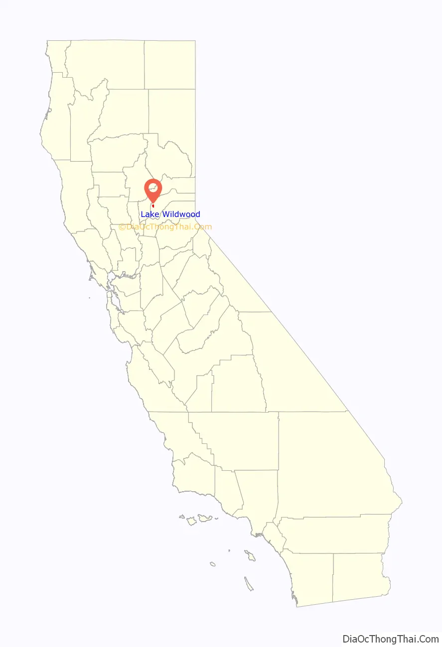
Lake Wildwood location map. Where is Lake Wildwood CDP?
History
Lake Wildwood was laid out by property developers in the 1960s.
In September 1988, the 49er Fire was accidentally started by a homeless and schizophrenic local man near Highway 49. The fire went on to burn well over a hundred homes and more than 33,000 acres in Nevada County, including many homes in the Lake Wildwood area.
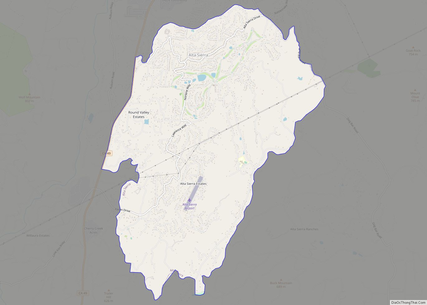
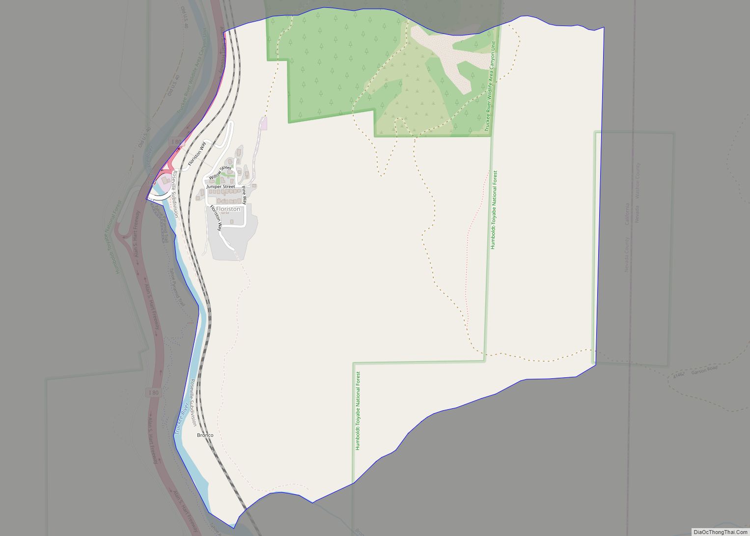
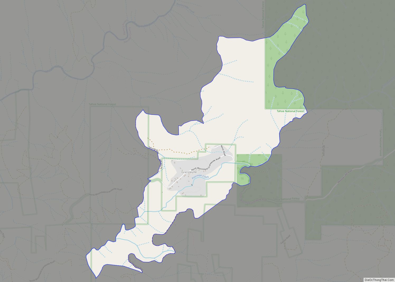
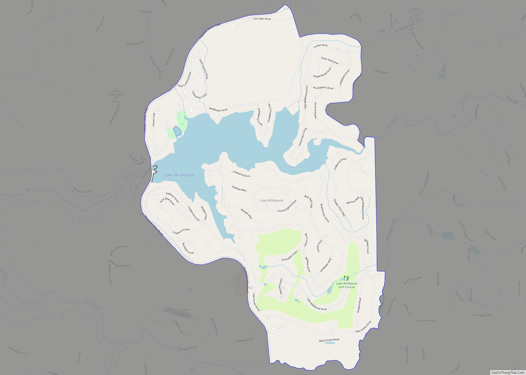
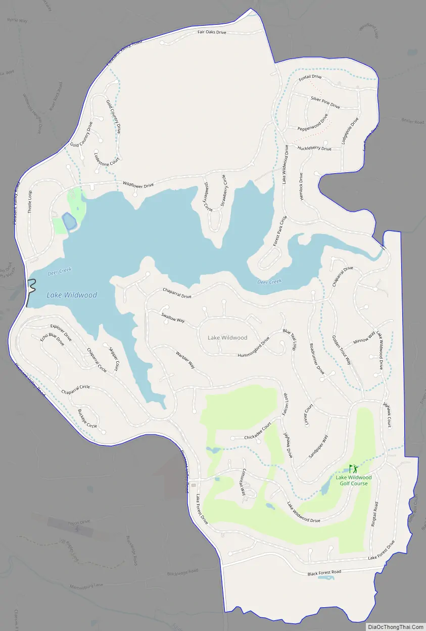
Lake Wildwood Road Map
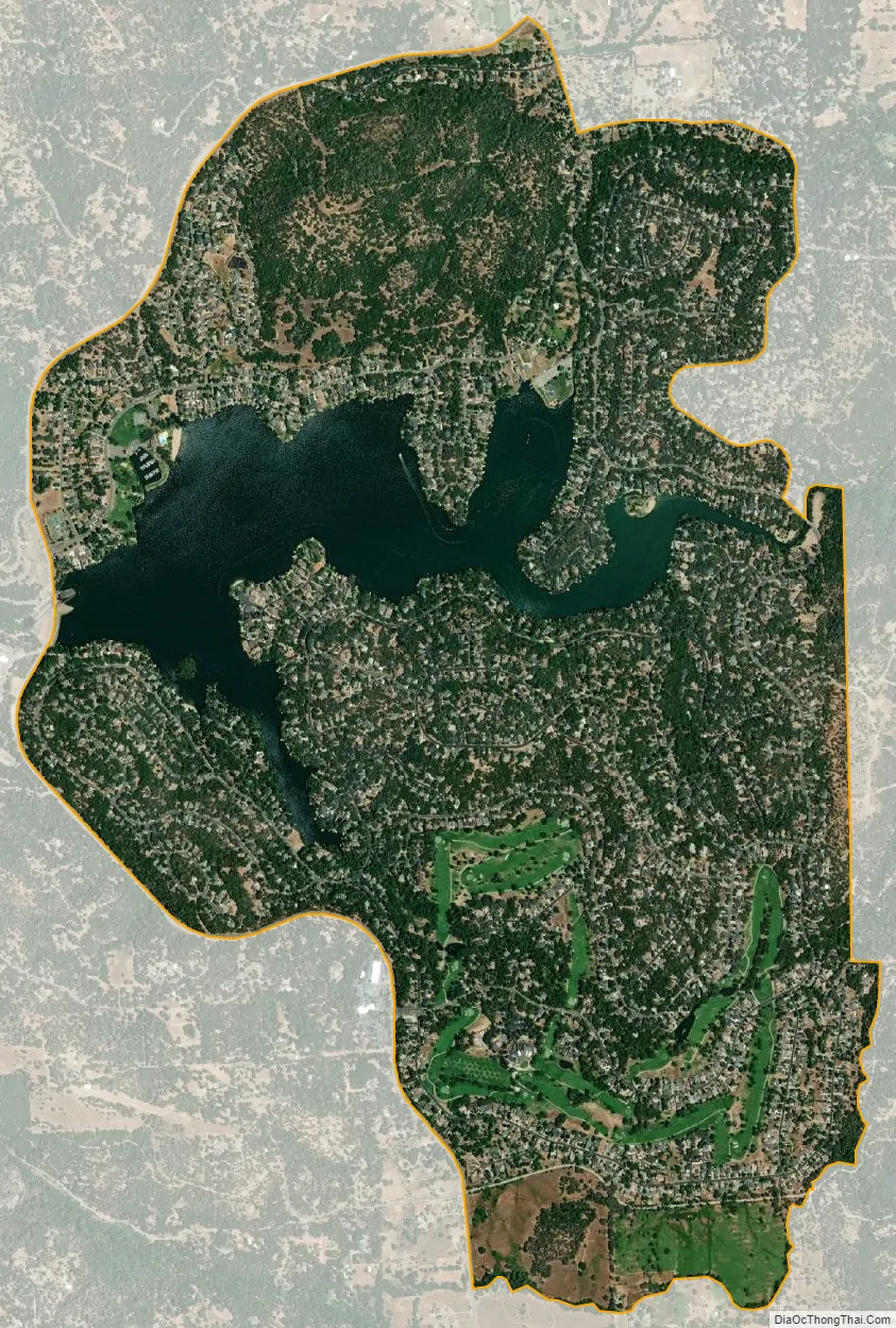
Lake Wildwood city Satellite Map
Geography
Lake Wildwood is located at 39°14′6″N 121°12′11″W / 39.23500°N 121.20306°W / 39.23500; -121.20306 (39.234885, -121.203026).
According to the United States Census Bureau, the CDP has a total area of 3.5 square miles (9.1 km), of which 3.1 square miles (8.0 km) is land and 0.5 square miles (1.3 km) (12.89%) is water.
See also
Map of California State and its subdivision:- Alameda
- Alpine
- Amador
- Butte
- Calaveras
- Colusa
- Contra Costa
- Del Norte
- El Dorado
- Fresno
- Glenn
- Humboldt
- Imperial
- Inyo
- Kern
- Kings
- Lake
- Lassen
- Los Angeles
- Madera
- Marin
- Mariposa
- Mendocino
- Merced
- Modoc
- Mono
- Monterey
- Napa
- Nevada
- Orange
- Placer
- Plumas
- Riverside
- Sacramento
- San Benito
- San Bernardino
- San Diego
- San Francisco
- San Joaquin
- San Luis Obispo
- San Mateo
- Santa Barbara
- Santa Clara
- Santa Cruz
- Shasta
- Sierra
- Siskiyou
- Solano
- Sonoma
- Stanislaus
- Sutter
- Tehama
- Trinity
- Tulare
- Tuolumne
- Ventura
- Yolo
- Yuba
- Alabama
- Alaska
- Arizona
- Arkansas
- California
- Colorado
- Connecticut
- Delaware
- District of Columbia
- Florida
- Georgia
- Hawaii
- Idaho
- Illinois
- Indiana
- Iowa
- Kansas
- Kentucky
- Louisiana
- Maine
- Maryland
- Massachusetts
- Michigan
- Minnesota
- Mississippi
- Missouri
- Montana
- Nebraska
- Nevada
- New Hampshire
- New Jersey
- New Mexico
- New York
- North Carolina
- North Dakota
- Ohio
- Oklahoma
- Oregon
- Pennsylvania
- Rhode Island
- South Carolina
- South Dakota
- Tennessee
- Texas
- Utah
- Vermont
- Virginia
- Washington
- West Virginia
- Wisconsin
- Wyoming