Littlerock is a census-designated place in California United States. The population was 1,377 at the 2010 census, down from 1,402 at the 2000 census. The Littlerock, and Sun Village community, which is typically referred to as Littlerock, has a population around 15,000. According to the Greater Antelope Valley Economic Alliance report of 2009, the Palmdale / Lancaster urban area has a population of 483,998, which Littlerock is a part of.
Littlerock is named after the Little Rock Wash that passes through the area and is known as “The Fruit Basket of the Antelope Valley.” There were orchards of fruit trees such as almonds, apples, peaches, and pears, along the side of the roads around Highway 138.
| Name: | Littlerock CDP |
|---|---|
| LSAD Code: | 57 |
| LSAD Description: | CDP (suffix) |
| State: | California |
| County: | Los Angeles County |
| Elevation: | 2,890 ft (881 m) |
| Total Area: | 1.843 sq mi (4.774 km²) |
| Land Area: | 1.842 sq mi (4.770 km²) |
| Water Area: | 0.001 sq mi (0.004 km²) 0.08% |
| Total Population: | 1,377 |
| Population Density: | 750/sq mi (290/km²) |
| ZIP code: | 93543 |
| Area code: | 661 |
| FIPS code: | 0641880 |
| GNISfeature ID: | 1660929 |
Online Interactive Map
Click on ![]() to view map in "full screen" mode.
to view map in "full screen" mode.
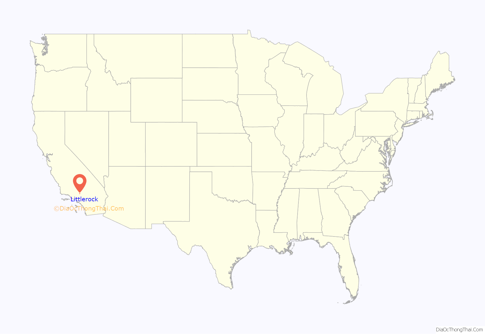
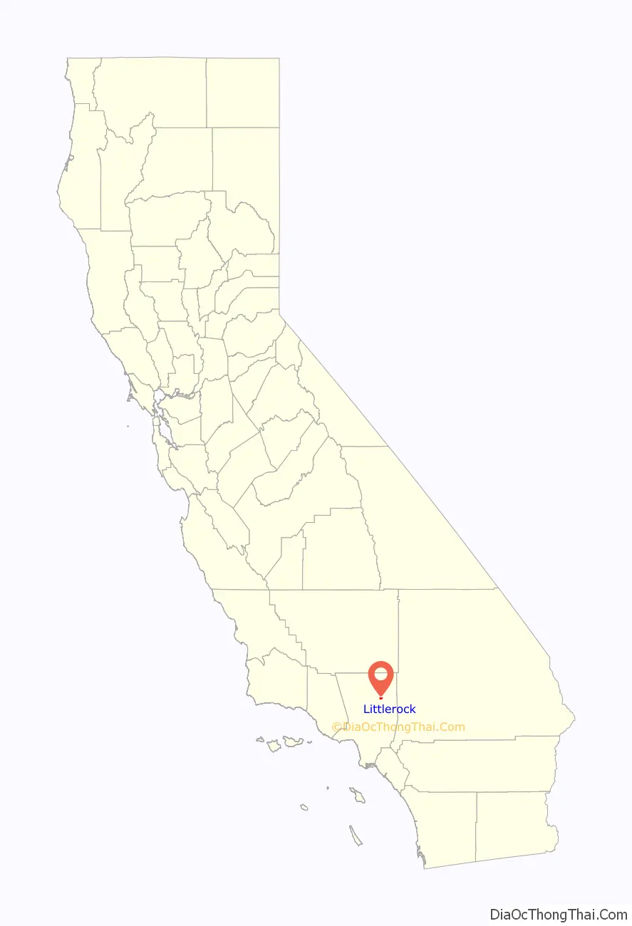
Littlerock location map. Where is Littlerock CDP?
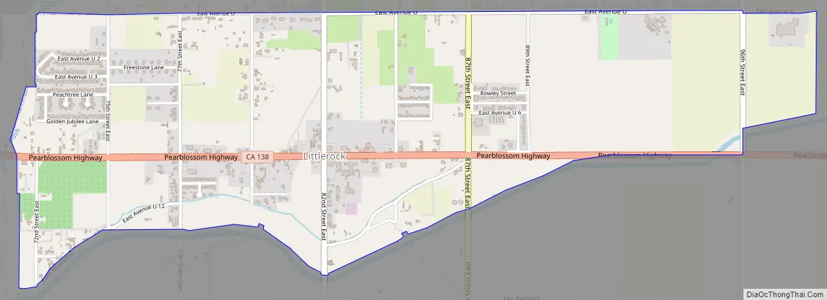
Littlerock Road Map
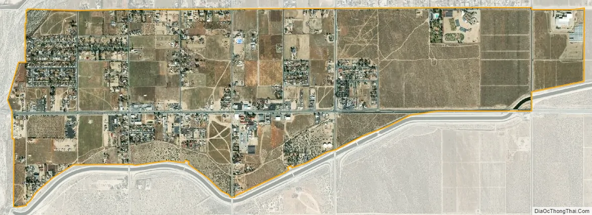
Littlerock city Satellite Map
Geography
Littlerock is located 11 miles (18 km) southeast of Palmdale’s Civic Center. It is surrounded by Palmdale to the northwest, Pearblossom to the southeast, Sun Village to the north, and the San Gabriel Mountains to the south.
According to the United States Census Bureau, Littlerock has a total area of 1.8 square miles (4.7 km), over 99% of it land.
See also
Map of California State and its subdivision:- Alameda
- Alpine
- Amador
- Butte
- Calaveras
- Colusa
- Contra Costa
- Del Norte
- El Dorado
- Fresno
- Glenn
- Humboldt
- Imperial
- Inyo
- Kern
- Kings
- Lake
- Lassen
- Los Angeles
- Madera
- Marin
- Mariposa
- Mendocino
- Merced
- Modoc
- Mono
- Monterey
- Napa
- Nevada
- Orange
- Placer
- Plumas
- Riverside
- Sacramento
- San Benito
- San Bernardino
- San Diego
- San Francisco
- San Joaquin
- San Luis Obispo
- San Mateo
- Santa Barbara
- Santa Clara
- Santa Cruz
- Shasta
- Sierra
- Siskiyou
- Solano
- Sonoma
- Stanislaus
- Sutter
- Tehama
- Trinity
- Tulare
- Tuolumne
- Ventura
- Yolo
- Yuba
- Alabama
- Alaska
- Arizona
- Arkansas
- California
- Colorado
- Connecticut
- Delaware
- District of Columbia
- Florida
- Georgia
- Hawaii
- Idaho
- Illinois
- Indiana
- Iowa
- Kansas
- Kentucky
- Louisiana
- Maine
- Maryland
- Massachusetts
- Michigan
- Minnesota
- Mississippi
- Missouri
- Montana
- Nebraska
- Nevada
- New Hampshire
- New Jersey
- New Mexico
- New York
- North Carolina
- North Dakota
- Ohio
- Oklahoma
- Oregon
- Pennsylvania
- Rhode Island
- South Carolina
- South Dakota
- Tennessee
- Texas
- Utah
- Vermont
- Virginia
- Washington
- West Virginia
- Wisconsin
- Wyoming


