Lomita (Spanish for “Little hill”) is a city in Los Angeles County, California, United States. The population was 20,921 at the 2020 census, up from 20,256 at the 2010 census.
| Name: | Lomita city |
|---|---|
| LSAD Code: | 25 |
| LSAD Description: | city (suffix) |
| State: | California |
| County: | Los Angeles County |
| Incorporated: | June 30, 1964 |
| Elevation: | 95 ft (29 m) |
| Total Area: | 1.91 sq mi (4.95 km²) |
| Land Area: | 1.91 sq mi (4.95 km²) |
| Water Area: | 0.00 sq mi (0.00 km²) 0% |
| Total Population: | 20,921 |
| Population Density: | 11,000/sq mi (4,200/km²) |
| ZIP code: | 90717 |
| Area code: | 310/424 |
| FIPS code: | 0642468 |
| Website: | www.lomita.com/cityhall |
Online Interactive Map
Click on ![]() to view map in "full screen" mode.
to view map in "full screen" mode.
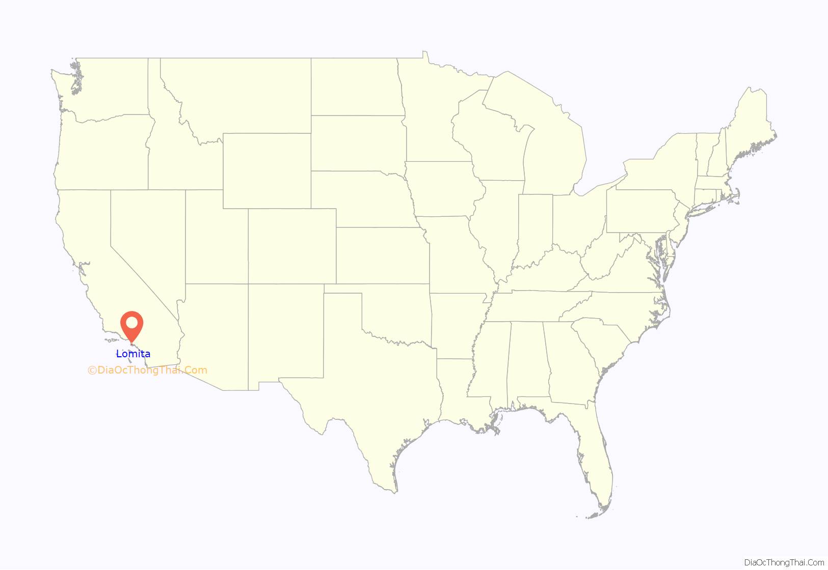
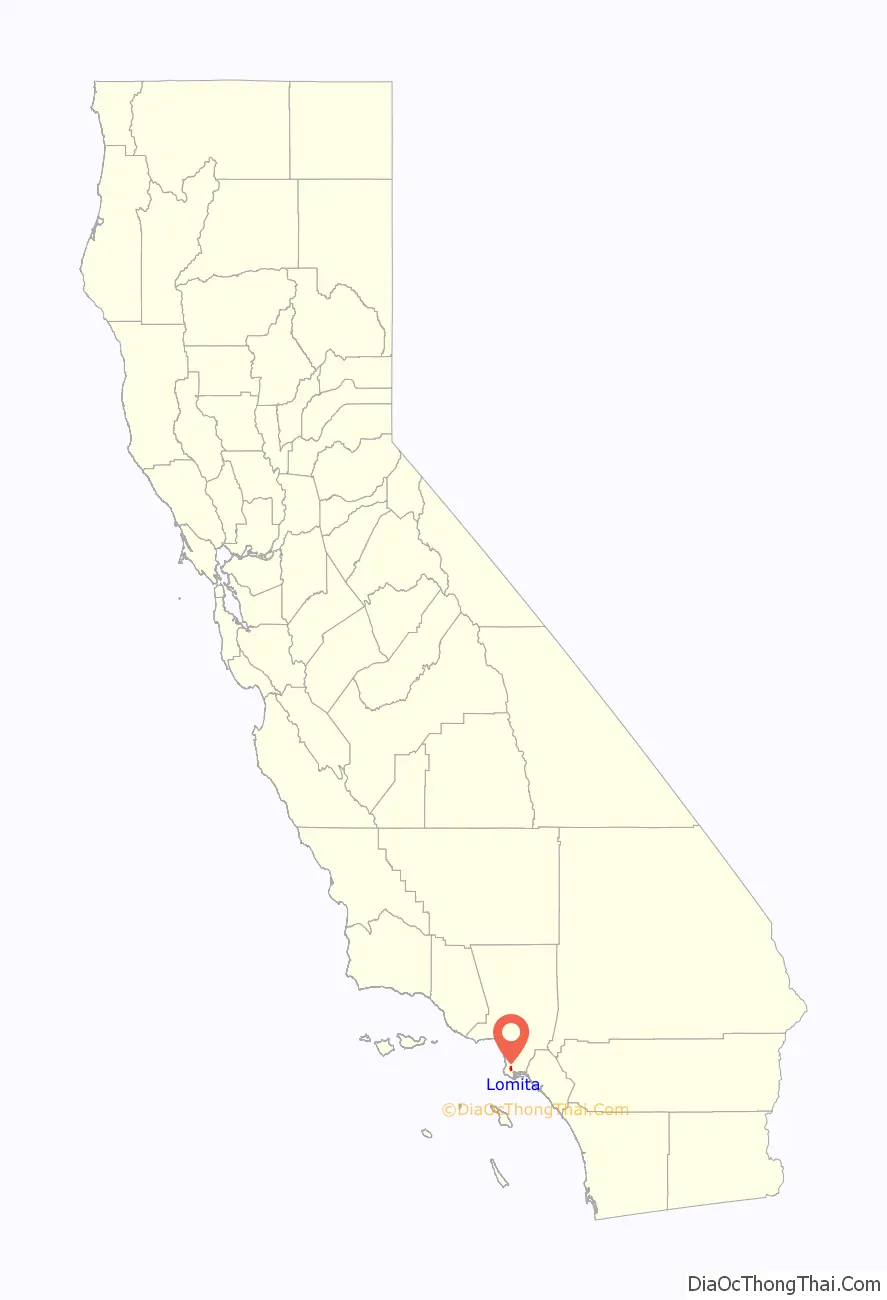
Lomita location map. Where is Lomita city?
History
The Spanish Empire had expanded into this area when the Viceroy of New Spain commissioned Juan Rodríguez Cabrillo to explore the Pacific Ocean in 1542–1543. In 1767, the area became part of the Province of the Californias (Spanish: Provincia de las Californias).
In 1784, the Spanish Crown deeded Rancho San Pedro, a tract of over 75,000 acres (300 km), to soldier Juan José Domínguez. The rancho changed in size over the years, as Domínguez’s descendants partitioned the land amongst family members, sold parcels to newly arriving settlers, or relinquished some when validating their legal claim with the Mexican government in 1828, and with the United States government in 1858. The Domínguez family name is still applied throughout the area, including the Dominguez Rancho Adobe historical landmark, in the unincorporated community of Rancho Dominguez, located northeast of Lomita.
Lomita was incorporated as a city on June 30, 1964, to prevent further annexation by neighboring cities and in an attempt to curtail the development of high-rise apartment buildings.
Lomita established a sister city relationship with Takaishi, Osaka, Japan, in October 1981.
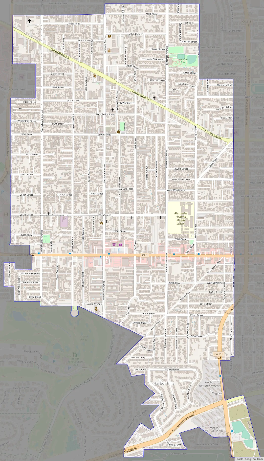
Lomita Road Map
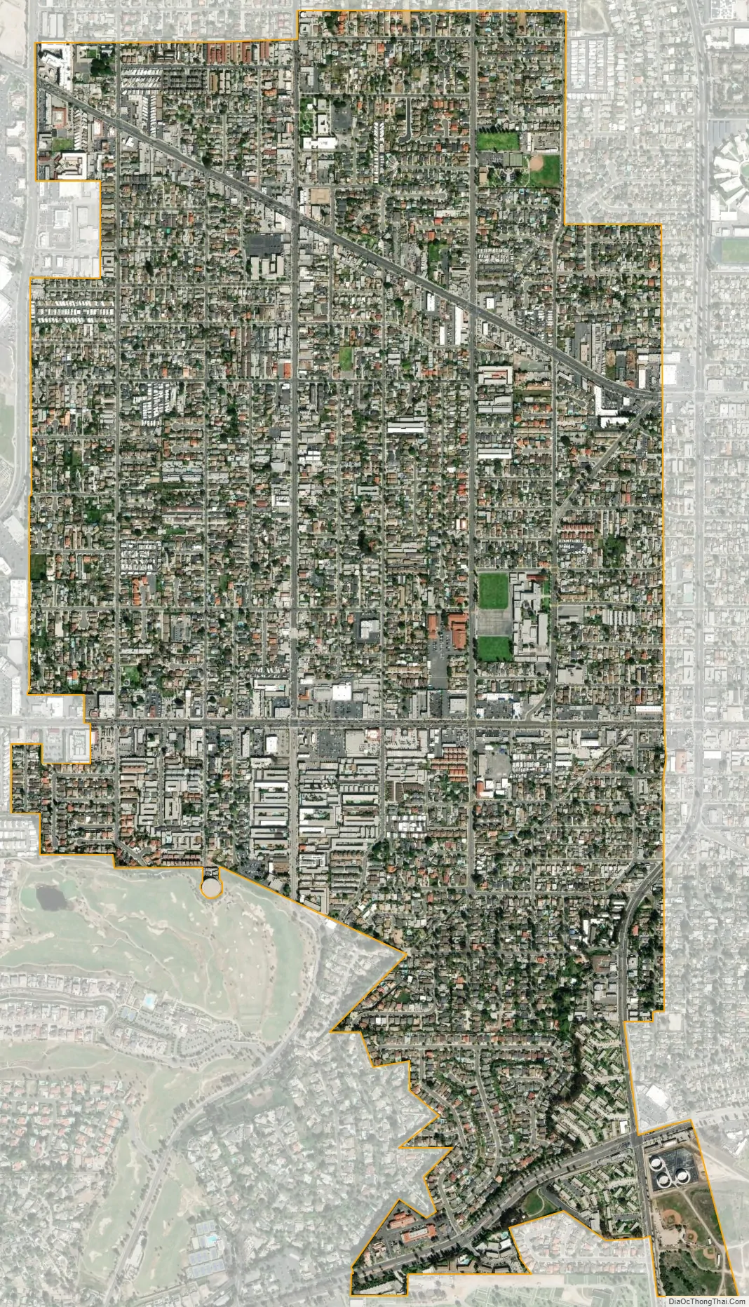
Lomita city Satellite Map
Geography
According to the United States Census Bureau, the city has a total area of 1.9 square miles (4.9 km), all of which is land.
Lomita originally spanned 7 square miles (18 km). However, over time, much of this area was annexed by neighboring cities. A notable example is “Lomita Fields”, now Zamperini Field (the Torrance Municipal Airport).
Climate
According to the Köppen Climate Classification system, Lomita has a semi-arid climate, abbreviated “BSk” on climate maps.
See also
Map of California State and its subdivision:- Alameda
- Alpine
- Amador
- Butte
- Calaveras
- Colusa
- Contra Costa
- Del Norte
- El Dorado
- Fresno
- Glenn
- Humboldt
- Imperial
- Inyo
- Kern
- Kings
- Lake
- Lassen
- Los Angeles
- Madera
- Marin
- Mariposa
- Mendocino
- Merced
- Modoc
- Mono
- Monterey
- Napa
- Nevada
- Orange
- Placer
- Plumas
- Riverside
- Sacramento
- San Benito
- San Bernardino
- San Diego
- San Francisco
- San Joaquin
- San Luis Obispo
- San Mateo
- Santa Barbara
- Santa Clara
- Santa Cruz
- Shasta
- Sierra
- Siskiyou
- Solano
- Sonoma
- Stanislaus
- Sutter
- Tehama
- Trinity
- Tulare
- Tuolumne
- Ventura
- Yolo
- Yuba
- Alabama
- Alaska
- Arizona
- Arkansas
- California
- Colorado
- Connecticut
- Delaware
- District of Columbia
- Florida
- Georgia
- Hawaii
- Idaho
- Illinois
- Indiana
- Iowa
- Kansas
- Kentucky
- Louisiana
- Maine
- Maryland
- Massachusetts
- Michigan
- Minnesota
- Mississippi
- Missouri
- Montana
- Nebraska
- Nevada
- New Hampshire
- New Jersey
- New Mexico
- New York
- North Carolina
- North Dakota
- Ohio
- Oklahoma
- Oregon
- Pennsylvania
- Rhode Island
- South Carolina
- South Dakota
- Tennessee
- Texas
- Utah
- Vermont
- Virginia
- Washington
- West Virginia
- Wisconsin
- Wyoming


