Matheny is a census-designated place (CDP) in Tulare County, California. Matheny sits at an elevation of 269 feet (82 m). The 2010 United States census reported Matheny’s population was 1,212.
Matheny’s water system, Pratt Mutual, has elevated arsenic levels. Matheny residents are attempting to merge Pratt Mutual into Tulare‘s water utility. On April 1, 2016, the State Water Resource Control Board issued a mandatory water system consolidation order directing the City of Tulare to connect Matheny Tract to the Tulare County water system.
| Name: | Matheny CDP |
|---|---|
| LSAD Code: | 57 |
| LSAD Description: | CDP (suffix) |
| State: | California |
| County: | Tulare County |
| Elevation: | 269 ft (82 m) |
| Total Area: | 0.430 sq mi (1.113 km²) |
| Land Area: | 0.430 sq mi (1.113 km²) |
| Water Area: | 0 sq mi (0 km²) 0% |
| Total Population: | 1,212 |
| Population Density: | 2,800/sq mi (1,100/km²) |
| FIPS code: | 0646223 |
| GNISfeature ID: | 2585433 |
Online Interactive Map
Click on ![]() to view map in "full screen" mode.
to view map in "full screen" mode.
Matheny location map. Where is Matheny CDP?


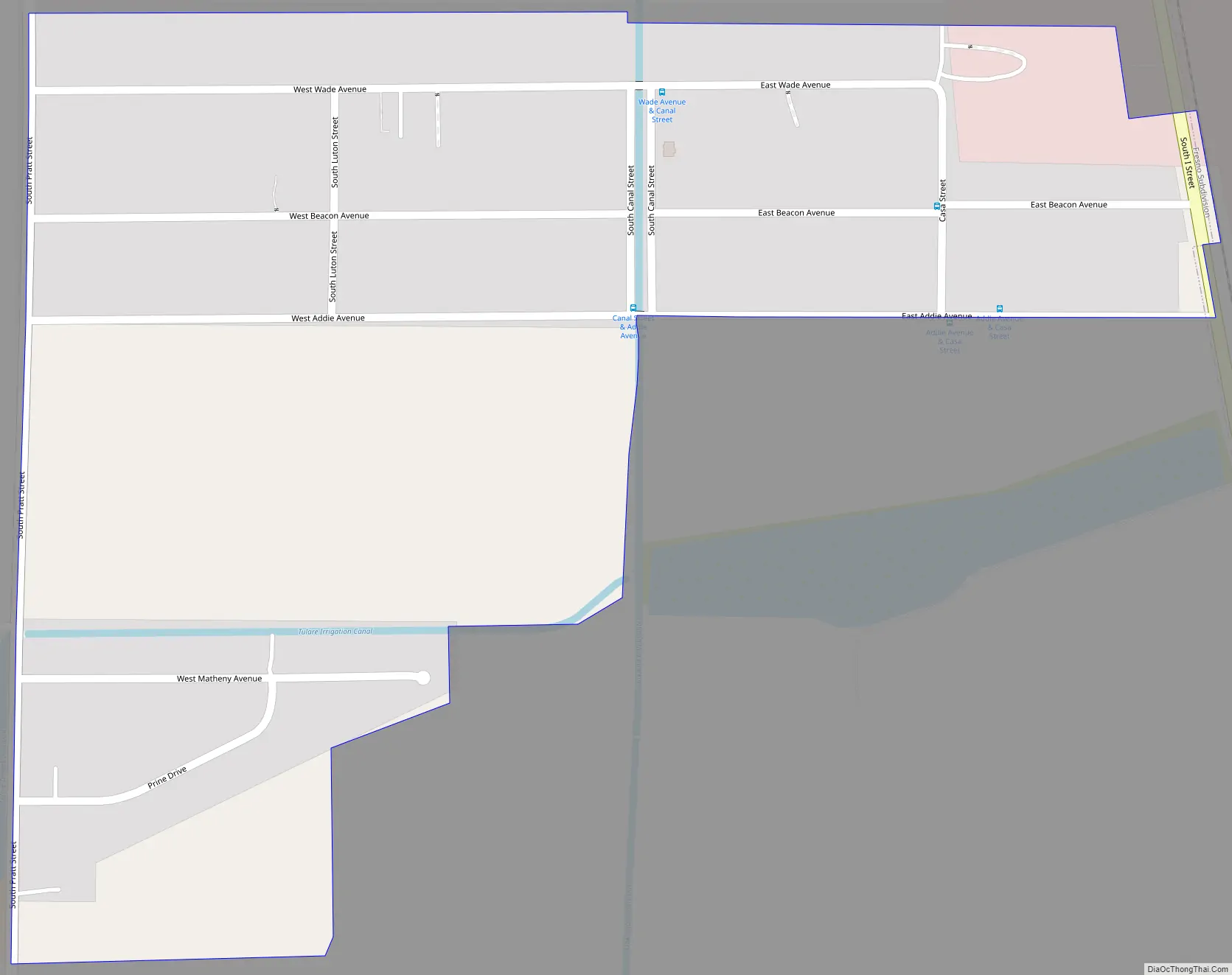
Matheny Road Map
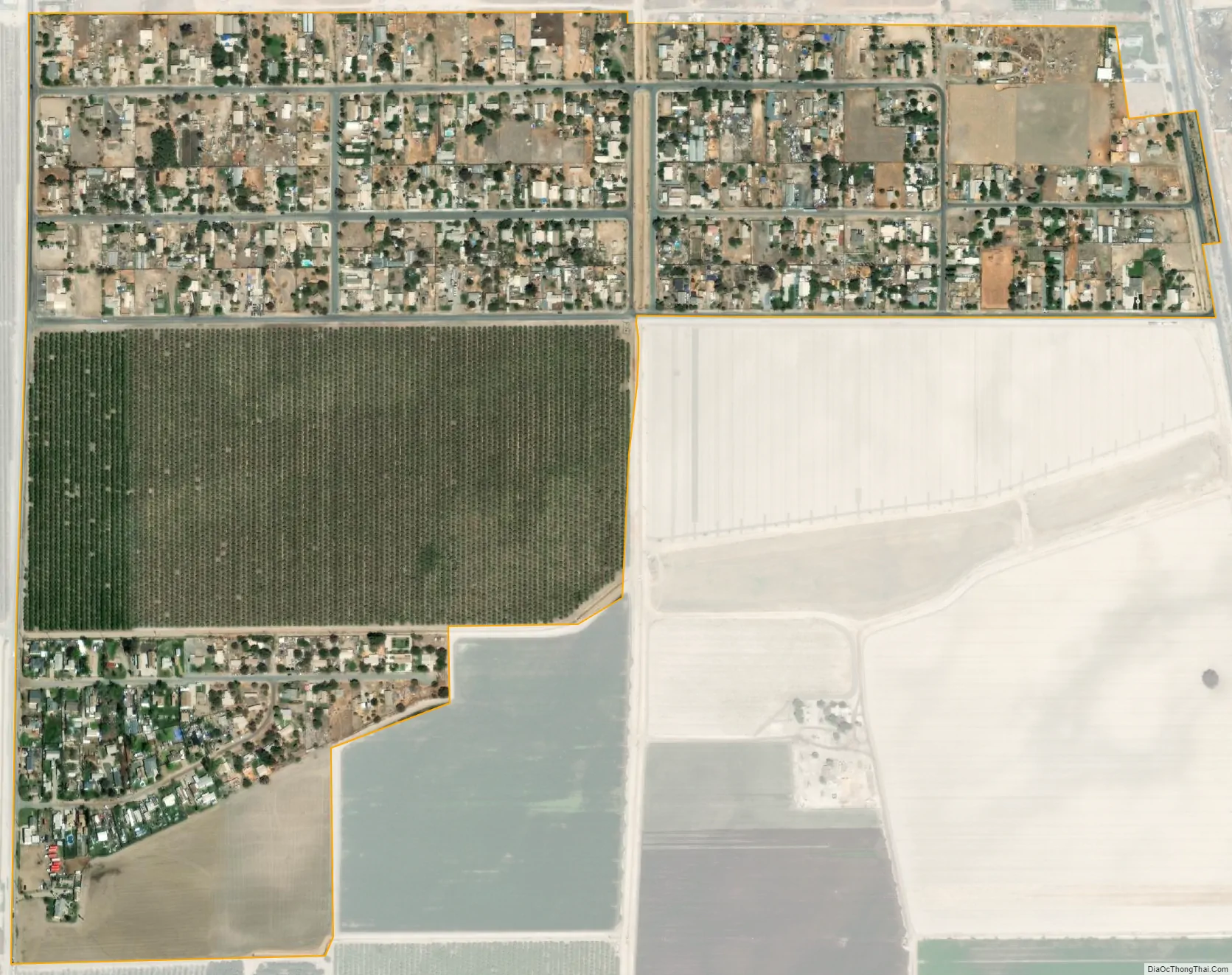
Matheny city Satellite Map
Geography
According to the United States Census Bureau, the CDP covers an area of 0.4 square miles (1.1 km), all of it land.
See also
Map of California State and its subdivision:- Alameda
- Alpine
- Amador
- Butte
- Calaveras
- Colusa
- Contra Costa
- Del Norte
- El Dorado
- Fresno
- Glenn
- Humboldt
- Imperial
- Inyo
- Kern
- Kings
- Lake
- Lassen
- Los Angeles
- Madera
- Marin
- Mariposa
- Mendocino
- Merced
- Modoc
- Mono
- Monterey
- Napa
- Nevada
- Orange
- Placer
- Plumas
- Riverside
- Sacramento
- San Benito
- San Bernardino
- San Diego
- San Francisco
- San Joaquin
- San Luis Obispo
- San Mateo
- Santa Barbara
- Santa Clara
- Santa Cruz
- Shasta
- Sierra
- Siskiyou
- Solano
- Sonoma
- Stanislaus
- Sutter
- Tehama
- Trinity
- Tulare
- Tuolumne
- Ventura
- Yolo
- Yuba
- Alabama
- Alaska
- Arizona
- Arkansas
- California
- Colorado
- Connecticut
- Delaware
- District of Columbia
- Florida
- Georgia
- Hawaii
- Idaho
- Illinois
- Indiana
- Iowa
- Kansas
- Kentucky
- Louisiana
- Maine
- Maryland
- Massachusetts
- Michigan
- Minnesota
- Mississippi
- Missouri
- Montana
- Nebraska
- Nevada
- New Hampshire
- New Jersey
- New Mexico
- New York
- North Carolina
- North Dakota
- Ohio
- Oklahoma
- Oregon
- Pennsylvania
- Rhode Island
- South Carolina
- South Dakota
- Tennessee
- Texas
- Utah
- Vermont
- Virginia
- Washington
- West Virginia
- Wisconsin
- Wyoming


