Maywood is a small Gateway city in Los Angeles County. At 1.18 square miles (3.1 km), Maywood is the third-smallest incorporated city in Los Angeles County. It is bordered by the cities of Bell on the south, Vernon on the north and west, Huntington Park on the southwest, and Commerce on the east.
As of July 1, 2010, Maywood became the first municipality in California to outsource all of its city services, dismantling its police department, laying off all city employees except for the city manager, city attorney and elected officials, and contracting with outside agencies for the provision of all municipal services. The population was 27,395 at the 2010 census.
| Name: | Maywood city |
|---|---|
| LSAD Code: | 25 |
| LSAD Description: | city (suffix) |
| State: | California |
| County: | Los Angeles County |
| Incorporated: | September 2, 1924 |
| Elevation: | 151 ft (46 m) |
| Total Area: | 1.18 sq mi (3.05 km²) |
| Land Area: | 1.18 sq mi (3.05 km²) |
| Water Area: | 0.00 sq mi (0.00 km²) 0% |
| Total Population: | 27,395 |
| Population Density: | 22,897.28/sq mi (8,837.52/km²) |
| ZIP code: | 90270 |
| Area code: | 213 / 323 |
| FIPS code: | 0646492 |
| GNISfeature ID: | 1661000 |
| Website: | www.cityofmaywood.com |
Online Interactive Map
Click on ![]() to view map in "full screen" mode.
to view map in "full screen" mode.
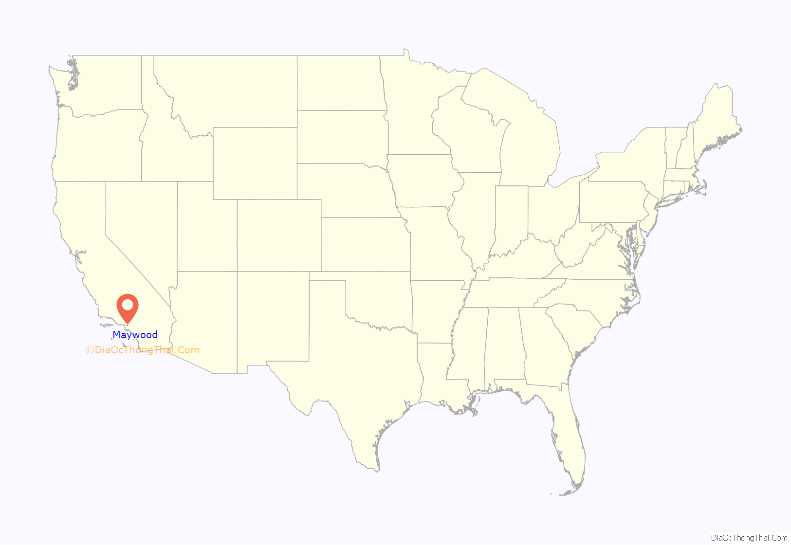
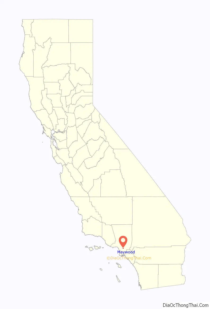
Maywood location map. Where is Maywood city?
History
The land on which Maywood now stands had been populated by Native American tribes for centuries. The area that would later become Maywood was deeded in 1781 by the Spanish monarchy to Spanish War veteran Manuel Nieto. When the settlement of Pueblo de Nuestra Senora de Los Angeles was recorded, it included the cow pasture (now Maywood) that eventually turned into a rancho.
In 1919, May Wood, a popular young woman who worked for the real estate corporation developing the 2,300 acres (930 hectares) ranch into home tracts, agreed to lend her name to the property. The development of Maywood later survived a bitter challenge to dissolve the prospective city in early 1924.
On September 2, 1924, Maywood’s citizens voted to incorporate. By 1924, the population of Maywood had reached 1,000. Maywood Parks and Recreation built Maywood Park, had its beginnings in the 1930s, when a large meadow was turned into a baseball field. The Golden State Baseball Association made Maywood Park its home in the early 1950s.
The Chrysler Corporation had an auto assembly plant in Maywood from the 1920s until its closing in July 1971. It was located at 5800 Eastern Avenue at Slauson, and was generally referred to as the “Los Angeles” Plant. When the city of Commerce was incorporated in 1961, that corner was annexed as were several in the surrounding area.
Maywood Assembly was a Ford Motor Company assembly plant also located in Maywood, that operated from 1948 until 1957. The address was 5801 S. Eastern Avenue, and it was across the street from the Chrysler Assembly factory, and exclusively built Lincoln and Mercury vehicles. The factory was closed and demolished when operations at Maywood and Long Beach were combined into a new factory in Pico Rivera in 1958.
Willys-Overland built its California factory in Maywood, California, in 1929 at the current location of 6201 Randolph Street. Over 900 people were employed at the new $1.5 million assembly plant. Willys-Overland became the second automobile manufacturer to build a major plant in the city. After the United States entered World War II, automobile production for civilians was phased out and in November 1941, automobile assembly at Maywood was stopped. A great many automobile plants were retooled to manufacture war machinery and for three years during the war, the Lockheed Aircraft Corporation rented the plant building from Willys-Overland for that purpose. Equipment was installed for the manufacture of sub-assemblies for Hudson Bombers until the war ended. Willys-Overland began to manufacture the first Jeeps (CJ-2As) for civilians in 1945. As the demand for Jeeps increased, the reconditioning of the plant back to automobile assembly began early in 1947 and by November, Willys was building “West Coast” CJ-2As. By the end of November, 108 Jeeps had been assembled. Jeep Trucks and Station Wagons were incorporated into the West Coast Division’s “final assemblies” production lines in 1948. The Maywood plant produced the entire CJ-3A model production duration and about 5% of all CJ-3As were assembled in California. In 1952, Willys-Overland introduced a new post-war model car, the Aero, and they were assembled in both Maywood and Toledo. The entire plant was shut down in 1954.
The Consolidated Steel Corporation had its main plant at Maywood since the early 1930s. Consolidated built prefabricated ship sections in Maywood during World War II and large diameter oil and gas line pipe in the 1950s.
2010 city layoffs
Maywood officials were given notice in June 2009 that the city would lose its insurance coverage unless they implemented a 20-point performance plan. Maywood also owed the California Insurance Authority $927,135 and had been making interest-only payments. Mainly because of the troubled history, including multiple lawsuits, and the dubious reputation of the Maywood Police Department, the city’s Liability and Workers Compensation insurer notified the city in August 2009, that it would cancel its coverage effective July 1, 2010. When the city was unable to find coverage elsewhere, it disbanded its police department, laid off all city employees, except for the city manager, city attorney and elected officials, and contracted with other agencies to provide all municipal services.
An outside audit found that Maywood was losing approximately $620,000 annually from its $10 million general fund budget under the previous seven-year contract with nearby Cudahy, because they had neglected to bill Cudahy for administration, vehicle maintenance or insurance. The firm concluded that Maywood was losing about $620,000 a year, or a total of about $4 million in the last six years. George Perez, Cudahy’s city manager, said Maywood’s “politics have been getting in the way.” Perez said that he and Paul Philips, then acting Maywood City Manager, would agree on a new contract, but the Maywood City Council would then send Philips back for further negotiation. Perez said that negotiations disintegrated in February, after Philips resigned.
Councilman Felipe Aguirre said, “We don’t want to file for bankruptcy. We don’t want to disappear as a city.” Aguirre said filing for bankruptcy was not an option for Maywood because its problems were related specifically to insurance coverage. Several cities in the state have said that they are close to bankruptcy because of the sharp drop in sales and property tax revenues caused by the deepest recession in decades. During a heated City Council meeting in June 2010, opponents of the plan accused council members of mismanaging the city by failing to maintain insurance coverage. Under the plan adopted by the City Council that night, council members would continue to be paid to set policy, but all services would be contracted out. “You single-handedly destroyed the city,” Lizeth Sandoval, the city treasurer, told the City Council. Sandoval, a city employee, spoke out as a private citizen, and was laid off as part of the cuts.
Though Maywood officials stopped short of filing for bankruptcy or even giving up the city’s municipal status, the city still faces a serious problem with a huge deficit. The city did keep a few employees as independent contractors when they outsourced most city functions to Bell and police duties to the Los Angeles County Sheriff’s Department. In September 2010, the troubled nearby city of Bell agreed to cancel the contract to handle the day-to-day operations of neighboring Maywood. Maywood has been overrun with political crises, from recalls to a city clerk accused of trying to contract a hit man to kill Councilman Aguirre. In early 2006, a newly elected Aguirre called Maywood a “sanctuary city” for illegal immigrants, stating: “I think we needed to amplify the debate by saying that no human being is illegal. These people are here … making your clothes, shining your shoes and taking care of your kids. And now you want to develop this hypocritical policy?” “Maywood’s actions have made the town a lightning rod for criticism on conservative radio shows and websites.”
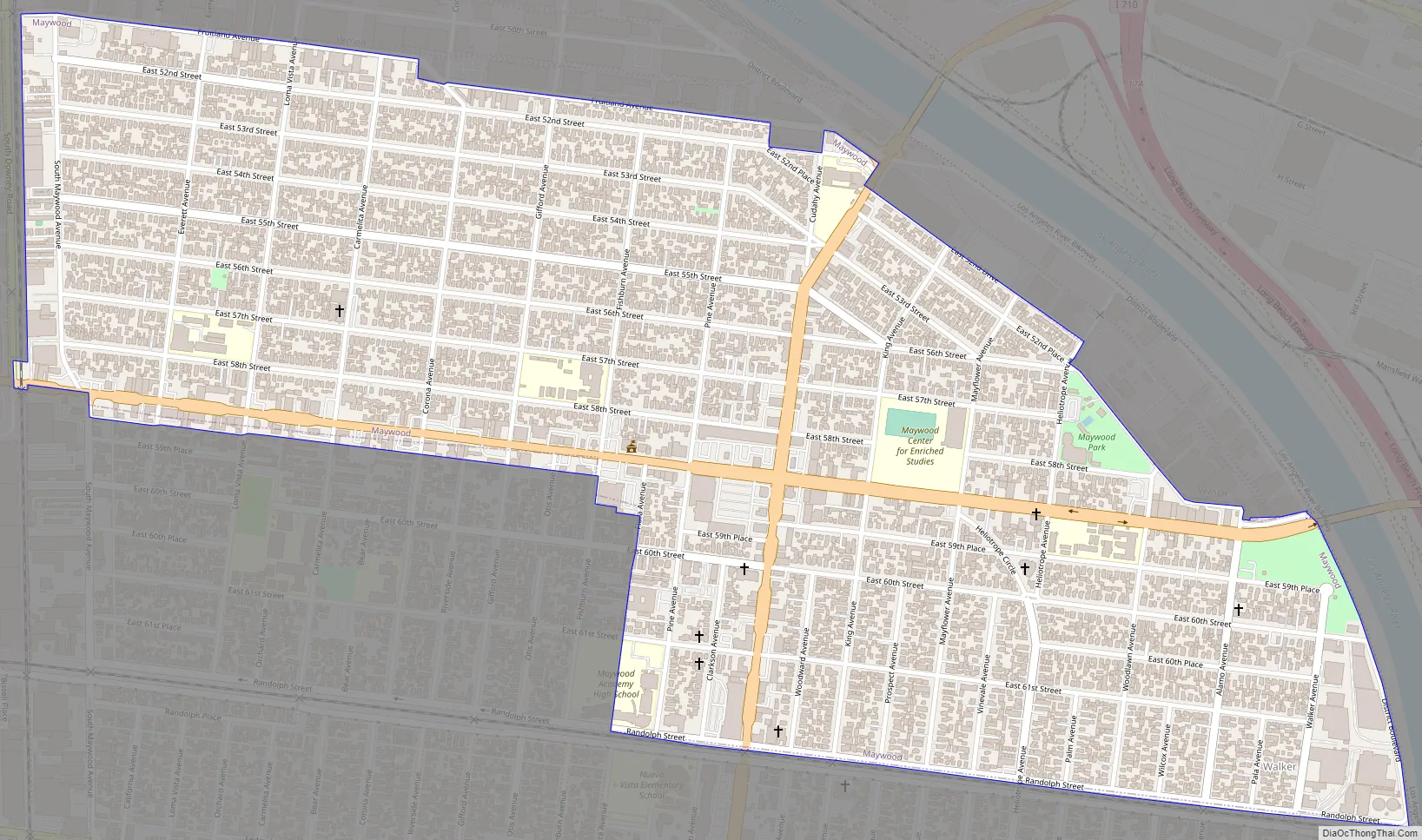
Maywood Road Map
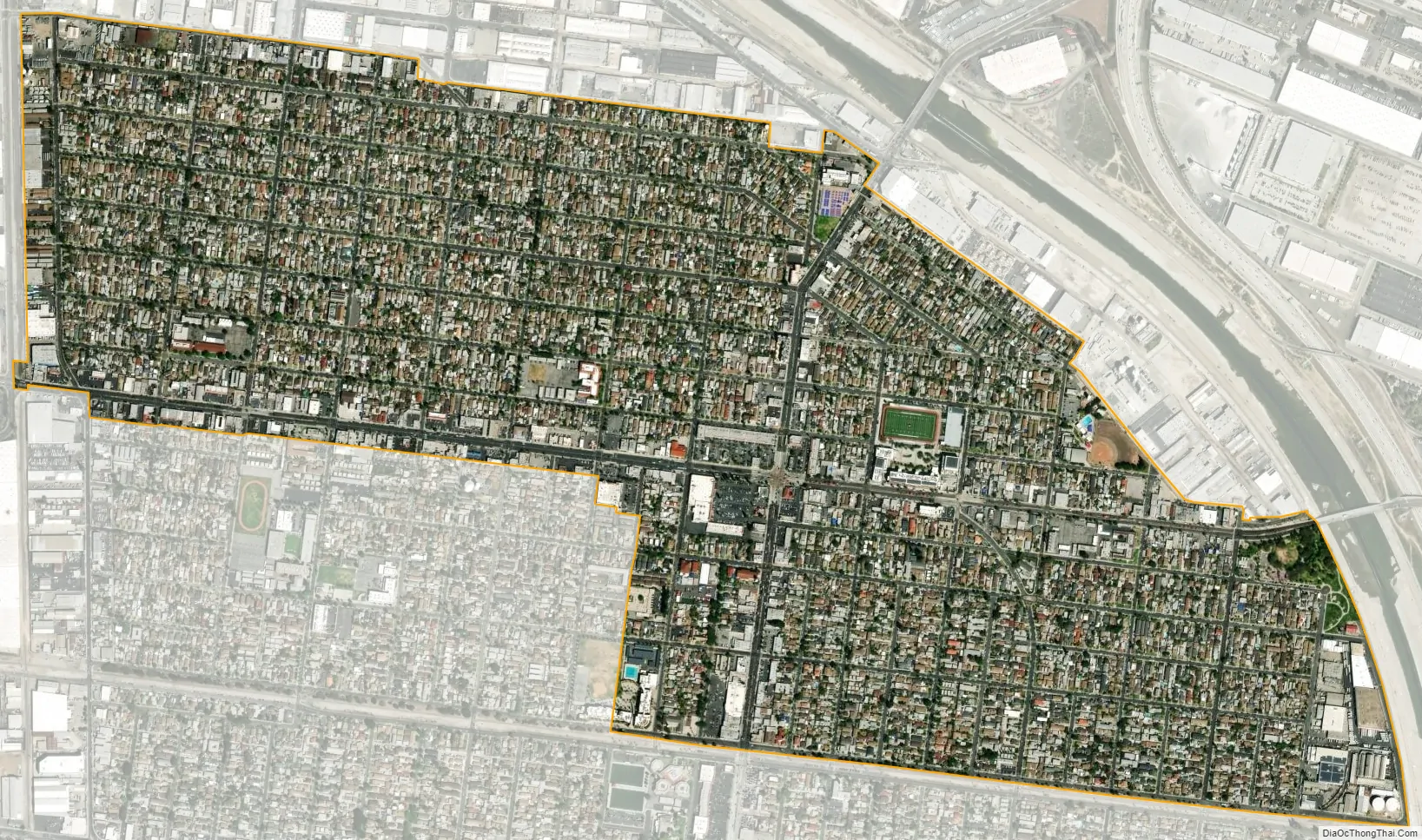
Maywood city Satellite Map
Geography
According to the United States Census Bureau, the city has a total area of 1.2 square miles (3.1 km), all land.
It is 8 miles (13 km) southeast from Downtown Los Angeles Financial District and only 2 miles (3.2 km) east of the Los Angeles city limit on Slauson Ave and Alameda St in the Central-Alameda neighborhood. Maywood is part of the Gateway Cities region of southeastern Los Angeles County area. Maywood is bordered by the city of Bell on the south, Vernon on the north and west, Huntington Park on the southwest, and Commerce on the east.
Climate
The climate in the city of Maywood is very warm during summer when high temperatures tend to be in the 80s and mild during winter when high temperatures tend to be in the 60s. The warmest month of the year is August with an average maximum temperature of 89.40 °F (31.89 °C), while the coldest month of the year is December with an average minimum temperature of 47.30 °F (8.50 °C). Temperature variations between night and day tend to be moderate during summer with a difference that can reach 24 °F (13.3 °C), and moderate during winter with an average difference of 22 °F (12.2 °C). The annual average precipitation at Maywood is 15.07 inches (383 mm). The wettest month of the year is February with an average rainfall of 3.75 inches (95 mm). Maywood-area historical tornado activity is significantly above California state average. It is 75% smaller than the overall U.S. average. On November 7, 1966, a category 2 (max. wind speeds 113-157 mph) tornado 6.2 miles (10.0 km) away from the Maywood city center injured 10 people and caused between $50,000 and $500,000 in damages.
See also
Map of California State and its subdivision:- Alameda
- Alpine
- Amador
- Butte
- Calaveras
- Colusa
- Contra Costa
- Del Norte
- El Dorado
- Fresno
- Glenn
- Humboldt
- Imperial
- Inyo
- Kern
- Kings
- Lake
- Lassen
- Los Angeles
- Madera
- Marin
- Mariposa
- Mendocino
- Merced
- Modoc
- Mono
- Monterey
- Napa
- Nevada
- Orange
- Placer
- Plumas
- Riverside
- Sacramento
- San Benito
- San Bernardino
- San Diego
- San Francisco
- San Joaquin
- San Luis Obispo
- San Mateo
- Santa Barbara
- Santa Clara
- Santa Cruz
- Shasta
- Sierra
- Siskiyou
- Solano
- Sonoma
- Stanislaus
- Sutter
- Tehama
- Trinity
- Tulare
- Tuolumne
- Ventura
- Yolo
- Yuba
- Alabama
- Alaska
- Arizona
- Arkansas
- California
- Colorado
- Connecticut
- Delaware
- District of Columbia
- Florida
- Georgia
- Hawaii
- Idaho
- Illinois
- Indiana
- Iowa
- Kansas
- Kentucky
- Louisiana
- Maine
- Maryland
- Massachusetts
- Michigan
- Minnesota
- Mississippi
- Missouri
- Montana
- Nebraska
- Nevada
- New Hampshire
- New Jersey
- New Mexico
- New York
- North Carolina
- North Dakota
- Ohio
- Oklahoma
- Oregon
- Pennsylvania
- Rhode Island
- South Carolina
- South Dakota
- Tennessee
- Texas
- Utah
- Vermont
- Virginia
- Washington
- West Virginia
- Wisconsin
- Wyoming


