Oceano (Spanish: Océano, meaning “Ocean”) is a census-designated place (CDP) in San Luis Obispo County, California, United States. The population was 7,286 at the 2010 census, up from 7,260 at the 2000 census.
| Name: | Oceano CDP |
|---|---|
| LSAD Code: | 57 |
| LSAD Description: | CDP (suffix) |
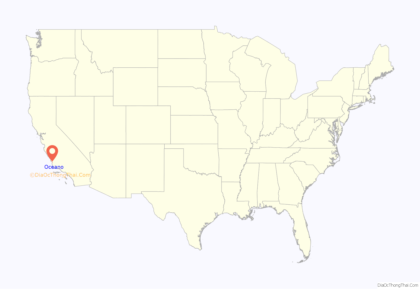
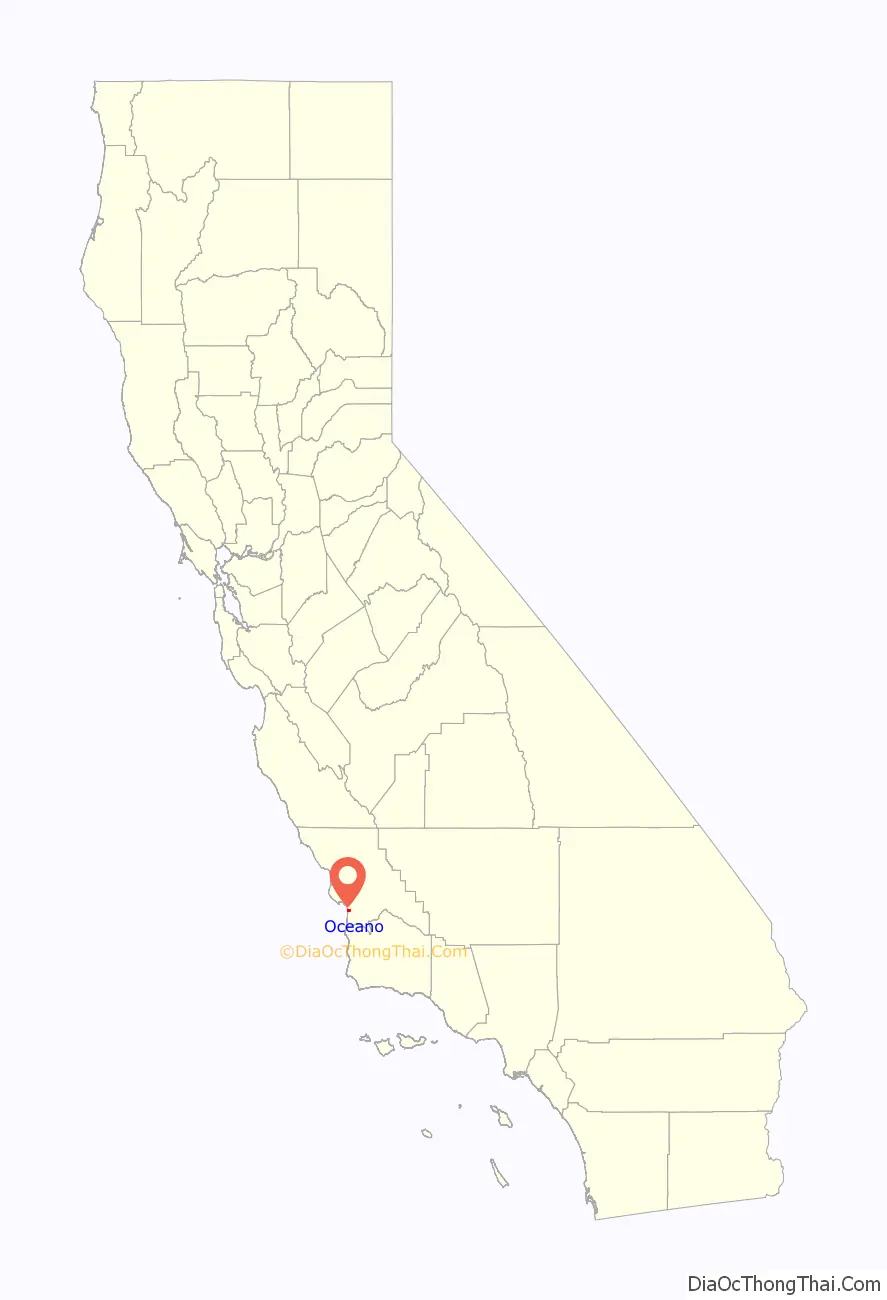
| State: | California |
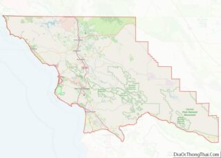
| County: | San Luis Obispo County |
| Elevation: | 30 ft (9 m) |
| Total Area: | 1.547 sq mi (4.006 km²) |
| Land Area: | 1.532 sq mi (3.967 km²) |
| Water Area: | 0.015 sq mi (0.039 km²) 0.98% |
| Total Population: | 7,286 |
| Population Density: | 4,700/sq mi (1,800/km²) |
| ZIP code: | 93445, 93475 |
| Area code: | 805 |
| FIPS code: | 0653294 |
| GNISfeature ID: | 1652760 |
Online Interactive Map
Click on ![]() to view map in "full screen" mode.
to view map in "full screen" mode.
Oceano location map. Where is Oceano CDP?
History
The environs of Oceano were the home of “Halcyon,” a utopian religious community established in 1903 by the theosophical Temple of the People, based in Syracuse, New York. The group, which believed in channeling unseen electromagnetic forces in an effort to attain human perfection, constructed a number of buildings in association with their colonizing effort, including the Blue Star Memorial Temple and the Halcyon Hotel and Sanatorium.
In 1948, Oceano, was the site of the founding by Catherine Nimmo (a registered nurse and Doctor of Chiropractic who had recently moved there from the Netherlands) and Rubin Abramowitz (an engineer) of the U.S. Vegan Society, the first vegan society in the United States. The Society lasted from 1948–1960 and was a predecessor to the American Vegan Society.
Oceano Road Map
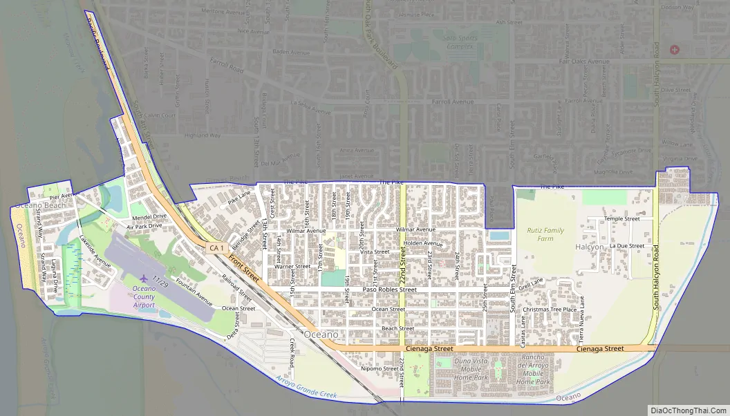
Oceano city Satellite Map

Geography
Oceano is located at 35°6′10″N 120°36′41″W / 35.10278°N 120.61139°W / 35.10278; -120.61139 (35.102680, -120.611471).
Oceano is part of the 5 Cities Metropolitan Area. According to the United States Census Bureau, the CDP has a total area of 1.5 square miles (3.9 km), of which, 1.5 square miles (3.9 km) of it is land and 0.02 square miles (0.052 km) of it (0.98%) is water.
Oceano’s beach is the Oceano Dunes State Vehicular Recreation Area, a 1,500 acres (6.1 km) coastal sand dune. As the only state park in California where visitors may drive vehicles on the beach, tourists are attracted from all over the United States. Activities on this beach include riding the sand dunes on all-terrain-vehicles, swimming, clamming, camping, surfing, surf fishing, hiking, and bird watching.
See also
Map of California State and its subdivision:- Alameda
- Alpine
- Amador
- Butte
- Calaveras
- Colusa
- Contra Costa
- Del Norte
- El Dorado
- Fresno
- Glenn
- Humboldt
- Imperial
- Inyo
- Kern
- Kings
- Lake
- Lassen
- Los Angeles
- Madera
- Marin
- Mariposa
- Mendocino
- Merced
- Modoc
- Mono
- Monterey
- Napa
- Nevada
- Orange
- Placer
- Plumas
- Riverside
- Sacramento
- San Benito
- San Bernardino
- San Diego
- San Francisco
- San Joaquin
- San Luis Obispo
- San Mateo
- Santa Barbara
- Santa Clara
- Santa Cruz
- Shasta
- Sierra
- Siskiyou
- Solano
- Sonoma
- Stanislaus
- Sutter
- Tehama
- Trinity
- Tulare
- Tuolumne
- Ventura
- Yolo
- Yuba
- Alabama
- Alaska
- Arizona
- Arkansas
- California
- Colorado
- Connecticut
- Delaware
- District of Columbia
- Florida
- Georgia
- Hawaii
- Idaho
- Illinois
- Indiana
- Iowa
- Kansas
- Kentucky
- Louisiana
- Maine
- Maryland
- Massachusetts
- Michigan
- Minnesota
- Mississippi
- Missouri
- Montana
- Nebraska
- Nevada
- New Hampshire
- New Jersey
- New Mexico
- New York
- North Carolina
- North Dakota
- Ohio
- Oklahoma
- Oregon
- Pennsylvania
- Rhode Island
- South Carolina
- South Dakota
- Tennessee
- Texas
- Utah
- Vermont
- Virginia
- Washington
- West Virginia
- Wisconsin
- Wyoming