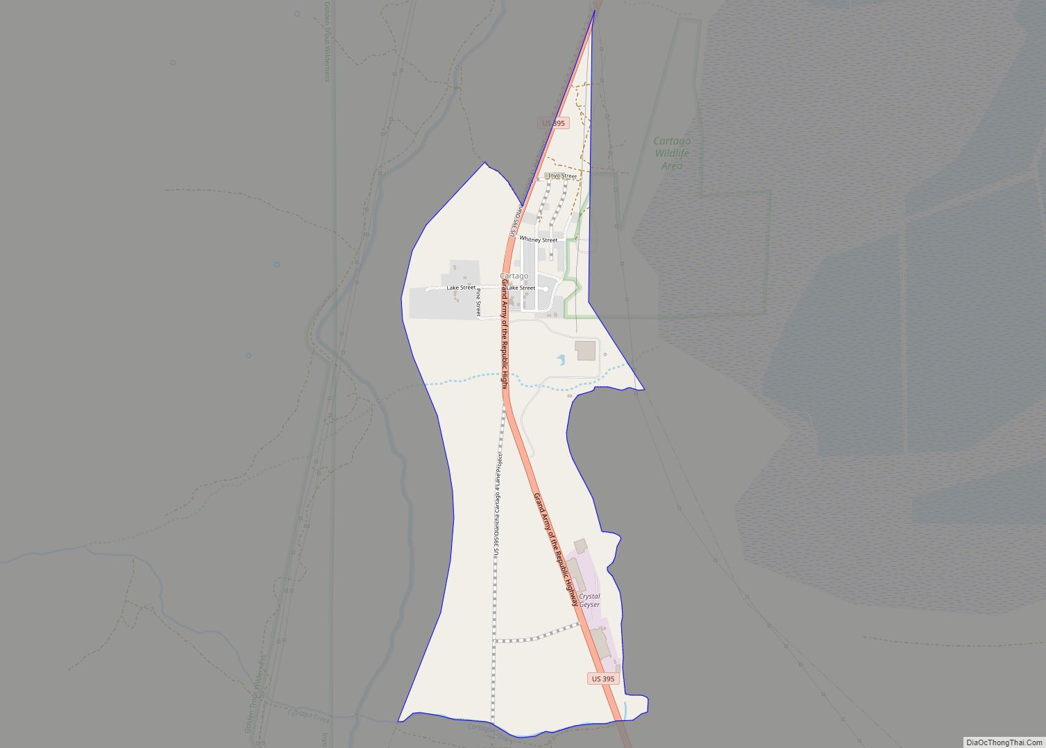
Olancha (Timbisha: Pakwa’ si) is a census designated place in Inyo County of the U.S. state of California. Olancha is located on U.S. Route 395 in California, 37 miles (60 km) south-southeast of Independence, at an elevation of 3658 feet (1115 m). As of the 2010 census, the population was 192, up from 134 at the 2000 census.
Located in the Owens Valley next to the now mostly dry Owens Lake, the arid settlement is home to a major bottled water plant for Crystal Geyser Natural Alpine Spring Water.
| Name: | Olancha CDP |
|---|---|
| LSAD Code: | 57 |
| LSAD Description: | CDP (suffix) |
| State: | California |
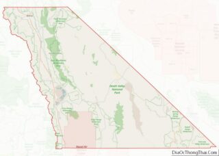
| County: | Inyo County |
| Elevation: | 3,658 ft (1,115 m) |
| Total Area: | 7.872 sq mi (20.388 km²) |
| Land Area: | 7.841 sq mi (20.308 km²) |
| Water Area: | 0.031 sq mi (0.080 km²) 0.39% |
| Total Population: | 192 |
| ZIP code: | 93549 |
| FIPS code: | 0653490 |
| GNISfeature ID: | 272775 |
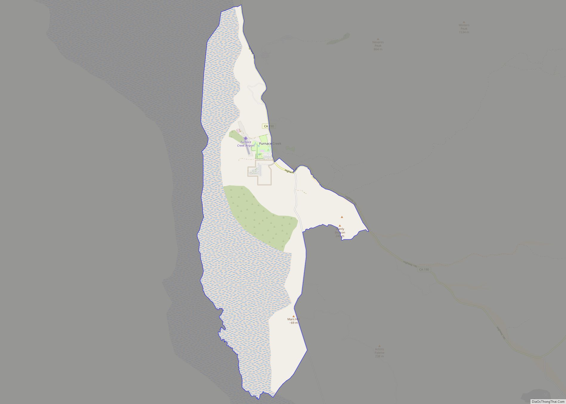
Online Interactive Map
Click on ![]() to view map in "full screen" mode.
to view map in "full screen" mode.
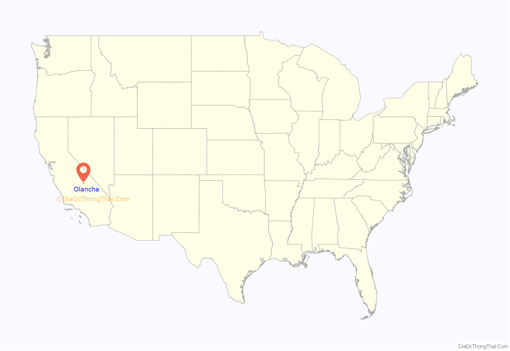
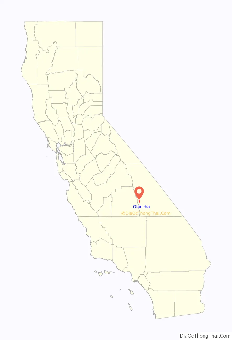
Olancha location map. Where is Olancha CDP?
History
Olancha was established by Minnard Farley, who came to the area in 1860 and discovered silver ore in the nearby Coso Range. The name “Olancha” is believed to be derived from the nearby Yaudanche tribe. For processing the ore, he built a stamp mill just south of Olancha Creek. The remains of a stone wall from this mill still exists and has been designated as a California Historical Site (marker #796).
The first post office at Olancha opened in 1870.
On August 11, 1969 Manson Family members Charles “Tex” Watson and Dianne “Snake” Lake settled down in Olancha two days after Watson had stabbed Sharon Tate to death. Here, Watson bought a newspaper revealing that it still was a mystery who committed the Manson murders and confessed to Lake: “I killed her, Charlie (Manson) ordered me to do so, it was fun”. This fact was witnessed by Lake during the Watson trial in 1971. Lake was shortly put into custody in Independence after complaints from Olancha inhabitants for swimming nude. After a few weeks the two of them left Olancha for the final Manson hideout in Death Valley.
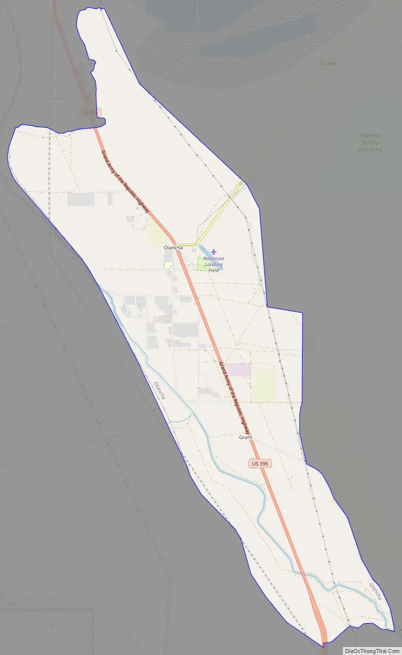
Olancha Road Map
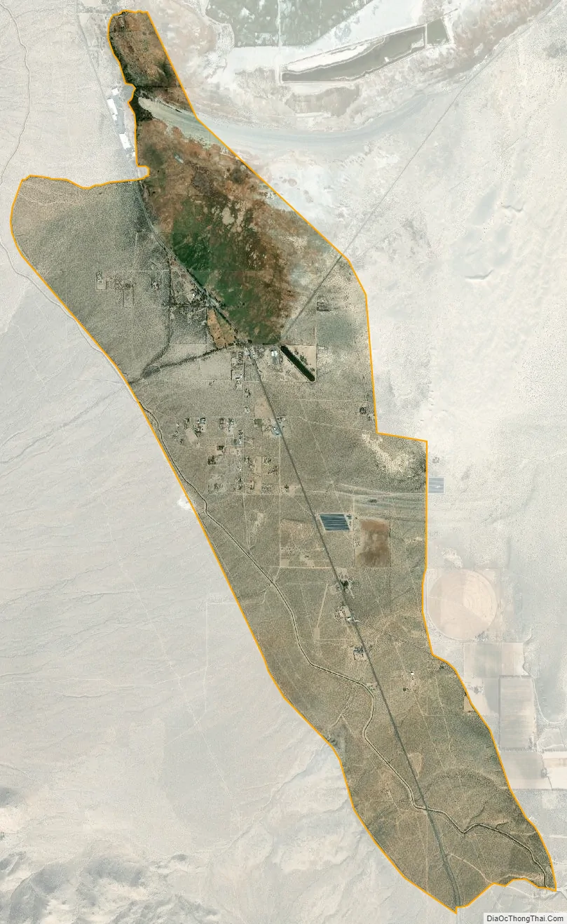
Olancha city Satellite Map
Geography
Olancha is an unincorporated community located in the Owens Valley on the eastern slope of the Sierra Nevada mountain range at the elevation of 3,650 feet (1,110 m), in Inyo County, California. It is on US Highway 395 near the junction of State Route 190, approximately 200 miles (320 km) due north of Los Angeles. Owens Lake – a dry saline lakebed – lies to the northeast of Olancha. Olancha Creek flows from the slopes of nearby Olancha Peak (12,123 ft), passing near the town of Olancha, and finally towards Owens Lake. To the east of town lie some sand dunes, as well as a hot spring known as “Dirty Socks”.
According to the United States Census Bureau, the CDP has a total area of 7.9 square miles (20 km), over 99% of it land.
Climate
According to the Köppen Climate Classification system, Olancha has a cold semi-arid climate, abbreviated “BSk” on climate maps due to it being in the rainshadow of the Sierra Nevada.
See also
Map of California State and its subdivision:- Alameda
- Alpine
- Amador
- Butte
- Calaveras
- Colusa
- Contra Costa
- Del Norte
- El Dorado
- Fresno
- Glenn
- Humboldt
- Imperial
- Inyo
- Kern
- Kings
- Lake
- Lassen
- Los Angeles
- Madera
- Marin
- Mariposa
- Mendocino
- Merced
- Modoc
- Mono
- Monterey
- Napa
- Nevada
- Orange
- Placer
- Plumas
- Riverside
- Sacramento
- San Benito
- San Bernardino
- San Diego
- San Francisco
- San Joaquin
- San Luis Obispo
- San Mateo
- Santa Barbara
- Santa Clara
- Santa Cruz
- Shasta
- Sierra
- Siskiyou
- Solano
- Sonoma
- Stanislaus
- Sutter
- Tehama
- Trinity
- Tulare
- Tuolumne
- Ventura
- Yolo
- Yuba
- Alabama
- Alaska
- Arizona
- Arkansas
- California
- Colorado
- Connecticut
- Delaware
- District of Columbia
- Florida
- Georgia
- Hawaii
- Idaho
- Illinois
- Indiana
- Iowa
- Kansas
- Kentucky
- Louisiana
- Maine
- Maryland
- Massachusetts
- Michigan
- Minnesota
- Mississippi
- Missouri
- Montana
- Nebraska
- Nevada
- New Hampshire
- New Jersey
- New Mexico
- New York
- North Carolina
- North Dakota
- Ohio
- Oklahoma
- Oregon
- Pennsylvania
- Rhode Island
- South Carolina
- South Dakota
- Tennessee
- Texas
- Utah
- Vermont
- Virginia
- Washington
- West Virginia
- Wisconsin
- Wyoming