Pine Mountain Club is an unincorporated area and census-designated place in southwestern Kern County, California. As of the 2010 census it had a population of 2,315.
It is one of the Mountain Communities of the Tejon Pass.
| Name: | Pine Mountain Club CDP |
|---|---|
| LSAD Code: | 57 |
| LSAD Description: | CDP (suffix) |
| State: | California |
| County: | Kern County |
| Elevation: | 5,554 ft (1,693 m) |
| Total Area: | 16.860 sq mi (43.667 km²) |
| Land Area: | 16.853 sq mi (43.649 km²) |
| Water Area: | 0.007 sq mi (0.017 km²) 0.044% |
| Total Population: | 2,315 |
| Population Density: | 137.3/sq mi (53.0/km²) |
| ZIP code: | 93222 |
| Area code: | 661 |
| FIPS code: | 0657240 |
| GNISfeature ID: | 254419 |
Online Interactive Map
Click on ![]() to view map in "full screen" mode.
to view map in "full screen" mode.
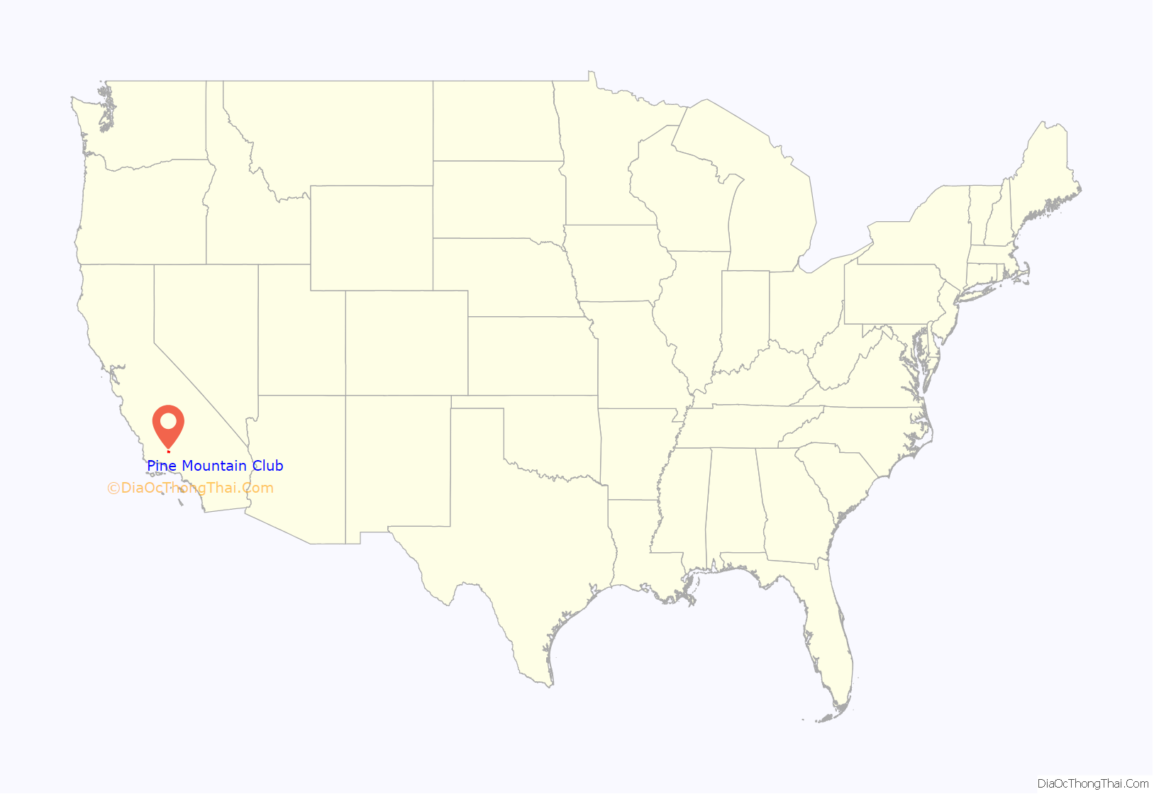
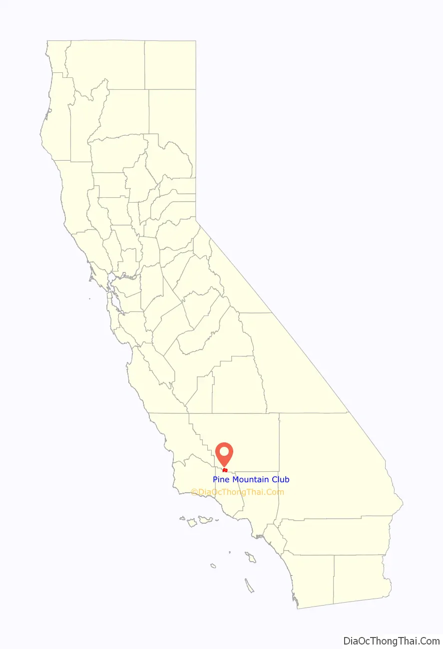
Pine Mountain Club location map. Where is Pine Mountain Club CDP?
History
Founding and development
Pine Mountain Club was developed in 1971 by Tenneco. The first announcement was made from Houston, Texas, in April of that year when the company said it would develop “more than 1.1 million acres of land in Arizona and Southern California.” Tenneco was the Bakersfield-based western land-development arm of Tenneco, Inc., of Houston.
About half that acreage was to be in Kern County, where the projects would include the residential development of 6,500 acres surrounding the then-new California State College near Bakersfield and 3,200 acres in the Los Padres National Forest, also mostly for residences (Pine Mountain Club).
The forest project was to set aside a thousand acres for vacation home sites and 2,200 acres “for permanent preservation in their natural state.” The program was to be directed by John E. Sommerhalder, president of Tenneco West. The land was part of a 3,200-acre tract of pine forest and meadowland, formerly a private preserve.
Tenneco West was a Bakersfield subsidiary that administered all the western holdings of Tenneco, “the parent, Houston-based, multi-industry company.”
Tenneco West President Sommerhalder said the club was believed to be among the largest all-electric family recreational resorts in California. Three kinds of “vacation or weekend homesites” were to be offered: (1) One- to three-bedroom dwellings, (2) modular homes, and (3) space for mobile homes.
The prices were estimated to begin from about $13,500 for a one-bedroom house and lot.
At the time of the announcement in 1971, “four deep wells” had already been sunk and an “extensive network of reservoirs and pipelines” laid, with a filtration plant near the commercial center.
Sommerhalder said the developer had the “assistance of Simon Eisner, nationally known environmental planner.”
Eight months after the opening, seventy-nine percent of the 1,309 purchasers indicated in a survey that construction of a vacation home was the prime reason for buying a lot and 43% of that group said they intended to start building during 1972.
The development’s sixth and final section, on a plateau some thousand feet higher than the clubhouse, went on sale in March 1973.
Mil Potrero Highway
Tenneco West improved a “winding, steep, one-lane dirt road” called Mil Potrero west from Pine Mountain Club to California State Highway 33 into a “comfortable, convenient and safe way . . . to view what is generally regarded as Southern California’s most strikingly beautiful scene.” The cost for the 6.5-mile segment was estimated at nearly a million dollars. John E. Sommerhalder, the company president, said the road opened up “a large segment of the [Los Padres National] forest that, until now, has been almost inaccessible.”
To keep damages to the forest at a minimum, contractors Yeager Construction of Riverside and Desert Construction of Victorville were required to do all the work from the existing right-of-way and forbidden to build a temporary construction road alongside. Fire-protection equipment had to be on hand at all times.
Fruition
By 1988, Pine Mountain Club had a small commercial district with about forty businesses, ranging from a Mobil gas station to a place called “Pheasants by Frank.” According to the Newhall Signal, the district was “more or less shut down on Mondays and Tuesdays . . . because there are so many people with weekend homes that the stores choose to stay open Saturday and Sunday.”
On July 31, 2021, the community celebrated its fiftieth birthday with a barbecue picnic on blankets spread beneath the trees next to the golf course. Also noted was the 50th anniversary of the founding of the Mil Potrero Mutual Water Company.
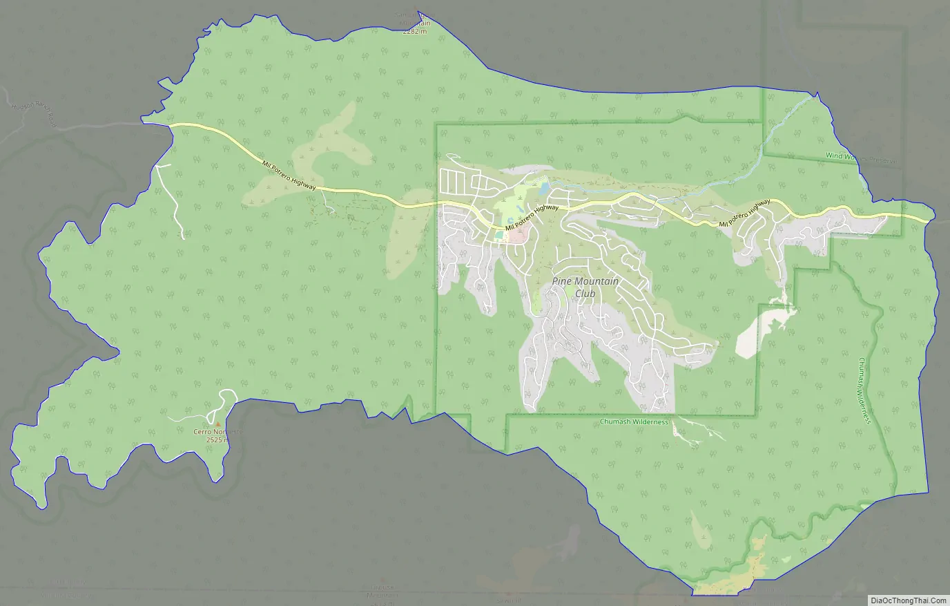
Pine Mountain Club Road Map
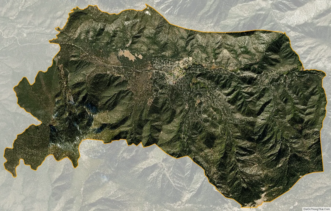
Pine Mountain Club city Satellite Map
Geography
Pine Mountain Club has an area of 16.7 square miles (43.25 km). It ranges from 4,901 to 6,400 feet (1,494 to 1,951 m) in elevation. The community sits in a deep valley of the San Emigdio Mountains, on the San Andreas fault. It is surrounded by Los Padres National Forest. The settlement lies between Apache Saddle and Pinon Pines Estates along Mil Potrero Highway. It is west of Frazier Park, Lebec, and Interstate 5.
See also
Map of California State and its subdivision:- Alameda
- Alpine
- Amador
- Butte
- Calaveras
- Colusa
- Contra Costa
- Del Norte
- El Dorado
- Fresno
- Glenn
- Humboldt
- Imperial
- Inyo
- Kern
- Kings
- Lake
- Lassen
- Los Angeles
- Madera
- Marin
- Mariposa
- Mendocino
- Merced
- Modoc
- Mono
- Monterey
- Napa
- Nevada
- Orange
- Placer
- Plumas
- Riverside
- Sacramento
- San Benito
- San Bernardino
- San Diego
- San Francisco
- San Joaquin
- San Luis Obispo
- San Mateo
- Santa Barbara
- Santa Clara
- Santa Cruz
- Shasta
- Sierra
- Siskiyou
- Solano
- Sonoma
- Stanislaus
- Sutter
- Tehama
- Trinity
- Tulare
- Tuolumne
- Ventura
- Yolo
- Yuba
- Alabama
- Alaska
- Arizona
- Arkansas
- California
- Colorado
- Connecticut
- Delaware
- District of Columbia
- Florida
- Georgia
- Hawaii
- Idaho
- Illinois
- Indiana
- Iowa
- Kansas
- Kentucky
- Louisiana
- Maine
- Maryland
- Massachusetts
- Michigan
- Minnesota
- Mississippi
- Missouri
- Montana
- Nebraska
- Nevada
- New Hampshire
- New Jersey
- New Mexico
- New York
- North Carolina
- North Dakota
- Ohio
- Oklahoma
- Oregon
- Pennsylvania
- Rhode Island
- South Carolina
- South Dakota
- Tennessee
- Texas
- Utah
- Vermont
- Virginia
- Washington
- West Virginia
- Wisconsin
- Wyoming


