Pleasant Hill is a city in Contra Costa County, California, United States, in the East Bay of the San Francisco Bay Area. The population was 34,613 at the 2020 census. It was incorporated in 1961. Pleasant Hill is the home of College Park High School, Diablo Valley College, the Pleasant Hill Library of the Contra Costa County Library system, and the Pleasant Hill Recreation & Park District.
| Name: | Pleasant Hill city |
|---|---|
| LSAD Code: | 25 |
| LSAD Description: | city (suffix) |
| State: | California |
| County: | Contra Costa County |
| Incorporated: | November 14, 1961 |
| Elevation: | 52 ft (16 m) |
| Total Area: | 7.08 sq mi (18.33 km²) |
| Land Area: | 7.08 sq mi (18.32 km²) |
| Water Area: | 0.00 sq mi (0.00 km²) 0% |
| Total Population: | 34,613 |
| Population Density: | 4,900/sq mi (1,900/km²) |
| ZIP code: | 94523 |
| Area code: | 925 |
| FIPS code: | 0657764 |
Online Interactive Map
Click on ![]() to view map in "full screen" mode.
to view map in "full screen" mode.
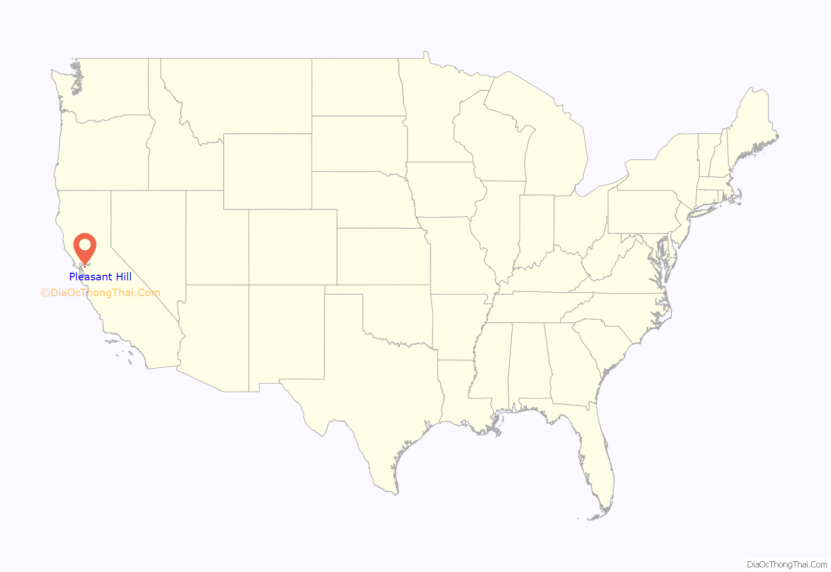
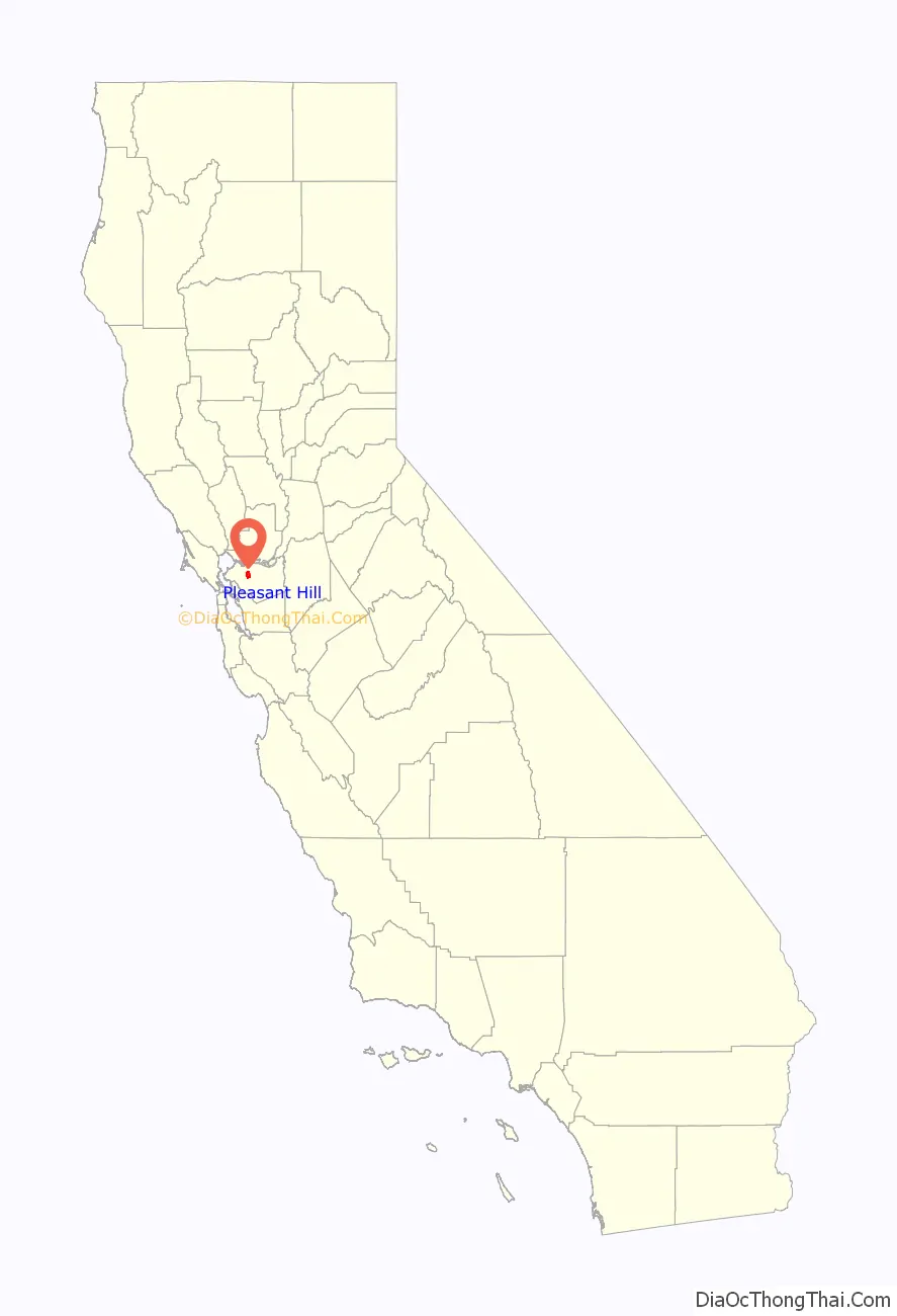
Pleasant Hill location map. Where is Pleasant Hill city?
History
Before colonization the area was inhabited by members of the Bay Miwok people. The San Ramon Valley Branch Line of the Southern Pacific entered service in 1891 with two flag stops in the area that would become the City of Pleasant Hill: Hookston, located today where the Iron Horse Regional Trail crosses Hookston Road, and Sparkle, where the Southern Pacific and Sacramento Northern Railway intersected and today stands the Pleasant Hill BART station. The area began to be suburbanized in the 1920s following prohibition, as the many local vineyards were removed and the formerly agricultural land was subdivided for housing. Monument Boulevard was named after the Soldiers Memorial Monument to commemorate veterans and war dead of World War I from Contra Costa County. It was erected on December 11, 1927 at the intersection of Monument Boulevard and the Contra Costa Highway, now Contra Costa Boulevard. The monument depicts one black and three white soldiers. It is 45 feet (14 meters) tall, constructed of formed concrete, and weighs 150 tons. In 1954 the monument was moved to its current site at the intersection of Boyd Road and Contra Costa Boulevard to make way for the construction of State Route 21.
Developed largely in the years following World War II, the area did not have a post office until 1948. The city incorporated in 1961.
On February 21, 1967, Century 21 Theaters opened an 895-seat dome theater between Monument Boulevard and Hookston Road (I-680 was later constructed passing west of here). Visible from the freeway after it was constructed, the futuristic dome-topped cinema became an iconic landmark for the newly incorporated city. The theater was designed by prolific Bay Area architect Vincent G. Raney. It had a distinctive 50-foot-high domed ceiling and oversized curved screen. The theater was initially built to showcase the Cinerama widescreen process developed in the 1950s. The screen was later updated to standard flat-screen. In 1973, four additional single-screen auditoriums were added to the front of the building. Renamed as Century 5 Theatres, it continued to be known familiarly as the Dome.
The city hall of Pleasant Hill was designed by architect Charles Moore. Completed in the late 20th century, it has won several awards for architectural design.
For most of its history, Pleasant Hill did not have a true downtown or Main Street. In 1991, the city began planning the redevelopment of the area around the intersection of Monument and Contra Costa boulevards. In July 2000, Downtown Pleasant Hill finally opened. The privately owned and operated outdoor shopping center was designed to resemble a typical small Main Street.
Starting in 2003, CinéArts operated the former Century 5 Theatres, screening primarily independent and foreign films. Due to changes in viewing habits, as many people screened movies at home, business continued to decline. The theater’s property owner, SyWest Development, closed the Dome on April 21, 2013. On its last night of operation, CinéArts screened Stanley Kubrick’s classic 2001: A Space Odyssey.
Sywest gained the approval of the Pleasant Hill City Council for its proposal to tear down the theater and redevelop the property as a two-story, 73,000+ square-foot building to house a Dick’s Sporting Goods. Supporters of the theater submitted two separate appeals to overturn the approval of demolition: one by a resident of Pleasant Hill, and one by Save the Pleasant Hill Dome (SPHD) organization. Both appeals were voted down by a majority of the city council; Mayor Michael G. Harris and councilmember Ken Carlson voted in favor of the appeal. SyWest had the Dome demolished on May 8, 2013, precluding any further court action.
On October 14, 2019, a magnitude 4.5 earthquake shook the town.
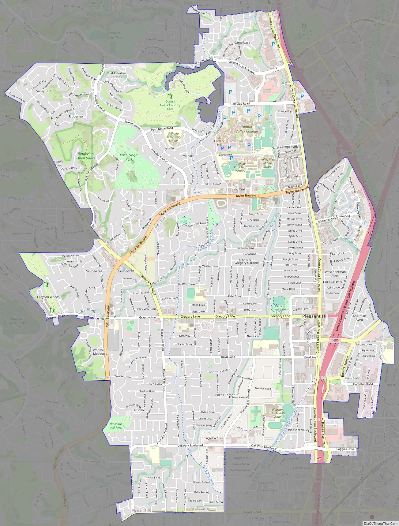
Pleasant Hill Road Map
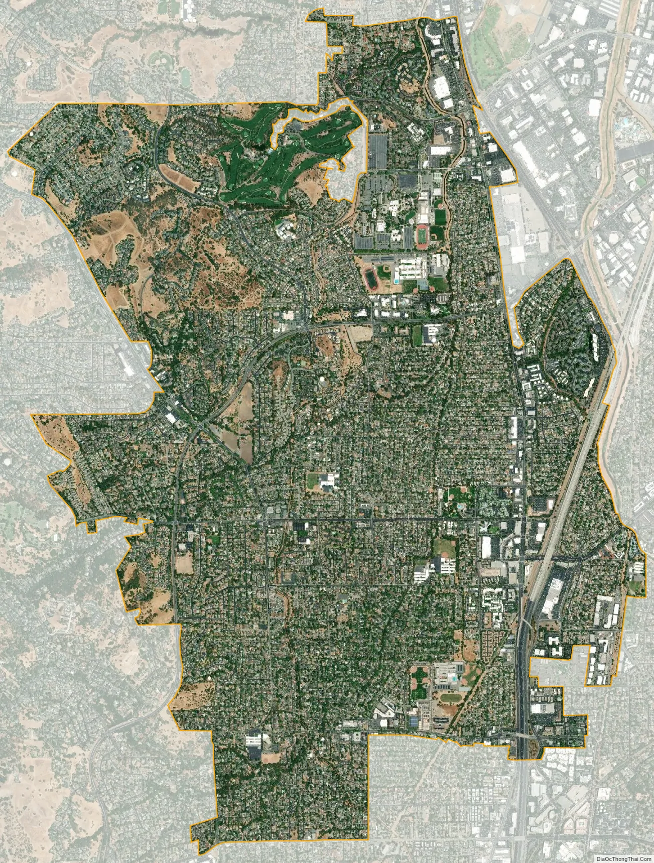
Pleasant Hill city Satellite Map
Geography
According to the United States Census Bureau, the city has a total area of 7.1 square miles (18 square kilometers). Pleasant Hill has a varied landscape with some valleys and rolling hills. In undisturbed wilderness, oak woodlands and mixed woods can be found. It is located in the central East San Francisco Bay.
This region has warm and dry summers, with no average monthly temperatures above 71 degrees Fahrenheit (22 degrees Celsius). According to the Köppen Climate Classification system, Pleasant Hill has a warm-summer Mediterranean climate, abbreviated “Csb” on climate maps. Winter daytime temperatures tend to be in the fifties and sixties, and summers range in the high seventies to upper eighties, occasionally reaching the low nineties. On very rare occasions, the temperatures can reach the one hundred degree range during extreme heat waves. Freezing in winter is rare, but it does happen. Summer fog is occasional but winter fog is very common.
See also
Map of California State and its subdivision:- Alameda
- Alpine
- Amador
- Butte
- Calaveras
- Colusa
- Contra Costa
- Del Norte
- El Dorado
- Fresno
- Glenn
- Humboldt
- Imperial
- Inyo
- Kern
- Kings
- Lake
- Lassen
- Los Angeles
- Madera
- Marin
- Mariposa
- Mendocino
- Merced
- Modoc
- Mono
- Monterey
- Napa
- Nevada
- Orange
- Placer
- Plumas
- Riverside
- Sacramento
- San Benito
- San Bernardino
- San Diego
- San Francisco
- San Joaquin
- San Luis Obispo
- San Mateo
- Santa Barbara
- Santa Clara
- Santa Cruz
- Shasta
- Sierra
- Siskiyou
- Solano
- Sonoma
- Stanislaus
- Sutter
- Tehama
- Trinity
- Tulare
- Tuolumne
- Ventura
- Yolo
- Yuba
- Alabama
- Alaska
- Arizona
- Arkansas
- California
- Colorado
- Connecticut
- Delaware
- District of Columbia
- Florida
- Georgia
- Hawaii
- Idaho
- Illinois
- Indiana
- Iowa
- Kansas
- Kentucky
- Louisiana
- Maine
- Maryland
- Massachusetts
- Michigan
- Minnesota
- Mississippi
- Missouri
- Montana
- Nebraska
- Nevada
- New Hampshire
- New Jersey
- New Mexico
- New York
- North Carolina
- North Dakota
- Ohio
- Oklahoma
- Oregon
- Pennsylvania
- Rhode Island
- South Carolina
- South Dakota
- Tennessee
- Texas
- Utah
- Vermont
- Virginia
- Washington
- West Virginia
- Wisconsin
- Wyoming


