Seaside, formerly East Monterey, is a city in Monterey County, California, United States, with a population of 32,366 as of the 2020 census. It is located 2.25 miles (3.6 km) east-northeast of Monterey, at an elevation of 33 feet (10 m), and is the home of California State University, Monterey Bay (CSUMB), UC MBEST Center, and the Monterey College of Law, which are located on the site of the former military base Fort Ord. Also on the site are the Bayonet and Black Horse golf courses, now open to the public and host to PGA Tour events, including the 2012 PGA Professional National Championship. Seaside is the gateway to Fort Ord National Monument, created on April 20, 2012.
| Name: | Seaside city |
|---|---|
| LSAD Code: | 25 |
| LSAD Description: | city (suffix) |
| State: | California |
| County: | Monterey County |
| Founded: | 1888 |
| Incorporated: | October 13, 1954 |
| Elevation: | 33 ft (10 m) |
| Total Area: | 9.06 sq mi (23.5 km²) |
| Land Area: | 8.92 sq mi (23.1 km²) |
| Water Area: | 0.14 sq mi (0.4 km²) 1.51% |
| Total Population: | 32,366 |
| Population Density: | 3,627.3/sq mi (1,400.5/km²) |
| ZIP code: | 93955 |
| Area code: | 831 |
| FIPS code: | 0670742 |
| GNISfeature ID: | 1659619 |
| Website: | www.ci.seaside.ca.us |
Online Interactive Map
Click on ![]() to view map in "full screen" mode.
to view map in "full screen" mode.
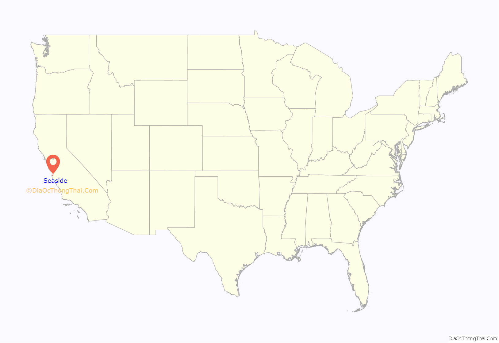
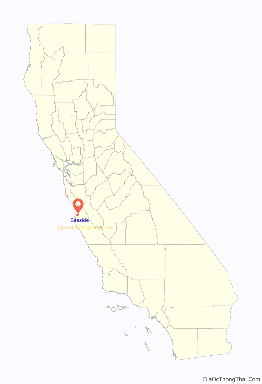
Seaside location map. Where is Seaside city?
History
Seaside, then called East Monterey, was laid out in 1888 by Dr. J.L.D. Roberts. The Seaside post office opened in 1891. Seaside was incorporated in 1954.
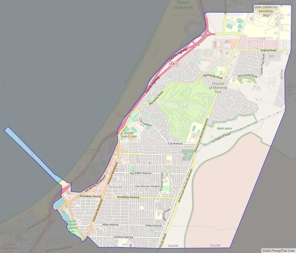
Seaside Road Map
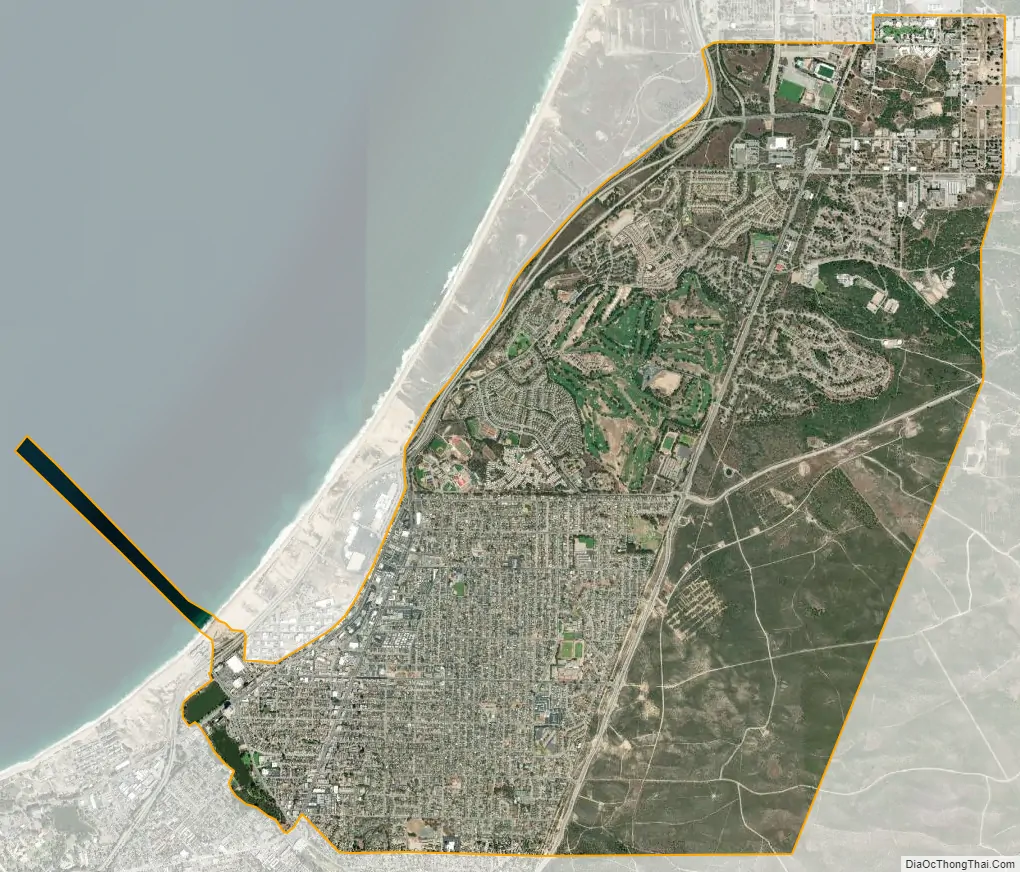
Seaside city Satellite Map
Geography
Seaside is located at 36°36′40″N 121°50′41″W / 36.61111°N 121.84472°W / 36.61111; -121.84472, toward the southern end of Monterey Bay. It is bordered to the north by Marina, to the west by Sand City, to the southwest by Monterey, and to the south by Del Rey Oaks. The California State Route 1 freeway runs along the western border of the city, north of Sand City.
According to the United States Census Bureau, the city of Seaside has a total area of 9.1 square miles (24 km), of which 8.9 square miles (23 km) are land and 0.1 square miles (0.3 km), or 1.51%, are water. According to the maps of the United States Geological Survey, the elevation ranges from 0 to 165 meters (0 to 541 feet).
Climate
The climate is a cool Mediterranean type, strongly influenced by the prevailing winds from the west, which blow over the Pacific Coast’s cool ocean currents from Alaska. At the nearest National Weather Service Climate Station, in the City of Monterey at 385 feet (117 m) elevation: The coldest month is January, with an average daily high of 59.9 °F (15.5 °C); the warmest month is September, with an average daily high of 72 °F (22 °C); the average daily low is 43 °F (6 °C) in January and 52.7 °F (11.5 °C) in September; and the average rainfall is 20 inches (51 centimeters) per year, with 90.3% falling during November through April. The weather can be much hotter when the winds blow from the east: Since 1906, there have been 11 days with a high of 100 °F (38 °C) or higher; all 11 days occurred in June, September, or October.
This region experiences warm (but not hot) and dry summers, with no average monthly temperatures above 71.6 °F (22.0 °C). According to the Köppen Climate Classification system, Seaside has a warm-summer Mediterranean climate, abbreviated “Csb” on climate maps.
See also
Map of California State and its subdivision:- Alameda
- Alpine
- Amador
- Butte
- Calaveras
- Colusa
- Contra Costa
- Del Norte
- El Dorado
- Fresno
- Glenn
- Humboldt
- Imperial
- Inyo
- Kern
- Kings
- Lake
- Lassen
- Los Angeles
- Madera
- Marin
- Mariposa
- Mendocino
- Merced
- Modoc
- Mono
- Monterey
- Napa
- Nevada
- Orange
- Placer
- Plumas
- Riverside
- Sacramento
- San Benito
- San Bernardino
- San Diego
- San Francisco
- San Joaquin
- San Luis Obispo
- San Mateo
- Santa Barbara
- Santa Clara
- Santa Cruz
- Shasta
- Sierra
- Siskiyou
- Solano
- Sonoma
- Stanislaus
- Sutter
- Tehama
- Trinity
- Tulare
- Tuolumne
- Ventura
- Yolo
- Yuba
- Alabama
- Alaska
- Arizona
- Arkansas
- California
- Colorado
- Connecticut
- Delaware
- District of Columbia
- Florida
- Georgia
- Hawaii
- Idaho
- Illinois
- Indiana
- Iowa
- Kansas
- Kentucky
- Louisiana
- Maine
- Maryland
- Massachusetts
- Michigan
- Minnesota
- Mississippi
- Missouri
- Montana
- Nebraska
- Nevada
- New Hampshire
- New Jersey
- New Mexico
- New York
- North Carolina
- North Dakota
- Ohio
- Oklahoma
- Oregon
- Pennsylvania
- Rhode Island
- South Carolina
- South Dakota
- Tennessee
- Texas
- Utah
- Vermont
- Virginia
- Washington
- West Virginia
- Wisconsin
- Wyoming


