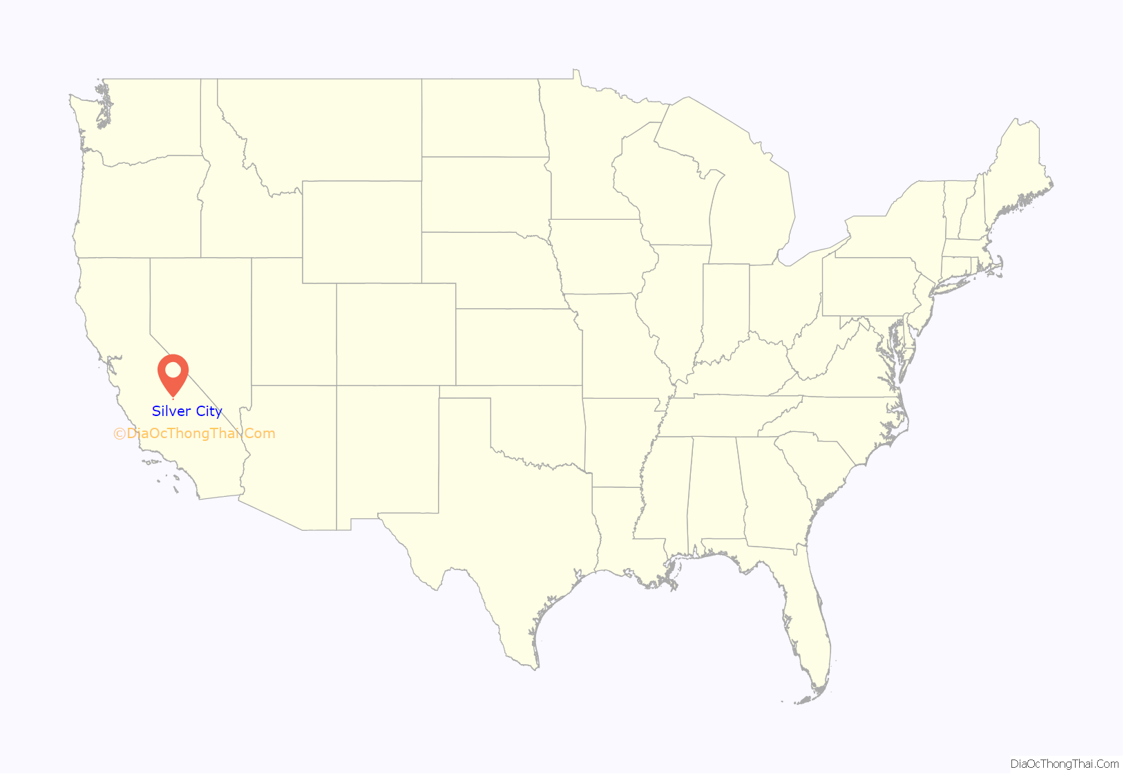
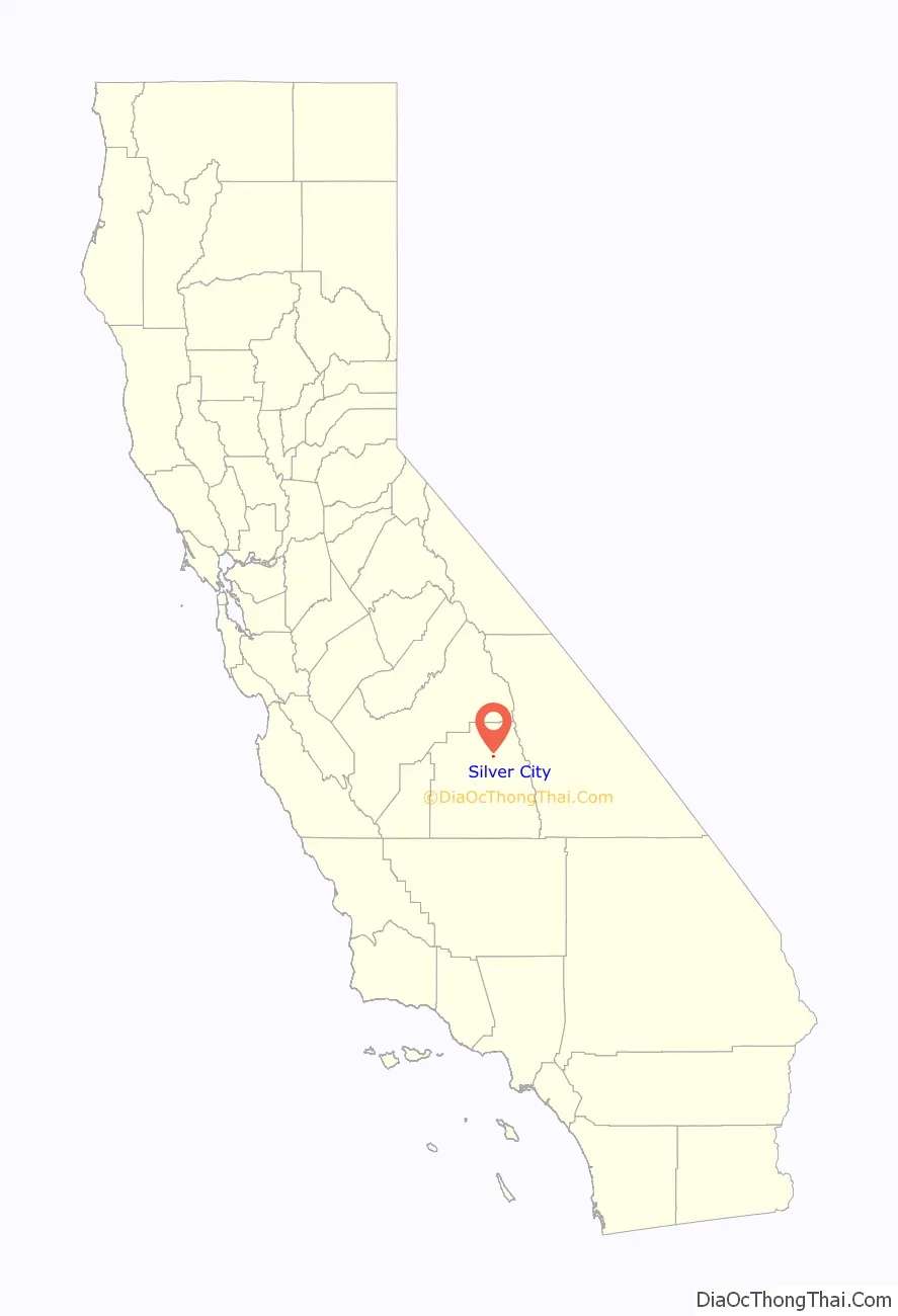
Silver City is a census-designated place (CDP) in the mountainous area of central Tulare County, California. Silver City sits at an elevation of 6,732 feet (2,052 m). It lies 72 km ENE of Visalia, California, within the boundary of Sequoia National Park. The 2010 United States census reported Silver City was uninhabited.
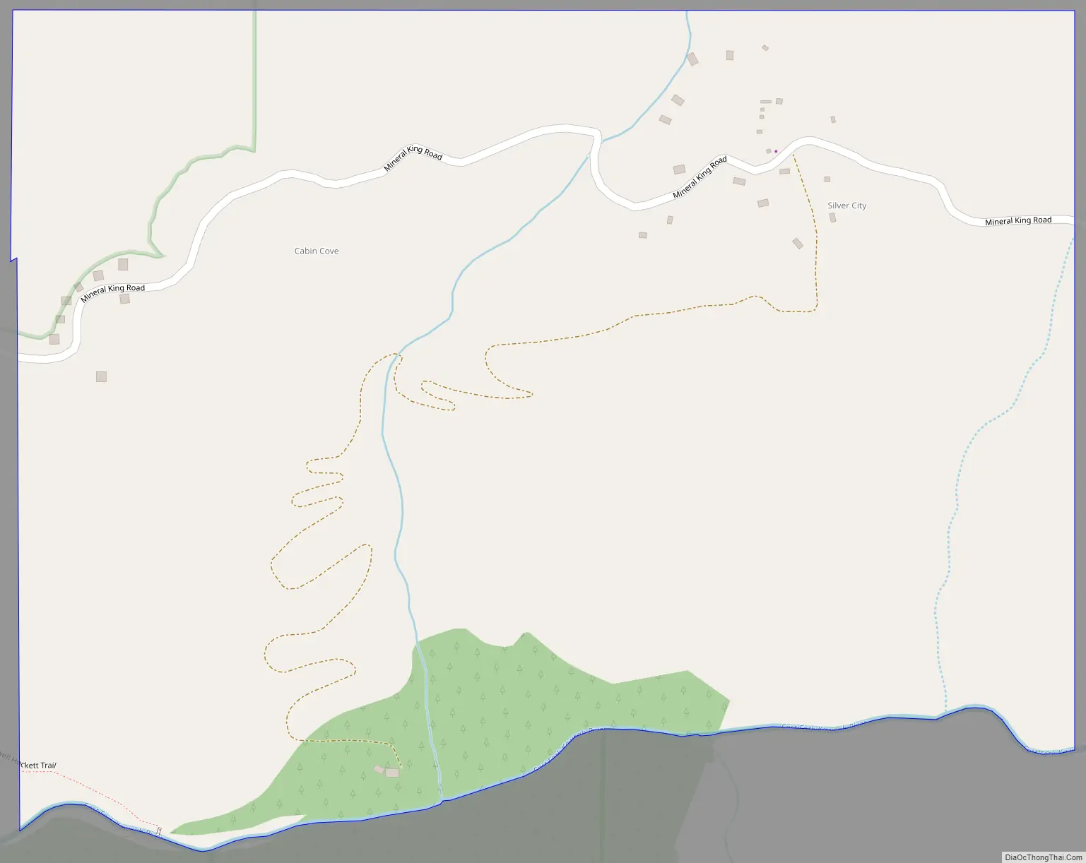
Silver City is the name of an inholding in Sequoia National Park located at Mile 21 on the 25-mile road to Mineral King. It consists of 58 fee-simple lots, 39 of which have cabins on them, plus a commercial area consisting of a store, restaurant and several rental cabins called the Silver City Mountain Resort. It is classified as a transient non-community because it is occupied only during the spring, summer and fall but not during the winter.
| Name: | Silver City CDP |
|---|---|
| LSAD Code: | 57 |
| LSAD Description: | CDP (suffix) |
| State: | California |
| County: | Tulare County |
| Elevation: | 6,732 ft (2,052 m) |
| Total Area: | 0.576 sq mi (1.491 km²) |
| Land Area: | 0.576 sq mi (1.491 km²) |
| Water Area: | 0 sq mi (0 km²) 0% |
| Total Population: | 0 |
| FIPS code: | 0671932 |
| GNISfeature ID: | 2585449 |
Online Interactive Map
Click on ![]() to view map in "full screen" mode.
to view map in "full screen" mode.
Silver City location map. Where is Silver City CDP?
History
Archaeological evidence indicates that the area surrounding Silver City has supported indigenous peoples for thousands of years. A Yokuts tribe called Wukchumni established permanent campsites along the Kaweah River in the lower elevations below Silver City. During the hot summers, these people moved to the higher elevations, thus becoming the first users of the Silver City area. They traded with the Monache and the Numic peoples who came over the Sierras from the eastern side in hunting and foraging movements.
The first settler of the modern historical era homesteaded Silver City in 1856; Hale Tharp. In 1858 Tharp’s brother-in-law, John Swanson, erected a dwelling there. For several subsequent years, valley ranchers used the alpine areas during the summer heat, allowing their cattle to graze there.
By 1873, sufficient metal ore had been identified in the nearby mountains to cause a minor gold rush. Although short-lived, it consolidated Mineral King and Silver City into viable summertime communities.
Silver City Road Map
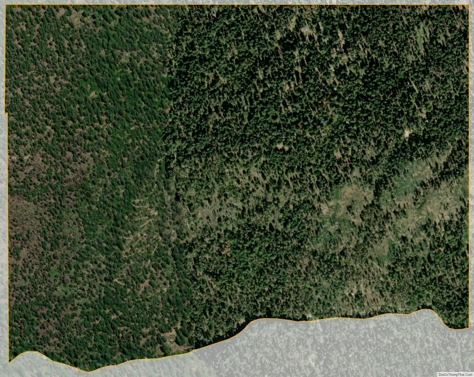
Silver City city Satellite Map
Geography
According to the United States Census Bureau, the CDP covers an area of 0.6 square miles (1.5 km), all of it land.
See also
Map of California State and its subdivision:- Alameda
- Alpine
- Amador
- Butte
- Calaveras
- Colusa
- Contra Costa
- Del Norte
- El Dorado
- Fresno
- Glenn
- Humboldt
- Imperial
- Inyo
- Kern
- Kings
- Lake
- Lassen
- Los Angeles
- Madera
- Marin
- Mariposa
- Mendocino
- Merced
- Modoc
- Mono
- Monterey
- Napa
- Nevada
- Orange
- Placer
- Plumas
- Riverside
- Sacramento
- San Benito
- San Bernardino
- San Diego
- San Francisco
- San Joaquin
- San Luis Obispo
- San Mateo
- Santa Barbara
- Santa Clara
- Santa Cruz
- Shasta
- Sierra
- Siskiyou
- Solano
- Sonoma
- Stanislaus
- Sutter
- Tehama
- Trinity
- Tulare
- Tuolumne
- Ventura
- Yolo
- Yuba
- Alabama
- Alaska
- Arizona
- Arkansas
- California
- Colorado
- Connecticut
- Delaware
- District of Columbia
- Florida
- Georgia
- Hawaii
- Idaho
- Illinois
- Indiana
- Iowa
- Kansas
- Kentucky
- Louisiana
- Maine
- Maryland
- Massachusetts
- Michigan
- Minnesota
- Mississippi
- Missouri
- Montana
- Nebraska
- Nevada
- New Hampshire
- New Jersey
- New Mexico
- New York
- North Carolina
- North Dakota
- Ohio
- Oklahoma
- Oregon
- Pennsylvania
- Rhode Island
- South Carolina
- South Dakota
- Tennessee
- Texas
- Utah
- Vermont
- Virginia
- Washington
- West Virginia
- Wisconsin
- Wyoming


