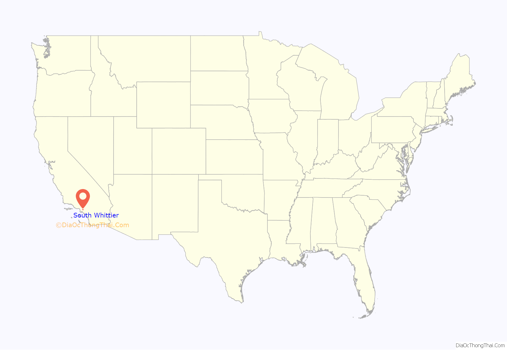
South Whittier (pronunciation) is an unincorporated community and census-designated place in Los Angeles County, California just south of the city of Whittier. As of the 2020 census, the CDP had a total population of 56,415, down from 57,156 at the 2010 census.
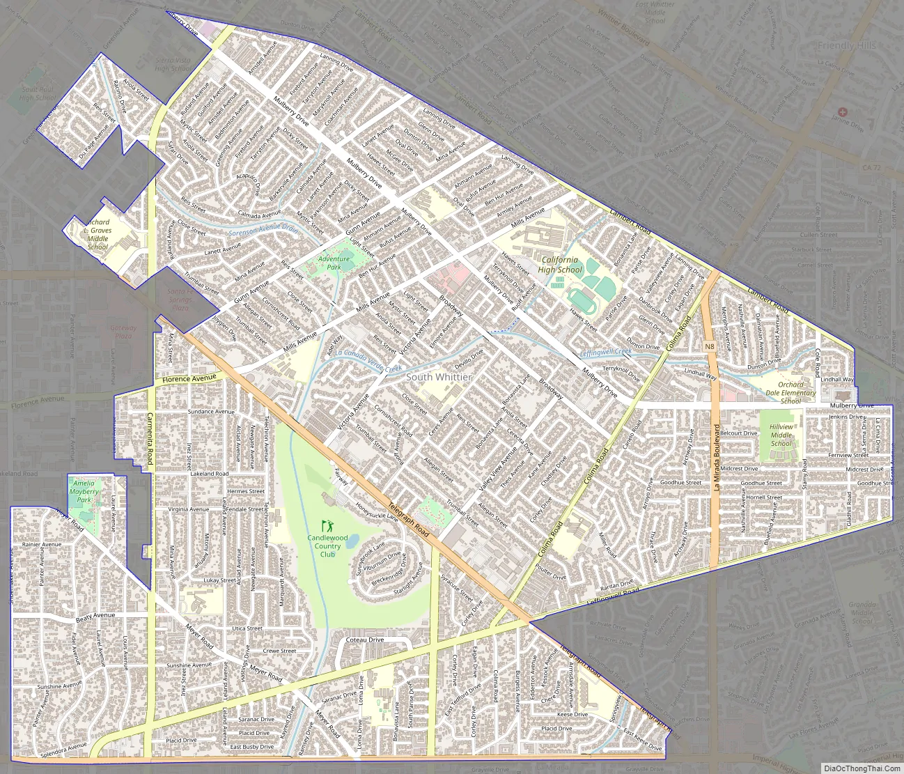
On 16 November 2022, a driver veered onto the wrong side of the road in an SUV and hit 25 Los Angeles County sheriff’s and police recruits who were jogging near the sheriff’s training academy near Mills Avenue and Trumball Street. Five recruits were in critical condition. Injuries included head trauma, broken bones and loss of limbs. The 22-year-old driver was arrested on suspicion of attempted murder of peace officers. Citing the need for further investigation, authorities released a 22-year-old man who was arrested on suspicion of attempted murder.
| Name: | South Whittier CDP |
|---|---|
| LSAD Code: | 57 |
| LSAD Description: | CDP (suffix) |
| State: | California |
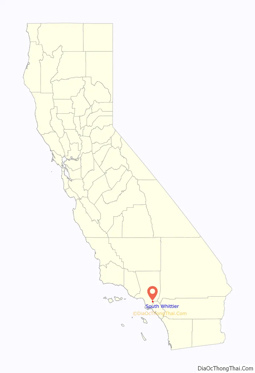
| County: | Los Angeles County |
| Elevation: | 177 ft (54 m) |
| Total Area: | 5.346 sq mi (13.846 km²) |
| Land Area: | 5.337 sq mi (13.823 km²) |
| Water Area: | 0.009 sq mi (0.022 km²) 0.16% |
| Total Population: | 56,415 |
| Population Density: | 11,000/sq mi (4,100/km²) |
| ZIP code: | 90602 |
| Area code: | 562 |
| FIPS code: | 0673430 |
| GNISfeature ID: | 1661484 |
Online Interactive Map
Click on ![]() to view map in "full screen" mode.
to view map in "full screen" mode.
South Whittier location map. Where is South Whittier CDP?
South Whittier Road Map
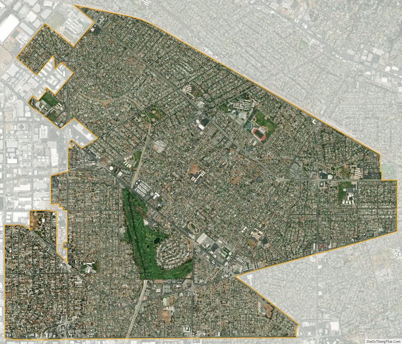
South Whittier city Satellite Map
Geography
South Whittier is located at 33°56′5″N 118°1′51″W / 33.93472°N 118.03083°W / 33.93472; -118.03083 (33.934724, -118.030800).
According to the United States Census Bureau, the CDP has a total area of 5.3 square miles (13.8 km), over 99% of it land.
Climate
According to the Köppen Climate Classification system, South Whittier has a warm-summer Mediterranean climate, abbreviated “Csa” on climate maps.
See also
Map of California State and its subdivision:- Alameda
- Alpine
- Amador
- Butte
- Calaveras
- Colusa
- Contra Costa
- Del Norte
- El Dorado
- Fresno
- Glenn
- Humboldt
- Imperial
- Inyo
- Kern
- Kings
- Lake
- Lassen
- Los Angeles
- Madera
- Marin
- Mariposa
- Mendocino
- Merced
- Modoc
- Mono
- Monterey
- Napa
- Nevada
- Orange
- Placer
- Plumas
- Riverside
- Sacramento
- San Benito
- San Bernardino
- San Diego
- San Francisco
- San Joaquin
- San Luis Obispo
- San Mateo
- Santa Barbara
- Santa Clara
- Santa Cruz
- Shasta
- Sierra
- Siskiyou
- Solano
- Sonoma
- Stanislaus
- Sutter
- Tehama
- Trinity
- Tulare
- Tuolumne
- Ventura
- Yolo
- Yuba
- Alabama
- Alaska
- Arizona
- Arkansas
- California
- Colorado
- Connecticut
- Delaware
- District of Columbia
- Florida
- Georgia
- Hawaii
- Idaho
- Illinois
- Indiana
- Iowa
- Kansas
- Kentucky
- Louisiana
- Maine
- Maryland
- Massachusetts
- Michigan
- Minnesota
- Mississippi
- Missouri
- Montana
- Nebraska
- Nevada
- New Hampshire
- New Jersey
- New Mexico
- New York
- North Carolina
- North Dakota
- Ohio
- Oklahoma
- Oregon
- Pennsylvania
- Rhode Island
- South Carolina
- South Dakota
- Tennessee
- Texas
- Utah
- Vermont
- Virginia
- Washington
- West Virginia
- Wisconsin
- Wyoming


