Stevenson Ranch is an unincorporated community in the Santa Clarita Valley of Los Angeles County, California. Stevenson Ranch is set in the foothills of the Santa Susana Mountains and lies west of Interstate 5 and the city of Santa Clarita. Stevenson Ranch encompasses about 6.4 square miles (17 km). About 1,000 acres (4.0 km) are set aside as parks, recreation areas, and open space. A master-planned community, it was approved by the county in 1987. The population was 20,178 at the time of the 2020 census. For statistical purposes, the Census Bureau has designated it a census-designated place (CDP).
It is home to Stevenson Ranch, Pico Canyon, and Oak Hills elementary schools (part of the Newhall School District), and Rancho Pico Junior High and West Ranch High School (part of the William S. Hart Union High School District). The Valencia Marketplace and Stevenson Ranch Shopping Center are popular shopping areas in the community. Six Flags Magic Mountain, an amusement park, is located about three miles (4.8 km) north of Stevenson Ranch. The area backs up to the historic oil-mining town of Mentryville, founded in 1875.
The names of many streets located in Stevenson Ranch are those of authors (e.g., Thackeray, Hemingway, Shakespeare, and Poe).
It is also the filming location of several film and television productions, including the television show Weeds, a Showtime original series, as well as the feature film Pleasantville. Its master-planned nature is at the heart of the suburban commentary of Weeds, such as the “Little Boxes” song and sprawling development portrayed in the opening of the show.
| Name: | Stevenson Ranch CDP |
|---|---|
| LSAD Code: | 57 |
| LSAD Description: | CDP (suffix) |
| State: | California |
| County: | Los Angeles County |
| Elevation: | 1,529 ft (466 m) |
| Total Area: | 6.362 sq mi (16.478 km²) |
| Land Area: | 6.361 sq mi (16.475 km²) |
| Water Area: | 0.001 sq mi (0.002 km²) 0.01% |
| Total Population: | 20,178 |
| Population Density: | 3,200/sq mi (1,200/km²) |
| ZIP code: | 91381 |
| Area code: | 661 |
| FIPS code: | 0674130 |
| GNISfeature ID: | 2583151 |
Online Interactive Map
Click on ![]() to view map in "full screen" mode.
to view map in "full screen" mode.
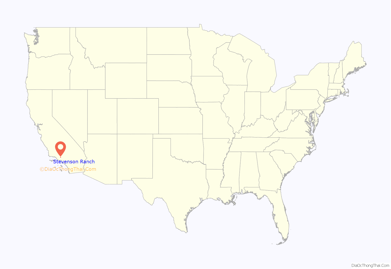
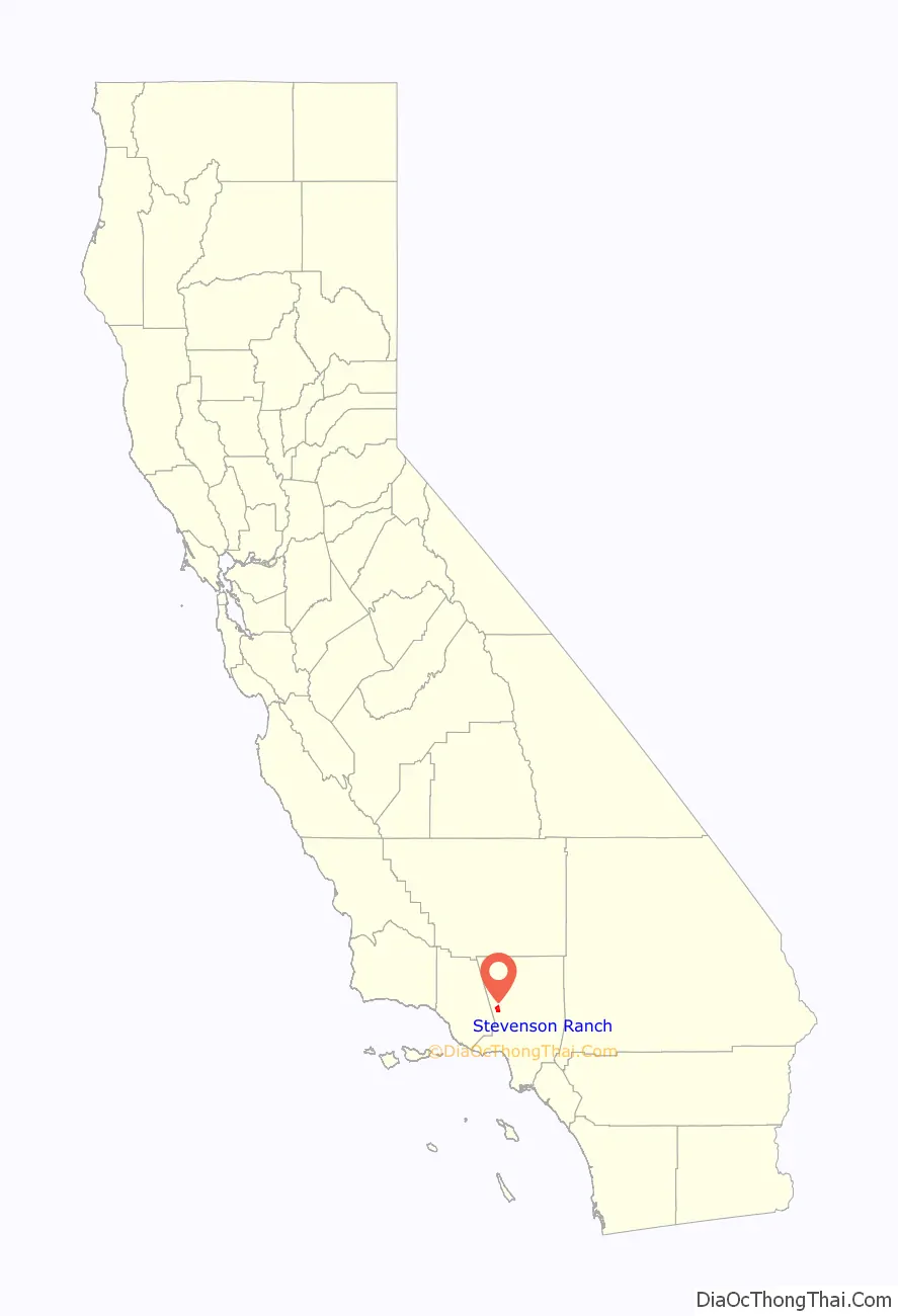
Stevenson Ranch location map. Where is Stevenson Ranch CDP?
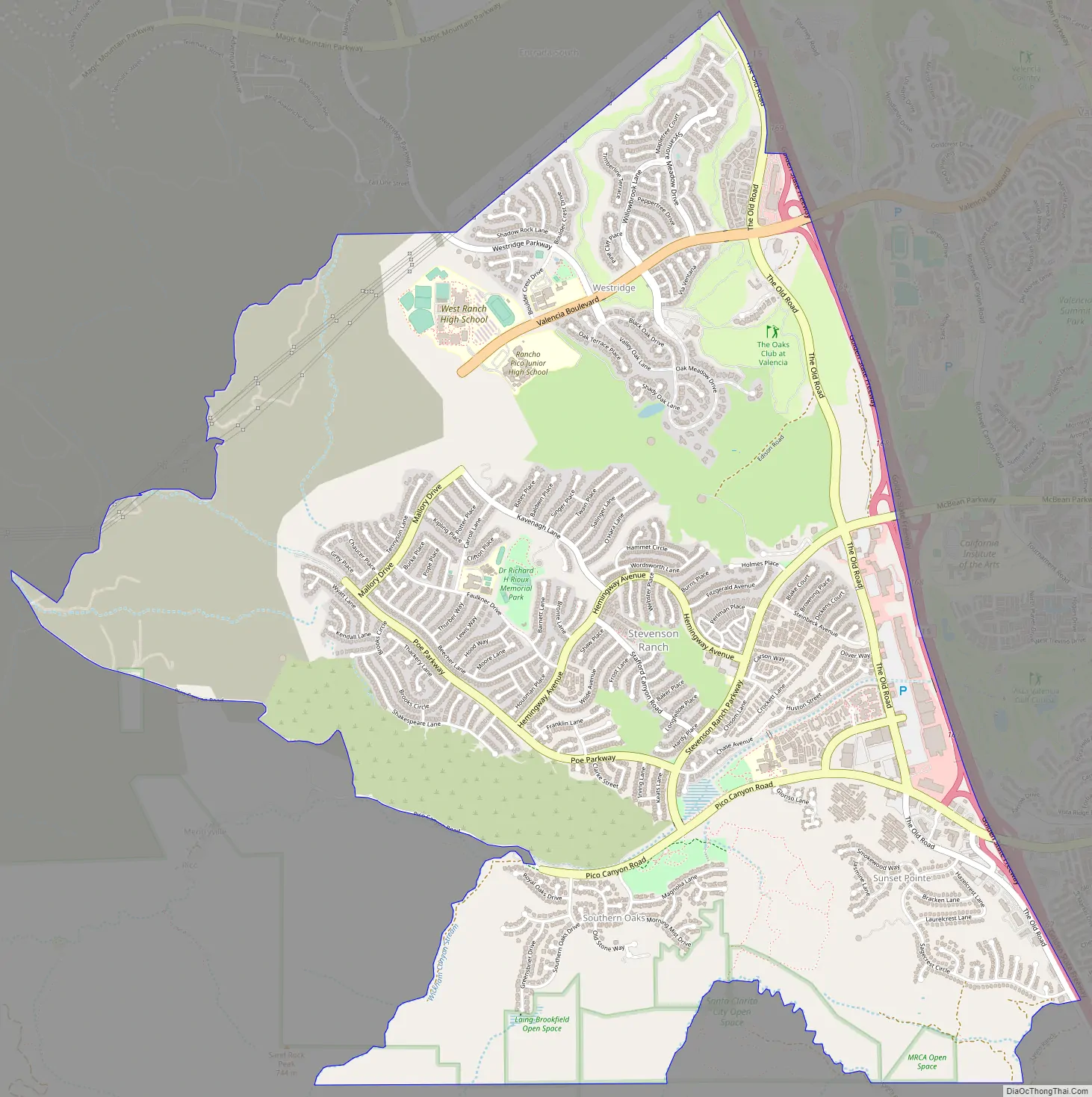
Stevenson Ranch Road Map
Stevenson Ranch city Satellite Map
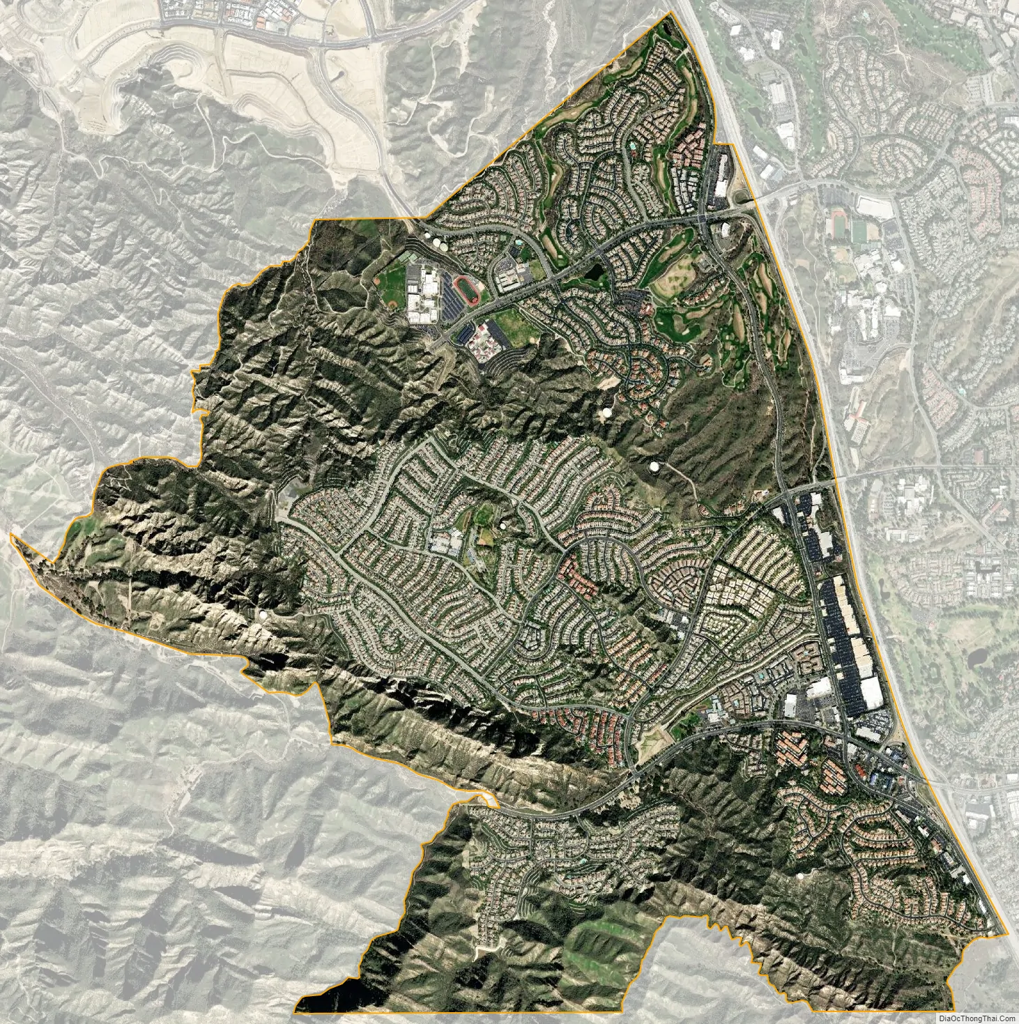
Geography
The Stevenson Ranch census-designated place includes two major subdivisions: Westridge and Stevenson Ranch proper.
Stevenson Ranch proper occupies the central and southern parts of the census-designated place. It includes the Valencia Marketplace and two elementary schools (Stevenson Ranch and Pico Canyon). Major thoroughfares in the community include Poe Parkway, Hemingway Avenue, Pico Canyon Road, and Stevenson Ranch Parkway. Pico Canyon Road and Stevenson Ranch Parkway continue east into the city of Santa Clarita as Lyons Avenue and McBean Parkway, respectively.
Westridge occupies the northern part of the CDP. It includes Oak Hills Elementary School, Rancho Pico Junior High, and West Ranch High School. The Oaks Club at Valencia, a country club and golf course, is located in Westridge. The major east-to-west thoroughfare is Valencia Boulevard. It is a wealthy community, with some of the Santa Clarita Valley’s most expensive real estate. Although Westridge lies in the Stevenson Ranch CDP and zip code 91381, it was developed as part of Valencia.
The two subdivisions are connected by The Old Road. Both subdivisions are located west of Interstate 5. The Valencia neighborhood of the city of Santa Clarita lies to the east and northeast, Newhall lies to the southeast, and unincorporated Valencia lies to the north.
See also
Map of California State and its subdivision:- Alameda
- Alpine
- Amador
- Butte
- Calaveras
- Colusa
- Contra Costa
- Del Norte
- El Dorado
- Fresno
- Glenn
- Humboldt
- Imperial
- Inyo
- Kern
- Kings
- Lake
- Lassen
- Los Angeles
- Madera
- Marin
- Mariposa
- Mendocino
- Merced
- Modoc
- Mono
- Monterey
- Napa
- Nevada
- Orange
- Placer
- Plumas
- Riverside
- Sacramento
- San Benito
- San Bernardino
- San Diego
- San Francisco
- San Joaquin
- San Luis Obispo
- San Mateo
- Santa Barbara
- Santa Clara
- Santa Cruz
- Shasta
- Sierra
- Siskiyou
- Solano
- Sonoma
- Stanislaus
- Sutter
- Tehama
- Trinity
- Tulare
- Tuolumne
- Ventura
- Yolo
- Yuba
- Alabama
- Alaska
- Arizona
- Arkansas
- California
- Colorado
- Connecticut
- Delaware
- District of Columbia
- Florida
- Georgia
- Hawaii
- Idaho
- Illinois
- Indiana
- Iowa
- Kansas
- Kentucky
- Louisiana
- Maine
- Maryland
- Massachusetts
- Michigan
- Minnesota
- Mississippi
- Missouri
- Montana
- Nebraska
- Nevada
- New Hampshire
- New Jersey
- New Mexico
- New York
- North Carolina
- North Dakota
- Ohio
- Oklahoma
- Oregon
- Pennsylvania
- Rhode Island
- South Carolina
- South Dakota
- Tennessee
- Texas
- Utah
- Vermont
- Virginia
- Washington
- West Virginia
- Wisconsin
- Wyoming


