Taft (formerly Moron, Moro, and Siding Number Two) is a city in the foothills at the extreme southwestern edge of the San Joaquin Valley, in Kern County, California. Taft is located 32 miles (51 km) west-southwest of Bakersfield, at an elevation of 955 feet (291 m). The population was 9,327 at the 2010 census. According to the United States Census Bureau, the city has a total area of 15.1 square miles (39.1 km).
It was named for President William H. Taft in 1909.
| Name: | Taft city |
|---|---|
| LSAD Code: | 25 |
| LSAD Description: | city (suffix) |
| State: | California |
| County: | Kern County |
| Incorporated: | November 7, 1910 |
| Elevation: | 955 ft (291 m) |
| Total Area: | 15.26 sq mi (39.53 km²) |
| Land Area: | 15.26 sq mi (39.53 km²) |
| Water Area: | 0.00 sq mi (0.00 km²) 0% |
| Total Population: | 9,327 |
| Population Density: | 607.44/sq mi (234.54/km²) |
| ZIP code: | 93268 |
| Area code: | 661 |
| FIPS code: | 0677574 |
| Website: | www.cityoftaft.org |
Online Interactive Map
Click on ![]() to view map in "full screen" mode.
to view map in "full screen" mode.
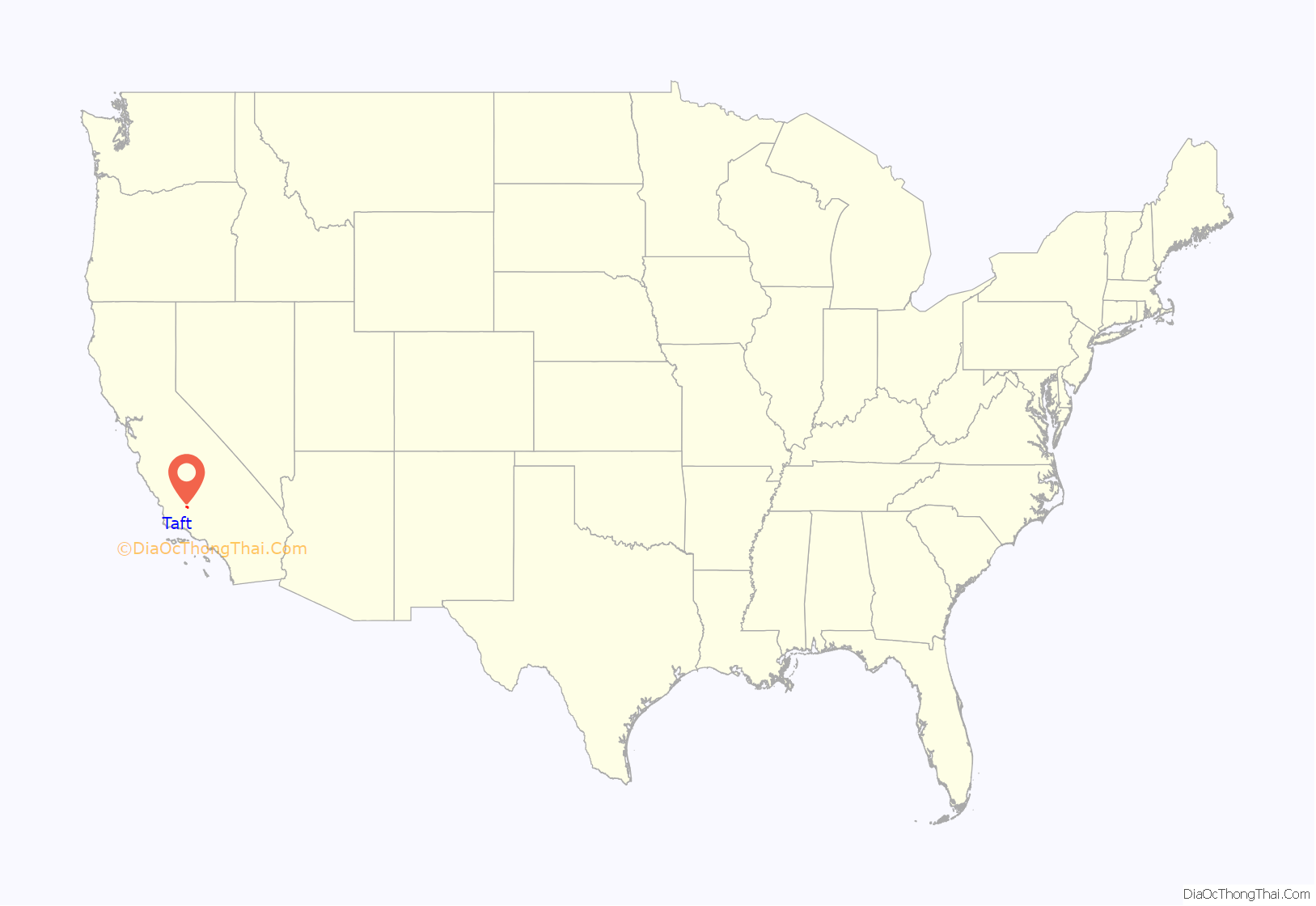
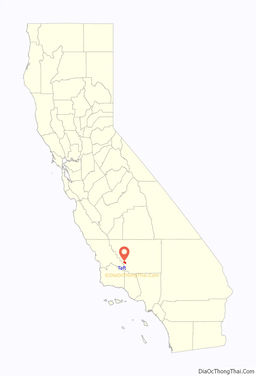
Taft location map. Where is Taft city?
History
The town began as Siding Number Two on the Sunset Railroad. According to a display at the West Kern Oil Museum, local residents asked the Southern Pacific Railroad if the station could be named Moro when the rails arrived in about 1900, but a railroad official declined because the name would be too easily confused with the coastal town of Morro Bay. Instead, the railroad directed the station be called Moron, a word which as yet had no association with lack of intelligence (cf. Spanish word for hillock, morón). Pictures of local businesses, including the Moron Pharmacy, hang in the museum.
After a fire burned much of the town, the name was changed to Taft in honor of William Howard Taft.
Taft was once a sundown town that posted “No Colored Allowed” signs.
Taft and oil
Taft is situated in a major petroleum and natural gas production region in California and is one of the few remaining towns in the United States which exist exclusively because of nearby oil reserves. The discovery of oil in the region occurred in the late 19th century near Maricopa, seven miles (11.27 km) south of Taft. Many other oil and gas accumulations were discovered around Taft during the early-to-mid-20th century, notably the Midway field (near Fellows, California), the Sunset field (later found to be part of the same trend, accounting for the modern combined name of Midway-Sunset), and the Buena Vista. The town is built directly between these two huge fields. The operational activities within these fields, as well as California Resources Corporation’s Elk Hills Oil Field north of Taft, have been the economic lifeblood of the town for over 100 years.
The super-giant Midway-Sunset field has produced approximately 2,800,000,000 barrels (450,000,000 m) of crude oil, most of it heavy gravity (13-14 degrees API). Enhanced oil recovery operations in the form of steam production and injection have been used on the thick viscous crude oil of the Midway-Sunset field since the mid-to-late-1960s. The reservoirs of the Midway-Sunset field are composited layers of mostly unconsolidated sandstones of late Miocene age, shallowly buried. The shallow burial depth and ideal nature of the sandstones make them almost perfectly suited for steam injection. As a result, the amount of oil that can be recovered has greatly increased.
Standard Oil, later the Standard Oil Company of California (modern Chevron), made Taft its corporate operational headquarters. At one time, it is reported that as many as 6,000 inhabitants of Taft were employed by Standard Oil. The hub of this activity was “11-C Camp”, so named due to its township location in section 11 and designated “township C” by Standard’s mapping department. The infrastructure to run a large oil and gas company included: a rail spur from the line running through Taft, steel and timber for derrick construction and maintenance, pipe, valves, numerous offices, an expansive and highly specialized machine shop, supply shops, the car and truck fleet on one side of the Main Street; bunkhouses for workers, and fourteen blocks on four streets of company homes for employees on the other side. 11-C Camp also included a playground, baseball field, tennis courts, a swimming pool, a cook-house open to the public, landscaped grounds, a clubhouse with a television, pool and card tables, and an ice-cream stand. The huge complex gradually closed down over a period of many years. In 1968, Standard Oil of California moved its accounting and finance offices to Concord, California. In the late 1980s, the machine shop was closed and auctioned, signaling the end of the 11-C Camp era. The houses were moved outside the camp into a new neighborhood.
Many other oil companies had operations in the area, including larger companies such as Shell, Texaco, Exxon, Mobil, Gulf, and ARCO, as well as smaller operations (but with a large local presence), such as Santa Fe Energy, Berry Petroleum, Tannehill, M.H. Whittier, and lately Plains Exploration & Production. In the mid-1990s, according to California’s Division of Oil, Gas, and Geothermal Resources (DOGGR), there were 68 operating companies working the Midway-Sunset field alone. While the names of most of these companies have changed, due to mergers, acquisitions, and liquidations, the production activities have been continuous.
In celebration of its oil heritage, Taft holds its “Oildorado” festival every five years. Oildorado was first started in 1930 (see below) and was held intermittently before then.
In the early days of oil exploration and production, long before the advent of modern blowout preventions, gushers were the norm. Although there were many, the Lakeview Gusher gushed more than any, producing 100,000 barrels (16,000 m) of oil per day at its peak. In all, the Lakeview No.1 produced about nine million barrels (1,400,000 m) of oil (a very respectable cumulative production for a single well in this area). The well and its State historical marker can be found along the Petroleum Club road, just off SR 33 south of town.
Taft was also the site of a military airfield, Gardner Army Airfield, which was used to train pilots during World War II. After the base was closed, its abandoned airstrip served as a clandestine dragstrip for many years.
Recent history
Today, the railroad—originally built to export crude oil and import drinking water—is gone, but the area still has a significant oil industry presence.
A private prison, Taft Correctional Institution, operated by Management & Training Corporation under contract to the U.S. Bureau of Prisons, is located on Cadet Road south of town. There is a large, modern high school serving area students. The West Kern Oil Museum, at 1168 Wood Street, has vast holdings, including pumps, fire apparatus, trucks, a historic wooden derrick, photos, models, and extensive displays of local history back to Indian times. The town’s newspaper, the Midway Driller, was reputed to be the oldest daily newspaper in California. About 2005, the Daily Midway Driller became the Midway Driller and is now published on Tuesdays and Fridays. The town’s second weekly newspaper, the Taft Independent, began publication on July 4, 2006.
The city, which has experienced the ups and downs of the boom and bust cycle of the oil industry, has recently experienced new development and business growth with the opening of a three-story, 70-room Taft Inn Best Western Plus Hotel, the opening of a craft brewery, Black Gold Brewing Company, in the historic downtown on Center Street, the reopening of the historic Taft Fox Theater, the opening of The Bank, a bar and grill in the historic Taft State Bank Building, a new Taco Bell restaurant and many more “mom and pop” small businesses. The city owns a 46-acre former BNSF railroad property in the center of town which features the West Kern Oilworker’s Monument, a 37 feet (11 m) tall bronze sculpture that features several human figures displayed on an oil derrick by artist Benjamin Victor that was paid for with donations from local residents, visitors and several oil companies. The railroad property is part of a redevelopment project that the city is using to attract new businesses, housing and commercial office space.
A shooting occurred at Taft Union High School on January 10, 2013. A 16-year-old student at the school entered a science classroom with a 12 gauge shotgun and fired shots inside the class. Another 16-year-old student was hit and critically injured. Another student was shot at and not injured. A teacher suffered minor head injuries when struck by a pellet. Fortunately, the shotgun was loaded with birdshot. A campus supervisor asked the shooter to surrender, which he did, and he was taken into custody.
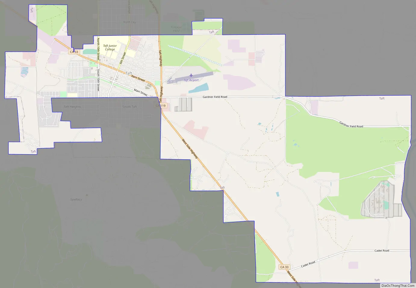
Taft Road Map
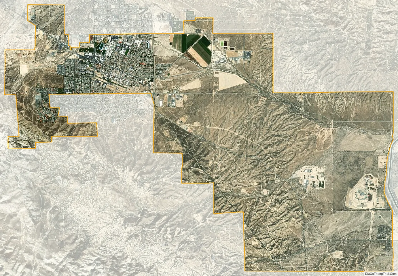
Taft city Satellite Map
Geography
Climate
Taft has a desert climate (Köppen BWh), with long, hot, dry summers, and brief, cool, moist winters. Rainfall averages only 5.39 in (137 mm) annually, mostly falling during winter and spring. Typically, no rain falls from June through September. The year with the most rainfall is 1998, with 17.61 in (447 mm). The year with the least rainfall is 2007, with 1.93 in (49 mm). The most rainfall in one month was 6.96 inches (177 mm), in February 1998. The most rainfall in one day was 1.48 inches (38 mm), on May 6, 1998. Taft averages 112.7 days with highs above 90 °F (32.2 °C) and 6.2 days with lows below 32 °F (0 °C). The highest recorded temperature in Taft is 112 °F (44.4 °C) on July 11, 2008. The lowest recorded temperature in Taft is 24 °F (−4.4 °C) on December 23, 1998.
See also
Map of California State and its subdivision:- Alameda
- Alpine
- Amador
- Butte
- Calaveras
- Colusa
- Contra Costa
- Del Norte
- El Dorado
- Fresno
- Glenn
- Humboldt
- Imperial
- Inyo
- Kern
- Kings
- Lake
- Lassen
- Los Angeles
- Madera
- Marin
- Mariposa
- Mendocino
- Merced
- Modoc
- Mono
- Monterey
- Napa
- Nevada
- Orange
- Placer
- Plumas
- Riverside
- Sacramento
- San Benito
- San Bernardino
- San Diego
- San Francisco
- San Joaquin
- San Luis Obispo
- San Mateo
- Santa Barbara
- Santa Clara
- Santa Cruz
- Shasta
- Sierra
- Siskiyou
- Solano
- Sonoma
- Stanislaus
- Sutter
- Tehama
- Trinity
- Tulare
- Tuolumne
- Ventura
- Yolo
- Yuba
- Alabama
- Alaska
- Arizona
- Arkansas
- California
- Colorado
- Connecticut
- Delaware
- District of Columbia
- Florida
- Georgia
- Hawaii
- Idaho
- Illinois
- Indiana
- Iowa
- Kansas
- Kentucky
- Louisiana
- Maine
- Maryland
- Massachusetts
- Michigan
- Minnesota
- Mississippi
- Missouri
- Montana
- Nebraska
- Nevada
- New Hampshire
- New Jersey
- New Mexico
- New York
- North Carolina
- North Dakota
- Ohio
- Oklahoma
- Oregon
- Pennsylvania
- Rhode Island
- South Carolina
- South Dakota
- Tennessee
- Texas
- Utah
- Vermont
- Virginia
- Washington
- West Virginia
- Wisconsin
- Wyoming


