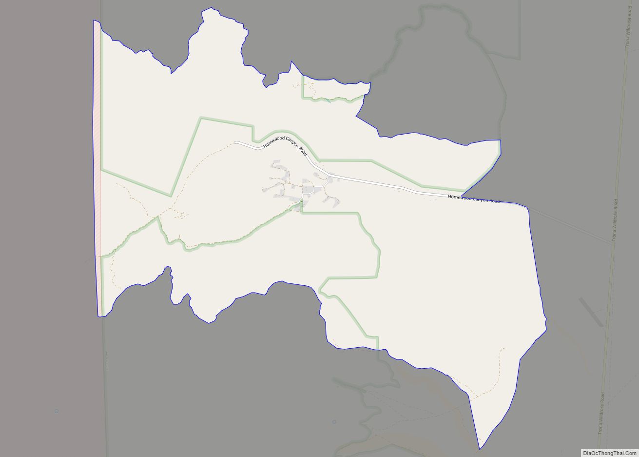
Valley Wells is a census-designated place in Inyo County, California. It lies at an elevation of 1,749 ft (533 m). Prior to 2010, for census purposes it was part of Homewood Canyon-Valley Wells CDP. The 2010 census reported that population was zero. The town is now registered as California Historical Landmark #443; in 1849, several groups of midwestern emigrants settled here to secure water from nearby Searles Lake.
The California Historical Landmark reads:
| Name: | Valley Wells CDP |
|---|---|
| LSAD Code: | 57 |
| LSAD Description: | CDP (suffix) |
| State: | California |
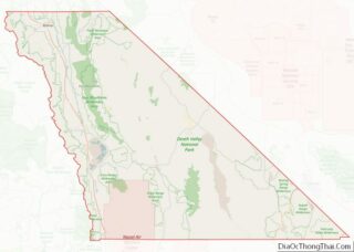
| County: | Inyo County |
| Elevation: | 1,749 ft (533 m) |
| Total Area: | 10.737 sq mi (27.809 km²) |
| Land Area: | 10.669 sq mi (27.632 km²) |
| Water Area: | 0.068 sq mi (0.177 km²) 0.64% |
| Total Population: | 0 |
| Population Density: | 0.0/sq mi (0.0/km²) |
| FIPS code: | 0681925 |
Online Interactive Map
Click on ![]() to view map in "full screen" mode.
to view map in "full screen" mode.
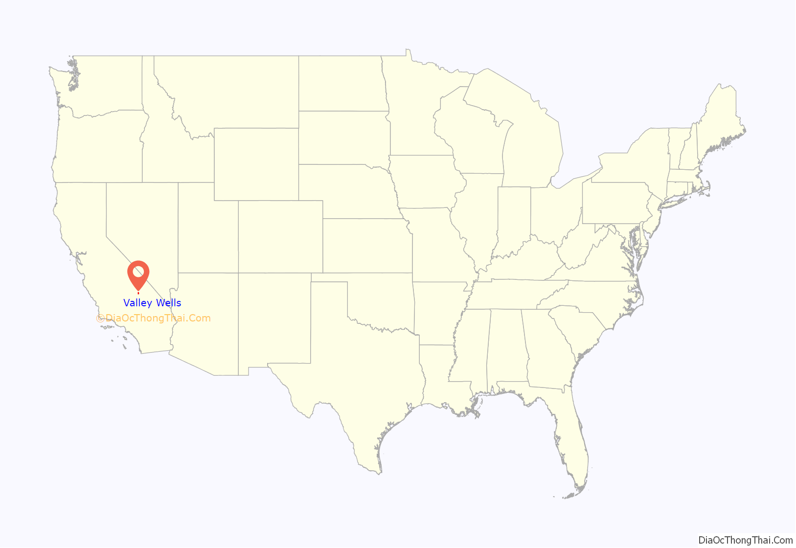
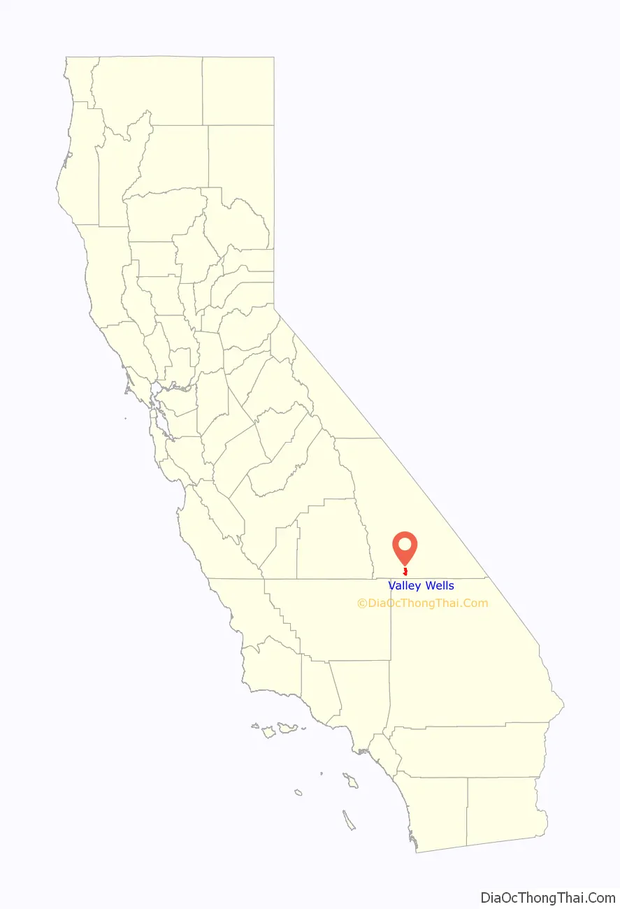
Valley Wells location map. Where is Valley Wells CDP?
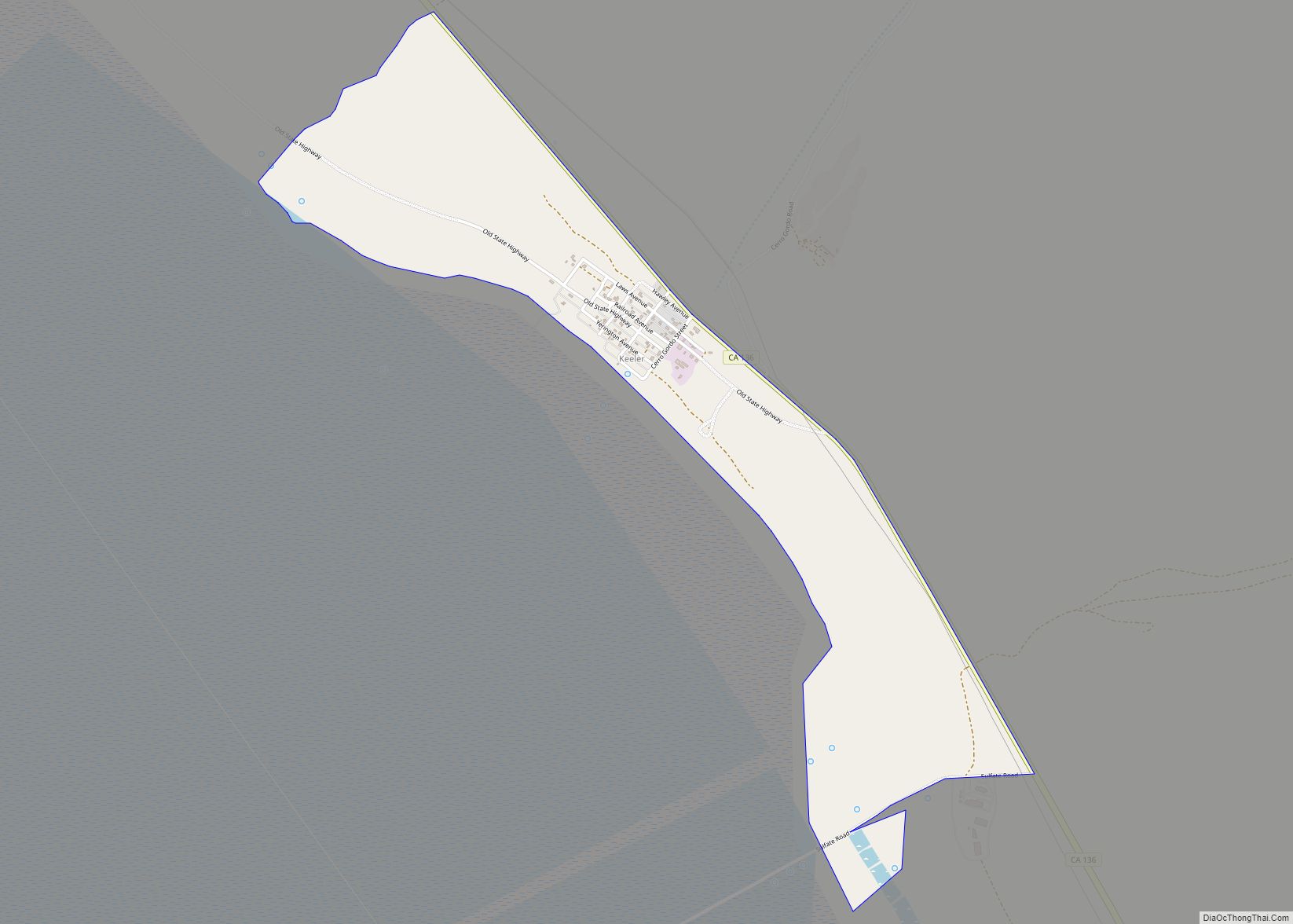
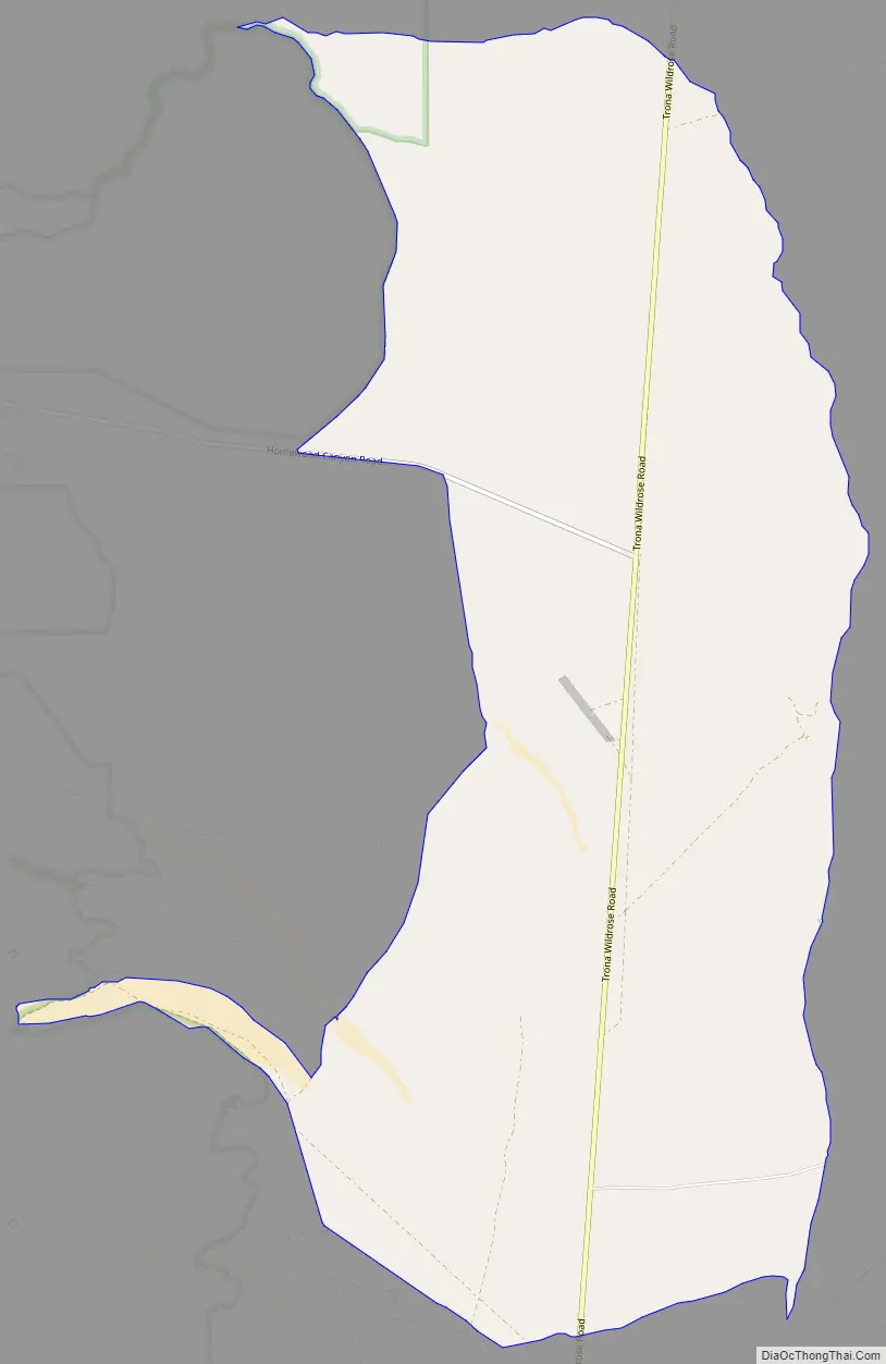
Valley Wells Road Map
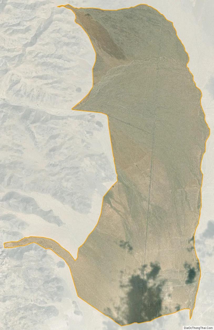
Valley Wells city Satellite Map
See also
Map of California State and its subdivision:- Alameda
- Alpine
- Amador
- Butte
- Calaveras
- Colusa
- Contra Costa
- Del Norte
- El Dorado
- Fresno
- Glenn
- Humboldt
- Imperial
- Inyo
- Kern
- Kings
- Lake
- Lassen
- Los Angeles
- Madera
- Marin
- Mariposa
- Mendocino
- Merced
- Modoc
- Mono
- Monterey
- Napa
- Nevada
- Orange
- Placer
- Plumas
- Riverside
- Sacramento
- San Benito
- San Bernardino
- San Diego
- San Francisco
- San Joaquin
- San Luis Obispo
- San Mateo
- Santa Barbara
- Santa Clara
- Santa Cruz
- Shasta
- Sierra
- Siskiyou
- Solano
- Sonoma
- Stanislaus
- Sutter
- Tehama
- Trinity
- Tulare
- Tuolumne
- Ventura
- Yolo
- Yuba
- Alabama
- Alaska
- Arizona
- Arkansas
- California
- Colorado
- Connecticut
- Delaware
- District of Columbia
- Florida
- Georgia
- Hawaii
- Idaho
- Illinois
- Indiana
- Iowa
- Kansas
- Kentucky
- Louisiana
- Maine
- Maryland
- Massachusetts
- Michigan
- Minnesota
- Mississippi
- Missouri
- Montana
- Nebraska
- Nevada
- New Hampshire
- New Jersey
- New Mexico
- New York
- North Carolina
- North Dakota
- Ohio
- Oklahoma
- Oregon
- Pennsylvania
- Rhode Island
- South Carolina
- South Dakota
- Tennessee
- Texas
- Utah
- Vermont
- Virginia
- Washington
- West Virginia
- Wisconsin
- Wyoming