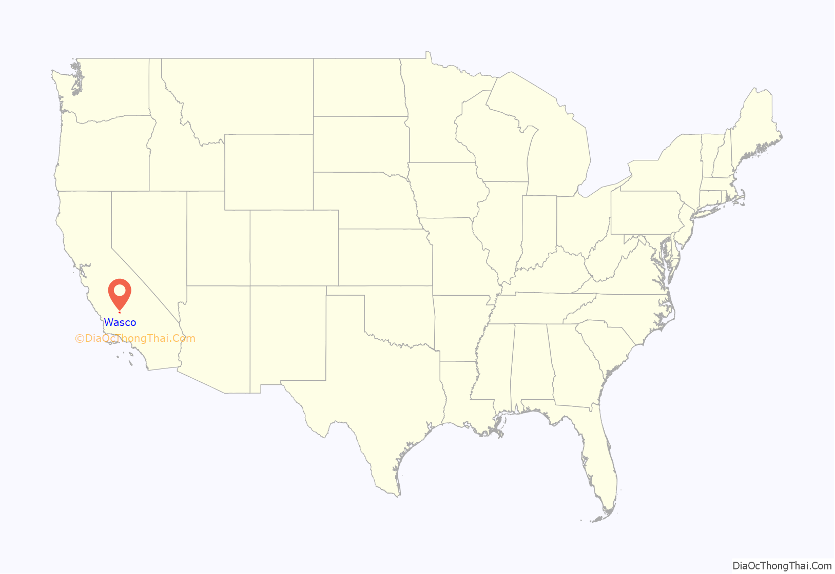
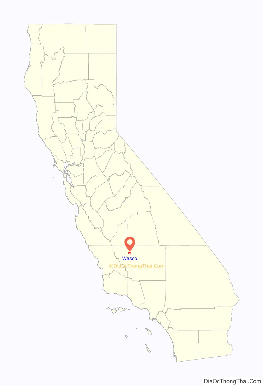
Wasco (formerly, Dewey and Deweyville) is a city in the San Joaquin Valley, in Kern County, California, United States. Wasco is located 24 miles (39 km) northwest of Bakersfield, at an elevation of 328 feet (100 m). The population was 25,545 at the 2010 census, up from 21,263 at the 2000 census.
Wasco is the headquarters of the Tejon Indian Tribe of California, a federally recognized tribe of Kitanemuk, Yokuts, and Chumash indigenous people of California.
| Name: | Wasco city |
|---|---|
| LSAD Code: | 25 |
| LSAD Description: | city (suffix) |
| State: | California |
| County: | Kern County |
| Incorporated: | December 22, 1945 |
| Elevation: | 328 ft (100 m) |
| Total Area: | 9.39 sq mi (24.32 km²) |
| Land Area: | 9.39 sq mi (24.32 km²) |
| Water Area: | 0.00 sq mi (0.00 km²) 0% |
| Total Population: | 25,545 |
| Population Density: | 3,058.16/sq mi (1,180.73/km²) |
| ZIP code: | 93280 |
| Area code: | 661 |
| FIPS code: | 0683542 |
| GNISfeature ID: | 1661652 |
| Website: | www.ci.wasco.ca.us |
Online Interactive Map
Click on ![]() to view map in "full screen" mode.
to view map in "full screen" mode.
Wasco location map. Where is Wasco city?
History
The name Dewey was in honor of Admiral George Dewey, a hero of the Spanish–American War. The Deweyville post office opened in 1899, and changed its name to Wasco in 1907.
The origin of the name Wasco is subject of two different theories: (1) That it was coined from Western American Sugar Company; and (2) that it was named by a resident from Wasco County, Oregon.
Wasco is the site of the Fourth Home Extension Colony, founded in 1907 by the American Home Extension Association.
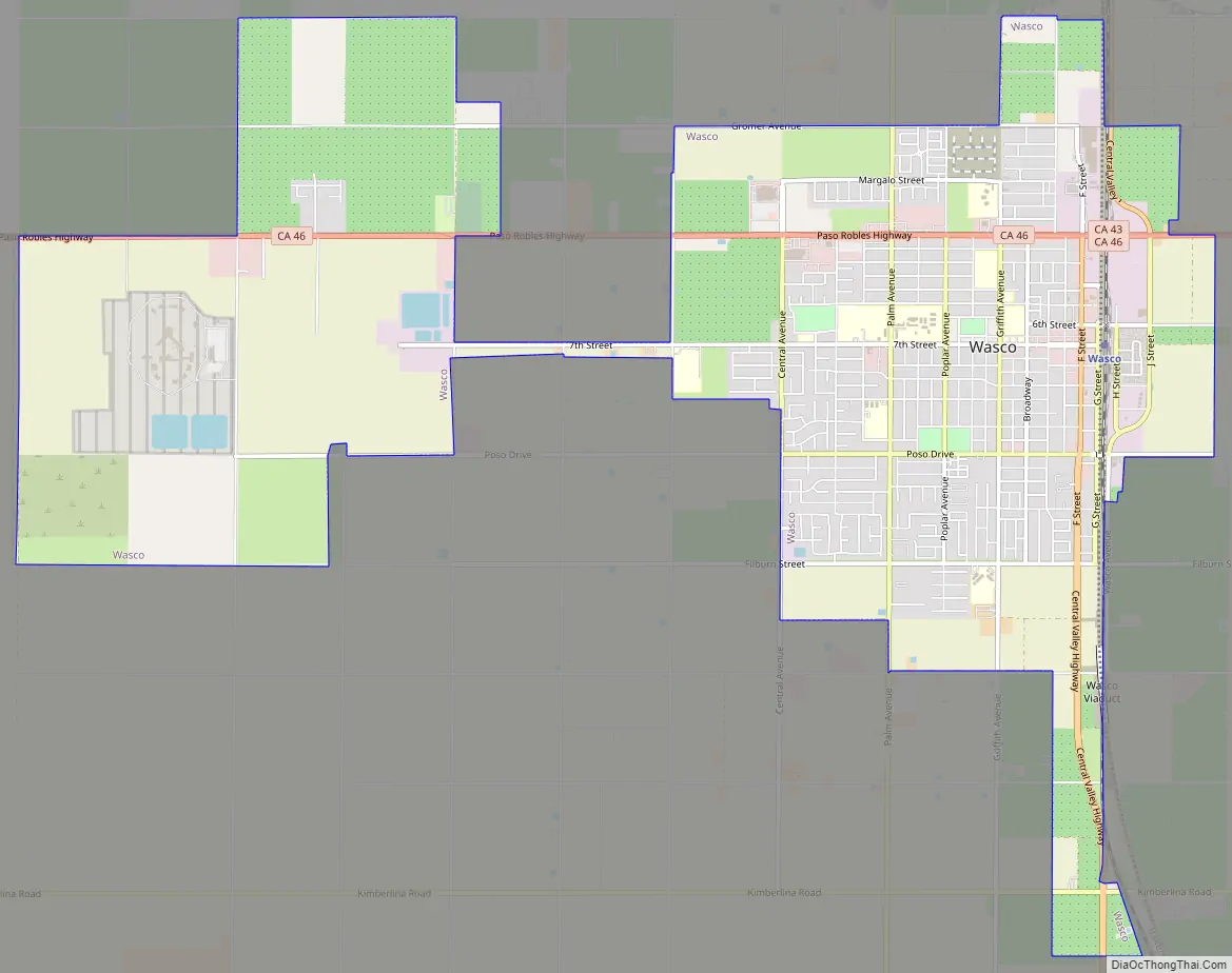
Wasco Road Map
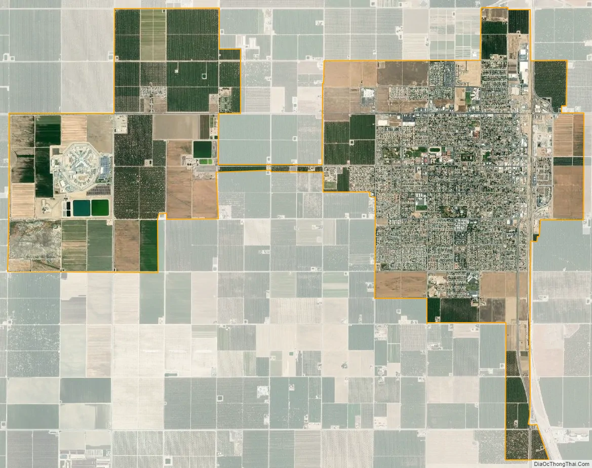
Wasco city Satellite Map
Geography
According to the United States Census Bureau, the city has a total area of 9.4 square miles (24 km), all of it land. At the 2000 census, according to the United States Census Bureau, the city had a total area of 7.6 square miles (20 km), all of it land. Wasco is located on the floor of the San Joaquin Valley, at the intersection of California State Routes 43, which runs north–south, and 46, which runs east–west.
Amtrak station, January 2014
City Hall, December 2010
The Wasco Union High School Auditorium is on the National Register of Historic Places.
Climate
According to the Köppen Climate Classification system, Wasco has a semi-arid climate (BSk, bordering on BSh) with extremely hot, dry summers and mild to cool winters. The average annual mean temperature is 64.1 °F (17.8 °C).
See also
Map of California State and its subdivision:- Alameda
- Alpine
- Amador
- Butte
- Calaveras
- Colusa
- Contra Costa
- Del Norte
- El Dorado
- Fresno
- Glenn
- Humboldt
- Imperial
- Inyo
- Kern
- Kings
- Lake
- Lassen
- Los Angeles
- Madera
- Marin
- Mariposa
- Mendocino
- Merced
- Modoc
- Mono
- Monterey
- Napa
- Nevada
- Orange
- Placer
- Plumas
- Riverside
- Sacramento
- San Benito
- San Bernardino
- San Diego
- San Francisco
- San Joaquin
- San Luis Obispo
- San Mateo
- Santa Barbara
- Santa Clara
- Santa Cruz
- Shasta
- Sierra
- Siskiyou
- Solano
- Sonoma
- Stanislaus
- Sutter
- Tehama
- Trinity
- Tulare
- Tuolumne
- Ventura
- Yolo
- Yuba
- Alabama
- Alaska
- Arizona
- Arkansas
- California
- Colorado
- Connecticut
- Delaware
- District of Columbia
- Florida
- Georgia
- Hawaii
- Idaho
- Illinois
- Indiana
- Iowa
- Kansas
- Kentucky
- Louisiana
- Maine
- Maryland
- Massachusetts
- Michigan
- Minnesota
- Mississippi
- Missouri
- Montana
- Nebraska
- Nevada
- New Hampshire
- New Jersey
- New Mexico
- New York
- North Carolina
- North Dakota
- Ohio
- Oklahoma
- Oregon
- Pennsylvania
- Rhode Island
- South Carolina
- South Dakota
- Tennessee
- Texas
- Utah
- Vermont
- Virginia
- Washington
- West Virginia
- Wisconsin
- Wyoming


