Weott is a census-designated place in Humboldt County, California. It is located 233 miles (375 km) north of San Francisco and 25 miles (40 km) due east of the Pacific Ocean. Lower Weott is situated at an elevation of 330 feet (100 m) along the Avenue of the Giants scenic highway and in the flood plain of the South Fork of the Eel River. The population was 288 at the 2010 census.
Weott is not related to Camp Weeott, a fishing village, which was established 37 miles (60 km) northwest of Weott, near Ferndale, California, about 1925, and destroyed in a 1955 flood.
| Name: | Weott CDP |
|---|---|
| LSAD Code: | 57 |
| LSAD Description: | CDP (suffix) |
| State: | California |
| County: | Humboldt County |
| Elevation: | 300 ft (100 m) |
| Total Area: | 0.771 sq mi (1.998 km²) |
| Land Area: | 0.753 sq mi (1.949 km²) |
| Water Area: | 0.019 sq mi (0.049 km²) 2.45% |
| Total Population: | 219 |
| Population Density: | 280/sq mi (110/km²) |
| ZIP code: | 95571 |
| Area code: | 707 |
| FIPS code: | 0684004 |
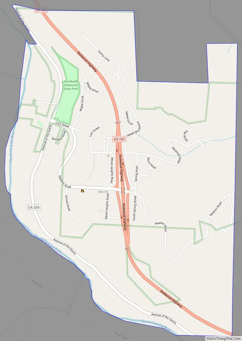
Online Interactive Map
Click on ![]() to view map in "full screen" mode.
to view map in "full screen" mode.
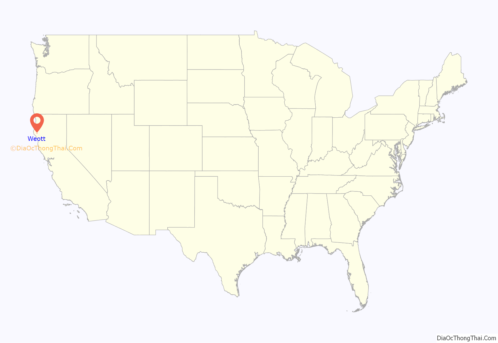
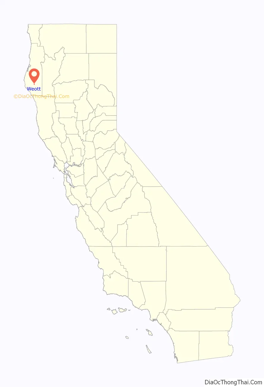
Weott location map. Where is Weott CDP?
History
The town of Weott is believed to be named after a sub-grouping of the Wishosk people who lived at the delta of the Eel River 37 miles (60 km) northwest of current-day Weott. The Wishosk word for that area and the people who lived there was wíyat. The general name for this group is now Wiyot. The town of Weott is beyond the bounds of the areas known to have been utilized or inhabited by the Wiyot. In 1849, when whites arrived looking for new supply routes to the Trinity gold mines, the Sinkyone peoples were living in the area. The Wiyot were further north and currently occupy the Table Bluff Reservation outside Loleta. Indian Agent Redick McKee’s 1851 expedition brought a rush of homestead filings. Native groups militated against this. The resulting conflicts led to the establishment of organized vigilante committees such as the Volunteer Company of Dragoons and continued through at least the 1870s.
Before 1925, Weott had been known informally as Helm’s Mill or Helm’s Camp. Helm’s Camp set up where redwood ties were being made for the railroad being constructed along the Eel River. It was later known as McKee’s Mill (named for Ernest McKee, who operated a shingle mill just east of lower Weott, but was lost in the flood of 1964. When the residents submitted a request to the United States Postal Service for a post office in that year, however, they had to decide on a definitive name. At least one source records that the residents were required to do this because there was already a town named McKee in California, but this appears to not be true. Another source says that a naming contest led to the name Weott, yet another that the USPOD chose the name from several submitted. The ZIP Code is 95571, with four-digit suffixes tied to post office box numbers. There is no home delivery in Weott. Weott is in area code 707.
Flooding
Though Weott had been hit by a flood in 1930, its recent history is shaped by two later major floods. In December 1955, lower Weott was partially destroyed when the South Fork of the Eel River overflowed its banks. The town largely re-built, but in December 1964, a Pineapple Express, a rare phenomenon in which a warm mass of moist Pacific air, a flow of cold air from an Alaskan high, a low pressure trough off the coast and a strong westerly air flow with gusts up to 50 mph (80 km/h), created the greatest flood in the recorded history of California’s North Coast. The storm was so intense that it destroyed 26 U.S. Geological Survey stream gauges. As a result, much of the flood data comes from qualitative reports and post-flood estimates. Other northern California rivers, such as the Russian, Eel, Klamath and Rogue Rivers, also rose to unprecedented heights. Rainfall totals as high as 30 inches (760 mm) were recorded for the 9-day period of the storm and 11 inches (290 mm) for the 24-hour period between December 21 and 22. The South Fork of the Eel River is estimated to have peaked at nearly 200,000 cubic feet per second (5,700 m/s) at a station 12 miles (20 km) south of Weott, nearly 2,800 cubic feet per second (80 m/s) greater than the 1955 flood. Tens of small towns were inundated. One of the worst hit was Weott.
Due to the 1955 and 1964 floods, nearly all residents now live in the hills above the flood plain, mostly at elevations of 390–660 feet (120–200 m). The greater area of Weott encompasses the Bull Creek, Dyerville, South Fork, Camp Grant and Burlington areas. Weott’s local services are run by the Weott Community Service District, which controls the town’s sewage treatment facility and water supply. The town’s water originally came from a property 0.93 miles (1.5 km) east of Weott. It now comes from a spring west of town, across the Eel River. The California State Parks has tried to provide Weott with alternatives to the spring, which is on State Parks land, including constructing a well on the Weott side of the river in 2003. This well had too much sediment, though, and was not usable. The WCSD has surveyed lands in the surrounding watershed but has yet to find an alternative water source. In summer, early morning and late evening fog typically protect the area from temperature extremes. Though daytime highs occasionally reach into the high 30 °C (86 °F)s, they are more typically below 86 °F (30 °C). Due to its proximity to the ocean and its position in the shadow of 3,380-foot-high (1,030 m) Grasshopper Peak, the area has an intense rainy season lasting from November through May. Locals report typical annual accumulations of 79 inches (2,000 mm), though the range is 28 to 98 inches (700 to 2,500 mm). Due to its moist climate, the town is surrounded on most sides by redwoods. Though most of the redwoods are second growth, the adjacent Humboldt Redwoods State Park has nearly 17,000 acres (7,000 ha) of old growth and includes Rockefeller Forest, the largest contiguous stand of old growth redwoods still in existence. Weott is located close to Giant Tree, a 354-foot-tall (108 m) redwood, and the Dyerville Giant, a 371-foot-tall (113 m) redwood that toppled in 1991. Due to a lack of water storage capacity, Weott sometimes suffers from water rationing in the summers.
Weott Road Map
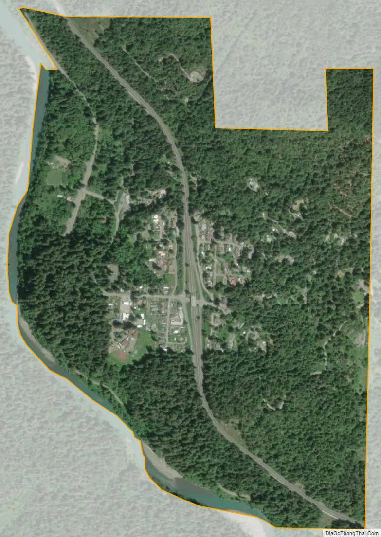
Weott city Satellite Map
See also
Map of California State and its subdivision:- Alameda
- Alpine
- Amador
- Butte
- Calaveras
- Colusa
- Contra Costa
- Del Norte
- El Dorado
- Fresno
- Glenn
- Humboldt
- Imperial
- Inyo
- Kern
- Kings
- Lake
- Lassen
- Los Angeles
- Madera
- Marin
- Mariposa
- Mendocino
- Merced
- Modoc
- Mono
- Monterey
- Napa
- Nevada
- Orange
- Placer
- Plumas
- Riverside
- Sacramento
- San Benito
- San Bernardino
- San Diego
- San Francisco
- San Joaquin
- San Luis Obispo
- San Mateo
- Santa Barbara
- Santa Clara
- Santa Cruz
- Shasta
- Sierra
- Siskiyou
- Solano
- Sonoma
- Stanislaus
- Sutter
- Tehama
- Trinity
- Tulare
- Tuolumne
- Ventura
- Yolo
- Yuba
- Alabama
- Alaska
- Arizona
- Arkansas
- California
- Colorado
- Connecticut
- Delaware
- District of Columbia
- Florida
- Georgia
- Hawaii
- Idaho
- Illinois
- Indiana
- Iowa
- Kansas
- Kentucky
- Louisiana
- Maine
- Maryland
- Massachusetts
- Michigan
- Minnesota
- Mississippi
- Missouri
- Montana
- Nebraska
- Nevada
- New Hampshire
- New Jersey
- New Mexico
- New York
- North Carolina
- North Dakota
- Ohio
- Oklahoma
- Oregon
- Pennsylvania
- Rhode Island
- South Carolina
- South Dakota
- Tennessee
- Texas
- Utah
- Vermont
- Virginia
- Washington
- West Virginia
- Wisconsin
- Wyoming


