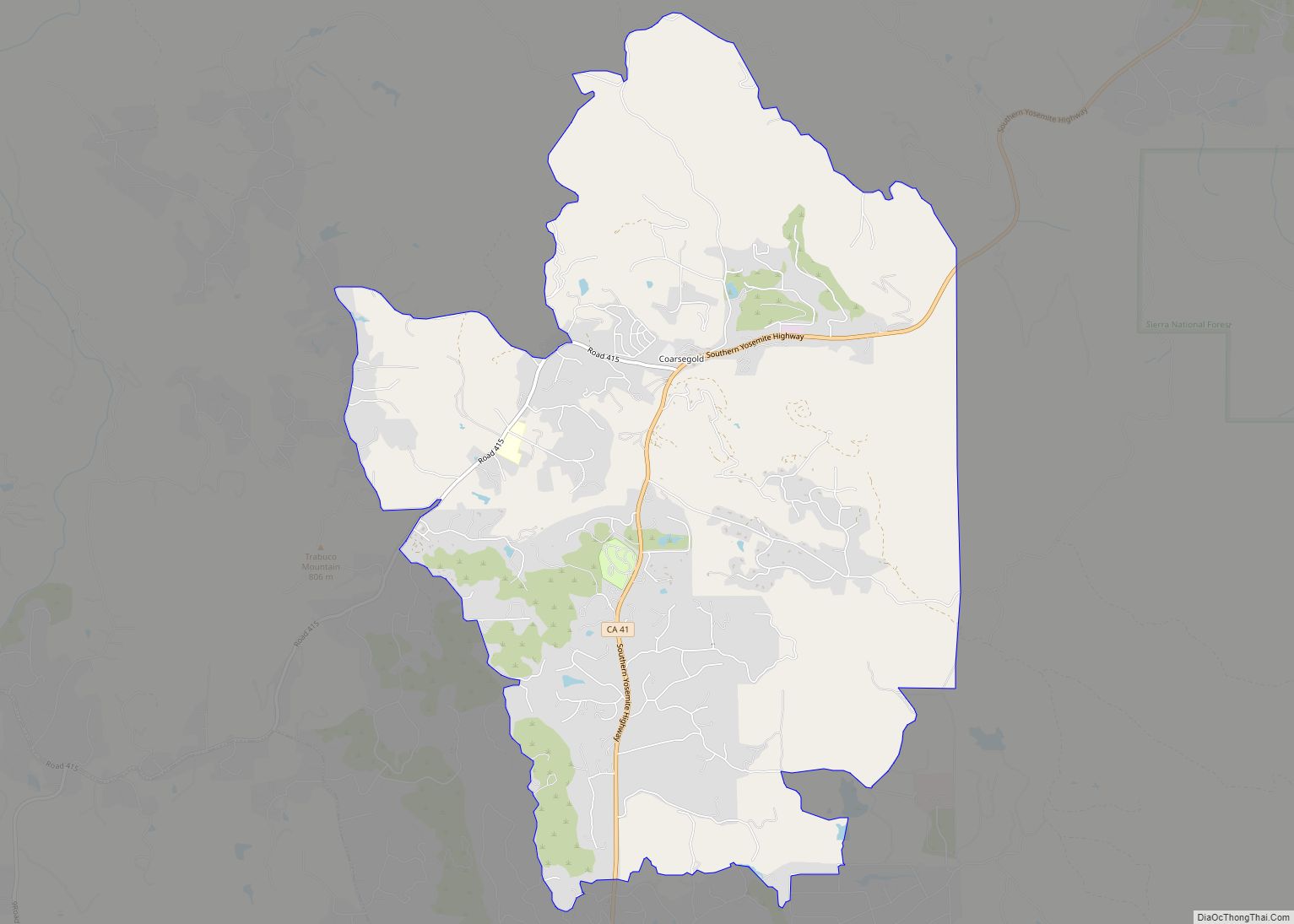
Yosemite Lakes Park is an unincorporated community in Madera County, California. It lies at an elevation of 1,230 feet (370 m). As a census-designated place (CDP) it is known as Yosemite Lakes. It is part of the Madera Metropolitan Statistical Area. The population was 5,022 at the 2020 census.
The area was developed by Titan Group in the 1970s, and includes an equestrian center, clubhouse, and three man-made lakes. Additionally the community has a homeowners association which operates the Blue Heron restaurant and the Fairway Cafe which is situated next to the golf course. The community also supports a local grocery store and other small shops.
| Name: | Yosemite Lakes CDP |
|---|---|
| LSAD Code: | 57 |
| LSAD Description: | CDP (suffix) |
| State: | California |
| County: | Madera County |
| Elevation: | 1,263 ft (385 m) |
| Total Area: | 20.999 sq mi (54.387 km²) |
| Land Area: | 20.902 sq mi (54.136 km²) |
| Water Area: | 0.097 sq mi (0.251 km²) 0.46% |
| Total Population: | 5,022 |
| Population Density: | 240.3/sq mi (92.8/km²) |
| ZIP code: | 93614 (Coarsegold) |
| Area code: | 559 |
| FIPS code: | 0686878 |
Online Interactive Map
Click on ![]() to view map in "full screen" mode.
to view map in "full screen" mode.
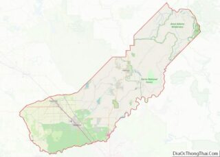
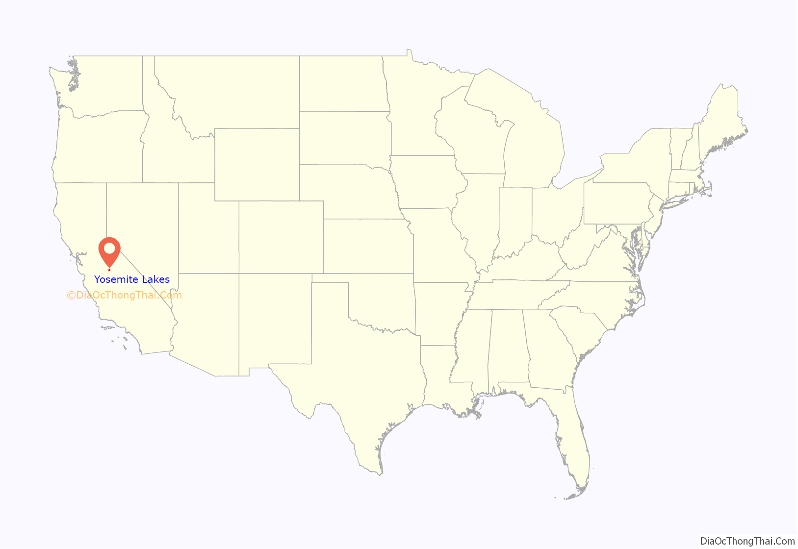
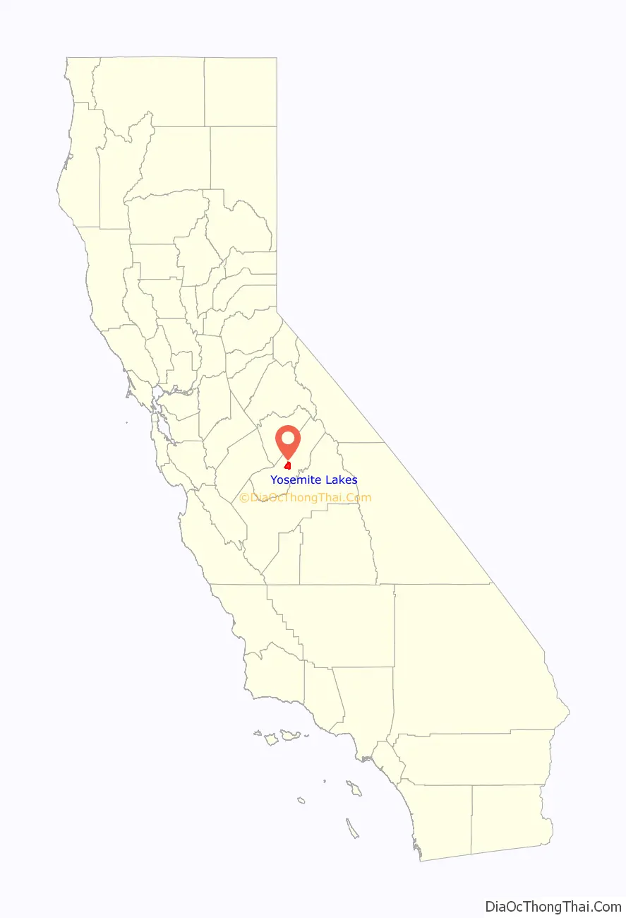
Yosemite Lakes location map. Where is Yosemite Lakes CDP?
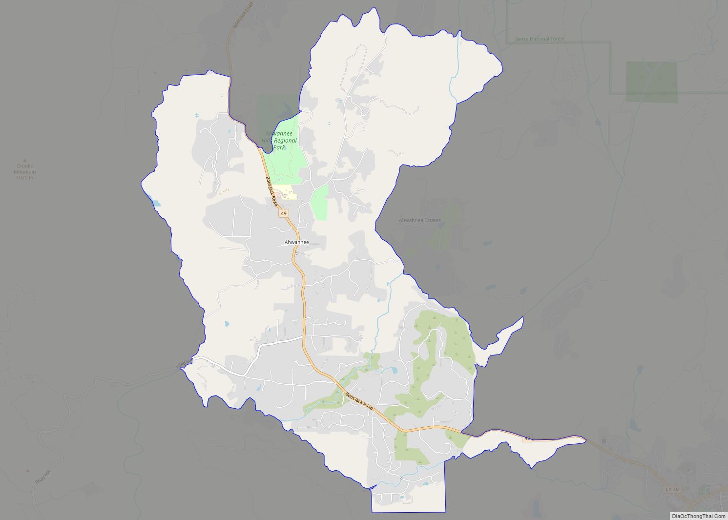
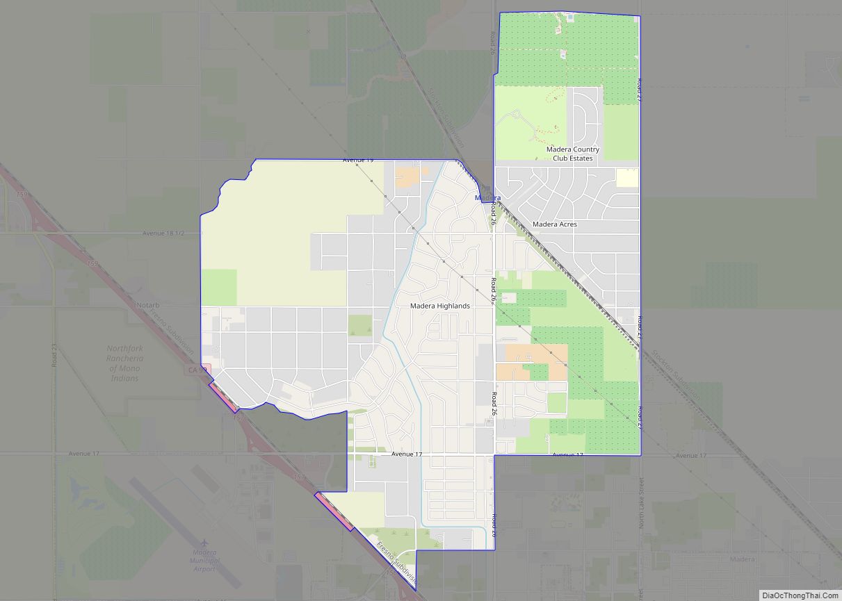
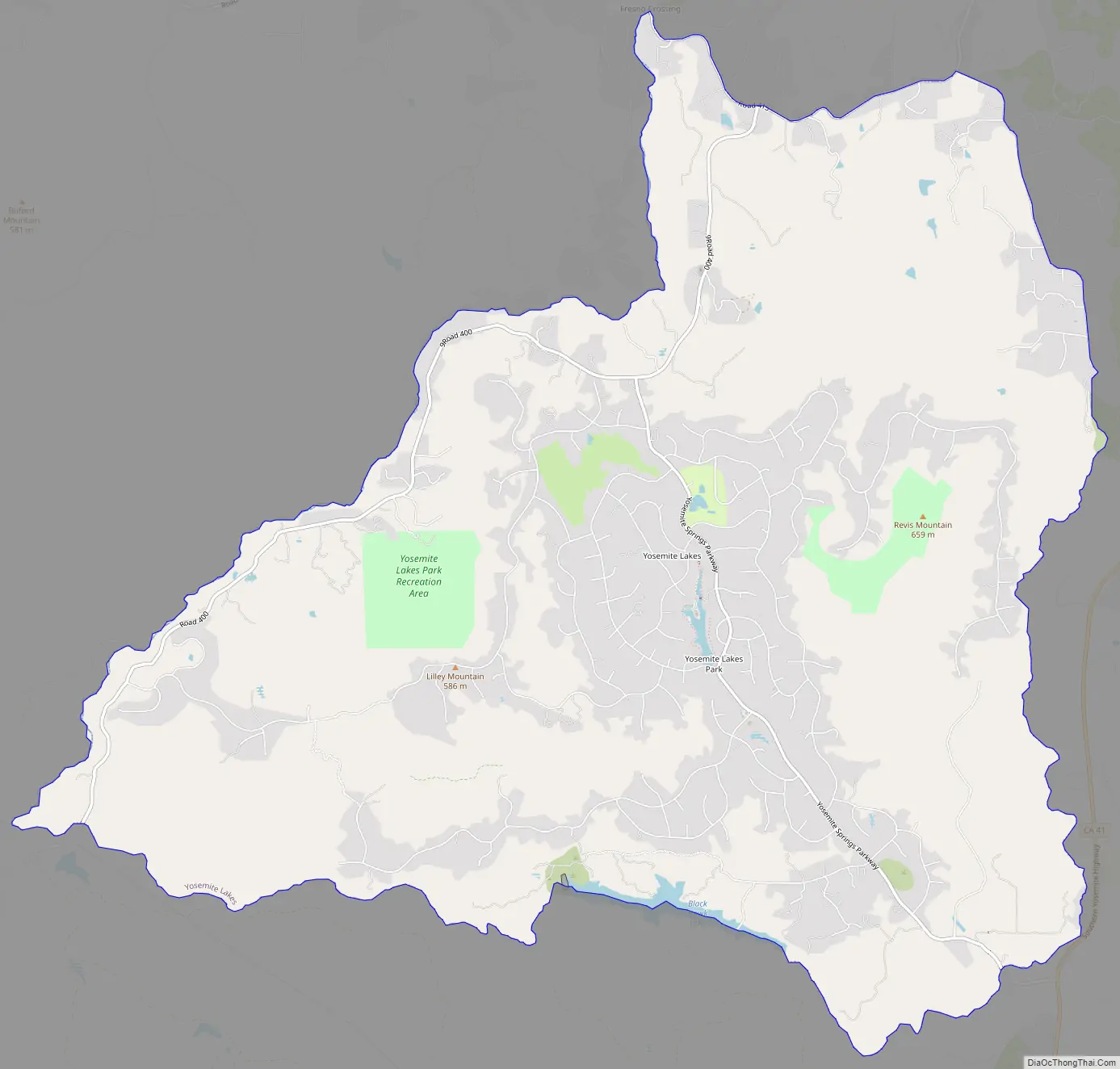
Yosemite Lakes Road Map
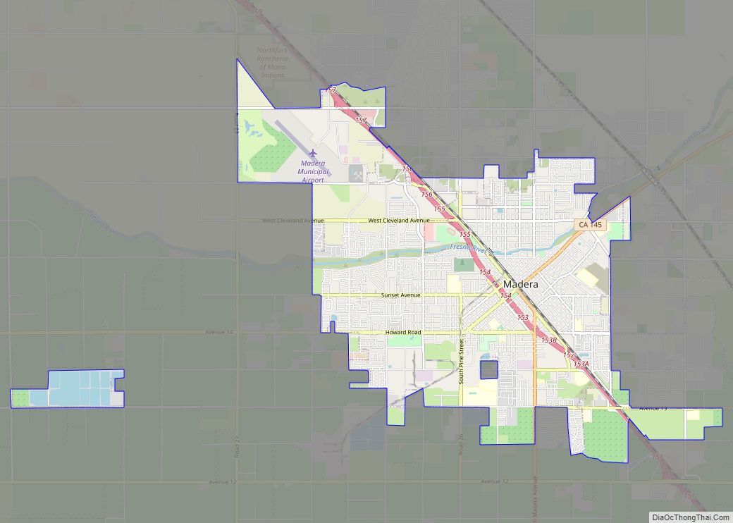
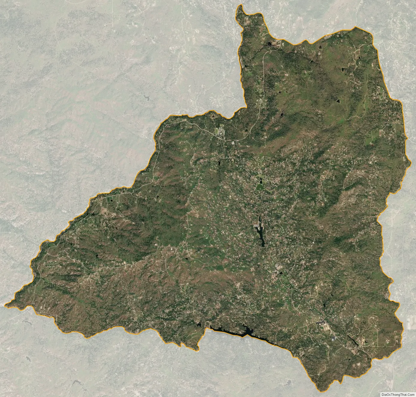
Yosemite Lakes city Satellite Map
Geography
Yosemite Lakes is located in the foothills of the Sierra Nevada at 37°11′28″N 119°46′22″W / 37.19111°N 119.77278°W / 37.19111; -119.77278. Its northwest border follows the Fresno River, and to the south and east it is bound by Coarsegold creek. The community is bordered to the northeast by Coarsegold, and it is 34 miles (55 km) north of Fresno. According to the United States Census Bureau, the CDP has a total area of 21.0 square miles (54 km), of which 0.1 square miles (0.3 km), or 0.46%, are water.
The highest point in the community is Lilley Mountain at 1,929 feet (588 m), and was a known landmark for drivers coming from Fresno on the way to Yosemite National Park.
See also
Map of California State and its subdivision:- Alameda
- Alpine
- Amador
- Butte
- Calaveras
- Colusa
- Contra Costa
- Del Norte
- El Dorado
- Fresno
- Glenn
- Humboldt
- Imperial
- Inyo
- Kern
- Kings
- Lake
- Lassen
- Los Angeles
- Madera
- Marin
- Mariposa
- Mendocino
- Merced
- Modoc
- Mono
- Monterey
- Napa
- Nevada
- Orange
- Placer
- Plumas
- Riverside
- Sacramento
- San Benito
- San Bernardino
- San Diego
- San Francisco
- San Joaquin
- San Luis Obispo
- San Mateo
- Santa Barbara
- Santa Clara
- Santa Cruz
- Shasta
- Sierra
- Siskiyou
- Solano
- Sonoma
- Stanislaus
- Sutter
- Tehama
- Trinity
- Tulare
- Tuolumne
- Ventura
- Yolo
- Yuba
- Alabama
- Alaska
- Arizona
- Arkansas
- California
- Colorado
- Connecticut
- Delaware
- District of Columbia
- Florida
- Georgia
- Hawaii
- Idaho
- Illinois
- Indiana
- Iowa
- Kansas
- Kentucky
- Louisiana
- Maine
- Maryland
- Massachusetts
- Michigan
- Minnesota
- Mississippi
- Missouri
- Montana
- Nebraska
- Nevada
- New Hampshire
- New Jersey
- New Mexico
- New York
- North Carolina
- North Dakota
- Ohio
- Oklahoma
- Oregon
- Pennsylvania
- Rhode Island
- South Carolina
- South Dakota
- Tennessee
- Texas
- Utah
- Vermont
- Virginia
- Washington
- West Virginia
- Wisconsin
- Wyoming